Safety Score: 3,0 of 5.0 based on data from 9 authorites. Meaning we advice caution when travelling to United Kingdom.
Travel warnings are updated daily. Source: Travel Warning United Kingdom. Last Update: 2024-08-13 08:21:03
Discover Passfield
Passfield in Hampshire (England) is a city in United Kingdom about 41 mi (or 66 km) south-west of London, the country's capital city.
Local time in Passfield is now 01:30 PM (Friday). The local timezone is named Europe / London with an UTC offset of zero hours. We know of 12 airports in the vicinity of Passfield, of which 5 are larger airports. The closest airport in United Kingdom is RAF Odiham in a distance of 10 mi (or 17 km), North-West. Besides the airports, there are other travel options available (check left side).
There are several Unesco world heritage sites nearby. The closest heritage site in United Kingdom is Dorset and East Devon Coast in a distance of 29 mi (or 46 km), South. Also, if you like golfing, there are a few options in driving distance. We discovered 2 points of interest in the vicinity of this place. Looking for a place to stay? we compiled a list of available hotels close to the map centre further down the page.
When in this area, you might want to pay a visit to some of the following locations: Lindford, Kingsley, Milland, Farnham and Seale. To further explore this place, just scroll down and browse the available info.
Local weather forecast
Todays Local Weather Conditions & Forecast: 9°C / 47 °F
| Morning Temperature | 4°C / 38 °F |
| Evening Temperature | 6°C / 42 °F |
| Night Temperature | 5°C / 41 °F |
| Chance of rainfall | 0% |
| Air Humidity | 76% |
| Air Pressure | 1028 hPa |
| Wind Speed | Light breeze with 4 km/h (2 mph) from North-East |
| Cloud Conditions | Overcast clouds, covering 90% of sky |
| General Conditions | Overcast clouds |
Saturday, 16th of November 2024
9°C (48 °F)
8°C (47 °F)
Light rain, gentle breeze, few clouds.
Sunday, 17th of November 2024
8°C (47 °F)
4°C (39 °F)
Light rain, moderate breeze, overcast clouds.
Monday, 18th of November 2024
7°C (44 °F)
11°C (51 °F)
Light rain, fresh breeze, overcast clouds.
Hotels and Places to Stay
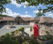
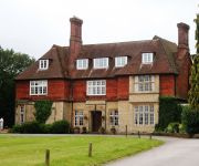
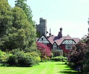
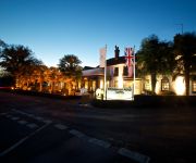
Old Thorns Manor
Champneys Forest Mere
Grayshott Medical Spa
Frensham Pond
Bel & The Dragon Churt
Overglen Court
Videos from this area
These are videos related to the place based on their proximity to this place.
Driving from High Pitfold, Hindhead to Liphook on B2131, Surrey county, England
Driving from High Pitfold, Hindhead to Liphook on B2131, Surrey county, England.
Minecraft Building Viper City Part 20 - Live at last!
The server is up! Details are still to be confirmed as modding and other things aren't quite finished yet, however I thought it was about time you all could come and see for yourselves! Minecraft...
Minecraft Building Viper City Minute Build 1 - The Curve Wall
I thought I would do one of these cause they're quick and simple, and it lets me show off the occasional little snippet of something small in the bigger scale. I can make these a weekly thing...
Minecraft Building Viper City Part 10 - Little Hanging Houses
This episode we continue building on the tree some more...
Minecraft Building Viper City Part 3 - I Think I Over Did It...
This week's Viper City doesn't have a talk and build because the entirety of the video is needed to tour around the ridiculous amount of work I've done since last time, more details in the video...
Minecraft Building Viper City 17 - UPDATERFACES
We're back on track here so prepare your butts. http://viperserver.webs.com/ EDIT - I just realized how badly out of time this is... I do apologize and it will not happen again...Speed Build...
Minecraft Building Viper City Part 21 - Have a Tour
Clue's in the name! I just blurt out a load of random crap that you may or may not want to hear and show you what we've been up to on the server! We'll try for a speed build next episode! ...
Minecraft Building Viper City Part 4 - It's a Long-en!
I've got a beast of an episode this week! If you can find the time to sit down for the full hour please do! I also talk a fair bit into the details of what my server will be like when it's...
Minecraft Building Viper City Part 8 - Here's One I Built Earlier
As I promised I have another for you! This week I'm showing off how i built some of the other towers so you guys can get a feel for the way I build and what things work and don't work with...
Videos provided by Youtube are under the copyright of their owners.
Attractions and noteworthy things
Distances are based on the centre of the city/town and sightseeing location. This list contains brief abstracts about monuments, holiday activities, national parcs, museums, organisations and more from the area as well as interesting facts about the region itself. Where available, you'll find the corresponding homepage. Otherwise the related wikipedia article.
Headley Grange
Headley Grange is a former poorhouse in Headley, East Hampshire, England, UK. It is best known as a recording and rehearsal venue in the 1960s and 1970s for bands such as Led Zeppelin, Bad Company, Fleetwood Mac, Genesis, Peter Frampton, the Pretty Things, Ian Dury and Clover. Today the house is a private residence.
Longmoor Military Railway
The Longmoor Military Railway (LMR) was a British military railway in Hampshire, built by the Royal Engineers from 1903 in order to train soldiers on railway construction and operations.
Liphook railway station
Liphook railway station is a railway station serving the large village of Liphook, Hampshire, England. It is served by the semi-fast service on the Portsmouth Direct Line running between and. One train per hour in each direction calls at Liphook station at off-peak times. Due to a short platform at this station, passengers must be in the front five coaches of a train to alight here.
Bohunt School
Bohunt School is a secondary school with academy status located in the rural village of Liphook, Hampshire. It is co-educational and takes children from age 11-16 and currently has over 1200 pupils enrolled. The school was opened in 1978 by Lady Madeleine Street of Liphook.
Headley Water Mill
Headley Water Mill is a water mill formerly used for the milling of flour and situated in the village of Headley in the east of the English county of Hampshire. It is likely that there was a mill on this site in 1086 at the time of the Domesday Book. The west end of the current mill is considered to date from the 16th Century, whilst the central section is older. The mill is powered by the south branch of upper reaches of the River Wey.
Old Thorns Manor Hotel
The Old Thorns is a 4 star hotel in Hampshire, England close to the village of Liphook and A3. The hotel has a famous golf course designed by Peter Aliss. The Old Thorns estate (which later become the hotel and golf resort) was previously the property of Ken Wood in the 1940s some ten years before he would invent the kenwood food mixer. It however was another 30 years before a golf course was to be constructed in the 400 acre site.
Weaversdown
Weaversdown or Weavers Down is an area of high ground in Hampshire, England, situated to the west of Liphook. It neighbours the Longmoor Military Camp. It formerly had a railway station on the Longmoor Military Railway, but the line was closed in 1969.
Weaversdown Halt railway station
Weaversdown Halt railway station is a former railway station, on the Longmoor Military Railway, which was closed along with the rest of the line in 1969. Originally a passing place at Weaversdown, a station was constructed which served the eastern side of Longmoor Military Camp. Preceding station Disused railways Following station Longmoor Downs Longmoor Military Railway Liss Forest Road


