Safety Score: 3,0 of 5.0 based on data from 9 authorites. Meaning we advice caution when travelling to United Kingdom.
Travel warnings are updated daily. Source: Travel Warning United Kingdom. Last Update: 2024-08-13 08:21:03
Delve into Nursling
Nursling in Hampshire (England) is located in United Kingdom about 70 mi (or 112 km) south-west of London, the country's capital town.
Current time in Nursling is now 03:32 AM (Friday). The local timezone is named Europe / London with an UTC offset of zero hours. We know of 11 airports close to Nursling, of which 5 are larger airports. The closest airport in United Kingdom is Southampton Airport in a distance of 5 mi (or 8 km), East. Besides the airports, there are other travel options available (check left side).
There are several Unesco world heritage sites nearby. The closest heritage site in United Kingdom is Dorset and East Devon Coast in a distance of 26 mi (or 42 km), South-East. Also, if you like playing golf, there are some options within driving distance. We encountered 2 points of interest near this location. If you need a hotel, we compiled a list of available hotels close to the map centre further down the page.
While being here, you might want to pay a visit to some of the following locations: Southampton, Winchester, Whiteparish, Gurnard and Yarmouth. To further explore this place, just scroll down and browse the available info.
Local weather forecast
Todays Local Weather Conditions & Forecast: 9°C / 48 °F
| Morning Temperature | 5°C / 40 °F |
| Evening Temperature | 7°C / 45 °F |
| Night Temperature | 6°C / 43 °F |
| Chance of rainfall | 0% |
| Air Humidity | 79% |
| Air Pressure | 1028 hPa |
| Wind Speed | Light breeze with 3 km/h (2 mph) from South-West |
| Cloud Conditions | Few clouds, covering 15% of sky |
| General Conditions | Few clouds |
Saturday, 16th of November 2024
10°C (49 °F)
10°C (49 °F)
Few clouds, gentle breeze.
Sunday, 17th of November 2024
9°C (49 °F)
5°C (42 °F)
Light rain, moderate breeze, overcast clouds.
Monday, 18th of November 2024
8°C (46 °F)
12°C (53 °F)
Light rain, fresh breeze, overcast clouds.
Hotels and Places to Stay
Mercure Southampton Centre Dolphin Hotel
DoubleTree by Hilton Southampton
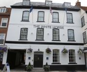
The White Horse Hotel & Brasserie
Fenland Guest House
Grand Harbour
Southampton Serviced Apartment
The Pilgrim Inn
Novotel Southampton
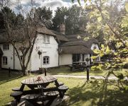
Mortimer Arms
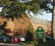
Highfield House
Videos from this area
These are videos related to the place based on their proximity to this place.
60163 Tornado Steam Locomotive at Romsey & Shawford station
Tornado working hard at Romsey and Shawford on the Cathedral Express on the 14th of Feb 2009.
River Test downstream of Romsey
An enjoyable day with friends fly fishing for Trout on the River Test on 7th April 2011.
Tornado steam locomotive 60163 in Hampshire,14th Feb.'09
Tornado seen between Romsey and Redbridge, Hants., on 14th February 2009 with "The Valentine's Day Special Tour".
230215 4 twats in one journey
1) cyclist blocks inside lane, bear in mind the pavement to his LEFT is a nationally registered Cycle Path, 2) RoKill AJ12 OND cuts across white hatching on late lane exit, 3) HW11 HDA forces...
The Sherwood Forester no: 45321 passing through Redbridge Station 28/08/2013
Dorset Coast Express Steam Train "The Sherwood Forester" no: 45321 with diesel Engine Loco no: 47237 passing through Redbridge Station from London to Weymouth she returned back to London ...
Dorset Coast Express No: 34046 Braunton passing through Redbridge Station 14/08/13
The Dorset Coast Express was running again today with steam train NO: 34046 Braunton a Light Pacific Class 4-6-2 with a diesel engine running at the rear outward to Weymouth and later on in...
Dorset Coast Express Steam Train Oliver Cromwell Millbrook, Redbridge 31/07/13
The Dorset Coast Express left Southampton Central Railway Station today for an outing to Weymouth at about 11:56am and the steam train "Oliver Cromwell 70013" is seen here passing Millbrook...
60163 Tornado on the VALENTINE'S DAY SPECIAL 14th Feb at Redbridge & Shawford
60163 Tornado on the VALENTINE'S DAY SPECIAL 14th Feb. First we see the loco approaching Redbridge and then joining the LSWR, then we move on to Shawford to see the loco pickup some ...
70000 at Redbridge with the Cathedrals Express 11/9/12
70000 Britannia is seen heading off of the Romsey line at Redbridge with a northbound Cathedrals Express on Tuesday 11/9/12. Her journey started at Salisbury and she is bound for Ely.
Dorset Coast Express with No: 70013 Oliver Cromwell Steam Train Redbridge 04/09/13
Well today was the last but one chance to see the 'Dorset Coast Express' for this current season of day trips running through Southampton to Weymouth from London. The first run through...
Videos provided by Youtube are under the copyright of their owners.
Attractions and noteworthy things
Distances are based on the centre of the city/town and sightseeing location. This list contains brief abstracts about monuments, holiday activities, national parcs, museums, organisations and more from the area as well as interesting facts about the region itself. Where available, you'll find the corresponding homepage. Otherwise the related wikipedia article.
M271 motorway
The M271 is a motorway near Southampton in Hampshire, England. It is 3 miles long. Construction began in 1973 and it opened in 1975. It provides part of the route to Southampton Docks from the M27.
Maybush
Maybush is a district in Southampton, England. Located in the western side of the city, Maybush is probably most famous as the former location of the Ordnance Survey head office.
Rownhams
Rownhams is a village in Hampshire, England, situated just outside the boundaries of the City of Southampton, to the north-west. It is most likely known for Rownhams services a service station on the M27 motorway which runs to the north of the village. {{#invoke: Navbox | navbox }} {{#invoke:Coordinates|coord}}{{#coordinates:50.947455|N|1.454157|W||||| |primary |name= }} for those interested in tracing family relatives from Rownhams, the burial records for St.
Millbrook Community School
Millbrook Community School was a secondary school in Southampton, England. The school was situated close to the west border of the city - formerly Millbrook Secondary School for Boys and attracted pupils from several surrounding areas. In early 1997 the school was granted a Sports Lottery Board award of £1.53 million. From late summer 1998 the local community and pupils were able to use some additional facilities in the school.
Oaklands Community School
Oaklands Community School was a mixed comprehensive school in west Southampton, Hampshire, in the south of England. The school was a specialist Arts College for 11 to 16 year olds. The most recent Ofsted inspection was 27 September 2004, when the school was praised, the introduction to the report reading "Oaklands Community School is a very good school. Its exceptional egalitarian ethos ensures that all students are treated with care, respect and encouragement.
Redbridge Community School
Redbridge Community School is a mixed secondary school with academy status in west Southampton, Hampshire, in the south of England. In an Ofsted inspection on 4 May 2007, the inspectors report praised the school saying "Redbridge provides outstanding quality education. Whilst the school modestly judges its overall effectiveness to be good, inspectors judge it to be excellent. Students speak very highly of their school and show considerable pride in it.
The Atherley School
The Atherley school was an allgirl independent school based in Southampton, Hampshire, England, from 1926 - 2006 until it merged with Embley Park school to become Hampshire Collegiate School.
Ordnance Survey
Ordnance Survey, an executive agency and non-ministerial government department of the Government of the United Kingdom, is the national mapping agency for Great Britain, producing maps of Great Britain (and to an extent, the Isle of Man). It does not produce maps of Northern Ireland. It is one of the world's largest producers of maps.


