Safety Score: 3,0 of 5.0 based on data from 9 authorites. Meaning we advice caution when travelling to United Kingdom.
Travel warnings are updated daily. Source: Travel Warning United Kingdom. Last Update: 2024-08-13 08:21:03
Delve into Leckford
Leckford in Hampshire (England) is located in United Kingdom about 63 mi (or 102 km) south-west of London, the country's capital town.
Current time in Leckford is now 10:08 AM (Sunday). The local timezone is named Europe / London with an UTC offset of zero hours. We know of 9 airports close to Leckford, of which 5 are larger airports. The closest airport in United Kingdom is Southampton Airport in a distance of 14 mi (or 22 km), South. Besides the airports, there are other travel options available (check left side).
There are several Unesco world heritage sites nearby. The closest heritage site in United Kingdom is City of Bath in a distance of 18 mi (or 30 km), North-West. Also, if you like playing golf, there are some options within driving distance. We encountered 2 points of interest near this location. If you need a hotel, we compiled a list of available hotels close to the map centre further down the page.
While being here, you might want to pay a visit to some of the following locations: Winchester, Whiteparish, Allington, Southampton and Shalbourne. To further explore this place, just scroll down and browse the available info.
Local weather forecast
Todays Local Weather Conditions & Forecast: 16°C / 60 °F
| Morning Temperature | 15°C / 59 °F |
| Evening Temperature | 14°C / 57 °F |
| Night Temperature | 9°C / 49 °F |
| Chance of rainfall | 12% |
| Air Humidity | 78% |
| Air Pressure | 996 hPa |
| Wind Speed | High wind, near gale with 22 km/h (14 mph) from North |
| Cloud Conditions | Overcast clouds, covering 100% of sky |
| General Conditions | Moderate rain |
Monday, 25th of November 2024
9°C (48 °F)
6°C (42 °F)
Light rain, moderate breeze, overcast clouds.
Tuesday, 26th of November 2024
8°C (46 °F)
6°C (43 °F)
Few clouds, moderate breeze.
Wednesday, 27th of November 2024
7°C (44 °F)
4°C (39 °F)
Moderate rain, moderate breeze, broken clouds.
Hotels and Places to Stay
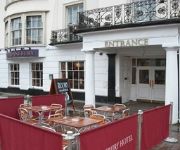
Peat Spade Inn
The White Hart
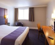
Best Western Andover
Star & Garter
Andover
Videos from this area
These are videos related to the place based on their proximity to this place.
Dylan - traffic, town and country driving.
Showing Dylan meeting large lorries on narrow country lanes and in the middle of a busy town. Also showing him crossing motorway bridges, being driven by different drivers (both male and female),...
Training scurry driving pair Spud and Millie on the roads.
Spud (offside, gelding) and Millie (nearside, mare) in harness together on a trip into Stockbridge. We show them building up their fitness on the roads, encountering pedestrians, bicycles and...
Breaking Connemaras to harness - mare and gelding pair.
After a break to get their owner's carriage repainted, Bea and Ghost came to us for a refresher course. Here we show them working as a pair down town and around our country lanes, being driven...
Riding a heavy mare - Roxy's owner in the saddle
Roxy's owner on his first hack out with Sarah on Suki the Cleveland Bay, and Nancy on Roly. We went for a ride around our local roads - here's how he did on his first trip out riding his mare....
Miniature shetland pair in the water and town.
Freddie (offside, 8hh) and Nigel (nearside, 7hh), a pair of 4yo miniature Shetland geldings that we broke for carriage driving. This video shows them driving in the river, meeting some admirers...
Meeting riders, loose dogs, tree cutters and busy traffic while carriage driving (Kermit).
We show how Kermit, a newly-broken 5yo Welsh Section D gelding reacts to traffic (including men overhead cutting trees with chainsaws), meeting ridden horses and loose dogs while out driving...
Driving a welsh cob in a pair - Captain Jack in harness.
Breaking Jack, a 4 1/2 yo Welsh Section D to harness. Showing him working offside and nearside as a pair, and being driven as part of a unicorn. While on a carriage drive into Stockbridge,...
Jezebel - Barry Hook horse drawn promotions
Jezebel, a 3yo Welsh x ISH filly, came to us to be broken to harness. As she will be driven single and pair with her sister in the future, we broke her to a pair, however she is at the point...
Problems with a green team on the road; leg over trace, tractors.
Showing that common carriage driving "issues" don't have to cause any trouble. Driving a newly-broken team of horses; what happens if your leader gets a leg over the traces? We show how Romeo,...
Videos provided by Youtube are under the copyright of their owners.
Attractions and noteworthy things
Distances are based on the centre of the city/town and sightseeing location. This list contains brief abstracts about monuments, holiday activities, national parcs, museums, organisations and more from the area as well as interesting facts about the region itself. Where available, you'll find the corresponding homepage. Otherwise the related wikipedia article.
Test Valley
Test Valley is a local government district and borough in Hampshire, England, named after the valley of the River Test. Its council is based in Andover. The borough was formed on 1 April 1974 by a merger of the boroughs of Andover and Romsey, along with Andover Rural District and Romsey and Stockbridge Rural District. Test Valley covers some 250 square miles of western Hampshire, stretching from boundaries with Southampton in the south to Newbury in the north.
Chilbolton Observatory
The Chilbolton Observatory is a facility for atmospheric and radio research located on the edge of the village of Chilbolton near Stockbridge in Hampshire, England. The facilities are run by the STFC Radio Communications Research Unit of the Rutherford Appleton Laboratory and form part of the Science and Technology Facilities Council.
Stockbridge F.C
Stockbridge Football Club is an English football club based in Stockbridge, Hampshire. The club is affiliated to the Hampshire Football Association, and is a FA Charter Standard club. The club also has the honour of never being relegated during its existence. The club are currently members of Division One of the Wessex League and play at the Stockbridge Recreation Ground.
Abbess Grange
Abbess Grange is a neo-Elizabethan house at Leckford, Hampshire, England designed by Sir Banister Fletcher, a British architect, in 1901 for George Miles Bailey, on the site of a former grange of St. Mary's Abbey, Winchester. The house consists of a two-storey main block with attic and a projecting single-storey billiards hall on the left, and is built on a levelled platform cut out of the hillside.
Wherwell Abbey
Wherwell Abbey was an abbey of Benedictine nuns in Wherwell, Hampshire, England.
RAF Chilbolton
Royal Air Force Station Chilbolton or more simply RAF Chilbolton is a former Royal Air Force station in Hampshire, England. The airfield is located approximately 4 miles south-southeast of Andover; about 62 miles southwest of London Opened in 1940, it was used by both the Royal Air Force and United States Army Air Forces. During the war it was used primarily as a troop carrier airfield for parachutists. After the war it was used for jet aircraft testing before being closed in 1946.
Eel buck
Eel bucks are a type of fish trap that was prevalent in the River Thames in England up to the 20th century. It was used particularly to catch eels which were a staple part of the London diet. Eel bucks were baskets made of willow wood, and were often strung together in a fishing weir. Construction of such weirs was outlawed under the terms of Magna Carta All fish-weirs shall be removed from the Thames, the Medway, and throughout the whole of England, except on the sea coast.


