Safety Score: 3,0 of 5.0 based on data from 9 authorites. Meaning we advice caution when travelling to United Kingdom.
Travel warnings are updated daily. Source: Travel Warning United Kingdom. Last Update: 2024-08-13 08:21:03
Discover Forton
Forton in Hampshire (England) is a place in United Kingdom about 59 mi (or 96 km) south-west of London, the country's capital city.
Current time in Forton is now 06:19 AM (Friday). The local timezone is named Europe / London with an UTC offset of zero hours. We know of 10 airports near Forton, of which 5 are larger airports. The closest airport in United Kingdom is Lasham Airport in a distance of 16 mi (or 26 km), East. Besides the airports, there are other travel options available (check left side).
There are several Unesco world heritage sites nearby. The closest heritage site in United Kingdom is City of Bath in a distance of 17 mi (or 28 km), North-West. Also, if you like playing golf, there are a few options in driving distance. We encountered 2 points of interest in the vicinity of this place. If you need a hotel, we compiled a list of available hotels close to the map centre further down the page.
While being here, you might want to pay a visit to some of the following locations: Winchester, Greenham, Newbury, Shalbourne and Winterbourne. To further explore this place, just scroll down and browse the available info.
Local weather forecast
Todays Local Weather Conditions & Forecast: 5°C / 42 °F
| Morning Temperature | 2°C / 36 °F |
| Evening Temperature | 2°C / 35 °F |
| Night Temperature | 1°C / 34 °F |
| Chance of rainfall | 0% |
| Air Humidity | 66% |
| Air Pressure | 1010 hPa |
| Wind Speed | Moderate breeze with 13 km/h (8 mph) from East |
| Cloud Conditions | Clear sky, covering 5% of sky |
| General Conditions | Sky is clear |
Saturday, 23rd of November 2024
9°C (48 °F)
14°C (57 °F)
Moderate rain, strong breeze, overcast clouds.
Sunday, 24th of November 2024
14°C (57 °F)
11°C (53 °F)
Moderate rain, strong breeze, overcast clouds.
Monday, 25th of November 2024
10°C (50 °F)
8°C (46 °F)
Light rain, fresh breeze, broken clouds.
Hotels and Places to Stay
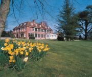
NORTON PARK - QHOTELS
Best Western Andover
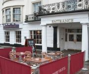
Star & Garter
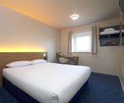
TRAVELODGE ANDOVER
DAYS INN SUTTON SCOTNEY NORTH
DAYS INN SUTTON SCOTNEY SOUTH
Videos from this area
These are videos related to the place based on their proximity to this place.
Andover - Old Winton Road (Byway, N-S)
Subscribe for the love of motorcycles and the great outdoors: http://www.youtube.com/subscription_center?add_user=wiltshirebyways Please click 'S H O W M O R E' for route info: ↓↓↓↓↓↓...
Dental Concepts - Manish Chitnis - Patient Journey - Whitchurch Dentist
http://www.dental-concepts.com Here at Dental Concepts we understand that not everyone looks forward to dental treatment. We believe in making our patients feel at ease from the moment...
A34 interchange near Tufton/Whitchurch safety (Dec 2012)
Ideas for improving the A34 interchange at Tufton, just south of Whitchurch, Hampshire so that people on bicycles, walking, driving or riding a horse can travel more safely. Campaign page on...
Dental Concepts - Manish Chitnis - Staff - Whitchurch Dentist
http://www.dental-concepts.com Here at Dental Concepts we understand that not everyone looks forward to dental treatment. We believe in making our patients feel at ease from the moment...
Max Keiser financial tyranny
Keiser Report #75 Markets, Finance, Scandal Max Keiser talks with Stacy Herbert about the scandal of insider trading "the weather in healthcare" and how it is that the American System is based...
Steam Engine Refuelling at Night
And it was a cold frosty night, too, with fires all over the yard to stop pipes freezing. See the steam condensing all over the place, and stunning silhouettes in the lights. Bulleid pacific...
LFS: Race of Champions Layout - Symek2010
Pierwsze spojrzenie na mój nowy layout do LFS - Race of Champion Layout. Data premiery nieznana. Niestety, ale gorszej jakości się nie dało:D Ale przynajmniej coś widać. Layout na torze...
Harry in harness - horse meets a JCB.
Horse Drawn Promotions - Breaking horses to harness. http://www.horsedrawnpromotions.com/ This is Harry, who went on to be a successful driving trials pony. For more videos please visit our...
Videos provided by Youtube are under the copyright of their owners.
Attractions and noteworthy things
Distances are based on the centre of the city/town and sightseeing location. This list contains brief abstracts about monuments, holiday activities, national parcs, museums, organisations and more from the area as well as interesting facts about the region itself. Where available, you'll find the corresponding homepage. Otherwise the related wikipedia article.
Chilbolton Observatory
The Chilbolton Observatory is a facility for atmospheric and radio research located on the edge of the village of Chilbolton near Stockbridge in Hampshire, England. The facilities are run by the STFC Radio Communications Research Unit of the Rutherford Appleton Laboratory and form part of the Science and Technology Facilities Council.
Bransbury
Bransbury is a hamlet situated in Hampshire southern England. There nearest village is Barton Stacey, halfway between Winchester and Andover, and there is a turning off to Bransbury, just off the A303 towards Exeter. There are a dozen or so houses in Bransbury and the River Dever runs through it.
Bourne Rivulet
The Bourne Rivulet is a river in the English county of Hampshire. It is a tributary of the River Test. The Bourne Rivulet (known simply as 'The Bourne' locally) is a seasonal chalk stream that rises and falls with the natural water table in the area. It usually rises in January and flows until around August each year.
Wherwell Abbey
Wherwell Abbey was an abbey of Benedictine nuns in Wherwell, Hampshire, England.
RAF Chilbolton
Royal Air Force Station Chilbolton or more simply RAF Chilbolton is a former Royal Air Force station in Hampshire, England. The airfield is located approximately 4 miles south-southeast of Andover; about 62 miles southwest of London Opened in 1940, it was used by both the Royal Air Force and United States Army Air Forces. During the war it was used primarily as a troop carrier airfield for parachutists. After the war it was used for jet aircraft testing before being closed in 1946.
Dead Man's Plack
Dead Man's Plack is a Grade-II listed 19th-century monument to Earl Athelwold of Wherwell, who was allegedly killed near the site where it stands by his rival in love, King Edgar, 'Edgar the Peaceful', in 963.


