Safety Score: 3,0 of 5.0 based on data from 9 authorites. Meaning we advice caution when travelling to United Kingdom.
Travel warnings are updated daily. Source: Travel Warning United Kingdom. Last Update: 2024-08-13 08:21:03
Delve into Ellingham
Ellingham in Hampshire (England) is located in United Kingdom about 84 mi (or 136 km) south-west of London, the country's capital town.
Current time in Ellingham is now 03:14 PM (Thursday). The local timezone is named Europe / London with an UTC offset of zero hours. We know of 9 airports close to Ellingham, of which 5 are larger airports. The closest airport in United Kingdom is Bournemouth Airport in a distance of 7 mi (or 10 km), South-West. Besides the airports, there are other travel options available (check left side).
There are several Unesco world heritage sites nearby. The closest heritage site in United Kingdom is City of Bath in a distance of 36 mi (or 58 km), North. Also, if you like playing golf, there are some options within driving distance. If you need a hotel, we compiled a list of available hotels close to the map centre further down the page.
While being here, you might want to pay a visit to some of the following locations: Downton, Bournemouth, Whiteparish, Bishopstone and Salisbury. To further explore this place, just scroll down and browse the available info.
Local weather forecast
Todays Local Weather Conditions & Forecast: 1°C / 33 °F
| Morning Temperature | 3°C / 37 °F |
| Evening Temperature | 1°C / 33 °F |
| Night Temperature | 0°C / 32 °F |
| Chance of rainfall | 5% |
| Air Humidity | 86% |
| Air Pressure | 998 hPa |
| Wind Speed | Moderate breeze with 12 km/h (8 mph) from South-West |
| Cloud Conditions | Overcast clouds, covering 100% of sky |
| General Conditions | Snow |
Friday, 22nd of November 2024
5°C (41 °F)
3°C (37 °F)
Sky is clear, moderate breeze, clear sky.
Saturday, 23rd of November 2024
10°C (49 °F)
14°C (57 °F)
Moderate rain, high wind, near gale, overcast clouds.
Sunday, 24th of November 2024
15°C (59 °F)
15°C (59 °F)
Light rain, high wind, near gale, overcast clouds.
Hotels and Places to Stay
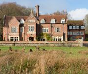
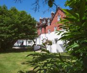
Burley Manor
Dunnroaming
Moorhill House
TRAVELODGE RINGWOOD
Videos from this area
These are videos related to the place based on their proximity to this place.
Think about the proposal's journey - Monthly Sales Tip, February 2013
Do you need to submit a proposal to the prospect / customer as part of your sales process and their purchasing process? Then this month's Sales Tip is most definitely for you...!
Jamie Bloemsma wakeboarding
28th June 2013, Jamie riding (well crashing mainly..) at Ellingham Waterski and Wakeboarding Club.
Steamrally and Roadrun 1984 Part 2-4 Netley Marsh and Alderholt.mpg
This is an old 8mm home movie made during a trip with our Lanz-Bulldog tractor and shepherdshut through the south of England. NetleyMarsh steamrally and a roadrun with steamengines through...
Avon Valley Path Walk: Fordingbridge to Ringwood 20 April 2013
After a gap of nearly six months because if the dire winter weather, I have finally walked a further section of the Avon Valley Path. This is the 9 mile section of the walk between Fordingbridge...
Blashford Macro
A munching caterpillar, Bee Orchid and mating Azure Damselflies taken at Blashford Lakes Nature Reserve, Ringwood on the 14th June 2014.
National Airsoft Event - 2012
Footage taken from several members of the Staffordshire University Airsoft Society at this years National Airsoft Event at Ground Zero on the 24th-26th August 2012. Over 1500 players attended...
Blashford Lakes Mix October 2014
A selection of birds, fungi and a caterpillar videoed at Blashford Lakes on the weekend of the 18-19th October 2014. Including a Kingfisher and fishing Grebes and an Earth Star Fungus.
Moors Valley Railway 2010 Garrett Event Pt 1
Action from the 2010 Garratt Event held on the miniature gauge tracks of the Moors Valley Railway near Ringwood in Hampshire. Clip taken from our DVD 'LINESIDE Late 2010'.
Hampshire Avon Pike Fishing (1)
An evening session on the Hampshire Avon fishing for pike. Nothing large landed, but great to be on the bank in such a glorious location. https://www.facebook.com/ThePikesterUK https://www.flickr....
Moors Valley Railway 2010 Garrett Event Pt 2
Action from the 2010 Garrett Event held on the miniature gauge tracks of the Moors Valley Railway near Ringwood in Hampshire. Clip taken from our DVD 'LINESIDE Late 2010'.
Videos provided by Youtube are under the copyright of their owners.
Attractions and noteworthy things
Distances are based on the centre of the city/town and sightseeing location. This list contains brief abstracts about monuments, holiday activities, national parcs, museums, organisations and more from the area as well as interesting facts about the region itself. Where available, you'll find the corresponding homepage. Otherwise the related wikipedia article.
Castleman Trailway
The Castleman Trailway is a footpath in Southern England. Portions of the trailway are also a cyclepath but the middle section from West Moors to Wimborne is not cyclable. One trailhead is on Bickerley Road in Ringwood and the other trailhead is the car park at Upton Country Park. The entire path is waymarked. The path passes through the villages of Ashley Heath, West Moors, Oakley, Broadstone and Upton, as well as Upton Heath and Upton Country Park.
Ringwood and Fordingbridge Rural District
Ringwood and Fordingbridge was a rural district in Hampshire from 1932 to 1974. It was formed by the merger of part of the disbanded Christchurch Rural District along with Ringwood Rural District and Fordingbridge Rural District. Its main urban centres were Ringwood and Fordingbridge. The district was split in 1974, between the districts of New Forest, East Dorset and Christchurch.
Latchmore Brook
The Latchmore Brook is a significant stream in the New Forest, Hampshire, England. It rises from the elevated gravel plateaus in the north of the Forest, north of Fritham, and drains into the River Avon north of Ibsley.
Ringwood railway station
Ringwood is a closed railway station in the county of Hampshire which served the town of Ringwood. It lay on the former Southampton and Dorchester Railway, the original main line from a connection with the London and South Western Railway at Southampton through Brockenhurst to Dorchester. The later development of Bournemouth as a major town led to the building of a branch from Ringwood through to Christchurch, later extended to Bournemouth - see Ringwood, Christchurch and Bournemouth Railway.
RAF Ibsley
Royal Air Force Station Ibsley or more simply RAF Ibsley is a former Royal Air Force station in Hampshire, England. The airfield is located near the village of Ibsley, approximately 2 miles north of Ringwood; about 85 miles southwest of London Opened in 1941, it was used by both the Royal Air Force and United States Army Air Forces. During the war it was used primarily as a fighter airfield. After the war it was closed in 1947.
Ellingham Harbridge and Ibsley
Ellingham Harbridge and Ibsley is a civil parish in the west of the English county of Hampshire. The civil parish was formed in 1974 by the amalgamation of the three titular villages which had all been civil parishes in their own right, it forms part of the New Forest District. The main geographical features of the area are the A338 road and the Hampshire Avon. The nearest towns are Ringwood and Fordingbridge.
Ellingham Priory
Ellingham Priory was a medieval monastic house in Ellingham, Hampshire, England. It was founded by William de Soleres in 1160. It was a cell to the Abbey of Saint-Sauveur-le-Vicomte in Normandy. The church of Ellingham formed part of the grant of William de Solers to Ellingham Priory. It was dissolved in 1414 and sold to Eton College in 1462.
Ibsley Circuit
Ibsley Circuit is a car racing circuit situated at RAF Ibsley, on the Fordingbridge to Ringwood Road in Hampshire, UK. Autosport states that the circuit was used for car racing from 1951 to 1955. All racing took place on Saturdays because its close proximity to the Church of St. Martin in Ibsley. The building was so close that the noise of the racing vehicles could disturb the congregation at worship.


