Safety Score: 3,0 of 5.0 based on data from 9 authorites. Meaning we advice caution when travelling to United Kingdom.
Travel warnings are updated daily. Source: Travel Warning United Kingdom. Last Update: 2024-08-13 08:21:03
Delve into The Hyde
The Hyde in Greater London (England) is a town located in United Kingdom a little north-west of London, the country's capital town.
Time in The Hyde is now 01:22 PM (Sunday). The local timezone is named Europe / London with an UTC offset of zero hours. We know of 9 airports closer to The Hyde, of which 5 are larger airports. The closest airport in United Kingdom is RAF Northolt in a distance of 8 mi (or 12 km), West. Besides the airports, there are other travel options available (check left side).
There are several Unesco world heritage sites nearby. The closest heritage site in United Kingdom is Tower of London in a distance of 15 mi (or 24 km), East. Also, if you like the game of golf, there are some options within driving distance. We saw 5 points of interest near this location. In need of a room? We compiled a list of available hotels close to the map centre further down the page.
Since you are here already, you might want to pay a visit to some of the following locations: Hendon, Wembley, Harrow, Ealing Broadway and Ealing. To further explore this place, just scroll down and browse the available info.
Local weather forecast
Todays Local Weather Conditions & Forecast: 15°C / 59 °F
| Morning Temperature | 15°C / 58 °F |
| Evening Temperature | 16°C / 60 °F |
| Night Temperature | 11°C / 51 °F |
| Chance of rainfall | 7% |
| Air Humidity | 76% |
| Air Pressure | 996 hPa |
| Wind Speed | High wind, near gale with 23 km/h (14 mph) from North |
| Cloud Conditions | Overcast clouds, covering 100% of sky |
| General Conditions | Moderate rain |
Monday, 25th of November 2024
9°C (48 °F)
6°C (43 °F)
Moderate rain, moderate breeze, overcast clouds.
Tuesday, 26th of November 2024
7°C (45 °F)
6°C (42 °F)
Light rain, moderate breeze, clear sky.
Wednesday, 27th of November 2024
6°C (44 °F)
4°C (39 °F)
Moderate rain, light breeze, broken clouds.
Hotels and Places to Stay
Apple House Guesthouse Wembley
Novotel London Wembley
MStay Golders Green
Holiday Inn LONDON - BRENT CROSS
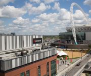
Hilton London Wembley
Holiday Inn LONDON - WEMBLEY
Clayton Crown
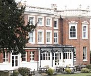
Hendon Hall
TRAVELODGE LONDON CRICKLEWOOD
The Windmill
Videos from this area
These are videos related to the place based on their proximity to this place.
21 01 2015 P838FJO Nob on the A5, Edgware Road
Nothing behind me but came out regardless, this inconsiderate person in an old Volvo just had to pull into the traffic and hold me up, typical Edgware Road driver..
21-01-2015 Edgware Road footage using RoadHawk software
RoadHawk HD DashCam footage on the A5 Edgware Road in London via the RoadHawk software.
Office Space Colindale - Serviced Offices Edgware
Serviced Offices Colindale http://www.searchofficespace.com/uk/office-space/colindale-serviced-offices.html Facilities at this serviced office space include; dedicated car parking spaces;...
Лондон: RAF Museum - Музей Королевских ВВС [По Морям Под Землёй]
Саша Дымов рассказывает от прекрасном лондонском музее Королевских ВВС (Royal Airforce Museum) Soundtrack: Bruce - Battle City...
Sunderland Flying Boat
This was one of many aircraft we saw on our day trip to the royal airforce museum near london on sunday 28th october 2012 and it was a brilliant day out.
England vs Ghana - Bernie Clifton
The Pukka Pies England Band are on route to Wembley. Former crackerjack star Bernie Clifton entertains on the trip down the motorway in his own inimitable way!!
Hendon Central Junctions - into a dual carriageway
Entering a cross road staggered junction into a Dual Carriageway www.cpdriving-lessons.co.uk.
Videos provided by Youtube are under the copyright of their owners.
Attractions and noteworthy things
Distances are based on the centre of the city/town and sightseeing location. This list contains brief abstracts about monuments, holiday activities, national parcs, museums, organisations and more from the area as well as interesting facts about the region itself. Where available, you'll find the corresponding homepage. Otherwise the related wikipedia article.
M1 motorway
The M1 is a north–south motorway in England connecting London to Leeds, where it joins the A1(M) near Aberford. It was the first inter-urban motorway to be completed in the United Kingdom; the first road to be built to motorway standard in the country was the Preston By-pass, which later became part of the M6. The motorway is 193 miles long and was constructed in four phases.
Royal Air Force Museum London
The Royal Air Force Museum London, commonly known as the RAF Museum, is a museum located on the former Hendon Aerodrome, dedicated to the history of aviation and the British Royal Air Force. The museum is a non-departmental public body sponsored by the Ministry of Defence and a registered charity. A second collection of exhibits is housed at the Royal Air Force Museum Cosford at RAF Cosford in Shropshire, five miles north west of Wolverhampton.
Hendon Police College
Hendon Police College is the principal training centre for London's Metropolitan Police Service. Founded with the official name of the Metropolitan Police College, the college is today officially called the Peel Centre, although its original name is still used frequently. Within the police it is known as just "Hendon". It is within walking distance of Colindale tube station on the Northern line.
Hendon Aerodrome
Hendon Aerodrome was an aerodrome in Hendon, north London, England that, between 1908 and 1968, was an important centre for aviation. It was situated in Colindale, seven miles (11.3 km) north west of Charing Cross. It nearly became "the Charing Cross of the UK's international air routes", but for the actions of RAF after the First World War.
London Tigers F.C
London Tigers F.C. is a football club based in Greenford, in the London Borough of Ealing, England. The club plays in the Spartan South Midlands League Premier Division.
Health Protection Agency
The Health Protection Agency was a non-departmental public body in the United Kingdom. It was an organisation that was set up by the UK government in 2003 to protect the public in England from threats to their health from infectious diseases and environmental hazards. It did this by providing advice and information to the general public, to health professionals such as doctors and nurses, and to national and local government.
Welsh Harp railway station
Welsh Harp railway station was built by the Midland Railway in 1870 on its extension to St. Pancras station.
Beis Yaakov Primary School
Beis Yaakov Primary School is a voluntary-aided primary school, for girls aged 3 to 11 from Orthodox Jewish families, situated in north-west London. It is the largest Jewish primary school for girls in the United Kingdom.
Welsh Harp (ward)
Welsh Harp ward is a political division of the London Borough of Brent that returns three representative Councillors and at the 2006 election was held by the Labour Party Francis Eniola, Mary Farrell, and Harbhajan Singh.
Silk Stream
The Silk Stream is a brook just over 4 kilometres long in the London Borough of Barnet. It is one of the major components of the Blue Ribbon Network. The Silk Stream is a tributary of the River Brent, which it joins at Brent Reservoir. It has several tributaries including Burnt Oak Brook, Edgware Brook, the Edgwarebury Brook and Deans Brook. The Silk Stream runs north-south through Colindale and Hendon. It gives its name to Silkstream Road, near Burnt Oak station.
St James' Catholic High School, Colindale
St James Catholic High School is voluntary aided mixed sex school for students from 11–18 years of age. It was founded by the Dominican sisters in 1934. Today it operates from one site in Colindale, Barnet in north London, England. The current headteacher is Mrs. Niamh Arnull (since 2010), a former pupil at the nearby Bishop Douglass School in Finchley.
West Hendon Playing Fields
West Hendon Playing Fields is a 62 acre public park in West Hendon in the London Borough of Barnet. It is one of Barnet's Premier Parks. It is a large grassed area with scattered mature trees. It has two tennis courts, several football pitches, a children's playground, a private bowls club, a basketball shooting hoop and a car park. The park formed part of the extensive open spaces owned by Hendon Borough Council in 1932 which became part of the London Borough of Barnet in 1965.


!['Лондон: RAF Museum - Музей Королевских ВВС [По Морям Под Землёй]' preview picture of video 'Лондон: RAF Museum - Музей Королевских ВВС [По Морям Под Землёй]'](https://img.youtube.com/vi/UFrEqa2EGh8/mqdefault.jpg)


