Safety Score: 3,0 of 5.0 based on data from 9 authorites. Meaning we advice caution when travelling to United Kingdom.
Travel warnings are updated daily. Source: Travel Warning United Kingdom. Last Update: 2024-08-13 08:21:03
Touring Thamesmead
Thamesmead in Greater London (England) is a town located in United Kingdom a little east of London, the country's capital place.
Time in Thamesmead is now 10:01 AM (Saturday). The local timezone is named Europe / London with an UTC offset of zero hours. We know of 8 airports nearby Thamesmead, of which 5 are larger airports. The closest airport in United Kingdom is London City Airport in a distance of 3 mi (or 4 km), West. Besides the airports, there are other travel options available (check left side).
There are several Unesco world heritage sites nearby. The closest heritage site in United Kingdom is Palace of Westminster and Westminster Abbey including Saint Margaret’s Church in a distance of 0 mi (or 1 km), South-East. Also, if you like the game of golf, there are several options within driving distance. We collected 3 points of interest near this location. Need some hints on where to stay? We compiled a list of available hotels close to the map centre further down the page.
Being here already, you might want to pay a visit to some of the following locations: Bexleyheath, Woolwich, Dagenham, Ilford and East Ham. To further explore this place, just scroll down and browse the available info.
Local weather forecast
Todays Local Weather Conditions & Forecast: 9°C / 47 °F
| Morning Temperature | 4°C / 39 °F |
| Evening Temperature | 12°C / 54 °F |
| Night Temperature | 14°C / 57 °F |
| Chance of rainfall | 8% |
| Air Humidity | 90% |
| Air Pressure | 1005 hPa |
| Wind Speed | Fresh Breeze with 16 km/h (10 mph) from North |
| Cloud Conditions | Overcast clouds, covering 100% of sky |
| General Conditions | Moderate rain |
Sunday, 24th of November 2024
15°C (59 °F)
13°C (56 °F)
Moderate rain, strong breeze, overcast clouds.
Monday, 25th of November 2024
11°C (52 °F)
9°C (49 °F)
Light rain, moderate breeze, broken clouds.
Tuesday, 26th of November 2024
11°C (51 °F)
10°C (51 °F)
Scattered clouds, moderate breeze.
Hotels and Places to Stay
Lucky 8 Hotel
Bexleyheath Marriott Hotel
TRAVELODGE LONDON ILFORD
Signature Hotel London
TRAVELODGE LONDON BARKING
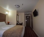
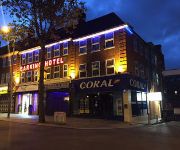
Barking Hotel
TRAVELODGE LONDON WOOLWICH
London Beckton
O'Grady's
TRAVELODGE LONDON BELVEDERE
Videos from this area
These are videos related to the place based on their proximity to this place.
HS1 at Dagenham Docks
Three scenes from HS1 at Dagenham Docks on the north bank of the Thames. This includes two Southeastern Trains Javelin services (one in each direction) and a Eurostar from the Continent towards.
92009 @ Dagenham HS1.MTS
92009 & 66152 ' 4O57 'entering HS1 from Ripple lane Yard @ Dagenham. this train was the first Freight to traverse the link line and was running to Dollands Moor.
HS1: London Tunnel 2 to Thames Tunnel
The journey from the Dagenham end of London Tunnel 2 to Thames Tunnel viewed aboard 395002 working 1J46 1610 St Pancras International to Dover Priory on Saturday 6th October 2012.
Vida & Sons: Užsukite pas mus! Come visit us! Приглашаем к нам!
Užsukite pas mus! Dirbame ir sekmadieniais! Come visit us! Vida & Sons 2-6 Goresbrook Road, Dagenham, Essex, RM9 6UR SUPERMARKET — Vida & Sons.
To Rent - Queens Road, Welling, DA16 3 Bedroom maisonette - £850 pcm
Queens Road, Welling, DA16 - 3 Bedroom maisonette - £850 pcm Anthony James Estate Agents - Tel 020 8304 0666 http://www.ajrproperty.com Anthony James are pleased to offer to the market...
Whats On London Tourist Attractions
http://www.whatonlondon.com/ Whats on London: An Remarkable Holiday! Life without event is boring. Lifestyle with dullness is not even a life! Why not visit a new place as a breather? Go...
Crossrail TBM Sophia Launched
Sophia, Crossrail's fifth tunnelling machine, has begun her journey from Plumstead to North Woolwich as part of the construction of a tunnel under the River Thames for London's new rail link....
Steampunk Umbrella Fencing
The final of the Umbrella Fencing at the First Crossness Steampunk Convivial. One of the combatants is none other than Staggering Stories' Karen 'Fake Keith' Dunn. http://www.crossnessconvivial.c...
West Kent Bus Or Car Driver, Who's In The Wrong?
14/11/2013 @ 08:10 approx the date on the camera is wrong. driving kids to school and this happens at a roundabout from what you can see who's in the wrong? no body was injured and there was...
Videos provided by Youtube are under the copyright of their owners.
Attractions and noteworthy things
Distances are based on the centre of the city/town and sightseeing location. This list contains brief abstracts about monuments, holiday activities, national parcs, museums, organisations and more from the area as well as interesting facts about the region itself. Where available, you'll find the corresponding homepage. Otherwise the related wikipedia article.
Lesnes Abbey
Lesnes Abbey /ˈlɛsnɨs/ is a former abbey, now ruined, in Abbey Wood, in the London Borough of Bexley. It is a scheduled ancient monument and the adjacent Lesnes Abbey Woods are a Local Nature Reserve. Part of the wood is the Abbey Wood SSSI, a geological Site of Special Scientific Interest which is an important site for early Tertiary fossils.
Crossness
Crossness is a place in south-east London. It is situated in the London Borough of Bexley, close to the southern bank of the River Thames, to the east of Thamesmead, west of Belvedere and north-west of Erith. The place takes its name from Cross Ness, a specific promontory on the southern bank of the River Thames. In maritime terms, the tip of Cross Ness, in the past referred to as 'Leather Bottle Point', marks the boundary between Barking Reach and Halfway Reach.
Erith and Thamesmead (UK Parliament constituency)
Erith and Thamesmead /ˈɪərɨθ ənd tɛmzmiːd/ is a constituency represented in the House of Commons of the U.K. Parliament and covers the areas of Erith and Thamesmead in the southeast of Outer London by the River Thames near the border of Greater London and Kent. Since 1997 it has been a Labour safe seat.
London Riverside
The London Riverside is a new development area in east London, England and part of the larger Thames Gateway redevelopment zone. The London Riverside area forms part of the Green Enterprise District, a project to create a low-carbon economy region in Greater London. It is one of two zones whose responsibility for delivery is with London Thames Gateway Development Corporation; the other is the Lower Lea Valley redevelopment.
Business Academy Bexley
The Business Academy Bexley is a school for ages 3–19 in South Thamesmead, the London Borough of Bexley, England, operating under the Academy programme for schools which are independently run but receive public funding. The secondary school opened in 2002, and relocated to dedicated premises in September 2003, while the primary school section opened in 2004. As of 2007 the total enrollment was 1,477. The school was constructed on a 33-acre site at a cost of £31m.
Lesnes Abbey Woods
Lesnes Abbey Woods, sometimes known as Abbey Wood, is an area of ancient woodland in southeast London, England. It is located near to, and named after, the ruined Lesnes Abbey in the London Borough of Bexley and gives its name to the Abbey Wood district. The woods are adjacent to Bostall Woods. The woods have several features dating back to the Bronze Age and a fine display of wild bluebells and daffodils in the Spring.
Church Manor Way Halt railway station
Church Manor Way Halt railway station was between Plumstead and Abbey Wood on the North Kent Line of the South Eastern and Chatham Railway. It was built to serve munitions workers in WWI. It opened in 1917 and closed in 1920. The road crossing the railway line is now named Church Manorway.
Thamesmead Housing Co-operative
The Thamesmead Housing Co-operative was a housing estate in Thamesmead, South East London in the London Borough of Greenwich. It was a purpose built housing cooperative and like others it was an experiment in building close-knit communities and as a way of helping single people and couples. It was dissolved in the 1990s and taken over by Hyde Housing Association (now The Hyde Group).
The Revells of Christendome
The Revells of Christendome is an engraving by English engraver Thomas Cockson. With image size of 21.6 x 35.5 cm and overall measure of 29.2 x 37.2 cm, it is now part of the collection of engravings in the Department of Prints and Drawings of the British Museum.
Abbey Wood SSSI
Abbey Wood is a 6.3 hectare geological Site of Special Scientific Interest in Abbey Wood in the London Borough of Bexley. It is located in Lesnes Abbey Woods south-east of the ruins of Lesnes Abbey. Members of the public can dig for fossils in a small area designated as the Fossil Bed with the permission of the Lesnes Abbey ranger. The site is late Palaeocene and early Eocene 50 to 60 million years ago.


