Safety Score: 3,0 of 5.0 based on data from 9 authorites. Meaning we advice caution when travelling to United Kingdom.
Travel warnings are updated daily. Source: Travel Warning United Kingdom. Last Update: 2024-08-13 08:21:03
Touring St Mary Cray
St Mary Cray in Greater London (England) is a town located in United Kingdom about 14 mi (or 22 km) south-east of London, the country's capital place.
Time in St Mary Cray is now 06:56 PM (Tuesday). The local timezone is named Europe / London with an UTC offset of zero hours. We know of 8 airports nearby St Mary Cray, of which 5 are larger airports. The closest airport in United Kingdom is London Biggin Hill Airport in a distance of 5 mi (or 8 km), South-West. Besides the airports, there are other travel options available (check left side).
There are several Unesco world heritage sites nearby. The closest heritage site in United Kingdom is Palace of Westminster and Westminster Abbey including Saint Margaret’s Church in a distance of 8 mi (or 13 km), North. Also, if you like the game of golf, there are several options within driving distance. We collected 3 points of interest near this location. Need some hints on where to stay? We compiled a list of available hotels close to the map centre further down the page.
Being here already, you might want to pay a visit to some of the following locations: Bexleyheath, Bromley, Woolwich, Catford and East Ham. To further explore this place, just scroll down and browse the available info.
Local weather forecast
Todays Local Weather Conditions & Forecast: 7°C / 44 °F
| Morning Temperature | 5°C / 40 °F |
| Evening Temperature | 6°C / 42 °F |
| Night Temperature | 4°C / 39 °F |
| Chance of rainfall | 0% |
| Air Humidity | 78% |
| Air Pressure | 1023 hPa |
| Wind Speed | Gentle Breeze with 7 km/h (4 mph) from South |
| Cloud Conditions | Broken clouds, covering 52% of sky |
| General Conditions | Broken clouds |
Wednesday, 4th of December 2024
6°C (44 °F)
9°C (47 °F)
Broken clouds, moderate breeze.
Thursday, 5th of December 2024
12°C (54 °F)
11°C (52 °F)
Moderate rain, fresh breeze, overcast clouds.
Friday, 6th of December 2024
8°C (46 °F)
13°C (55 °F)
Light rain, strong breeze, overcast clouds.
Hotels and Places to Stay
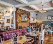
7 Hotel Diner
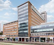
Bexleyheath Marriott Hotel
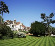
Rowhill Grange and Utopia Spa
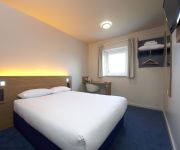
TRAVELODGE CROYDON CENTRAL
TRAVELODGE LONDON SIDCUP
Bull's Head Hotel
Clay Farm Guest House
Holiday Inn LONDON - BEXLEY
Mary Rose Inn Hotel
Swanley
Videos from this area
These are videos related to the place based on their proximity to this place.
Channel Update - 1500 subs - THANK YOU!
Hey, before I write anything here I just wanna THANK YOU ALL for 1500 subs it really means a lot! Also this is update video and if you have suggestion - questions feel free to ask in comment...
34046 Braunton at Chelsfield - 9th April 2014
Under bright sunshine, running 18 minutes late, Braunton heads up the 1 in 120 to the summit near Knockholt. However, with a Sevenoaks stopper only three minutes ahead it was likely to suffer...
dc shuttle on another mission
an inverted pass .. a nice in flight stall but no big deal for the shuttle. The motor kept cutting out but generally a good fun flight. Friday 13th October 2006. Well that was lucky!
Jump Schooling 15/02/2015
After a month of holiday this is Newtown Beauty's (Blanco) first time jumping again and loving it.
A Few Trains at Orpington 15/11/14
A few trains seen at Orpington on Saturday 15th November 2014. 0:00 375814+375815 pass with 2R34 1210 London Charing Cross to Ramsgate and Canterbury West. 0:09 465014 arrives on 2M52 ...
34067 Tangmere at Orpington station 11/11/12
34067 Tangmere on the return leg of the Kentish Belle Armistice day special to Dover and back, light is fading fast as 34067 Tangmere appears from behind the 16:46 slow to Hastings at Orpington...
Spitfire flying over Orpington in Kent
Supermarine Spitfire filmed flying over Orpington in Kent on 19th July 2014.
Bank Holiday Monday
A quick evening vlog on this bank holiday Monday here in the UK. Check out my friend Matt's first YouTube video at the link below. http://www.youtube.com/watch?v=kbgA_fiNSGQ&feature=plcp.
70013 Oliver Cromwell on Cathedrals Express at Orpington
Britannia Class Pacific 70013 Oliver Cromwell passes through Orpington on the evening of Wednesday 24th September 2008 with the return leg of the Cathedrals Express from Canterbury to London ...
Videos provided by Youtube are under the copyright of their owners.
Attractions and noteworthy things
Distances are based on the centre of the city/town and sightseeing location. This list contains brief abstracts about monuments, holiday activities, national parcs, museums, organisations and more from the area as well as interesting facts about the region itself. Where available, you'll find the corresponding homepage. Otherwise the related wikipedia article.
River Cray
The River Cray is a tributary of the River Darent in southern England. It rises in Priory Gardens in Orpington in the London Borough of Bromley, where rainwater permeates the chalk bedrock and forms a pond at the boundary between the chalk and impermeable clay. It then flows northwards past the industrial and residential area of St Mary Cray, through St Paul's Cray where there was once a paper mill, through Foots Cray, and enters the parkland of Foots Cray Meadows.
Crofton Roman Villa
Crofton Roman Villa in Orpington, in the London Borough of Bromley, is a Roman villa which was inhabited between approximately 140 and 400 AD. It was the centre of a farming estate of about 500 acres (2 km²), with farm buildings nearby, surrounded by fields, meadows and woods. The house was altered several times during its 260 years of occupation, and at its largest it probably had at least 20 rooms. The remains of ten rooms can be seen today.
Orpington Urban District
Orpington was a local government district in north west Kent from 1934 to 1965 around the town of Orpington, England. It was created an urban district in 1934 from parts of the abolished districts of Bromley Rural District and Chislehurst Urban District, taking in the entirety of Chelsfield, Cudham, and Knockholt parishes, and most of Farnborough, part of Keston, most of Orpington, most of St Mary Cray, part of St Paul's Cray and part of West Wickham.
Bromley Rural District
Bromley was a rural district in north-west Kent, England from 1894 to 1934. Its area now forms part of the London Borough of Bromley in Greater London. It did not include the main settlement of Bromley; which constituted the Municipal Borough of Bromley. Mottingham formed an exclave of the district. It was created under the Local Government Act 1894 based on the existing Bromley rural sanitary district.
Hundred of Ruxley
Ruxley was an ancient hundred, a land division in the north west of the county of Kent, England. Its area has been mostly absorbed by the growth of London; with its name currently referring to the Ruxley district. Its former area now corresponds to a majority of the London Borough of Bromley, a large part of the London Borough of Bexley and a small part of the Kent District of Sevenoaks. The hundred was within the Lathe of Sutton-at-Hone, in the west division of Kent.
Ramsden estate
The Ramsden Estate is a council estate in Orpington, South East London part of the London Borough of Bromley. It was built in the 1950s after the boom in council housing developed after World War II. The estate was built on green belt land south of London and north of Kent and is made up of three high rise blocks and 48 maisonettes. The Estate comprises Ramsden Road, Tintagel Road, Petten Grove, Eldred Drive, Quilter Road and Rye Crescent.
Seven Acre & Sidcup F.C
Seven Acre & Sidcup F.C. is an English football club located in Sidcup, in the London Borough of Bexley. The club is affiliated to the London Football Association. The club plays in the Kent Invicta Football League.
Ruxley Gravel Pits
Ruxley Gravel Pits is an 18.7-hectare biological Site of Special Scientific Interest in Ruxley, Orpington, in the London Borough of Bromley. It is also a Local Nature Reserve, a Site of Metropolitan Importance for Nature Conservation. It is owned by the Environment Agency and managed by Kent Wildlife Trust. Natural England has assessed its condition as "unfavourable recovering".


