Safety Score: 3,0 of 5.0 based on data from 9 authorites. Meaning we advice caution when travelling to United Kingdom.
Travel warnings are updated daily. Source: Travel Warning United Kingdom. Last Update: 2024-08-13 08:21:03
Delve into Norwood Green
The district Norwood Green of Southall in Greater London (England) is a subburb in United Kingdom a little west of London, the country's capital town.
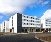
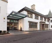
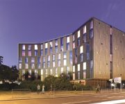
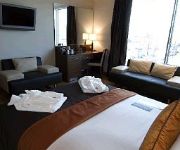
If you need a hotel, we compiled a list of available hotels close to the map centre further down the page.
While being here, you might want to pay a visit to some of the following locations: Hounslow, Twickenham, Ealing, Ealing Broadway and Harrow. To further explore this place, just scroll down and browse the available info.
Local weather forecast
Todays Local Weather Conditions & Forecast: 15°C / 59 °F
| Morning Temperature | 15°C / 58 °F |
| Evening Temperature | 16°C / 61 °F |
| Night Temperature | 11°C / 52 °F |
| Chance of rainfall | 7% |
| Air Humidity | 75% |
| Air Pressure | 997 hPa |
| Wind Speed | Strong breeze with 20 km/h (13 mph) from North |
| Cloud Conditions | Overcast clouds, covering 100% of sky |
| General Conditions | Moderate rain |
Monday, 25th of November 2024
10°C (49 °F)
7°C (44 °F)
Moderate rain, moderate breeze, overcast clouds.
Tuesday, 26th of November 2024
8°C (47 °F)
6°C (43 °F)
Sky is clear, gentle breeze, clear sky.
Wednesday, 27th of November 2024
7°C (44 °F)
5°C (41 °F)
Moderate rain, gentle breeze, broken clouds.
Hotels and Places to Stay
Heston Hyde Hotel
Crompton Guest House
Airlink Hotel London Heathrow Best Western
DoubleTree by Hilton Hotel London Heathrow Airport
Best Western Plus Park Grand London Heathrow
The Continental
HYATT PLACE LONDON HEATHROW AIRPORT
TRAVELODGE LONDON HOUNSLOW
RAMADA HOUNSLOW - HEATHROW EAS
MOXY London Heathrow Airport
Videos from this area
These are videos related to the place based on their proximity to this place.
HSC Development Centre Campaign Initial SPEAKERS January 2014
Welcome to HSC six months campaign initial gathering and speakers on the 18th January 2014. You may watch HSC Development Centre Campaign Initial Presentations 18 January 2014 ...
The Tunnel....leading to the straight ( old gasworks) southall - UB2...
the tunnel leading to the straight, southall, UB2 where the old gasworks were. loved walking through this tunnel back in the olde days (1978-1985). love it, and so good to walk through, after...
Laser Hair Removal for Men at CoLaz Southall
Laser Hair Removal is very popular with men too. Since men started thinking about their looks and appearance in non-classic way, the need for them to be less hairy is in. Many men want to...
London Fire Brigade - G241 Southall
Southall's pump ladder is seen responding to an emergency call received by radio and having some problems turning round in the traffic. Find more LFB videos @ www.lfbsite.com.
Hair Removal and Beauty Salon in Southall
This video is of Kay the branch manager of CoLaz in Southall. We perform Laser hair removal,inch loss treatments,beauty treatments,Skin blemishes Our Address CoLaz Advanced Beauty Specialists...
Man and Van Southall - 07888123888
Elite Man and Van provides great house and flat removals and furniture courier services in Southall, Wembley, Ealing, Hounslow and Uxbridge ...
Urse Paak Mehfil e Giarveen Sharif Jamia Masjid Townsend Southall
Urse Paak Mehfil e Giarveen Sharif Jamia Masjid Townsend Southall 22/02/2014. Qari Shahid Mehmood short appearance. Mera Murshid Sohna 11:49.
Masala Creations of Southall Incredible 5 Star Review
http://masalacreations.com 0208 606 8996 Masala Creations of Southall 5 Star Review - 'Keep It Hot' Onsite Catering Specialists We had Masala Creations for my birthday party. We only found...
Steam rail motor SRM93 @ Southall 19/10/14
Steam rail motor SRM93 runs from Southall - Brentford on 19 October 2014. The steam rail motors (SRM) were self-propelled carriages operated by the Great Western Railway in England and Wales...
Man and Van Southall - House removals, Courier Multi Drops, Rubbish clearance, small or large van
Man and Van Southall http://www.elitemanandvan.co.uk/ We offer man and van hire services in and around Southall * Local pick up and deliveries * Pallet deliveries * Local, National or Europe...
Videos provided by Youtube are under the copyright of their owners.
Attractions and noteworthy things
Distances are based on the centre of the city/town and sightseeing location. This list contains brief abstracts about monuments, holiday activities, national parcs, museums, organisations and more from the area as well as interesting facts about the region itself. Where available, you'll find the corresponding homepage. Otherwise the related wikipedia article.
A30 road
The 284 miles (457 km) A30 road from London to Land's End, used to provide the most direct route from London to the south west; more recently the M3 motorway and A303 road performs this function for much of the route and only parts of A30 now retain trunk road status. Places on the trunk section have been bypassed and sections of road widened.
Blair Peach
Clement Blair Peach (25 March 1946 – 23 April 1979) was a New Zealand-born teacher who died during an anti-racism demonstration in London, England. A campaigner and activist against the far right, Peach was knocked unconscious in April 1979 during an Anti-Nazi League demonstration which turned violent in Southall against a National Front election meeting in the town hall. He died the next day in hospital from head injuries that he sustained.
Sunrise Radio
Sunrise Radio is the United Kingdom's first Independent Local Radio station to cater specifically for the Asian community. Dr Avtar Lit is the chairman and chief executive of this media group which also operates Kismat Radio, Buzz Asia, Punjabi Radio as well as Sunrise TV.
Osterley Park
Osterley Park is a mansion set in a large park of the same name. It is in the London Borough of Hounslow, part of the western suburbs of London. When the house was built it was surrounded by rural countryside. It was one of a group of large houses close to London which served as country retreats for wealthy families, but were not true country houses on large agricultural estates. Other surviving country retreats of this type near London include Syon House and Chiswick House.
Southall rail crash
The Southall rail crash was an accident on the British railway system that occurred on 19 September 1997, on the Great Western Main Line at Southall, west London. Seven people were killed and 139 injured.
Ealing Southall (UK Parliament constituency)
Ealing, Southall is a constituency represented in the House of Commons of the UK Parliament since 2007 by Virendra Sharma of the Labour Party.
Cavalry Barracks, Hounslow
Hounslow Barracks redirects here. The London Underground station so named is now named Hounslow West tube station. Cavalry Barracks is a British Army installation located north of Hounslow Heath in Hounslow, west London. The site, which has been used for more than two centuries by the British Army, is currently part of the Ministry of Defence's SLAM (single living accommodation modernisation) project to improve military accommodation.
Kismat Radio
Kismat Radio is a radio station broadcasting from the Crystal Palace Transmitter in south-east London.
Municipal Borough of Southall
Southall (until 1936 Southall Norwood) was a local government district in the county of Middlesex, United Kingdom from 1891 to 1965. It consisted of the civil parish of Norwood. Southall Norwood Local Government District was created on 16 January 1891, when the parish of Norwood adopted the Local Government Act 1858. The district was governed by a local board. The Local Government Act 1894 reconstituted the local board's area as an urban district.
Western International Market
The Western International Market market in Southall in West London, England is one of the principal wholesale markets in the London region. It is owned by the Hounslow London Borough Council and covers 86 acres . The current market was built in 1974. It is close to Heathrow Airport and acts as a conduit for fresh produce airlifted to Heathrow to reach the retail and catering trades.
Gurdwara Sri Guru Singh Sabha
Gurdwara Sri Guru Singh Sabha Southall (SGSS) is a Sikh Gurdwara situated in the London suburb of Southall on Havelock Road and Park Avenue. It is the largest Sikh temple in Europe. Building work at the Havelock Road site commenced in March 2000 and the Gurdwara opened on Sunday 30 March 2003, in order to accommodate for Southall's growing Sikh community. The Gurdwara cost £17.5 million to build. Funding came by way of donations from members of the local Sikh community and abroad.
Hanwell Asylum
The (1st Middlesex) County Asylum at Hanwell, also known as Hanwell Insane Asylum, and Hanwell Pauper and Lunatic Asylum, was built for the pauper insane. Hanwell was the first purpose-built asylum in England and Wales, and it opened in 1831. Some of the original buildings are now part of the headquarters for the West London Mental Health (NHS) Trust (WLMHT).
Southall East Junction
Southall East Junction is a railway junction in the vicinity of Southall on the outskirts of London, England on the former GWR main line. It was the scene of a collision on 19 September 1997 between a HST and an EWS freight train that was crossing into Southall Yard in front of the HST.
Southall Railway Centre
Southall Railway Centre is a railway heritage centre at Southall in west London, near to Southall railway station and the Grand Union Canal. It is run by the GWR Preservation Group Limited (GWRPG).
West London Mental Health NHS Trust
The West London Mental Healthcare NHS Trust (WLMHT) was established 1 October 2000. The head quarters is situated in St. Bernard's Hospital Building. This is on the south side of the Uxbridge Road between the towns of Southall and Hanwell and 8½ miles west from London, in the Southall district of the London Borough of Ealing, Greater London, England. With its duties spread across some 32 geographical sites it employs over 4,300 people.
Yarr Radio
Yarr Radio is/was a British music radio station aimed at a young Asian audience. It broadcast on digital radio in various regions of the UK and on Sky Channel 187. Launched in 2003 by Indo-Canadian singer Jazzy B, it was called 'London's First Young Asian Hit Music Station'. The original presenters of 'Yaar Radio' can were: Maya, Ranj Rekhi, Sonia Paneser, Danny Deol, Dee Singh, Kim Boss, Vinny Virdee, Ellia Khan .
Amar Radio
Amar Radio is a community radio channel, aimed at the Asian community. Based in Southall, London, it was launched on 27 June 2002 as Akash Radio. During May 2010, Akash Radio had a change of management with the name, imaging and content all undergoing a refresh. Akash Radio became known as Amar Radio. In December 2010, Jaswant Singh, the President of Southall's Miri Piri Gurdwara bought Amar Radio with plans to give the station an overhaul.
North Hyde
North Hyde is a suburban development situated between the towns of Heston, Hayes and Southall under the administrative control of the London Borough of Hounslow. It is bordered to the north by the Grand Union Canal mainline and to the south by the M4. The area now consists of a mixture of mostly spacious, semi detached suburban properties. It is also home to the Airlinks golf course and Convent Way, an estate with a mixture of high and low-rise housing.
1958 London Vickers Viking accident
The London Vickers Viking accident occurred on 2 September 1958 when an Independent Air Travel Vickers VC.1 Viking, loaded with two Bristol Proteus turboprop engines as cargo, and with three crew members aboard, attempted a flight from London Heathrow Airport to Tel Aviv via Nice, Brindisi and Athens.
Indian Gymkhana Cricket Club Ground
Indian Gymkhana Cricket Club Ground is a cricket ground in Osterley, London. which was founded in 1916. The first recorded match on the ground was in 1932, when Indian Gymkhana played the touring Indians. The ground has also held Middlesex Second XI fixtures, the first of which came in the 1935 Minor Counties Championship when the Middlesex Second XI played the Glamorgan Second XI.
Cranford Community College
Cranford Community College is a secondary school with academy status in the London Borough of Hounslow, England. The school first opened as Woodfield Secondary School. After the 1944 Education Act, Spring Grove Central School and the council senior schools became secondary modern schools. The Hounslow Heath secondary school was closed and its buildings were transferred to the neighbouring primary school when the Woodfield secondary modern school was opened in 1954 at the Great South West Road.
Lampton
Lampton is a small area located in the borough of Hounslow, London between Hounslow and Spring Grove.
Southall Gas Works
Southall Gas Works is a site of around 83 acres in Southall, west London, formerly occupied by a plant for the manufacture of town gas. Today a much reduced site is used for the pressure reduction and storage of natural gas and the remainder of the site is the subject of planning proposals.
Heston Community School
Heston Community School is a secondary school with academy status situated in Heston, London, England. It caters for a wide range of children aged between 11 and 19, including those with a hearing impairment. The School as opened on 19 October 1932 by the Charter Mayor, Councillor H J Nias MBE JP at a cost of ₤21, 730 though the old Heston Schools had been built in 1861 by the Charter Mayor's father.
St Anselm's Church, Southall
St Anselm's Church in Southall is a Roman Catholic parish church served by the Society of Jesus in the London Borough of Ealing within the administration of the Archdiocese of Westminster. It is situated on The Green, a main thoroughfare into Southall. The parish is home to the De Nobili Dialogue Centre; a Jesuit building for inter-religious dialogue. It is also the only Catholic church in Southall and the parish has more than fifty nationalities represented in the congregation.


