Safety Score: 3,0 of 5.0 based on data from 9 authorites. Meaning we advice caution when travelling to United Kingdom.
Travel warnings are updated daily. Source: Travel Warning United Kingdom. Last Update: 2024-08-13 08:21:03
Discover Gidea Park
The district Gidea Park of Romford in Greater London (England) is a subburb in United Kingdom about 15 mi east of London, the country's capital city.
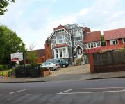
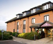
If you need a hotel, we compiled a list of available hotels close to the map centre further down the page.
While being here, you might want to pay a visit to some of the following locations: Dagenham, Ilford, Bexleyheath, East Ham and Grays. To further explore this place, just scroll down and browse the available info.
Local weather forecast
Todays Local Weather Conditions & Forecast: 8°C / 47 °F
| Morning Temperature | 4°C / 39 °F |
| Evening Temperature | 12°C / 53 °F |
| Night Temperature | 13°C / 56 °F |
| Chance of rainfall | 9% |
| Air Humidity | 91% |
| Air Pressure | 1005 hPa |
| Wind Speed | Fresh Breeze with 17 km/h (11 mph) from North |
| Cloud Conditions | Overcast clouds, covering 100% of sky |
| General Conditions | Moderate rain |
Sunday, 24th of November 2024
15°C (59 °F)
13°C (56 °F)
Moderate rain, strong breeze, overcast clouds.
Monday, 25th of November 2024
11°C (51 °F)
9°C (48 °F)
Light rain, fresh breeze, broken clouds.
Tuesday, 26th of November 2024
10°C (50 °F)
10°C (50 °F)
Scattered clouds, moderate breeze.
Hotels and Places to Stay
Marygreen Manor
Gidea Park Hotel
Harefield Manor
TRAVELODGE LONDON ROMFORD
JCT.28 Holiday Inn BRENTWOOD M25
The Blue Boar
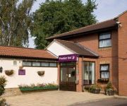
Premier Inn London Romford Central
Romview
London Rainham
London Romford West
Videos from this area
These are videos related to the place based on their proximity to this place.
First Play: The Spatials
First Impression: Not bad... I'm tempted to do a series on this... what do you think? Comment Below The Spatials is a Space Station Building / Management Simulator from Weird and Wry. It some...
Welcome to FootAsylum Romford
Check out 'A day in the life' working in the Romford Foot Asylum Store. FootAsylum is one of the leading high street retailers in the UK, trading now at 30 stores nationwide. For the latest...
Tour of lifts at romford shopping centres
Tour of lifts at romford shopping centres http://benobve.110mb.com.
Early Days - Romford Skatepark '96
Hitting 'The Rom' Skatepark in Romford, England sometime in 1996, with Greg Finch and Brenton Dawber aka Pinga. Greg was ruling it. Goodtimes as always.
Joey The Clown - Fiction Romford - Halloween Weekender
From Thursday 30th October to Saturday 1st November, do you dare to enter Fiction Romford…. Joey The Clown and his Circus Freaks take over Fiction for one Halloween Weekender you won't forget!
Romford Accountants - Self Assessment Tax Returns
http://www.holgatecourtaccountants.co.uk/self-assessment/self-assessment-help Holgate Court Accountants in Romford strongly advise that businesses file and pay tax on time to avoid hefty fines...
Joey The Clown - Fiction Romford - Halloween Weekender
From Thursday 30th October to Saturday 1st November, do you dare to enter Fiction Romford…. Joey The Clown and his Circus Freaks take over Fiction for one Halloween Weekender you won't forget!
First Play: This War of Mine, by 11 bit Studios
Take a look at this new twist on a survival simulation game, as we delve into the war-torn world of "This War of Mine" from 11 bit Studios. This dark and twisted game places you in control...
KSP Live! 6 Dec 2014 - Part 2
After our 1 year of KSP Live celebrations (video to follow), we're back with our usual career mode game and this week we attempt two very different missions. Firstly we finally go back to...
KSP Live! 6 Dec 2014 - Part 1
After our 1 year of KSP Live celebrations (video to follow), we're back with our usual career mode game and this week we attempt two very different missions. Firstly we finally go back to...
Videos provided by Youtube are under the copyright of their owners.
Attractions and noteworthy things
Distances are based on the centre of the city/town and sightseeing location. This list contains brief abstracts about monuments, holiday activities, national parcs, museums, organisations and more from the area as well as interesting facts about the region itself. Where available, you'll find the corresponding homepage. Otherwise the related wikipedia article.
Romford Market
Romford Market is a large open market with 270 stalls, located in Romford, London Borough of Havering, Greater London, England. The market is open on Wednesdays, Fridays and Saturdays from 8.30 am to 4.30 pm (5 pm on Saturdays). There is a farmers' market at the site from 10 am to 3 pm on the second and fourth Sundays of the month.
The Liberty
The Liberty, is a covered shopping centre located in the London Borough of Havering. It is the largest shopping centre in Romford, a metropolitan centre of Outer London. It was originally built in 1968 as the Liberty Shopping Centre and underwent a four-year redevelopment completed in 2004. The centre takes its name from the former Liberty of Havering and is owned by the Cosgrave Property Group.
Hare Hall
Hare Hall is a house and grounds located in Gidea Park in the London Borough of Havering, east London. It was built in 1769-70 as a country house for John A. Wallinger and since 1921 has housed the Royal Liberty School. The Palladian mansion was built to designs by James Paine, who included it in his published Plans. The main north front is of five bays, with a rusticated basement storey, above which the two upper storeys are unified by a giant portico and pilasters at the angles.
Langtons
Langtons House and Langtons Gardens are a grade II listed 18th century house and landscaped gardens located in Hornchurch, in the London Borough of Havering, Greater London. The house and gardens became local authority property in 1929 and are currently used as the borough register office and a public park. Langtons House was used as the council offices of Hornchurch Urban District Council from 1929 to 1965.
Romford (UK Parliament constituency)
Romford is a constituency represented in the House of Commons of the UK Parliament since 2001 by Andrew Rosindell, a Conservative.
Hornchurch Urban District
Hornchurch was a local government district in south west Essex, England from 1926 to 1965. The urban district council was based at Langtons House. The district formed a suburb of London and was expanded in 1934. It now forms the greater part of the London Borough of Havering in Greater London.
Municipal Borough of Romford
Romford was a local government district in southwest Essex from 1851 to 1965. It was significantly expanded in 1934 and gained the status of municipal borough in 1937. The population density of the district consistently increased during its existence and its former area now corresponds to the northern part of the London Borough of Havering in Greater London.
Hornchurch and Upminster (UK Parliament constituency)
Hornchurch and Upminster is a constituency represented in the House of Commons of the UK Parliament since 2010 by Angela Watkinson, a Conservative.
Bedfords Park
Bedfords Park is a 106 hectare park in Havering-atte-Bower in the London Borough of Havering. It is one of three large parklands in Havering-atte-Bower, the others are Havering Country Park and Pyrgo Park. It is situated 110 metres above sea level with views across east London, Essex and Kent. It is a Site of Metropolitan Importance for Nature Conservation and it has received a Green Flag Award.
Romford Ice Arena
Romford Ice Arena is an ice rink located in Romford in the London Borough of Havering, England. The venue was built in the 1980s and at the time of opening in 1987 was equipped with a full range of facilities, including a cafe and arcade games. It is the home of the Romford Raiders ice hockey team. In addition to ice hockey, the arena has resident professional figure skating coaches. The rink is also used for public skating, as a conference centre and a party venue.
Harold Wood Hospital
Harold Wood Hospital was a hospital in northeast London, United Kingdom. It was located in Gubbins Lane, Harold Wood, in the London Borough of Havering. The Havering Campus of London South Bank University, an NHS polyclinic and a long term conditions unit continue to operate at the hospital site, and a residential development by Countryside Properties is planned.
Oldchurch Hospital
Oldchurch Hospital was a hospital in London, United Kingdom, located in Romford, in the London Borough of Havering and part of the Barking, Havering and Redbridge Hospitals NHS Trust. The hospital incorporated the buildings of the former Romford Union Workhouse, built in 1838. The hospital closed in December 2006 with functions moved to the new, state of the art Queen's Hospital, located nearby and to King George Hospital in Chadwell Heath.
Gidea Hall
Gidea Hall was a manor house, located in Gidea Park, the historic parish and Royal liberty of Havering-atte-Bower, whose former area today forms the north eastern extremity of Greater London, England. The first record of Gidea Hall is in 1250, and in 1466 Sir Thomas Cooke (c.1410-1478), a lord mayor of London, was granted a licence to crenellate, which is a licence for the manor house to be fortified.
Star Brewery
The Star Brewery was a brewery in Romford, England. For much of its history, it was a main industry and a significant employer in the area. It was closed in 1993. The site was redeveloped as a shopping centre named The Brewery, which opened in 2001. The brewery produced John Bull Bitter.
Frances Bardsley Academy for Girls
Frances Bardsley Academy for Girls Frances Bardsley Academy for Girls is a non-denominational girls school and sixth form centre in the London Borough of Havering, England. The school educates girls between the ages of 11 and 18 (school years 7 to 13).
The Mercury Mall
The Mercury Mall is a enclosed shopping centre in Romford, in the London Borough of Havering, Greater London. It opened in June 1990 as Liberty 2. From 2006 to August 2010 it was owned by The Mall Fund and was known as The Mall Romford. It is—along with The Liberty and The Brewery—one of the three main shopping centres in Romford.
Rise Park
See all Rise Park, Beverley, home of the ancestral Bethells http://www. bethellj. plus. com/notrise. htm Rise Park is an area of Romford, a district in the London Borough of Havering. The park is one of a series of parks which stretch northwards from the railway line at Romford. The southern entrance to Rise Park is just north of the A12 Eastern Avenue, and the northern entrance is on Lower Bedfords Road.
Lodge Farm Park
Lodge Farm Park is a public park in the town of Romford in the London Borough of Havering. The park is one of a series of parks which stretch northwards from the railway line at Romford. The southern entrance to Lodge Farm Park is in Carlton Road in Romford (which runs parallel to the railway line), and the northern entrance is on Main Road in Romford.
Raphael Park
Raphael Park is a public park in Romford, London Borough of Havering, one of a series of parks stretching northwards from the railway line at Romford. The name of this park is commonly pronounced by locals as "ray-fel" as opposed to "raff-ahy-al" (as in the name, Raphael). The southern entrance to Raphael Park is on Main Road in Romford, and the northern entrance is just south of the A12 Eastern Avenue.
Marshalls (house)
Marshalls was a house, located in Romford in the historic parish and Royal liberty of Havering, whose former area today forms the north eastern extremity of Greater London, England. The name Marshalls dates back to 1213 when Gilbert, son of Roger Marschal is recorded as leasing land in Havering to the house of Canons at St Bernard, and in 1321 Richard le Marescall owned land near the eventual site of the house.
Langton Park
Langton Park was a first-class cricket ground in Hornchurch, Essex. Surrounding Langton's House, built in the 18th century, the park was the home of Hornchurch Cricket Club and was a major venue from 1785 to 1793. At that time, the Hornchurch club was representative of Essex as a county. The earliest recorded first-class match at Langton Park was in May 1785 when Essex played Middlesex and the last was Essex v MCC in May 1793.
Heath Park, London
Heath Park is a district of the London Borough of Havering in London, England.
The Brewery (shopping centre)
The Brewery is a shopping and leisure centre in Romford, in the London Borough of Havering, England. It is located on the site of the former Star Brewery, and it opened in 2001. It is—along with The Liberty and The Mercury—one of the three main shopping centres in Romford. In 2010, a 25% stake in the complex was sold by the Henderson Group to Prudential Property Investment Managers for £44.25m.
Bower Park School
Bower Park School is a secondary school with academy status in the London Borough of Havering for 11 to 16 year olds. The school gained its specialist Arts College (media) in 2010.
Gidea Park Sports Ground
Gidea Park Sports Ground is a cricket ground in Romford, England. The first recorded match on the ground was in 1948, when the Essex Second XI played the Sussex Second XI in the Minor Counties Championship. Essex played their first first-class match there in 1950, when they played Hampshire. From 1950 to 1968, the ground played host to 34 first-class matches, the last of which saw Essex play Surrey.


