Safety Score: 3,0 of 5.0 based on data from 9 authorites. Meaning we advice caution when travelling to United Kingdom.
Travel warnings are updated daily. Source: Travel Warning United Kingdom. Last Update: 2024-08-13 08:21:03
Touring Kingsland
The district Kingsland of in Greater London (England) is a subburb located in United Kingdom a little north-east of London, the country's capital place.
Need some hints on where to stay? We compiled a list of available hotels close to the map centre further down the page.
Being here already, you might want to pay a visit to some of the following locations: Islington, Hackney, City of London, City of Westminster and London. To further explore this place, just scroll down and browse the available info.
Local weather forecast
Todays Local Weather Conditions & Forecast: 9°C / 48 °F
| Morning Temperature | 4°C / 39 °F |
| Evening Temperature | 12°C / 54 °F |
| Night Temperature | 14°C / 57 °F |
| Chance of rainfall | 9% |
| Air Humidity | 90% |
| Air Pressure | 1005 hPa |
| Wind Speed | Fresh Breeze with 16 km/h (10 mph) from North |
| Cloud Conditions | Overcast clouds, covering 100% of sky |
| General Conditions | Moderate rain |
Sunday, 24th of November 2024
15°C (60 °F)
13°C (55 °F)
Moderate rain, strong breeze, overcast clouds.
Monday, 25th of November 2024
11°C (51 °F)
9°C (48 °F)
Broken clouds, moderate breeze.
Tuesday, 26th of November 2024
10°C (51 °F)
10°C (51 °F)
Scattered clouds, moderate breeze.
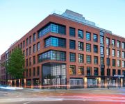
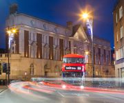
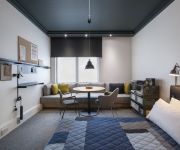
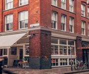
Hotels and Places to Stay
The Curtain
Courthouse Hotel Shoreditch
M by Montcalm Shoreditch London Tech City
ACE Hotel - London Shoreditch
Boundary
The Hoxton Shoreditch
Landmark Apartments
The Re London Shoreditch
Shoreditch One
citizenM London Shoreditch
Videos from this area
These are videos related to the place based on their proximity to this place.
Car mounts island
Last night a car hurring to jump his traffic light change made his right turn too sharp and ran over the corner of the traffic island ripping the bollard cover off. EY08 PFE needs to take...
Pops Mensah-Bonsu Balls Out at Late Night Hackney Scrimmage with Old Friends!
Subscribe NOW to be the first to see our new vids! Click here to subscribe - http://bit.ly/hoopsfixsub Like us on Facebook: http://www.facebook.com/hoopsfix Follow us on Twitter: http://www.twitter...
Commercial waste collection Hackney London E8
Commercial Waste Collection Hackney London E8. Call 07946 765444 For A FREE Estimate. http://rubbishremovalpro.co.uk/ We offer a range of commercial waste disposal and recycling collection...
Urban squirrel in Hackney London
This urban squirrel was filmed looking for food in the borough of Hackney, London next to a bus stop. Squirrels in London are extra friendly, nosey and extremely cute which is great to be...
Videos provided by Youtube are under the copyright of their owners.
Attractions and noteworthy things
Distances are based on the centre of the city/town and sightseeing location. This list contains brief abstracts about monuments, holiday activities, national parcs, museums, organisations and more from the area as well as interesting facts about the region itself. Where available, you'll find the corresponding homepage. Otherwise the related wikipedia article.
London Borough of Hackney
The London Borough of Hackney is a London borough located northeast of the City of London. It is currently part of the subregion of East London, though was formerly included in North/North East London/. It is one of the boroughs of Inner London. The local authority is Hackney London Borough Council. Hackney's southwestern boundary is adjacent to the City and Broadgate.
Kingsland Road
Kingsland Road is the name of a road, part of the A10, in the London Borough of Hackney in England. It runs from the junction with Old Street and Hackney Road (the section of the A10 south of this is Shoreditch High Street) north to the junction with Balls Pond Road and Dalston Lane, where it changes its name to Kingsland High Street. Kingsland Road means the road to Kingsland, an old settlement that has been largely absorbed by modern Dalston.
Newington Green
Newington Green is an open space in north London that straddles the border between Islington and Hackney. It gives its name to the surrounding area, roughly bounded by Ball's Pond Road to the south, Petherton Road to the west, the southern section of Stoke Newington with Green Lanes, Matthias Road to the north, and Boleyn Road to the east. The Green itself is in N16 and the area is covered by the N16, N1 and N5 postcodes.
Shacklewell
Shacklewell is a district within the London Borough of Hackney, roughly north-east of modern-day Dalston, (which historically was due south of Shacklewell).
Kingsland, London
Kingsland was a small road-side settlement centred on Kingsland High Street, on the Old North Road (the present A10), in the former county of Middlesex. It has now been subsumed within inner city London, principally as part of Dalston in the London Borough of Hackney, and has lost its separate identity.
Haggerston Park
Haggerston Park is an open space in Haggerston, in the London Borough of Hackney. It is bounded by Whiston Road (to the north), Hackney Road (south) and St Saviour's Priory, Queensbridge Road (west) and Goldsmith's Row (east). The park was originally created in the 1950s and extended in the 1980s. It was carved out of an area of derelict housing, a tile manufacturer, and the old Shoreditch gasworks, which had been hit by a V-2 rocket in 1944 and badly damaged.
Vortex Jazz Club
The Vortex Jazz Club is a London venue that primarily features live contemporary jazz. The club's official website features book reviews and jazz CD reviews by critic Chris Parker. The Vortex started as a jazz club in 1987 and was located in Stoke Newington Church Street.
Dalston (Hackney ward)
Dalston is a ward in the London Borough of Hackney. It roughly corresponds to the Dalston area of London and now forms part of the Hackney North and Stoke Newington constituency. Previously, the ward was split between the two Hackney constituencies, the other half being part of Hackney South and Shoreditch. The ward returns three councillors to the Borough Council, with elections every four years.
Rosemary Branch Theatre
Rosemary Branch Theatre is a theatre above a public house, in Islington on the borders of Hackney and Shoreditch. It has a capacity of 57 seats, expandable to 65. The pub is a freehouse and the venue is independent and privately owned. The theatre has a tradition of presenting an eclectic mix of art and entertainment in what was once a Victorian music hall, and takes pride in providing a safe and supportive place for emerging talent in all areas of theatre.
Mildmay Park railway station
Mildmay Park railway station is a former railway station on the North London Line between Canonbury and Dalston Kingsland stations. The station was on Mildmay Park between Newington Green and Balls Pond Road. The North London Railway from Dalston Junction to Highbury & Islington was opened on 26 September 1850 although the station was not opened until 1 October 1880. It was closed by the London, Midland and Scottish Railway on 30 September 1934, probably as it was near Canonbury station.
St Matthias Church (Stoke Newington)
St Matthias Church is an Anglican church in Stoke Newington, north London, England. It is dedicated to St Matthias.
De Beauvoir (ward)
De Beauvoir is a ward in the London Borough of Hackney and forms part of the Hackney South and Shoreditch constituency. The ward returns three councillors to Borough Council, with an election every four years. At the last election on 6 May 2010, Rob Chapman, Gulay Icoz, and Tom Ebbutt, all Labour Party candidates, were returned. Turnout was 57%; with 5,458 votes cast. In 2001, De Beauvoir ward had a total population of 9,932.
Kingsland Secondary School
Kingsland Secondary School was a school located on Shacklewell Lane in the London Borough of Hackney, England. It closed in August 2003. The school, originally built as Dalston County School in ca. 1937, was closed in August 2003, demolished and rebuilt under the new name of the 'Petchey Academy', named after Jack Petchey.
Fassett Square
Fassett Square is a small residential square in the London Borough of Hackney between Hackney Central and Dalston, just to the north of Graham Road. It was built in the early 1860s on land owned by the Graham family. The north west part of the square contains the bauhaus-influenced new extension to the German Hospital, which was built in 1935 and closed in 1987. To the north is the stretch of railway track that carries the North London Line.
Kingsland Basin
Kingsland Basin is a canal basin in Kingsland, London, part of the London Borough of Hackney. The basin is located off the Regents Canal. The basin is the site of numerous housing redevelopments. C.H.U.G. and Kingsland Basin Kingsland Basin is home to Canals in Hackney Users Group (CHUG). CHUG is a local charity based in Kingsland Basin, London N1. Founded in 1983, it was set up to 'promote use of the canal in Hackney'.
Whitmore Primary School
Whitmore Primary School is a mixed state primary school located on Bridport Place, Hoxton, in the London Borough of Hackney.
Shoreditch Park
Shoreditch Park is an open space in Hoxton, in the London Borough of Hackney. It is bounded by Poole Street (to the north), Rushton and Mintern Streets (south) and New North Road (west) and Pitfield Street (east). The park derives its name from the Metropolitan Borough of Shoreditch, the local authority when it was established. The park is 7.7 hectares in extent.
Point Blank Music College
Point Blank is a music and creative media training school founded by musician and producer Robert Cowan. It offers courses in Electronic Music Production and Sound Engineering, DJing, Music Business, Singing and Songwriting at its premises in Hoxton, North London and online.
Ridley Road Market
Ridley Road Food Market (known locally as Ridley Road) is a market situated in the London Borough of Hackney, North East London. Opposite Dalston Kingsland railway station just off the Kingsland High Street section of the A10 about three miles north of the City of London. This market specialises in food from around the world. It is held Monday to Saturday and is predominantly British African-Caribbean ciceable blend of other cultures and traditions found around the local area.
Newington Green Unitarian Church
Newington Green Unitarian Church (NGUC) in north London is one of England's oldest Unitarian churches. It has had strong ties to political radicalism for over 300 years, and is London's oldest Nonconformist place of worship still in use. It was founded in 1708 by English Dissenters, a community of which had been gathering around Newington Green for at least half a century before that date.
Suleymaniye Mosque (London)
The Suleymaniye Mosque is a mosque at Kingsland Road in London, United Kingdom which serves mainly the British Turkish community. The mosque was funded by the UK Turkish Islamic Cultural Centre and the construction began in 1995 and was finally opened to the public in October 1999. With a total floor space of 8,000 square metres, the total capacity of its Ottoman style mosque is 3,000 people.
Kingsland Viaduct
Kingsland Viaduct is a railway viaduct about 2 miles in length, almost wholly within the present London Borough of Hackney in the north-east part of Inner London. It was built in the 1860s but closed in the 1980s until it was reopened to carry the London Overground in 2010. Since then it has carried East London Line services between Shoreditch High Street and Dalston.
Dalston Synagogue
The Dalston Synagogue was a Jewish place of worship in Newington Green, North London, from about 1885 to 1970. It was also known as the Poets Road Synagogue and was not in Dalston, another area of north-east London. This became one of the leading synagogues of London.
Shacklewell Lane Mosque
Shacklewell Lane Mosque is a Turkish mosque located in Shacklewell, London. Established by the Turkish Cypriot community in 1977, it is the first ever Turkish mosque in the United Kingdom. The mosque is an Andalusian-style building and was previously a synagogue.
Occupy London
Occupy London is an activist group, stemming from the non-violent protest and demonstration against economic inequality that took place in London, United Kingdom, from 15 October 2011 till 14 June 2012. Its original remit was to unite workers and unemployed alike in order to bring to the fore, the lack of affordability of housing in the United Kingdom, social injustice, corporate greed and the influence of companies and lobbyists on government.


