Safety Score: 3,0 of 5.0 based on data from 9 authorites. Meaning we advice caution when travelling to United Kingdom.
Travel warnings are updated daily. Source: Travel Warning United Kingdom. Last Update: 2024-08-13 08:21:03
Touring Hale End
The district Hale End of in Greater London (England) is a subburb located in United Kingdom a little north-east of London, the country's capital place.
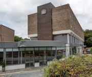
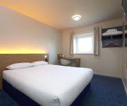
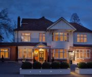
Need some hints on where to stay? We compiled a list of available hotels close to the map centre further down the page.
Being here already, you might want to pay a visit to some of the following locations: Walthamstow, Hackney, Ilford, East Ham and Poplar. To further explore this place, just scroll down and browse the available info.
Local weather forecast
Todays Local Weather Conditions & Forecast: 7°C / 44 °F
| Morning Temperature | 4°C / 40 °F |
| Evening Temperature | 6°C / 44 °F |
| Night Temperature | 4°C / 40 °F |
| Chance of rainfall | 0% |
| Air Humidity | 79% |
| Air Pressure | 1023 hPa |
| Wind Speed | Gentle Breeze with 6 km/h (4 mph) from South-East |
| Cloud Conditions | Broken clouds, covering 78% of sky |
| General Conditions | Broken clouds |
Wednesday, 4th of December 2024
7°C (44 °F)
9°C (47 °F)
Light rain, moderate breeze, broken clouds.
Thursday, 5th of December 2024
12°C (54 °F)
11°C (51 °F)
Moderate rain, fresh breeze, overcast clouds.
Friday, 6th of December 2024
8°C (46 °F)
13°C (55 °F)
Light rain, fresh breeze, overcast clouds.
Hotels and Places to Stay
Marlin Apartments Stratford
Novotel London Heathrow Airport T1 T2 and T3(Opening Feb 2018)
Best Western Plus Epping Forest
ibis Styles London Leyton
TRAVELODGE LONDON CHIGWELL
Holiday Inn Express LONDON CHINGFORD-NTH CIRCULAR
Gilwell Park
The Lion & Key Hotel
The Hub
Packfords Hotel
Videos from this area
These are videos related to the place based on their proximity to this place.
1974 - Woodford Green Prep School - West Linton - France
Sports Day at Woodford Prep School; Penny Day, Mrs Greaves, Mrs Rosser, Mrs Heavens, Mrs Gwynne West Linton, the Day's house; Andrew and Robert Day, Patrick and Charles Latham Holiday in...
WOHAA South Woodford Library Bake Sale
Team Live2Learn would like to thank every single person who contributed to raising an amazing £314.23 for The Wings of Hope Children's Charity at our (over 6 hour long) bake sale, outside...
Stagecoach London On Route 179
Route 179 South Woodford to Ilford Staion. This route operates between Ilford and Chingford Station by Stagecoach. Enjoy :) (NOTE: THIS VIDEO SHOULD OF BEEN UPLOADED BEFORE THE ...
Wanstead Practical Test Routes - Waterworks Roundabout
www.uturndriving.com You might come across this notorious junction about half way into your test. Many people get into trouble because they find themselves in a position that makes it hard...
County Hotel/Epping Forest Hotel
The transformation of the County Hotel. £1.5 million refurbishment, Best Western Plus Epping Forest Hotel. Brought to you by Redefine|BDL Hotels.
Chingford Station 2009
Class 315 departing platform 2 Chingford Station.For more on Walthamstow and it's railways please visit www(dot)walthamstowhistory(dot)com.
WALTHAMSTOW EASTER PARADE & MUSICAL 2015
Some shots from the 2015 Easter Parade and musical production.
MOT Walthamstow | 020 85211882
MOT Special Offer http://motusedcarservices.com/ MOT Walthamstow | 020 85211882 Driving Force was established since 1938 in Walthamstow. We are located near the edge of Walthamstow, Leyton,.
Walthamstow Central Garage - MOT's I Servicing I Repairs
Car broken down? Needs a service or due an MOT. At Walthamstow Central Garage we offer a full range of affordable services. Car servicing, Mot Testing, Repairs, Diagnostics, Electrics. We...
walthamstow greyhound stadium penultimate meeting
Holmeboy film enjoys the sights and sounds at Walthamstow stadium 14 August 2008.
Videos provided by Youtube are under the copyright of their owners.
Attractions and noteworthy things
Distances are based on the centre of the city/town and sightseeing location. This list contains brief abstracts about monuments, holiday activities, national parcs, museums, organisations and more from the area as well as interesting facts about the region itself. Where available, you'll find the corresponding homepage. Otherwise the related wikipedia article.
Walthamstow Village
Walthamstow Village is an ancient nucleus of present day Walthamstow, located in North East London. Designated a Conservation Area by the London Borough of Waltham Forest in 1967, it centres around St. Mary's Church, which was founded in the 12th century. Across the road from this is a 15th century timber-framed "hall house" which locals have dubbed "The Ancient House".
St. Mary's Church, Walthamstow
St. Mary’s Church, Walthamstow is in Walthamstow Village, a conservation area in Walthamstow, London. It was founded in the 12th century and is still a working church. It retains over one hundred and fifty brasses and monuments, the oldest dating from 1436, though all that now remains of the original Norman church is some pillar bases and the chisel marks on them.
William Morris Gallery
The William Morris Gallery, opened by Prime Minister Clement Attlee in 1950, is the only public museum devoted to English Arts and Crafts designer and early socialist William Morris. The gallery is located at Walthamstow in Morris's family home from 1848 to 1856, the former Water House, a substantial Grade II* listed Georgian dwelling of about 1750 which is set in its own extensive grounds. The Gallery underwent major redevelopment and reopened in August 2012.
Walthamstow Stadium
Walthamstow Stadium was a greyhound racing track located in the London Borough of Waltham Forest in east London and was one of a limited number of remaining greyhound race tracks operating in Greater London. The track closed in August 2008, despite assurances from the owners in December 2007 that no deal had been made to sell the track and that racing would continue for years.
Chingford and Woodford Green (UK Parliament constituency)
Chingford and Woodford Green is a constituency in Greater London represented in the House of Commons of the UK Parliament since its 1997 creation by Iain Duncan Smith of the Conservative Party.
Chartered Insurance Institute
The Chartered Insurance Institute (also known as the CII) is a United Kingdom based professional organisation for those working in the insurance and financial services industries. The Institute provides accreditation and professional qualifications to UK and international members. Current (designated) qualifications include (in ascending level order): Cert CII, Dip CII, Advanced Dip CII (ACII - previously called Associateship CII) & Fellowship CII (FCII).
Municipal Borough of Chingford
Chingford was a local government district in south west Essex, England from 1894 to 1965, around the town of Chingford. It was within the London suburbs, forming part of the London postal district and Metropolitan Police District. Its former area now corresponds to the northern part of the London Borough of Waltham Forest in Greater London.
Municipal Borough of Walthamstow
Walthamstow was a local government district in south west Essex, England from 1894 to 1965, around the town of Walthamstow. It was within the London suburbs, forming part of the London postal district and Metropolitan Police District. Its former area now corresponds to the central part of the London Borough of Waltham Forest in Greater London.
Vestry House Museum
Vestry House Museum is the local history museum for the London Borough of Waltham Forest, and stands within the village of Church End, Walthamstow. This secluded area still preserves a rural atmosphere, although it lies only a quarter of a mile from Walthamstow's main shopping centre and barely six and a half miles from the City of London. Vestry House, a two-storey building of brown stock brick, was constructed in 1730 as a workhouse by order of the Walthamstow Vestry.
Woodford Urban District
Woodford was a local government district in the county of Essex, England from 1873 to 1934, corresponding to the London suburb of Woodford. The parish of Woodford St Mary adopted the Local Government Act 1858 in 1873, setting up a local board of nine members. The Local Government Act 1894 reconstituted its area as an urban district, governed by an urban district council. St Mary's church is a thriving Anglican parish today.
Whipps Cross
Whipps Cross is an area of the London Borough of Waltham Forest in London, England. It is most famous for Whipps Cross University Hospital.
Chingford (UK Parliament constituency)
Chingford was a parliamentary constituency centred on the town of Chingford in the London Borough of Waltham Forest. It returned one Member of Parliament to the House of Commons of the Parliament of the United Kingdom by the first past the post system.
M12 motorway
The M12 motorway was a planned motorway starting in north-east London and joining the A12 road in Essex. The 1960s scheme would have started at a junction with the M11 motorway and North Circular and ended near Brentwood, Chelmsford or at the proposed new Maplin Sands airport; the motorway was part of the ambitious London Ringways plan to build motorways throughout London.
Sir George Monoux College
Sir George Monoux College is a sixth form college located in Walthamstow, East London.
Old Foresters F.C
The Old Foresters Football Club is an Association Football club made up exclusively of former pupils of Forest School, located in Snaresbrook, near Walthamstow, London, England. The Old Foresters Football Club is probably one of the half dozen or so oldest "soccer" clubs in the world. It has a continuous and proud history going back before its own formal constitution in 1876 and the founding of The Football Association in 1863.
A104 road (England)
The A104 is an A road in London, England. It runs from Islington Green to Epping. It takes in Essex Road, Balls Pond Road, Dalston Lane(part of), Pembury Road, Cricketfield Road, Downs Road(part of), Lower Clapton Road(part of) and Lea Bridge Roundabout(both shared with A107), Lea Bridge Road, Whipps Cross Roundabout, Woodford New Road, High Road Woodford Green, and Epping New Road ending at the Wake Arms Roundabout before Epping.
Chingford Mount
Chingford Mount is an area in South Chingford. The name refers to the shopping area located around A112/A1009 crossroads (OS Grid Reference TQ373928), though it is also used for the hill leading north from the crossroads to Chingford Old Church. (The original name for this hill was Merry Hill or Church Hill. ) Many of the buildings were erected in the 1930s to Art Deco designs.
Friday Hill, London
Friday Hill is a housing estate in Chingford, named after the hill of the same name, lying north of Chingford Hatch. It takes its name from a John Friday who held land there in the fifteenth century; prior to this, it was known as Jackatt Hill. ', on the crest of the hill, designed by the architect Lewis Vulliamy (1791–1871), was built in 1839. It served as the manor house of the Heathcote family, replacing an earlier Jacobean house on the site (built in 1608).
Chingford Hatch
Chingford Hatch was one of the three hamlets comprising the old parish of Chingford, before the area was developed in the nineteenth century. The name is still widely used for the area immediately around Hatch Lane (A1009) at the foot of Friday Hill (OS Grid Reference TQ389930). St Anne's Church serves the area and is located in Larkshall Road (at the western end of Hatch Lane). Originating in 1891 as a Mission Room, a permanent church was built and given its own separate parish in 1953.
Thorpe Coombe Hospital
Thorpe Coombe Hospital is a psychiatric unit and former maternity hospital in Walthamstow, north-east London, and part of North East London NHS Mental Health Trust.
Waltham Forest Guardian
The Waltham Forest Guardian is a local paper sold every Thursday in the London Borough of Waltham Forest. The paper is part of the Guardian Series of newspapers, the other titles in the group being the Chingford Guardian, Wanstead and Woodford Guardian, and Epping Forest Guardian. The paper is printed by Newsquest which also prints dozens of local and regional papers across the UK. The offices for the Waltham Forest Guardian are in Epping, Essex.
Haringey & Waltham Development F.C
Haringey & Waltham Development F.C. are a London-based non-League football team who currently play in the Essex Senior League. They previously played in the Middlesex County Football League Premier Division. The club currently ground share with Haringey Borough at Coles Park, on White Hart Lane in Tottenham in the London Borough of Haringey.
Aveling Park School
Aveling Park School was a mixed secondary school situated on Aveling Park Road, Walthamstow which educated up to 600 pupils. In the early 1970s it was called William Fitt Junior High School and was a feeder school to McEntee, Walthamstow Girls, and Sir George Monoux Senior High Schools. William Fitt Secondary Modern School moved from its temporary site (shared with Winns Avenus Junior School) in Elphinstone Road, to the new purpose built school building in Lloyds Park in September 1962.
Warwick School for Boys
Warwick School for Boys was an all-boys school in The London Borough of Waltham Forest. Warwick was one of only two boys' schools in the Borough. The school had two sites (North and South). The North site was a combination of two Victorian buildings and two newer buildings. The South site was just one newer building. there were 2 playgrounds.
Heathcote School, Chingford
Heathcote School is a state secondary school located in North Chingford in the London Borough of Waltham Forest. It is located on Normanton Park.


