Safety Score: 3,0 of 5.0 based on data from 9 authorites. Meaning we advice caution when travelling to United Kingdom.
Travel warnings are updated daily. Source: Travel Warning United Kingdom. Last Update: 2024-08-13 08:21:03
Discover Hackbridge
Hackbridge in Greater London (England) is a town in United Kingdom a little south of London, the country's capital city.
Current time in Hackbridge is now 06:56 PM (Thursday). The local timezone is named Europe / London with an UTC offset of zero hours. We know of 9 airports near Hackbridge, of which 5 are larger airports. The closest airport in United Kingdom is London Biggin Hill Airport in a distance of 9 mi (or 14 km), East. Besides the airports, there are other travel options available (check left side).
There are several Unesco world heritage sites nearby. The closest heritage site in United Kingdom is Stonehenge, Avebury and Associated Sites in a distance of 14 mi (or 22 km), South. Also, if you like playing golf, there are a few options in driving distance. We discovered 4 points of interest in the vicinity of this place. Looking for a place to stay? we compiled a list of available hotels close to the map centre further down the page.
When in this area, you might want to pay a visit to some of the following locations: Morden, Sutton, Croydon, Wandsworth and Camberwell. To further explore this place, just scroll down and browse the available info.
Local weather forecast
Todays Local Weather Conditions & Forecast: 2°C / 36 °F
| Morning Temperature | 2°C / 35 °F |
| Evening Temperature | 2°C / 36 °F |
| Night Temperature | 2°C / 36 °F |
| Chance of rainfall | 0% |
| Air Humidity | 78% |
| Air Pressure | 998 hPa |
| Wind Speed | Gentle Breeze with 9 km/h (5 mph) from East |
| Cloud Conditions | Few clouds, covering 20% of sky |
| General Conditions | Few clouds |
Friday, 22nd of November 2024
5°C (42 °F)
2°C (36 °F)
Broken clouds, moderate breeze.
Saturday, 23rd of November 2024
8°C (46 °F)
13°C (55 °F)
Moderate rain, strong breeze, overcast clouds.
Sunday, 24th of November 2024
14°C (58 °F)
13°C (56 °F)
Light rain, strong breeze, overcast clouds.
Hotels and Places to Stay
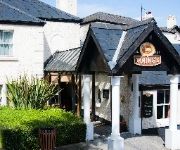
The Dukes Head Hotel
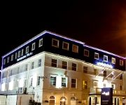
Hilton London Croydon
Best Western Plus London Croydon Aparthotel
Hallmark Croydon
Holiday Inn Express LONDON - WIMBLEDON SOUTH
Hampton by Hilton London Croydon
TRAVELODGE LONDON WIMBLEDON MORDEN
The Lansdowne
Jurys Inn Croydon South London
The Lansdowne Hotel
Videos from this area
These are videos related to the place based on their proximity to this place.
Olympic Torch Carshalton High Street HD Quality
The Olympic torch passes through Carshalton, Sutton, London.
Self Assessment tax returns | HMRC Tax advisor, accountant in Croydon, Wandsworth, Merton, Lambeth.
0208 664 8096 http://www.ibissandco.com/ At iBISS & Co we appreciate the complexities of providing self assessment tax advice in respect of HMRC. We are based in Croydon and serve almost...
Old Plymouthians 3 - 3 Cheam Village Warriors Penalty Shoot
The first penalty in Old Plymouthians' epic cup semi-final penalty shootout win against Cheam Village Warriors. 3-0 down at half-time, it looked like another semi-final exit for OPFC, but they...
ABC LIGHT REMOVALS professional removalist
http://www.abc-light-removals.com/ 07930302580 info@abc-light-removals.com ..WHY CHOOSE A B C ..? A B C Light Removals gets the job done right! We move you efficiently from A to B and...
Minecraft | The Shrine Server | SMP | Factions | Plugins | Shops | Trading | & More
JOIN NOW: 77.103.222.251:25575.
Croydon tramlink and a class 377 electrostar at Mitcham junction
A new liveried tram and a passing class 377 "electrostar" at Mitcham junction on 26/2/09.
Carshalton Athletic v Faversham Town - Oct 2014
Carshalton Athletic v Faversham Town, Ryman League - Division One South, Saturday, 11 October 2014, Score: Carshalton Athletic 1 Faversham Town 2 Attendance: 184.
Videos provided by Youtube are under the copyright of their owners.
Attractions and noteworthy things
Distances are based on the centre of the city/town and sightseeing location. This list contains brief abstracts about monuments, holiday activities, national parcs, museums, organisations and more from the area as well as interesting facts about the region itself. Where available, you'll find the corresponding homepage. Otherwise the related wikipedia article.
London Borough of Merton
The London Borough of Merton is a borough in southwest London, England. The borough was formed under the London Government Act 1963 in 1965 by the merger of the Municipal Borough of Mitcham, the Municipal Borough of Wimbledon and the Merton and Morden Urban District, all formerly within Surrey. The main commercial centres in Merton are Mitcham, Morden and Wimbledon, of which Wimbledon is the largest.
BedZED
Beddington Zero Energy Development (BedZED) is an environmentally friendly housing development in Hackbridge, London, England. It is in the London Borough of Sutton, about two miles east of the town of Sutton itself. It was designed by the architect Bill Dunster to support a more sustainable lifestyle. The project was led by the Peabody Trust in partnership with Bill Dunster Architects, Ellis & Moore Consulting Engineers, BioRegional, Arup and the cost consultants Gardiner and Theobald.
Carshalton and Wallington (UK Parliament constituency)
Carshalton and Wallington /kɑːˈʃɔːltən ənd wɒlɪŋɡtən/ is a constituency represented in the House of Commons of the Parliament of the United Kingdom. It elects one Member of Parliament (MP) by the first past the post system of election. It is a marginal seat between the Liberal Democrats and the Conservatives. The constituency was created at the 1983 general election, replacing the former seat of Carshalton.
Carshalton Urban District
Carshalton was a local government district in north east Surrey from 1883 to 1965 around the town of Carshalton. The parish of Carshalton adopted the Local Government Act 1858 in 1883 and a local board was formed to govern the town. The Local Government Act 1894 reconstituted the area as an urban district, and an elected urban district council replaced the local board. In 1933 the boundaries of the district were altered after the abolition of Epsom Rural District.
Municipal Borough of Beddington and Wallington
Beddington and Wallington was, from 1915 to 1965, a local government district in north east Surrey, England. It formed part of the London suburbs, lying within the Metropolitan Police District and the London Passenger Transport Area. In 1965 it was abolished on the creation of Greater London.
Beddington Lane tram stop
Beddington Lane tram stop is a halt on the Tramlink service. There was previously a railway station on this site, on the single track line from Wimbledon to Croydon, which closed in 1997 in order for it to be converted for Tramlink use. The stop is accessible from the east from Beddington Lane, and also from the pathway leading to the west and south.
St Philomena's Catholic High School for Girls
St Philomena's Catholic High School for Girls is a school for girls (aged 11–18) in Carshalton, South London, England. Ofsted praised the school as 'outstanding' and the Archdiocese of Southwark found the establishment to be 'a very strong school'. , the chair of governors is Dr. Mary Howard, and the current Head Girl is Hannah Potter. It also has Technology and Language College Status.
Beddington Lane railway station
Beddington Lane railway station was a small single-platform station on the West Croydon to Wimbledon Line. It was situated in a semi-rural location the nearest major neighbourhoods were Beddington and Mitcham.
Grove Park (Sutton)
The Grove Park, or The Grove is a public park in Carshalton in the London Borough of Sutton. It is situated close to Carshalton Village in the area approximately bounded by the High Street, North Street and Mill Lane. The southwest corner of the park abuts one of Carshalton's ponds (Lower Pond) from where water flows through the park as the river Wandle.
Carshalton Park
Carshalton Park is a public park in Carshalton, in the London Borough of Sutton. It is situated south of the High Street, in the area bounded by Ruskin Road, Ashcombe Road, Woodstock Road and The Park. Carshalton Park and some of the surrounding houses, are within a conservation area.
Carshalton College
Carshalton College is a further education college located in the Carshalton area of the London Borough of Sutton, in South London, England. The college offers a range of courses for students from the surrounding area including vocational education, ESOL courses, apprenticeships and Access courses. The college also offers a provision of higher education level courses in conjunction with Canterbury Christchurch University, London South Bank University and Roehampton University.


