Safety Score: 3,0 of 5.0 based on data from 9 authorites. Meaning we advice caution when travelling to United Kingdom.
Travel warnings are updated daily. Source: Travel Warning United Kingdom. Last Update: 2024-08-13 08:21:03
Delve into Elmers End
Elmers End in Greater London (England) is a city located in United Kingdom a little south-east of London, the country's capital town.
Current time in Elmers End is now 07:22 PM (Thursday). The local timezone is named Europe / London with an UTC offset of zero hours. We know of 8 airports closer to Elmers End, of which 5 are larger airports. The closest airport in United Kingdom is London Biggin Hill Airport in a distance of 6 mi (or 9 km), South-East. Besides the airports, there are other travel options available (check left side).
There are several Unesco world heritage sites nearby. The closest heritage site in United Kingdom is Tower of London in a distance of 9 mi (or 15 km), North-East. Also, if you like playing golf, there are some options within driving distance. We saw 4 points of interest near this location. In need of a room? We compiled a list of available hotels close to the map centre further down the page.
Since you are here already, you might want to pay a visit to some of the following locations: Catford, Croydon, Bromley, Camberwell and Poplar. To further explore this place, just scroll down and browse the available info.
Local weather forecast
Todays Local Weather Conditions & Forecast: 2°C / 36 °F
| Morning Temperature | 1°C / 34 °F |
| Evening Temperature | 2°C / 36 °F |
| Night Temperature | 2°C / 36 °F |
| Chance of rainfall | 0% |
| Air Humidity | 79% |
| Air Pressure | 998 hPa |
| Wind Speed | Moderate breeze with 9 km/h (6 mph) from East |
| Cloud Conditions | Few clouds, covering 20% of sky |
| General Conditions | Few clouds |
Friday, 22nd of November 2024
5°C (41 °F)
2°C (36 °F)
Broken clouds, moderate breeze.
Saturday, 23rd of November 2024
8°C (46 °F)
13°C (55 °F)
Moderate rain, strong breeze, overcast clouds.
Sunday, 24th of November 2024
14°C (57 °F)
14°C (57 °F)
Light rain, strong breeze, overcast clouds.
Hotels and Places to Stay
Hallmark Croydon
Westciti Caroco Aparthotel
Croydon Park
Croham Park Bed & Breakfast
Best Western Plus London Croydon Aparthotel
De Vere Selsdon Estate
Queens Euro Hotel
The Victoria Inn
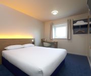
TRAVELODGE LONDON SOUTH CROYDON
Lyall Apartment Hotel
Videos from this area
These are videos related to the place based on their proximity to this place.
Beckenham High Street.
theo harpik, http://youtu.be/2JUfjG30uVsa short video of Beckenham High Street, filmed in HD and slow motion at 50% speed by Keith Pharo. War Memorial to Kelsey Park Road.
Allen Heritage Estate Agents In Beckenham, West Wickham & Shirley
A brief introduction to our Company and the service we provide.
Eden Park to Hayes on Southeastern 465014
The journey from Eden Park to Hayes aboard Southeastern Networker 465014 working 2V27 1030 London Cannon Street to Hayes (Kent) on Saturday 9th March 2013.
Croydon Tramlink Beckenham Road - Beckenham Junction
A view through the front driver's compartment of a Croydon Tramlink tram from Beckenham Road stop to Beckenham Junction stop.
Mail Art Martha and her Shopping Trolley Art Gallery in London - The Film
When I was in London, I had the chance to meet in person Mail Art Martha and see her famous Shopping Trolley Art Gallery. We both agreed that there is no reason not to share these moments...
Beckenham Town 4 - 2 Ashford Utd 08/03/14
Southern Counties East Football League - 08/03/14 at Eden Park Avenue. The players come out for the 2nd half, followed by some of the 2nd half action - including Beckenham going 2-1 ahead,...
Siemens Washing Machine Repair - Worn Carbon Brushes - Beckenham - Kent
A.Brassett are called out to repair a customers faulty Siemens washing machine. The fault is diagnosed as worn carbon brushes which are replaced and the unit is up and working again.
Kelsey Park, Beckenham, Kent
http://zoqy.net A stroll round Kelsey Park in Beckenham, Kent enjoying the tame waterfowl and squirrels. Used on blog post: http://zoqy.net/?p=6242.
Beckenham Dry Cleaners. Welcome to the Best Dry Cleaners in Beckenham 0208 658 5470
http://www.MeritDryCleaners.co.uk 0208 658 5470 Beckenham Dry Cleaners are located at 293 Upper Elmers End Rd,Beckenham BR3 3QP Dry Cleaners in Beckenham are not happy that...
Beckenham Town 1-5 Bromley
Highlights from Bromley's pre-season friendly against Beckenham Town on 17th July 2012. Filmed and edited by Mark Dickins.
Videos provided by Youtube are under the copyright of their owners.
Attractions and noteworthy things
Distances are based on the centre of the city/town and sightseeing location. This list contains brief abstracts about monuments, holiday activities, national parcs, museums, organisations and more from the area as well as interesting facts about the region itself. Where available, you'll find the corresponding homepage. Otherwise the related wikipedia article.
South Norwood Country Park
South Norwood Country Park is a park in South Norwood, close to Elmers End station, mainly in the London Borough of Croydon. It is a 47 hectare (116 acre) green space which opened in 1989. The park occupies a mix of countryside and parkland, and land formerly used for sewage farms serving the growing London population. It is very popular with cyclists and has several viewpoints where you can see the Docklands sky scrapers. Croydon Sports Arena, the home of Croydon F.C.
Croydon Road Recreation Ground
Croydon Road Recreation Ground is a public park located in Beckenham in the London Borough of Bromley. It is near the High St and adjacent to Beckenham Hospital. The park features a café and bandstand, as well as a bowling green and other sports facilities. The United Kingdom’s first manned airmail flight left from here in 1902, travelling to Calais by hot air balloon The event was held to celebrate the coronation of King Edward VII. The crew were. A E Gaudron, a French balloonist and Dr.
Arena tram stop
Arena tram stop is a light rail stop in the Woodside area of South Norwood in the London Borough of Croydon in the southern suburbs of London. The stop is located by the Croydon Sports Arena and serves the council estates of Longheath Gardens Estate and Tollgate Estate.
Penge Common
Penge Common was an area of north east Surrey and north west Kent which now forms part of London, England; covering most of Penge, all of Anerley, and parts of surrounding suburbs including South Norwood. It abutted the Great North Wood and John Rocque's 1745 map of London and its environs showed that Penge Common now included part of that wood. An area named Penge Place was excised from the northernmost part of Penge Common and was later used for the relocation of The Crystal Palace.
A234 road
The A234 is an A road between Crystal Palace and Beckenham in London, England. It starts as Crystal Palace Park Road near the top of Sydenham Hill. Running down on the North side of Crystal Palace Park it passes under two viaducts for the railway lines between London Bridge and East Croydon and Crystal Palace. It then enters Penge as Penge High Street before crossing the A213. It then passes underneath Tramlink route 2, before finishing at Beckenham town centre.
Harrington Road tram stop
Harrington Road tram stop is a light rail stop in South Norwood in the London Borough of Croydon in the southern suburbs of London. Harrington Road is in a residential area, and along with Woodside tram stop is the nearest tram stop to the town of South Norwood. Beckenham Cemetery lies immediately to the east. The tram stop is served by Tramlink route 2, which connects central Croydon with Beckenham. The stop is at ground level on double track, with platforms on each side of the track.
Ashburton Playing Fields
Ashburton Playing Fields is a playing field located in Woodside, London. It is managed by the London Borough of Croydon. Monks Orchard, the playing fields run from Bywood Avenue in the north to Chaucer Green in the west and Woodville Avenue in the east, the houses in Stroud Green Way back onto the western boundary. Tramlink service for the park are Arena and Woodside - Route 1 and Route 2. It covers an area of 49.5 acres .
Avenue Road tram stop
Avenue Road tram stop is a light rail stop in the London Borough of Bromley in the southern suburbs of London. It is located on Avenue Road in a mainly residential area between Penge and Beckenham. The tram stop is served by Tramlink route 2, which connects central Croydon with Beckenham.
Beckenham Road tram stop
Beckenham Road tram stop is a light rail stop in the London Borough of Bromley in the southern suburbs of London. The stop is located on an embankment above Beckenham Road (A234) which connects Beckenham with Crystal Palace and Penge on the site of the short-lived (1858–1860) West End of London & Crystal Palace Railway Penge station. The tram stop is served by Tramlink route 2, which connects central Croydon with Beckenham.
Ashburton (ward)
Ashburton is a ward in the London Borough of Croydon, in London in the United Kingdom. The ward is wider than the Ashburton area, covering the main retail area of Addiscombe, the Stroud Green, Tollgate and Longheath Garden estates, and large parts of northern Shirley. The ward currently forms part of the Croydon Central constituency, which is one of the most marginal in the country, 75 votes separating the Conservatives and Labour.
Beckenham Crematorium and Cemetery
Beckenham Crematorium and Cemetery is a cemetery in the London Borough of Bromley
Congregational Church, Penge
The Congregational Church is the Congregational church in Penge in the London Borough of Bromley located on Penge High Street between Sainsburys and Kenilworth Road. It was built 1912 to designs by P. Morley Horder "with passage aisles and clerestory. Shafts on large, excellently carved corbels. " The structure appears fortress-like in its Romanesque Revival architectural style massing. Its elevated situation and tower dominate Penge High Street, more so than the stone broach spire of St.


