Safety Score: 3,0 of 5.0 based on data from 9 authorites. Meaning we advice caution when travelling to United Kingdom.
Travel warnings are updated daily. Source: Travel Warning United Kingdom. Last Update: 2024-08-13 08:21:03
Touring Southwark
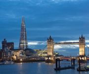
The district Southwark of City of London in Greater London (England) is a subburb located in United Kingdom a little east of London, the country's capital place.
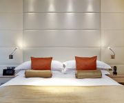
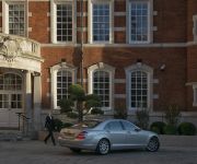
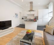
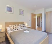
Need some hints on where to stay? We compiled a list of available hotels close to the map centre further down the page.
Being here already, you might want to pay a visit to some of the following locations: Camberwell, City of Westminster, Islington, London and Hackney. To further explore this place, just scroll down and browse the available info.
Local weather forecast
Todays Local Weather Conditions & Forecast: 3°C / 37 °F
| Morning Temperature | 1°C / 35 °F |
| Evening Temperature | 2°C / 36 °F |
| Night Temperature | 2°C / 36 °F |
| Chance of rainfall | 0% |
| Air Humidity | 44% |
| Air Pressure | 1000 hPa |
| Wind Speed | Gentle Breeze with 8 km/h (5 mph) from East |
| Cloud Conditions | Overcast clouds, covering 100% of sky |
| General Conditions | Overcast clouds |
Friday, 22nd of November 2024
5°C (41 °F)
3°C (38 °F)
Broken clouds, moderate breeze.
Saturday, 23rd of November 2024
7°C (44 °F)
13°C (55 °F)
Light rain, fresh breeze, overcast clouds.
Sunday, 24th of November 2024
15°C (60 °F)
16°C (60 °F)
Light rain, fresh breeze, overcast clouds.
Hotels and Places to Stay
Cheval Three Quays
Lalit london
Shangri-La at The Shard London
ST MARY APARTMENTS
Bermondsey Square
Monument One
London Bridge
Marlin Apartments Empire Square
Union Apartments
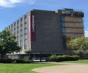
Residence Inn London Bridge
Videos from this area
These are videos related to the place based on their proximity to this place.
City Hall, in London
Video showing City Hall in London. From http://www.londondrum.com/cityguide/city-hall.php The video is provided by http://www.londondrum.com, a tourist guide to London with information about...
London: A Walk Along The River Thames South Bank, From The OXO Tower to The Shard - 19th May, 2014
This film features footage taken from a walk along the South Bank of the River Thames in Southwark, beginning at the OXO Tower and ending at The Shard skyscraper. Along the journey a number...
South Bank, London in HD
The south bank of London's Thames River is a great place to walk. Start at Tower Bridge and follow the Queen's Way past City Hall, the Hays Gallery, HMS Belfast, London Bridge, Borough Market,...
Southwark Olympic Poem
Pupils from Harris Girls' Academy East Dulwich, Harris Academy Peckham, Walworth Academy, Globe Academy and Dulwich Library Young Poets took part in Southwark's unique celebration of the ...
A Walk Across Tower Bridge, London, England - 15th June, 2014
Tower Bridge (built 1886--1894) is a combined bascule and suspension bridge in London which crosses the River Thames. It is close to the Tower of London, from which it takes its name, and has...
アキーラさん!イギリス・ロンドン・タワーブリッジ11,Tower-bridge,London,UK
When I visied at London in England on May in 2012,I went to see the Tower bridge. 2012年5月にイギリス・ロンドンを訪問した際に、タワーブリッジを訪問した。タワー...
アキーラさん!イギリス・ロンドン・タワーブリッジ10,Tower-bridge,London,UK
When I visied at London in England on May in 2012,I went to see the Tower bridge. 2012年5月にイギリス・ロンドンを訪問した際に、タワーブリッジを訪問した。タワー...
Electric Bike Rentals Tour East London and the Docklands
Electric bike rentals. Hire bikes riding through Wapping, Tower Bridge, St Katherines Dock, Canary Wharf and Royal Docks.
Caroline on tour with 37423
An inspection trip (!) around the "Southern", on this occasion leaving London Bridge for Grain via Lewisham, with Caroline, a former Hastings DEMU buffet car.
London Bridge to New Cross Gate
The journey from London Bridge to New Cross Gate, taking in the sights from the train.
Videos provided by Youtube are under the copyright of their owners.
Attractions and noteworthy things
Distances are based on the centre of the city/town and sightseeing location. This list contains brief abstracts about monuments, holiday activities, national parcs, museums, organisations and more from the area as well as interesting facts about the region itself. Where available, you'll find the corresponding homepage. Otherwise the related wikipedia article.
Greater London
Greater London is an administrative area, ceremonial county and the London region of England. It was created as an area for local government on 1 April 1965, comprising the City of London and 32 London boroughs, of which twelve are Inner London boroughs and twenty are Outer London boroughs. The ceremonial county created at the same time, and used for the purposes of the Lord Lieutenant of Greater London, does not include the City of London.
City Hall (London)
City Hall is the headquarters of the Greater London Authority (GLA) which comprises the Mayor of London and the London Assembly. It is located in Southwark, on the south bank of the River Thames near Tower Bridge. It was designed by Norman Foster and opened in July 2002, two years after the Greater London Authority was created.
London Dungeon
The London Dungeon is a popular London tourist attraction, which recreates various gory and macabre historical events in a gallows humour style aimed at younger audiences. It uses a mixture of live actors, special effects and rides. Opening in 1974, it was initially designed as a museum of macabre history, but the Dungeon has evolved to become an actor-led, interactive experience. The Dungeon is operated by Merlin Entertainments.
Fashion and Textile Museum
The Fashion and Textiles Museum is a museum based in Bermondsey dedicated to all aspects of fashion and textile design. Founded in 2003 by the designer Zandra Rhodes, the museum is now operated by Newham College and rather than running a permanent exhibition, offers an ongoing programme of temporary displays.
Guy's Hospital
Guy's Hospital is a large NHS hospital in the borough of Southwark in central London. It is administratively a part of Guy's and St Thomas' NHS Foundation Trust. It is a large teaching hospital and is, with St. Thomas' Hospital and King's College Hospital, the location of King's College London School of Medicine (formerly known as the GKT School of Medicine).
Southwark Towers
Southwark Towers was a high rise building at 32 London Bridge Street, designed by tp bennett architects, overlooking London Bridge station, in Southwark, London. Completed in 1975, it was 100 metres tall and had 25 floors in three wings. In 2008 it was demolished to make way for The Shard, which at 310 metres (1020 feet) is the tallest building in the United Kingdom and the European Union. The building was formerly occupied by PricewaterhouseCoopers.
Bermondsey Market
Officially called New Caledonian Market, Bermondsey Market is an antiques market located at Bermondsey Square on Tower Bridge Road in Bermondsey, part of the London Borough of Southwark, in South London, England. The location was formerly the site of Bermondsey Abbey. The site underwent redevelopment in 2006 and the Market remained open during this period.
Tooley Street
Tooley Street is a road in Central and South London connecting London Bridge to St Saviour's Dock; it runs past Tower Bridge on the Southwark/Bermondsey side of the River Thames, and forms part of the A200 road.
White Cube
White Cube is a contemporary art gallery owned by Jay Jopling with two branches in London: Mason's Yard in central London and Bermondsey in South East London, one in Hong Kong and one in São Paulo. The Hoxton Square space in the East End of London was closed at the end of 2012. The gallery became famous curating Damien Hirst, Tracey Emin, Marc Quinn and other internationally recognised artists.
Hay's Galleria
Hay's Galleria is a major riverside tourist attraction on the Jubilee Walk in the London Borough of Southwark situated on the south bank of the River Thames. Originally a warehouse and associated wharf (Hay's Wharf) for the port of London, it was redeveloped as a visitor attraction in the 1980s. It is a Grade II listed structure.
More London
More London is a new development on the south bank of the River Thames, immediately south-west of Tower Bridge in London. The southern exit is on Tooley Street. It includes the City Hall, a sunken amphitheatre called The Scoop, office blocks, shops, restaurants, cafes, and a pedestrianized area containing open-air sculptures and water features, including fountains lit by coloured lights. The Hilton London Tower Bridge hotel opened in September 2006.
Bermondsey Abbey
Bermondsey Abbey was an English Benedictine monastery. Most widely known as an 11th-century foundation, it had a precursor mentioned in the early 8th century, and was centred on what is now Bermondsey Square, the site of Bermondsey Market, Bermondsey, in the London Borough of Southwark, southeast London, England.
Southwark St John Horsleydown
Southwark St John Horsleydown was a small parish on the south bank of the River Thames in London, opposite the Tower of London. The name Horsleydown, apparently derived from the "horse lie-down" next to the river, is no longer used. The parish was created by splitting St Olave's parish in 1733.
The Urban Academy
The Urban Academy is a post-16 educational and life skills academy at 34 Decima Street in south London. It was founded by Camila Batmanghelidjh and is run by her Kids Company organisation.
Bricklayers' Arms
Bricklayers' Arms is a busy road intersection between A2 and the London Inner Ring Road in south London, England. It is the junction of Tower Bridge Road, Old Kent Road, New Kent Road and Great Dover Street; Old Kent Road and New Kent Road east-bound are connected by a flyover. The area is named after a local coaching inn that was situated at the junction. It is also the former site of a large railway facility.
St John Horsleydown
St John Horsleydown was the Anglican parish church of Horsleydown in Bermondsey, South London, Built for the Commission for Building Fifty New Churches to the designs of Nicholas Hawksmoor and John James in. 1726-33, it was noted for its distinctive spire in the form of a tapering column.
St Mary Magdalen Bermondsey
St Mary Magdalen Bermondsey is an Anglican church dedicated to St Mary Magdalen in Bermondsey in the London Borough of Southwark. The present building is late 17th century and is a Grade II* listed building. Its parish extends as far as the Thames. The parishes of St Olave Tooley Street, St Luke Grange Road and St John Horsleydown have all been merged into it.
The Scoop
The Scoop is an outdoor amphitheatre situated on the south side of the River Thames near Tower Bridge in London, located underneath City Hall, providing seating for approximately 800 people. Designed by Townshend Landscape Architects, it is a venue used during the summer to show films, musical performances and theatre productions by such companies as The Steam Industry and The Pantaloons. In June 2008, films shown at The Scoop included The Dam Busters, Atonement and Withnail and I.
St Saviour's and St Olave's Church of England School
St Saviour's and St Olave's Church of England School is a comprehensive secondary school for girls. It is a voluntary aided Church of England school in the Anglican Diocese of Southwark and is affiliated to the Woodard Schools group. It caters for girls aged 11–18 and is sited on New Kent Road near Elephant and Castle, in the London Borough of Southwark.
SeOne
SeOne was a nightclub in London, United Kingdom. It claimed to be London's largest licensed nightclub with a capacity of 3,000 people. It was located on Weston Street underneath the London Bridge transit centre. The licensing authority requiried the nightclub to scan and retain clubbers' ID details. SeOne used Clubscan for this purpose. On 22 February 2010 it officially closed down due to financial difficulties. On 21 May 2010 it reopened as Debut London, a live music and club venue.
Long Lane, Southwark
Long Lane is a major road in Southwark, south London, England. At the northwest end is a complicated junction with Borough High Street, Marshalsea Road, Tabard Street, and Great Dover Street. The historic St George the Martyr church, with Dickensian connections, is at this junction, now standing on an island surrounded by roads and cut off from its original churchyard. In this church the eponymous Dickens character Little Dorrit was baptised and married.
Bermondsey Square
Bermondsey Square is located on Tower Bridge Road in Bermondsey, part of the London Borough of Southwark, in south London, England. The location was formerly the site of the 11th century Bermondsey Abbey. Archaeological excavations were undertaken in 2005–6 by English Heritage. The earliest medieval remains found were a Norman church from around 1080, which was recorded in the Domesday Book.
Southwark Crown Court
The Crown Court, Southwark is one of three Crown Court buildings in London SE1, along with Inner London Crown Court and Blackfriars Crown Court. Opened in 1983, the brick building is located on the south bank of the River Thames between London Bridge and Tower Bridge, next to Hay's Galleria. It contains 15 courtrooms, making it the fourth largest court centre in the country, and is a designated serious fraud centre.
London Bridge bus station
London Bridge bus station serves the London Bridge area of the city of London and is situated at the London Bridge tube and rail station. There are three stands at the station which are situated at the station forecourt. The services that use this bus station are routes 17, 43, 48, 141, 149, 521, N21 and N343.
Southwark St Olave
Southwark St Olave was an ancient civil and ecclesiastical parish on the south bank of the River Thames, covering the area around where Shard London Bridge now stands in the modern London Borough of Southwark. The boundaries varied over time but in general the parish stretched east from London Bridge past Tower Bridge to St Saviour's Dock. Southwark St Olave and St Thomas replaced the civil parish in 1896. It was abolished in 1904 and absorbed by Bermondsey parish.


