Safety Score: 3,0 of 5.0 based on data from 9 authorites. Meaning we advice caution when travelling to United Kingdom.
Travel warnings are updated daily. Source: Travel Warning United Kingdom. Last Update: 2024-08-13 08:21:03
Delve into Carshalton on the Hill
The district Carshalton on the Hill of in Greater London (England) is a subburb in United Kingdom a little south of London, the country's capital town.
If you need a hotel, we compiled a list of available hotels close to the map centre further down the page.
While being here, you might want to pay a visit to some of the following locations: Sutton, Morden, Croydon, Wandsworth and Headley. To further explore this place, just scroll down and browse the available info.
Local weather forecast
Todays Local Weather Conditions & Forecast: 3°C / 37 °F
| Morning Temperature | 1°C / 34 °F |
| Evening Temperature | 2°C / 35 °F |
| Night Temperature | 1°C / 34 °F |
| Chance of rainfall | 0% |
| Air Humidity | 45% |
| Air Pressure | 999 hPa |
| Wind Speed | Gentle Breeze with 8 km/h (5 mph) from East |
| Cloud Conditions | Overcast clouds, covering 100% of sky |
| General Conditions | Overcast clouds |
Friday, 22nd of November 2024
5°C (41 °F)
2°C (36 °F)
Scattered clouds, moderate breeze.
Saturday, 23rd of November 2024
7°C (45 °F)
12°C (54 °F)
Light rain, strong breeze, overcast clouds.
Sunday, 24th of November 2024
15°C (59 °F)
15°C (60 °F)
Light rain, strong breeze, overcast clouds.
Hotels and Places to Stay
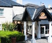
The Dukes Head Hotel
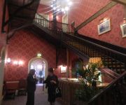
Hilton London Croydon
Coulsdon Manor Hotel and Golf Club
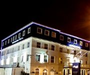
Hallmark Croydon
Best Western Plus London Croydon Aparthotel
Greyhound Hotel
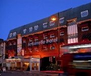
Antoinette Wimbledon
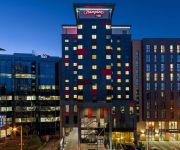
Hampton by Hilton London Croydon
The Lansdowne Hotel
The Lansdowne
Videos from this area
These are videos related to the place based on their proximity to this place.
Olympic Torch Carshalton High Street HD Quality
The Olympic torch passes through Carshalton, Sutton, London.
New 'Arts & Craft' style house, Webb Estate, Purley
See www.brooksandware.com for more details of this new Arts and Craft style house proposed for the Webb Estate, Purley.
ABC LIGHT REMOVALS professional removalist
http://www.abc-light-removals.com/ 07930302580 info@abc-light-removals.com ..WHY CHOOSE A B C ..? A B C Light Removals gets the job done right! We move you efficiently from A to B and...
Herald Land - Grove Lane, Coulsdon, United Kingdom
Herald Land's exclusive 10 acre site situated within Greater London offering any investor the potential of healthy returns.
How to Prune Roses - Full Renovation
www.lawnandborder.co.uk/wp LawN & Border have been Landscaping and maintaining gardens for nearly 10 years. Currently our projects include: Turfing Garden Makeovers Re-establishing old ...
Carshalton Athletic v Faversham Town - Oct 2014
Carshalton Athletic v Faversham Town, Ryman League - Division One South, Saturday, 11 October 2014, Score: Carshalton Athletic 1 Faversham Town 2 Attendance: 184.
Carshalton Fireworks Bonfire Build Time Lapse 2014
Carshalton Fireworks 2014 bonfire build in time lapse photography. Built over 2 days with a photo taken every 60 seconds. Over 1200 photos then put together, with each photo displayed for...
Lift the ban...on your fans Carshalton Athletic
Dulwich Hamlet fans protesting against the chairman of Carshalton athletic banning fans for dissent in the stands. Freedom of speech free zone.
Videos provided by Youtube are under the copyright of their owners.
Attractions and noteworthy things
Distances are based on the centre of the city/town and sightseeing location. This list contains brief abstracts about monuments, holiday activities, national parcs, museums, organisations and more from the area as well as interesting facts about the region itself. Where available, you'll find the corresponding homepage. Otherwise the related wikipedia article.
London Borough of Merton
The London Borough of Merton is a borough in southwest London, England. The borough was formed under the London Government Act 1963 in 1965 by the merger of the Municipal Borough of Mitcham, the Municipal Borough of Wimbledon and the Merton and Morden Urban District, all formerly within Surrey. The main commercial centres in Merton are Mitcham, Morden and Wimbledon, of which Wimbledon is the largest.
London Borough of Sutton
The London Borough of Sutton is a London borough in South London, England and forms part of Outer London. It covers an area of 43 km and is the 80th largest local authority in England by population. It is one of the southernmost boroughs of London. It is south of the London Borough of Merton, west of the London Borough of Croydon and east of the Royal Borough of Kingston Upon Thames. The local authority is Sutton London Borough Council.
BedZED
Beddington Zero Energy Development (BedZED) is an environmentally friendly housing development in Hackbridge, London, England. It is in the London Borough of Sutton, about two miles east of the town of Sutton itself. It was designed by the architect Bill Dunster to support a more sustainable lifestyle. The project was led by the Peabody Trust in partnership with Bill Dunster Architects, Ellis & Moore Consulting Engineers, BioRegional, Arup and the cost consultants Gardiner and Theobald.
Institute of Cancer Research
The Institute of Cancer Research (the ICR) is a public research institute and university located in London, United Kingdom specialised in oncology, and a constituent college of the University of London. It was founded in 1909 as a research department of the Royal Marsden Hospital and joined the University of London in 2003. It has been responsible for a number of breakthrough discoveries, including that the basic cause of cancer is damage to DNA.
Carshalton and Wallington (UK Parliament constituency)
Carshalton and Wallington /kɑːˈʃɔːltən ənd wɒlɪŋɡtən/ is a constituency represented in the House of Commons of the Parliament of the United Kingdom. It elects one Member of Parliament (MP) by the first past the post system of election. It is a marginal seat between the Liberal Democrats and the Conservatives. The constituency was created at the 1983 general election, replacing the former seat of Carshalton.
Oaks Park (London)
The Oaks Park is a public park in Carshalton in the London Borough of Sutton. It is bounded on the south by Croydon Lane (A2022), and on the east by Woodmansterne Road; smaller roads lie to west and north.
Carshalton Urban District
Carshalton was a local government district in north east Surrey from 1883 to 1965 around the town of Carshalton. The parish of Carshalton adopted the Local Government Act 1858 in 1883 and a local board was formed to govern the town. The Local Government Act 1894 reconstituted the area as an urban district, and an elected urban district council replaced the local board. In 1933 the boundaries of the district were altered after the abolition of Epsom Rural District.
Epsom Downs Branch
|} The Epsom Downs Branch is a railway line in the United Kingdom. The line runs from Sutton to Epsom Downs and is about 3+⁄4 miles long. The line starts at Sutton in the London Borough of Sutton. It is double track for about ⁄4 miles until it reaches the approach to Belmont where it becomes single track. The line continues from Belmont through Banstead and terminates at Epsom Downs in Surrey. The "Downs" referred to in the name are part of the North Downs.
HM Prison High Down
HM Prison High Down is a Category B men's local prison. High Down is located on the outskirts of Banstead in Surrey, England, and is immediately adjacent to the southern boundary of Belmont in Greater London. The prison is operated by Her Majesty's Prison Service, and is situated in proximity to Downview Prison for women.
HM Prison Downview
HM Prison Downview is a women's closed category prison. Downview is located on the outskirts of Banstead in Surrey, England, and is immediately adjacent to the southern boundary of Belmont in Greater London. The prison is operated by Her Majesty's Prison Service, and is situated in proximity to High Down Prison for men.
Roundshaw
Roundshaw is a housing estate and park in south Wallington on the eastern edge of the London Borough of Sutton. Grid Ref TQ302633. It was built on part of the site of the former Croydon Airport, and occupying roughly the area on which once stood the buildings of the first Croydon Aerodrome (the 'Plough Lane' aerodrome) which was demolished in 1928. The name comes from Roundshaw Park on the edge of the site, itself named from a round 'shaw' or grove of trees, which is still a feature.
Municipal Borough of Sutton and Cheam
Sutton and Cheam was a local government district in north east Surrey, England from 1882 to 1965. Sutton Local Government District was formed on 20 December 1882, when the parish of Sutton adopted the Local Government Act 1858. Sutton Local Board was formed to govern the area. The Local Government Act 1894 reconstituted the local government district as Sutton Urban District and an urban district council replaced the local board.
Municipal Borough of Beddington and Wallington
Beddington and Wallington was, from 1915 to 1965, a local government district in north east Surrey, England. It formed part of the London suburbs, lying within the Metropolitan Police District and the London Passenger Transport Area. In 1965 it was abolished on the creation of Greater London.
Carshalton Athletic F.C
Carshalton Athletic F.C. is an English football club based in Carshalton in the London Borough of Sutton. They currently play in the Isthmian League Premier Division and are based at the War Memorial Sports Ground (also known as Colston Avenue).
Bandon Halt railway station
Bandon Halt was a station on the 1847 London, Brighton and South Coast Railway extension from West Croydon to Epsom. It was situated between Waddon and Wallington stations and was open between 1906 and 1914. It takes its name from the immediate area which is called Bandon Hill. It was located at grid reference TQ301644 and was accessed from Plough Lane, the platforms lying to the immediate east of the overbridge.
St Philomena's Catholic High School for Girls
St Philomena's Catholic High School for Girls is a school for girls (aged 11–18) in Carshalton, South London, England. Ofsted praised the school as 'outstanding' and the Archdiocese of Southwark found the establishment to be 'a very strong school'. , the chair of governors is Dr. Mary Howard, and the current Head Girl is Hannah Potter. It also has Technology and Language College Status.
Benhilton
Benhilton is a suburban parish in North Sutton. It is dominated by All Saints Church, which is a Grade II listed building designed by Samuel Sanders Teulon in a Gothic Revival style opened in 1863. It also contains All Saints Benhilton, C of E Primary and Greenshaw High School. Benhilton is mostly residential comprising a low-rise council estate which is currently being refurbished, Victorian town houses, flats and the Thomas Wall centre, with an L-shape town centre.
Grove Park (Sutton)
The Grove Park, or The Grove is a public park in Carshalton in the London Borough of Sutton. It is situated close to Carshalton Village in the area approximately bounded by the High Street, North Street and Mill Lane. The southwest corner of the park abuts one of Carshalton's ponds (Lower Pond) from where water flows through the park as the river Wandle.
Carshalton Park
Carshalton Park is a public park in Carshalton, in the London Borough of Sutton. It is situated south of the High Street, in the area bounded by Ruskin Road, Ashcombe Road, Woodstock Road and The Park. Carshalton Park and some of the surrounding houses, are within a conservation area.
St Helier Hospital
St Helier Hospital is a hospital in the London Borough of Sutton. It is owned and run by Epsom and St Helier University Hospitals NHS Trust. The hospital offers a full range of hospital services including a 24-hour accident and emergency department. The site is also home to the South West Renal and Transplantation Service and the Queen Mary's Hospital for Children, a dedicated children's hospital.
Banstead Downs
Banstead Downs is a Site of Special Scientific Interest in Surrey, England. It covers 430 acres . To the west is the A217 and to east is the B2218. The town to the north is Sutton; whilst Banstead lies to the south. It lies at about 125 m above sea level and is bisected by a railway line. The Downs is one of four green areas in the area, which are overall referred to as Banstead Commons. The other areas are Burgh Heath (87 acres), Banstead Heath (760 acres) and Park Downs (74 acres).
Overton Grange School
Overton Grange School is a mixed academy school in Sutton, Greater London, England. The school's opening year was 1997 with the first intake. Planning for a new school in the area was identified in the 1980s. The capacity is approximately 1300 students. It has a sixth form college, opened in 2003. Since 2008 it has been an International Baccalaureate World School and a specialist English and Humanities College since 2009.
Carshalton College
Carshalton College is a further education college located in the Carshalton area of the London Borough of Sutton, in South London, England. The college offers a range of courses for students from the surrounding area including vocational education, ESOL courses, apprenticeships and Access courses. The college also offers a provision of higher education level courses in conjunction with Canterbury Christchurch University, London South Bank University and Roehampton University.
Queen Mary's Park
Queen Mary's Park is a small public park in Carshalton Beeches, in the London Borough of Sutton. It is situated on the old site of St Mary's hospital.
Austenasia
The Empire of Austenasia is a micronation and self-declared sovereign state based in the United Kingdom. It operates under constitutional monarchy and comprises five properties that have declared themselves independent under the leadership of a house in south London. Austenasia is recognized by Vikesland, among others.


