Safety Score: 3,0 of 5.0 based on data from 9 authorites. Meaning we advice caution when travelling to United Kingdom.
Travel warnings are updated daily. Source: Travel Warning United Kingdom. Last Update: 2024-08-13 08:21:03
Explore Brockley
Brockley in Greater London (England) is located in United Kingdom a little south-east of London, the country's capital.
Local time in Brockley is now 05:33 PM (Thursday). The local timezone is named Europe / London with an UTC offset of zero hours. We know of 8 airports in the wider vicinity of Brockley, of which 5 are larger airports. The closest airport in United Kingdom is London City Airport in a distance of 5 mi (or 8 km), North-East. Besides the airports, there are other travel options available (check left side).
There are several Unesco world heritage sites nearby. The closest heritage site in United Kingdom is Tower of London in a distance of 6 mi (or 9 km), North-East. Also, if you like golfing, there are multiple options in driving distance. We found 4 points of interest in the vicinity of this place. If you need a place to sleep, we compiled a list of available hotels close to the map centre further down the page.
Depending on your travel schedule, you might want to pay a visit to some of the following locations: Catford, Poplar, Camberwell, City of London and Bromley. To further explore this place, just scroll down and browse the available info.
Local weather forecast
Todays Local Weather Conditions & Forecast: 3°C / 37 °F
| Morning Temperature | 2°C / 35 °F |
| Evening Temperature | 3°C / 37 °F |
| Night Temperature | 3°C / 37 °F |
| Chance of rainfall | 0% |
| Air Humidity | 78% |
| Air Pressure | 998 hPa |
| Wind Speed | Gentle Breeze with 8 km/h (5 mph) from East |
| Cloud Conditions | Few clouds, covering 20% of sky |
| General Conditions | Few clouds |
Friday, 22nd of November 2024
5°C (41 °F)
3°C (37 °F)
Broken clouds, moderate breeze.
Saturday, 23rd of November 2024
8°C (46 °F)
13°C (56 °F)
Moderate rain, fresh breeze, overcast clouds.
Sunday, 24th of November 2024
15°C (58 °F)
14°C (57 °F)
Light rain, fresh breeze, overcast clouds.
Hotels and Places to Stay
Novotel London Canary Wharf
De Vere Devonport House
ABILITY PLACE APARTMENTS
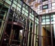
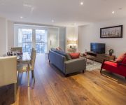
Lincoln Plaza London Curio Collection by Hilton
Lincoln Plaza
Marlin Apartments Canary Wharf
SACO Canary Wharf
DoubleTree by Hilton London - Greenwich
Ascot Apartments
Novotel London Greenwich
Videos from this area
These are videos related to the place based on their proximity to this place.
When Kai bites a gyoza in Honor Oak
A clip that captured the moment when a 5-year-old boy bites a fake plastic dumpling at a sacred place in Lewisham, London.
Class 455 and Class 378 at New Cross Gate
Class 455 and Class 378 trains arriving at New Cross Gate, 16/04/11.
London Overground train on the New Cross Gate flyover
A London Overground Class 378 heading northbound over the New Cross Gate flyover.
Bouncy Castle Lewisham - Bubble and Bounce - Bouncy Castles In Lewisham
Bouncy Castles Lewisham. Bubble and Bounce, Childrens bouncy castle hire specialists in Lewisham! 0208 3330191 http://www.bubbleandbounce.co.uk New December Promotion!!! Quote " Bubble ...
Lewisham Dental Pratice - Patient Heena - 020 8852 3000
http://www.lewishamdental.co.uk Heena talks about her positive experiences at Lewisham Dental Practice. Call us now on 020 8852 3000 to book your appointment. Produced by: http://www.jspmediagr ...
Deptford Bridge Fire in Lewisham
It was a minor fire above the shops near Deptford Bridge train station in Lewisham, London.
Lewisham Dental Pratice - Patient McKinley- 020 8852 3000
http://www.lewishamdental.co.uk McKinley talks about her positive experiences at Lewisham Dental Practice. Call us now on 020 8852 3000 to book your appointment. Produced by: http://www.jspmedi.
Videos provided by Youtube are under the copyright of their owners.
Attractions and noteworthy things
Distances are based on the centre of the city/town and sightseeing location. This list contains brief abstracts about monuments, holiday activities, national parcs, museums, organisations and more from the area as well as interesting facts about the region itself. Where available, you'll find the corresponding homepage. Otherwise the related wikipedia article.
Lewisham Deptford (UK Parliament constituency)
Lewisham, Deptford is a parliamentary constituency represented in the House of Commons of the UK Parliament since 1987 by Joan Ruddock of the Labour Party.
A20 road (England)
The A20 is a major road in south-east England, carrying traffic from London to Dover in Kent. Parts of the route date back to turnpikes established in the early part of the 18th century. The line of the road throughout Kent runs closely in parallel with the M20 motorway.
Metropolitan Borough of Deptford
The Metropolitan Borough of Deptford was a Metropolitan borough in the County of London between 1900 and 1965, when it became part of the London Borough of Lewisham along with the Metropolitan Borough of Lewisham. Deptford Town Hall was built between 1903 and 1905 on New Cross Road. The building is in a grand baroque style, featuring carvings of tritons and admirals to emphasise Deptford's maritime heritage. It is now used by Goldsmiths College.
New Cross house fire
The New Cross house fire was a devastating house fire during a birthday party in New Cross, southeast London, on Sunday, 18 January 1981. The blaze killed 13 young black people. Some in Britain were shocked by what they perceived as indifference among the white population and accused London's Metropolitan Police Service of covering-up the cause, which some suspected was an arson attack motivated by racism.
Haberdashers' Aske's Hatcham College
Haberdashers' Aske's Hatcham College is a secondary school with academy status located in New Cross. The school was formerly a Grammar school, then a comprehensive City Technology College and now an Academy operating between two sites near New Cross Gate in South-East London.
Hatcham
Hatcham was a manor and later chapelry in what is now London, England. It corresponds to the area around New Cross Gate station in the London Borough of Lewisham. The civil parish of St Paul Deptford was partly in the counties of Surrey and Kent, with Hatcham forming the part in Surrey. It also gave its name to the ecclesiastical parishes of All Saints, Hatcham Park and St James, Hatcham which extended into the Kent section of the parish. In the Domesday Book it is recorded as Hacheham.
Stone House, Deptford
Stone House is one of the oldest and most distinctive buildings in the London Borough of Lewisham. It was built between 1771 and 1773 by George Gibson the younger, for himself. It is Grade II* Listed. The house has columns with capitals formed of leaves and florets, which are also used on St Mary's church in Lewisham, another of George Gibson's designs. The land on which the house stands, originally known as "halfpenny's field", was purchased by Gibson in 1766.
Brockley and Ladywell Cemeteries
Brockley and Ladywell Cemeteries were opened within one month of each other in 1858 and are sited on adjacent plots of previously open land. The two component parts are characteristic examples of the first wave of Victorian public cemeteries and are now part of the Brockley Conservation Area. The cemeteries occupy 37 acres of land wholly within the London Borough of Lewisham and are owned and managed by the Cemeteries and Crematorium Services of the Borough.
Lewisham Road railway station
Lewisham Road railway station was a railway station in Lewisham, London built by the London, Chatham and Dover Railway on the Greenwich Park branch. It was opened in 1871. It was very close to the South Eastern Railway's St Johns railway station, which still remains open.
Brockley Lane railway station
Brockley Lane railway station was a railway station in Brockley, London which was opened in 1872 on the Greenwich Park branch which was owned by the London, Chatham and Dover Railway. It was shut to passenger traffic in 1917 along with the rest of the Greenwich Park line, but remained in use as a goods station until its eventual closure in 1970.
Crossways Sixth Form
Crossways Sixth Form was a sixth form centre located in the Telegraph Hill area of London Borough of Lewisham, in South London, England. The centre was operated by the Crossways Consortium, a federation of four secondary schools in the Lewisham Borough, consisting of Addey and Stanhope School, Catford Business and Enterprise College, Crofton Park School and Deptford Green School. Courses offered by Crossways Sixth Form included A Levels and BTEC awards.
The Waldron
The Waldron Health Centre is a National Health Service (NHS) building next to New Cross railway station in Lewisham, South London. It was completed in 2008.


