Safety Score: 3,0 of 5.0 based on data from 9 authorites. Meaning we advice caution when travelling to United Kingdom.
Travel warnings are updated daily. Source: Travel Warning United Kingdom. Last Update: 2024-08-13 08:21:03
Explore Bickley
Bickley in Greater London (England) is a city in United Kingdom a little south-east of London, the country's capital.
Local time in Bickley is now 02:59 PM (Thursday). The local timezone is named Europe / London with an UTC offset of zero hours. We know of 9 airports in the vicinity of Bickley, of which 5 are larger airports. The closest airport in United Kingdom is London Biggin Hill Airport in a distance of 5 mi (or 8 km), South. Besides the airports, there are other travel options available (check left side).
There are several Unesco world heritage sites nearby. The closest heritage site in United Kingdom is Tower of London in a distance of 7 mi (or 12 km), North. Also, if you like golfing, there are multiple options in driving distance. We found 3 points of interest in the vicinity of this place. If you need a place to sleep, we compiled a list of available hotels close to the map centre further down the page.
Depending on your travel schedule, you might want to pay a visit to some of the following locations: Bromley, Catford, Woolwich, Bexleyheath and Poplar. To further explore this place, just scroll down and browse the available info.
Local weather forecast
Todays Local Weather Conditions & Forecast: 2°C / 36 °F
| Morning Temperature | 1°C / 33 °F |
| Evening Temperature | 1°C / 34 °F |
| Night Temperature | 1°C / 34 °F |
| Chance of rainfall | 0% |
| Air Humidity | 44% |
| Air Pressure | 999 hPa |
| Wind Speed | Gentle Breeze with 8 km/h (5 mph) from East |
| Cloud Conditions | Overcast clouds, covering 100% of sky |
| General Conditions | Overcast clouds |
Friday, 22nd of November 2024
5°C (41 °F)
2°C (36 °F)
Broken clouds, moderate breeze.
Saturday, 23rd of November 2024
6°C (44 °F)
12°C (54 °F)
Light rain, strong breeze, overcast clouds.
Sunday, 24th of November 2024
15°C (58 °F)
15°C (59 °F)
Light rain, strong breeze, overcast clouds.
Hotels and Places to Stay
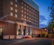
DoubleTree by Hilton London - Greenwich
Novotel London Greenwich
De Vere Devonport House
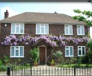
Greenland Villa - Guest house
Clay Farm Guest House
Bull's Head Hotel
TRAVELODGE LONDON GREENWICH HIGH ROAD
16 St Alfeges
The Clarendon Hotel Blackheath
Lyall Apartment Hotel
Videos from this area
These are videos related to the place based on their proximity to this place.
Sundridge Park, Bromley, Kent.
theo harpik, http://youtu.be/AHFO_U_JOxs A walk from Sundridge Park Manor, along Willoughby Lane, passing by the side of Sundridge Park Golf Course, ablaze with the colours of Autumn.
Bromley U18 vs Ashford United
Highlights from Bromley's U18 Ryman youth match against Ashford United. Played at Hayes Lane on 13th March 2012.
Heavy Snow in Bromley, Kent.
theo harpik, http://youtu.be/ZQ9kseAsH3I A short video clip showing heavy snow falling at Burnt Ash Lane, Bromley in Kent. Filmed in the early hours of the morning in February 2012.
70013 Oliver Cromwell storms past Petts Wood Junction.
After an unscheduled stop near Penge East, Oliver Cromwell makes up some time as it climbs the Tonbridge Loop from Bickley to Petts Wood. The train, 1Z82, was heading for what may really have...
Chislehurst Caves Kent
Well worth a conducted tour of these manmade chalk caves that date back to prehistory but during WWII a nightly shelter for 1000s of Londoners. Very modest entry fee and cafe and free carpark...
Trains at Chislehurst 15/11/14
A look at some Southeastern trains seen at Chislehurst station on Saturday 15th November 2014 including 395014 working The Victoria Cross railtour. 0:03 465913+465018 pass on 2H78 1051 ...
Ringing at Chislehurst, Annunciation BVM, Kent - 21st April 2014
Some rounds and call changes being rung on the glorious 8 hung in the detached tower at Chislehurst Annunciation on Easter Monday as part of the ringing route on KCACR AGM day.
Tornado Christmas Lunch Trip round Kent
60163 TORNADO on 1Z82 London Victoria to London Victoria via Tonbridge, Canterbury West, Folkestone and Tonbridge after restarting from Bromley South and making a vigorous if slightly slippery...
IVAN - extended preview ( Prologue / Trailer )
2007-police reports stated no bodies were found even tho a few fragments such as 2 phones, 1 foot and 1 handbag were scattered 2 miles from the chislehurst caves which indicates they never...
Videos provided by Youtube are under the copyright of their owners.
Attractions and noteworthy things
Distances are based on the centre of the city/town and sightseeing location. This list contains brief abstracts about monuments, holiday activities, national parcs, museums, organisations and more from the area as well as interesting facts about the region itself. Where available, you'll find the corresponding homepage. Otherwise the related wikipedia article.
Bromley and Chislehurst (UK Parliament constituency)
Bromley and Chislehurst is a constituency represented in the House of Commons of the UK Parliament since 2006 by Bob Neill of the Conservative Party.
Chislehurst Caves
Chislehurst Caves a 22 miles long series of tunnels in Chislehurst, in the south eastern suburbs of London. Today they are a tourist attraction and although they are called caves, they are entirely man-made and were dug and used as chalk and flint mines. The earliest mention of the mines is circa 1250 and they are last believed to have been worked in the 1830s.
Derwent House
Derwent House, on Camden Park Road, Chislehurst, Bromley, is one of a number of the locally renowned 'Willett-built' houses erected on the Camden Park Estate by high-class speculative builder William Willett in the 1900s. Willett bought the entire estate in 1890 with the intention of building on it all but the venture was not successful and he erected only a small number of houses there and on Wilderness Road.
Mavelstone Road
Mavelstone Road is located in the Bickley area of the London Borough of Bromley, a major suburb of Greater London. This residential road dates from early in the Edwardian period. It is notable because, although it is located in one of the wealthier areas of one of Greater London’s more affluent suburbs, it remains unpaved. This is due to its unadopted status; i.e. the borough council is not responsible for the road's maintenance.
Chislehurst Junction
Chislehurst Junction is an important railway junction near Chislehurst in the London Borough of Bromley, England. It is the point where the South Eastern Main Line and the Chatham Main Line pass over each other, with diversion chords between each line. These are arranged such that a London-bound train on one line can transfer to the other, and likewise for services heading away from the capital.
Bromley College of Further & Higher Education
Bromley College of Further and Higher Education is situated in the London Borough of Bromley, London, England. It is affiliated to the University of Greenwich. Bromley College’s main campus, Rookery Lane, is just south of Bromley town centre on the A21. The college was founded in 1959 and has approximately 8,000 students enrolled on its full and part-time courses.
Jubilee Country Park
Jubilee Country Park is a 62 acre public park in Petts Wood in the London Borough of Bromley. It is a Local Nature Reserve and a Site of Metropolitan Importance for Nature Conservation. It was purchased by Bromley Council to celebrate the Silver Jubilee of Queen Elizabeth II in 1977, and opened as a park in 1981. The Park is part of an extensive wildlife corridor together with Petts Wood and Scadbury Park. The London Loop goes through it.
Elmstead Pit
Elmstead Pit is a geological Site of Special Scientific Interest in Elmstead in the London Borough of Bromley. Formerly known as Rock Pits, it is a small area of 0.05 hectare. The pit exposes an important layer of the Oldhaven or Blackheath Beds laid down about 50 million years ago during the Eocene epoch. It has a rich and diverse selection of fossils fauna from a sub-tidal estuarine environment. Fossils include molluscs, sharks' teeth and fish scales.


