Safety Score: 3,0 of 5.0 based on data from 9 authorites. Meaning we advice caution when travelling to United Kingdom.
Travel warnings are updated daily. Source: Travel Warning United Kingdom. Last Update: 2024-08-13 08:21:03
Discover Kilburn
The district Kilburn of Belsize Park in Greater London (England) is a district in United Kingdom a little north-west of London, the country's capital city.
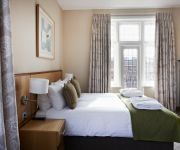
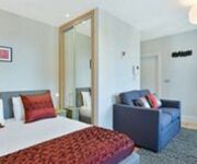
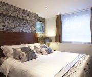
Looking for a place to stay? we compiled a list of available hotels close to the map centre further down the page.
When in this area, you might want to pay a visit to some of the following locations: Camden Town, Kensington, Hendon, Hammersmith and London. To further explore this place, just scroll down and browse the available info.
Local weather forecast
Todays Local Weather Conditions & Forecast: 15°C / 60 °F
| Morning Temperature | 14°C / 58 °F |
| Evening Temperature | 16°C / 61 °F |
| Night Temperature | 11°C / 53 °F |
| Chance of rainfall | 5% |
| Air Humidity | 71% |
| Air Pressure | 997 hPa |
| Wind Speed | Strong breeze with 19 km/h (12 mph) from North-East |
| Cloud Conditions | Overcast clouds, covering 100% of sky |
| General Conditions | Moderate rain |
Monday, 25th of November 2024
10°C (49 °F)
7°C (45 °F)
Moderate rain, moderate breeze, overcast clouds.
Tuesday, 26th of November 2024
9°C (47 °F)
7°C (44 °F)
Light rain, gentle breeze, clear sky.
Wednesday, 27th of November 2024
7°C (45 °F)
5°C (41 °F)
Moderate rain, gentle breeze, broken clouds.
Hotels and Places to Stay
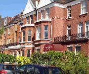
Clayton Crown
Regent's Park One
New London Carlton
Best Western Swiss Cottage
London Marriott Hotel Maida Vale
Dawson House Hotel
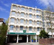
Quality Hotel Hampstead
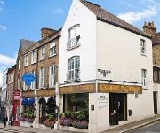
La Gaffe - Restaurant with Rooms
Anchor House
Best Western Palm
Videos from this area
These are videos related to the place based on their proximity to this place.
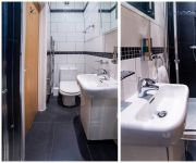
Cheap, awesome room to rent in Hampstead, London (NW3) more info on Spareroom
More info here http://www.spareroom.co.uk/flatshare/flatshare_detail.pl?flatshare_id=3075264.
Very fast otis lifts at Hampstead underground station
Very fast otis lifts at Hampstead london underground station http://beno.org.uk.
West Hampstead Stations Contrasts 2 - 2012/13
This film shows all three West Hampstead stations - London Underground, North London Line (London Overground) and Midland Main Line (Thameslink). Passenger trains, freight trains, views from...
43048+43082 Pass West Hampstead Thameslink
43048 leads 43082 and the rest of the East Midlands Trains Mk3 HST set through West Hampstead Thameslink station whilst working 1D52 1601 St Pancras International to Nottingham on Saturday...
Trains at West Hampstead 18/09/13
A few trains seen at West Hampstead station on the Jubilee line on Wednesday 18th September 2013. 0:00 96002+96125 depart for Stanmore working Train 336. 0:21 21018+21017 pass heading for...
Fordwych Road West Hampstead London NW2
STUNNING newly refurbished flooded with light first floor flat for sale on Fordwych Road, West Hampstead NW2. The flat has been finished to a very high specification and comprises good sized...
20302 & 20305 thrash past West Hampstead Thameslink with 'The Deviationer'
Here we see DRS' 20302 and 20305 whistle and thrash past West Hampstead Thameslink on the slow lines with the 1Z20 Crewe to Ely leg of 'The Deviationer' tour, ran by Pathfinder tours. DRS'...
RARE 57011 & 57003 work 6M69 through West Hampstead with full thrash.
DRS' 57011 and 57003 crawl into West Hampstead, and them give it full power through the station, working the 6M69 Sizewell to Willesden Brent Flasks. This working is usually entrusted to a...
Thumper '1001' at West Hampstead
Thumper '1001' at west Hampstead on 'The Sheringham Crabber', first at about 07:20am and then at about 08:25pm (the railtour is running about an hour late in the evening). Great wistle by the...
Scotrail Turbostars in London!
First ScotRail 170421 and 170423 pass West Hampstead working from Craigentinny T&R.S.M.D. to Steawarts Lane T&R.S.M.D. These units are transferring contracts from the First Group's old ScotRail.
Videos provided by Youtube are under the copyright of their owners.
Attractions and noteworthy things
Distances are based on the centre of the city/town and sightseeing location. This list contains brief abstracts about monuments, holiday activities, national parcs, museums, organisations and more from the area as well as interesting facts about the region itself. Where available, you'll find the corresponding homepage. Otherwise the related wikipedia article.
West Hampstead interchange
West Hampstead interchange is a proposal by Chiltern Railways to connect three existing railway stations and two lines now without platforms, on West End Lane in West Hampstead in the London Borough of Camden in London, England. Although physically separate, they are near each other and the stations form a railway interchange. Two of the stations are part of the National Rail network and the third is on the London Underground.
Royal Free Hospital
The Royal Free Hospital (also known simply as the Royal Free) is a major teaching hospital in Hampstead, London. It was rated 'excellent' for quality of services and 'good' for quality of financial management by the Healthcare Commission in 2009. The hospital is part of the Royal Free London NHS Foundation Trust, which is a member of the UCL Partners' academic health science centre. The nearest London Underground station is Belsize Park.
Finchley Road
Finchley Road, an inner city main road which runs for about 7 kilometres/4 miles, is one of the major thoroughfares of north London, England. Originally named Finchley New Road, it was built as a turnpike road in the late 1820s/early 1830s to provide a by-pass to the existing route north from London through Hampstead. The Hampstead route contained two steep hills either side of Hampstead Village and was difficult for horses with carriages to negotiate when muddy.
Fenton House
Fenton House is a 17th century merchant's house in Hampstead in North London which belongs to the National Trust, bequeathed to them in 1952 by Lady Binning, its last owner and resident. It is a detached house with a walled garden, which is large by London standards, and features roses, an orchard and a working kitchen garden.
Camden Arts Centre
Camden Arts Centre in the London Borough of Camden, England, is a contemporary visual art gallery, dedicated to engaging living artists from across the world. Positioning the artist at the centre of the programme, Camden Arts Centre strives to involve the public in the ideas and work of today's artists. The exhibition and education programmes are developed with equal importance, and are continually intertwined.
Hampstead and Kilburn (UK Parliament constituency)
Hampstead and Kilburn is a constituency represented in the House of Commons of the UK Parliament since its 2010 creation by former actress Glenda Jackson of the Labour Party.
Kilburn Grange Park
Kilburn Grange Park is a 3.2 hectares open space in Kilburn, north-west London adjacent to Kilburn High Road. It is administered by the London Borough of Camden and includes a children's playground, basketball court, outdoor gym equipment and tennis courts. The park first opened in 1913 having previously been part of the Grange estate.
Frognal
Not to be confused with Frognal House, in Foots Cray near Sidcup, London Frognal London borough Camden Ceremonial county Greater London Region London Country England Sovereign state United Kingdom Post town LONDON Postcode district NW3 Dialling code 020 Police Metropolitan Fire London Ambulance London EU Parliament London UK Parliament Hampstead and Kilburn London Assembly Barnet and Camden List of places UK England London Frognal is an area of Hampstead, North West London in the London Borough of Camden.
Fortune Green
Fortune Green was originally part of the district of Hampstead but became physically separated from it by the building of the new turnpike road in the 1830s. Lying on the south-west side of the Finchley Road, Hampstead town council decided to build its overflow cemetery there in the 1840s. A guide to the cemetery, with short biographies of selected grave occupants with map of their location and illustrations of the more prominent monuments was published in 2000.
6 Ellerdale Road
6 Ellerdale Road (now the Institute of St Marcellina) is a house built by the Arts and Crafts movement architect Richard Norman Shaw for himself in the period of 1874 to 1876. It is a large red brick detached house in between Frognal and Hampstead in London. It was made a Grade I listed building in 1950 and as of 2006, it has been used as a convent.
Everyman Cinema
The Everyman, in Hampstead, London, England opened as a cinema on 26 December 1933. The building was first opened as the Hampstead Drill Hall and Assembly Rooms in the 1880s. Later it was transformed into a theatre, the Everyman Theatre, which opened in 1920 under the direction of Norman MacDermott (1890–1977) with the first British production of Jacinto Benavente's The Bonds of Interest (Los intereses creados, 1907).
O2 Centre
The O2 Centre (regularly stylised as O2 Centre) is an indoor shopping and leisure centre on Finchley Road, London, near Finchley Road tube station. It is located in between Hampstead, West Hampstead and Swiss Cottage. Owned by the X-Leisure group, and opened in 1998. Despite the same name and very similar logo, it is no relation to the O2 telecommunications brand, which was launched 4 years later.
Hendon South (UK Parliament constituency)
Hendon South was a constituency in the former Municipal Borough of Hendon (later subsumed into the London Borough of Barnet) which returned one Member of Parliament to the House of Commons of the Parliament of the United Kingdom. It was created for the 1945 general election, when the existing Hendon constituency was split into two parts, and abolished for the 1997 general election. The constituency included the wards of Childs Hill, Golders Green, Hampstead Garden Suburb, and West Hendon.
Finchley Road railway station
Finchley Road railway station was built by the Midland Railway in 1868 on its extension to St. Pancras. Situated at the north end of the Belsize Tunnels, it served the newly-developed area of St John's Wood. For a short period from 1878 and 1880, the MR operated the Super Outer Circle service through the station from St. Pancras to Earl's Court Underground station via tracks through Cricklewood, then using the Dudding Hill Line to South Acton and Hammersmith.
Decca Studios
Decca Studios was a recording facility in Broadhurst Gardens, West Hampstead, North London, England. From the companies beginnings in 1929, British Decca's earliest recordings were made at two locations: firstly the Chenil Galleries Studios in Chelsea, and later in Lower Thames Street.
Hampstead Cemetery
Hampstead Cemetery is a historic cemetery in West Hampstead, London, located at the upper extremity of the NW6 district. Despite the name, the cemetery is three-quarters of a mile from Hampstead Village, and bears a different postcode. It is jointly managed by Islington and Camden Cemetery Service and opens 7 days a week, with closing times varying throughout the year.
Gaumont State Cinema
The Gaumont State Cinema is a Grade II* listed Art Deco theatre located in Kilburn, a district in northwest London. Designed by George Coles and opened in 1937, the Gaumont State was one of the biggest auditoria in Europe, with seating for 4,004 people. The name State is said to come from the huge 120 feet tower, inspired by the Empire State Building in New York City. The exterior of the cinema is designed in an Art Deco Italian Renaissance style, covered in cream ceramic tiles.
The Luminaire
The Luminaire was a live music venue on Kilburn High Road in north west London, UK. It opened on 1 March 2005 in what was a nightclub called Late, above McGovern's Pub and The Kilburn Bar. Its last public show was 7 March 2011. It was co-founded by John Donnelly, a publican from Ireland, and Andy Inglis, a Scot.
St John-at-Hampstead
St John-at-Hampstead is a Church of England parish church dedicated to St John the Evangelist (though the original dedication was only refined from St John to this in 1917 by the Bishop of London) in Church Row, Hampstead, London.
St Mary's Church, Hampstead
St Mary’s Chapel in Holly Place, Holly Walk, Hampstead, London, NW3, is now known as St Mary's Church. It is a Grade II* listed building.
Frognal and Fitzjohns (ward)
Frognal and Fitzjohns is a ward in the London Borough of Camden, the United Kingdom. It covers the neighbourhoods between Hampstead and West Hampstead, and takes its name from Frognal and Fitzjohn's Avenue.
Lithos Road Estate
The Lithos Road Estate is an housing estate located at grid reference TQ260849 in West Hampstead just off Finchley Road, London Borough of Camden. It is run by the estate's four consortia landlords Odu-Dua Housing Association, Paddington Churches Housing Association, Circle 33 and Notting Hill Housing Trust. The estate was built in 1991 and consists of a number of high and low rise blocks - bordered on each side by railway tracks.
Kilburn Priory
Kilburn Priory was a small monastic community of nuns established around 1130–1134 three miles north-east of the medieval City of London, where Watling Street met the stream now known as the Westbourne, but variously known as Cuneburna, Keneburna, Keeleburne, Coldburne, or Caleburn, meaning either the royal or cow's stream. The priory gave its name to the area now known as Kilburn, and the local streets Priory Road, Kilburn Priory and Abbey Road.
The Academy School
Klooks Kleek
Klooks Kleek was a jazz/R&B club in the 1960s, based in The Railway Hotel, West Hampstead, North West London, next to the Decca Records studio. The club was named after a 1956 album by Kenny Clarke (Klook Clique, Savoy Records 12006).


