Safety Score: 3,0 of 5.0 based on data from 9 authorites. Meaning we advice caution when travelling to United Kingdom.
Travel warnings are updated daily. Source: Travel Warning United Kingdom. Last Update: 2024-08-13 08:21:03
Delve into High Barnet
The district High Barnet of Barnet in Greater London (England) with it's 7,062 habitants High Barnet is a district located in United Kingdom a little north of London, the country's capital town.
In need of a room? We compiled a list of available hotels close to the map centre further down the page.
Since you are here already, you might want to pay a visit to some of the following locations: Potters Bar, Hendon, Wood Green, Enfield Town and Camden Town. To further explore this place, just scroll down and browse the available info.
Local weather forecast
Todays Local Weather Conditions & Forecast: 15°C / 59 °F
| Morning Temperature | 14°C / 58 °F |
| Evening Temperature | 16°C / 60 °F |
| Night Temperature | 11°C / 51 °F |
| Chance of rainfall | 6% |
| Air Humidity | 75% |
| Air Pressure | 996 hPa |
| Wind Speed | Strong breeze with 22 km/h (14 mph) from North |
| Cloud Conditions | Overcast clouds, covering 100% of sky |
| General Conditions | Moderate rain |
Monday, 25th of November 2024
9°C (48 °F)
6°C (43 °F)
Moderate rain, moderate breeze, overcast clouds.
Tuesday, 26th of November 2024
7°C (45 °F)
6°C (42 °F)
Light rain, moderate breeze, clear sky.
Wednesday, 27th of November 2024
6°C (43 °F)
4°C (39 °F)
Moderate rain, light breeze, broken clouds.
Hotels and Places to Stay
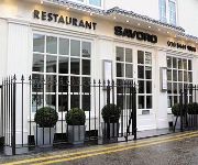
Savoro Restaurant with Rooms
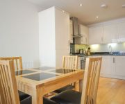
Crompton House Serviced Apartments
MStay Golders Green
Bay Tree House B&B
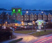
JCT.23 Holiday Inn LONDON-ELSTREE M25
Laura Ashley The Manor
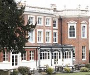
Hendon Hall
West Lodge Park A Beales Hotel
Iolanthe
Brooklyn House
Videos from this area
These are videos related to the place based on their proximity to this place.
Call of Duty MW3 Wii - Lockdown TDM 2
Another game of Lockdown! Again, after another few months hiatus, I decided to go back to this awesome game and see who was still playing. My brother decided to join me too. Just like old times......
Double Extension Hertfordshire
London Builder, Home Extension in Watford, Loft conversion North London, - Top Tips on how to choose a builder.
New Homes | Plot 3 | Imperial Grove | Hadley Wood | Greater London | Banner Homes
A stylish new development consisting of a charming mews house, stunning two bedroom conversion apartments, new two and three bedroom apartments and an exceptionally spacious four storey, six...
Snowberry Close, High Barnet, EN5.
ONLY A FEW REMAINING! A newly constructed 4 bedroom mid terrace town house, situated on a new development consisting of 19 town houses and 8 luxury flats. Martyn Gerrard Estate Agents ...
Kyran Bracken learns about volatile markets and the importance of having a trading plan
England Rugby star, Kyran Bracken, asks City Index's Josh Raymond how to deal with unpredictable financial markets and learns about the importance of having a trading plan. http://www.cityindex.co...
Danielle Stern comes home!
My dearest twin decided to fly home on the 4th July from New York City ( where she lives) to surprise our friend Natalie for her engagement party. Here are a few videos of the "BIG REVEAL"....
hotbird
back in the village called after a hairdo. lived at the only off licence, last nightbus stop and copper base. much to see there. but that here is not your every day cowboy.
New Homes | Plot 6 - The Penthouse | Imperial Grove | Hadley Wood | Greater London | Banner Homes
A stylish new development consisting of a charming mews house, stunning two bedroom conversion apartments, new two and three bedroom apartments and an exceptionally spacious six bedroom ...
Hadley Road, Barnet, Hertfordshire, EN5.
Hadley Road, Barnet, Hertfordshire, EN5. Four bedroom detached family home. Martyn Gerrard Estate Agents Tel: 020 8203 2012 www.martyngerrard.co.uk.
Videos provided by Youtube are under the copyright of their owners.
Attractions and noteworthy things
Distances are based on the centre of the city/town and sightseeing location. This list contains brief abstracts about monuments, holiday activities, national parcs, museums, organisations and more from the area as well as interesting facts about the region itself. Where available, you'll find the corresponding homepage. Otherwise the related wikipedia article.
Battle of Barnet
The Battle of Barnet was a decisive engagement in the Wars of the Roses, a dynastic conflict of 15th-century England. The military action, along with the subsequent Battle of Tewkesbury, secured the throne for Edward IV. On 14 April 1471 near Barnet, then a small town north of London, Edward led the House of York in a fight against the House of Lancaster, which backed Henry VI for the throne.
Northern line
The Northern line is a London Underground line, coloured black on the Tube map. For most of its length it is a deep-level tube line. It carries about 252,310,000 passengers per year, making it the second busiest line on the Underground. It is unique in having two different routes through central London - the Charing Cross branch, serving the central part of zone 1, and the Bank branch, serving the eastern part of that zone.
Chipping Barnet (UK Parliament constituency)
Chipping Barnet is a constituency represented in the House of Commons of the UK Parliament since 2005 by Theresa Villiers of the Conservative Party.
Underhill Stadium
Underhill is the home of Barnet F.C. It is situated in Barnet in the London Borough of Barnet and has a capacity of 6,023. The stadium is famous for its slope from the North to South end. It is also used for Arsenal reserve games. Barnet F.C. will leave the stadium in May 2013 as the club move to The Hive Stadium.
Barnet Urban District
Barnet was a local government district in south Hertfordshire from 1863 to 1965 around the town of Barnet.
Potters Bar Urban District
South Mimms Rural District (1894–1934) and Potters Bar Urban District (1934–1974) were local government districts occupying the area around the town of Potters Bar, England. The change from a rural district to an urban district occurred in 1934; with the new district retaining the same boundaries. The urban district was transferred from Middlesex to Hertfordshire in 1965.
Wrotham Park, Hertfordshire
Wrotham Park, Hertsmere, Hertfordshire is a neo-Palladian English country house, designed by Isaac Ware in 1754 for Admiral John Byng, the fourth son of Admiral Sir George Byng, which remains in the family at the heart of a 2,500 acres estate seventeen miles (27 km) from Hyde Park Corner. It is one of the largest private houses inside the M25 motorway. Its distinctive exterior has often been used as a filming location.
Barnet General Hospital
Barnet Hospital, formerly called Barnet General Hospital, is a hospital in Barnet, north London, run by Barnet and Chase Farm NHS Hospitals Trust as part of the National Health Service.
Spires Shopping Centre
The Spires Shopping Centre (also referred to as Barnet Spires) is a shopping centre in Barnet, north London, England. It is located in the centre of the town, on the High Street. The Spires gained its name by incorporating the two spires of the Methodist church that had formerly stood on the site into the street-front facade of the shopping centre. It has many hallmarks of a smaller suburban shopping centre, and receives around 70,000 visitors per week.
Barnet Museum
Barnet Museum is in the London Borough of Barnet. It has displays on topics including the Battle of Barnet, Barnet Fair and Market. It is a centre for local and family research and its archives, library and reference collection are available for use by members of the public.
Underhill School
Underhill School was built in 1932. School’s name is from its location in Underhill, London Borough of Barnet.
Barnet Market
Barnet Market is a weekly market held in Barnet, which was first established on 23 August 1199 when King John issued a Charter for a Market at Barnet to the Lord of the Manor, the Abbot of St. Albans, John de Cella. This charter is one of the oldest recorded for a market. On 6 February 1588 a new Barnet Market Charter was issued by Queen Elizabeth I to the then Lord of the Manor, Charles Butler, which also allowed the holding of the Barnet Horse Fair.
Hadley Green
Hadley Green is a 10 hectare Site of Metropolitan Importance for Nature Conservation in Monken Hadley in the London Borough of Barnet. It is an area of acid grassland interspersed with trees, and has several ponds. The acid grassland, ditches and ponds have several regionally rare species of plants, and the invertebrate fauna include eleven species of dragonflies and damselflies. The reserve straddles the Great North Road between Hadley Green Road and Fold Lane.
King George's Fields (Monken Hadley)
King George's Fields is a 28 hectare Site of Borough Importance for Nature Conservation, Grade II, in Monken Hadley in the London Borough of Barnet. The site consists of a patchwork of fields, intersected by overgrown hedgerows, narrow strips of woodland and small streams. There are a number of magnificent old oaks, and breeding birds include sparrowhawk, stock dove, bullfinch, willow warbler and chaffinch. There are also a number of common butterflies and the uncommon chimney sweeper moth.
Arkley South Fields
Arkley South Fields are a Site of Borough Importance for Nature Conservation, Grade II, in Arkley in the London Borough of Barnet. It is an extensive area of set-aside agricultural fields with hedgerows and ditches. It is not of great botanical interest, and its conservation value lies in its breeding birds, especially skylarks, a declining species which is a priority under the UK Biodiversity Action Plan.
Glebe Lane Pastures
Glebe Lane Pastures is a Site of Borough Importance for Nature Conservation, Grade I, in Arkley in the London Borough of Barnet. It consists of five fields off Glebe Lane, some managed for hay while others are grazed by horses. It contains flower-rich unimproved grassland which is dominated by Yorkshire Fog, with a good variety of other grasses, and Tufted hair-grass is dominant in damper areas. The most important feature of the site is the diversity of its old meadow plants.
Arkley Lane and Pastures
Arkley Lane and Pastures is a 50 hectare Site of Borough Importance for Nature Conservation, Grade II, in Arkley in the London Borough of Barnet. Arkley Lane, off Barnet Road, is an old drovers' road. Located in Barnet Plateau, it is now a quiet country lane with a traditional bank and ditch. The thick hedges are composed of beech and hornbeam, ash, field maple and magnificent old pedunculate oaks.
Greenhill Gardens
Greenhill Gardens is a 1.6 hectare public park in High Barnet in the London Borough of Barnet. Its main feature is an ornamental lake with a wooded island, which attracts many birds, and it also has a grassed area with scattered mature trees. It is a Site of Local Importance for Nature Conservation. The park is the small surviving part of large country estate known as Pricklers, named after a medieval family called Prittle.
Whitings Hill Open Space
Whitings Hill Open Space is a large public open space in Chipping Barnet in the London Borough of Barnet. It is mainly grassed with clumps of young trees, planted as part of the Watling Chase Community Forest, and a few mature trees. There are good views in all directions from the top of Whitings Hill. A small stream, a tributary of Dollis Brook, flows through the site. There is access from Shelford Road, Quinta Drive, Brett Road and Hackford Close.
Old Court House Recreation Ground
Old Court House Recreation Ground is a public park in High Barnet in the London Borough of Barnet. It is one of the borough's Premier Parks and received a Green Flag Award for 2009-2010. The park has six free tennis courts, a bowling green with a pavilion, a children's playground, a café and a car park (off Manor Close). It has formal gardens, grassed areas, rockeries, and a tree trail.
The Totteridge Academy
The Totteridge Academy (Formerly The Ravenscroft School) is a British secondary school and sixth form with academy status in Barnet, North London. The Totteridge Academy is an 11-18 school and is a specialist Technology College. It remains a non-selective, co-educational, community school as of 2012. The school, previously known as The Ravenscroft School became an academy in the new academic year starting in September 2011 under the new name "The Totteridge Academy"
King George V Playing Fields, Totteridge
King George V Playing Fields is an area of playing fields of approximately 14 acres in Totteridge in the London Borough of Barnet. It is located south east of the junction of Barnet Lane and Dollis Brook. Following the death of King George V in 1936 the King George's Fields Foundation was established to give grants for the establishment of playing fields.
Bell's Hill Burial Ground
Bell's Hill Burial Ground is a 3.3 hectare cemetery and Site of Local Importance for Nature Conservation in the Parish of Chipping Barnet in the London Borough of Camden. It was opened in 1895 and closed in 2005 when it became full. In 2006 control was passed to Barnet Council. The north-eastern end has older monuments and is wooded with mature cedar and yew trees. Wildflowers include common knapweed and lady's bedstraw, while brambles and roses climb the tombs in wilder areas.
Northern Line Embankment, High Barnet
The Northern Line Embankment between Totteridge and Whetstone and High Barnet tube stations on the Northern Line is a Site of Borough Importance for Nature Conservation, Grade II, in the London Borough of Barnet. It has typical suburban railway vegetation, with low brambles and light secondary woodland. The wooded areas have been naturally colonised, with the main trees being silver birch, sycamore and ash. It also provides an excellent habitat for small birds.
Barnet Countryside Centre
Barnet Countryside Centre is a 3.3 hectare Site of Local Importance for Nature Conservation in High Barnet in the London Borough of Barnet. It is run by the Friends of Barnet Countryside Centre as a nature reserve and to provide environmental education for schools. The site has areas of native woodland which support a wide variety of birds. Several small ponds have frogs, newts and the ruddy darter dragonfly.


