Safety Score: 3,0 of 5.0 based on data from 9 authorites. Meaning we advice caution when travelling to United Kingdom.
Travel warnings are updated daily. Source: Travel Warning United Kingdom. Last Update: 2024-08-13 08:21:03
Discover Willersey
Willersey in Gloucestershire (England) is a city in United Kingdom about 83 mi (or 133 km) north-west of London, the country's capital city.
Local time in Willersey is now 06:08 AM (Friday). The local timezone is named Europe / London with an UTC offset of zero hours. We know of 7 airports in the vicinity of Willersey, of which 5 are larger airports. The closest airport in United Kingdom is Gloucestershire Airport in a distance of 17 mi (or 28 km), South-West. Besides the airports, there are other travel options available (check left side).
There are several Unesco world heritage sites nearby. The closest heritage site in United Kingdom is City of Bath in a distance of 47 mi (or 76 km), South. Also, if you like golfing, there are a few options in driving distance. We discovered 1 points of interest in the vicinity of this place. Looking for a place to stay? we compiled a list of available hotels close to the map centre further down the page.
When in this area, you might want to pay a visit to some of the following locations: Shipton, Swindon Village, Uckington, Tidbury Green and Cheswick Green. To further explore this place, just scroll down and browse the available info.
Local weather forecast
Todays Local Weather Conditions & Forecast: 8°C / 47 °F
| Morning Temperature | 5°C / 41 °F |
| Evening Temperature | 6°C / 43 °F |
| Night Temperature | 5°C / 41 °F |
| Chance of rainfall | 0% |
| Air Humidity | 77% |
| Air Pressure | 1028 hPa |
| Wind Speed | Light breeze with 4 km/h (3 mph) from North-East |
| Cloud Conditions | Overcast clouds, covering 99% of sky |
| General Conditions | Overcast clouds |
Saturday, 16th of November 2024
8°C (47 °F)
7°C (44 °F)
Light rain, gentle breeze, overcast clouds.
Sunday, 17th of November 2024
8°C (46 °F)
3°C (37 °F)
Light rain, moderate breeze, overcast clouds.
Monday, 18th of November 2024
6°C (42 °F)
2°C (35 °F)
Moderate rain, moderate breeze, overcast clouds.
Hotels and Places to Stay
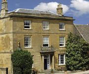
FOXHILL MANOR
The Fish Hotel
Dormy House Hotel
Buckland Manor
Kings Hotel
Cotswold House
The Broadway
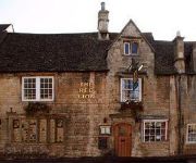
The Red Lion Inn
Noel Arms A Classic British Hotel
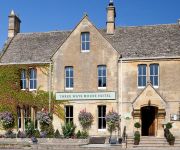
Three Ways House
Videos from this area
These are videos related to the place based on their proximity to this place.
2008 Tour around the Cotswolds
A cycle ride around the Cotswolds by Naoko Motohiro and Mike Newton in October 2008, 29 miles on the first day and 66 miles on the second day.
The Cotswolds
The Cotswolds, an officially designated area of outstanding beauty since 1966. A lovely short break destination and here we feature a typical Cotswold village, Bourton-on-the water; Thistle...
Driving On Evesham Road, Station Road, High Street & Leamington Road, Broadway, Worcestershire, UK
Driving along Evesham Road, Station Road, High Street & Leamington Road, Broadway, Worcestershire, England Videoed on Saturday, 22nd June 2013 Playlist: ...
Me Driving in the Cotswolds
A shot video of myself driving on the other side of the road while in the Cotswolds.
Harveywetdog's Broadway Bloopers
A bit of fun at my expense showing how you have to suffer for your art!! See the original video at https://www.youtube.com/watch?v=DW_NAgZV9jc.
Videos provided by Youtube are under the copyright of their owners.
Attractions and noteworthy things
Distances are based on the centre of the city/town and sightseeing location. This list contains brief abstracts about monuments, holiday activities, national parcs, museums, organisations and more from the area as well as interesting facts about the region itself. Where available, you'll find the corresponding homepage. Otherwise the related wikipedia article.
Broadway Tower
Broadway Tower is a folly located on Broadway Hill, near the village of Broadway, in the English county of Worcestershire, at the second highest point of the Cotswolds after Cleeve Hill. Broadway Tower's base is 1,024 feet (312 metres) above sea level. The tower itself stands 55 feet (17 metres) high. The "Saxon" tower was designed by James Wyatt in 1794 to resemble a mock castle, and built for Lady Coventry in 1799.
The Fleece Inn
The Fleece Inn is a public house in Bretforton, Worcestershire in the Vale of Evesham: the half-timbered building, over six hundred years old, has been a pub since 1848, and is now owned by the National Trust. The inn was extensively damaged by fire on 27 February 2004 — repairs and rebuilding commenced on 1 November 2004. The Fleece officially reopened — with a new roof and improved facilities — on 18 June 2005.
Willersey
Willersey is a village in Gloucestershire, England, situated close to the boundary with Worcestershire and southwest of Evesham. Although in the County of Gloucestershire it has a Worcestershire postcode. It is an old village with much character. There are two pubs in the village - The Bell Inn and The New Inn. There is also a shop near the New Inn that sells newspapers, as well as a few grocery items. There is a primary school and as well as a large park area.
RAF Honeybourne
Royal Air Force Station Honeybourne or RAF Honeybourne was a Royal Air Force station located 0.6 miles south of Honeybourne, Worcestershire, England and 4.6 miles east of Evesham, Worcestershire, England The station was operational from 1940 or 1941 to 1946 or 15 November 1947.
Broadway railway station
Broadway railway station was a railway station that served the town of Broadway in Worcestershire, England. It was opened by the Great Western Railway in 1904 and closed to passengers in 1968. Today only the platform edgings remain with the track long gone. (There was another Broadway opened by the GWR, in Dorset, but renamed Broadwey for a while, then Upwey)
Weston-sub-Edge railway station
Weston-sub-Edge railway station is a disused station on the Honeybourne Line from Stratford-upon-Avon to Cheltenham which served the hamlet of Weston-sub-Edge in Gloucestershire between 1904 and 1960. The Gloucestershire Warwickshire Railway aims to reopen the line through the station as part of its extension to Honeybourne.


