Safety Score: 3,0 of 5.0 based on data from 9 authorites. Meaning we advice caution when travelling to United Kingdom.
Travel warnings are updated daily. Source: Travel Warning United Kingdom. Last Update: 2024-08-13 08:21:03
Touring Stratton
Stratton in Gloucestershire (England) with it's 2,570 residents is a town located in United Kingdom about 81 mi (or 130 km) west of London, the country's capital place.
Time in Stratton is now 10:09 PM (Thursday). The local timezone is named Europe / London with an UTC offset of zero hours. We know of 10 airports nearby Stratton, of which 5 are larger airports. The closest airport in United Kingdom is RAF Fairford in a distance of 9 mi (or 14 km), South-East. Besides the airports, there are other travel options available (check left side).
There are several Unesco world heritage sites nearby. The closest heritage site in United Kingdom is City of Bath in a distance of 28 mi (or 46 km), South-East. Also, if you like the game of golf, there are several options within driving distance. We collected 1 points of interest near this location. Need some hints on where to stay? We compiled a list of available hotels close to the map centre further down the page.
Being here already, you might want to pay a visit to some of the following locations: Kemble, Minety, Hankerton, Shipton and Leigh. To further explore this place, just scroll down and browse the available info.
Local weather forecast
Todays Local Weather Conditions & Forecast: 11°C / 51 °F
| Morning Temperature | 9°C / 48 °F |
| Evening Temperature | 10°C / 50 °F |
| Night Temperature | 5°C / 41 °F |
| Chance of rainfall | 0% |
| Air Humidity | 76% |
| Air Pressure | 1033 hPa |
| Wind Speed | Gentle Breeze with 8 km/h (5 mph) from South-West |
| Cloud Conditions | Broken clouds, covering 50% of sky |
| General Conditions | Scattered clouds |
Friday, 15th of November 2024
8°C (46 °F)
4°C (40 °F)
Overcast clouds, light breeze.
Saturday, 16th of November 2024
7°C (45 °F)
6°C (43 °F)
Broken clouds, gentle breeze.
Sunday, 17th of November 2024
6°C (43 °F)
3°C (38 °F)
Light rain, moderate breeze, overcast clouds.
Hotels and Places to Stay
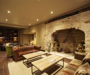
Kings Head
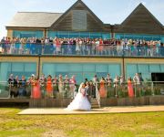
De Vere Cotswold Water Park
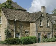
Stratton House
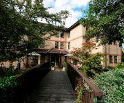
Corinium Hotel & Restaurant
Riverside House
The Crown of Crucis Country Inn & Hotel Ampney Crucis
TRAVELODGE CIRENCESTER
Cirencester
Videos from this area
These are videos related to the place based on their proximity to this place.
The Roman amphitheatre in Cirencester, UK.
A short clip showing the remains of the Roman amphitheatre in Cirencenter, Gloucestershire, UK. Built in the early 2nd century, the Corinium (now Cirencester) Roman amphitheatre was one of...
Sophie Ryder's sculpture Paintpots installed at New Brewery Arts in Cirencester
New Brewery Arts, in collaboration with Wetpaint Gallery and Wildmoor Properties, arranged for Sophie Ryder's fantastic sculpture, entitled 'Paintpots', to be installed outside New Brewery...
Holidays in Cirencester
Visit http://www.holidaycottages.co.uk/cotswolds/cirencester to view our collection of holiday cottages in Cirencester. Cirencester is a holiday destination in the Cotswolds with a lot of...
Gta Episodes from liberty city review pt 1
Part 1 of 2 of the Gta Episodes from liberty City Reviews.
Police Helicopter Take-Off, Cirencester Leisure Centre
My friend and I were just leaving the gym when this guy landed, so i thought i'd film the take-off as i couldn't get my camera out quick enough to catch the landing. The wind blew my sunglasses...
jordan meredith prcticing on his rm65 in cirencester
jordan meredith on his rm65 practicing in cirencester.
Videos provided by Youtube are under the copyright of their owners.
Attractions and noteworthy things
Distances are based on the centre of the city/town and sightseeing location. This list contains brief abstracts about monuments, holiday activities, national parcs, museums, organisations and more from the area as well as interesting facts about the region itself. Where available, you'll find the corresponding homepage. Otherwise the related wikipedia article.
Cotswold District
Cotswold is a local government district in Gloucestershire in England. It is named after the wider Cotswolds region. Its main town is Cirencester. It was formed on 1 April 1974 by the merger of the urban district of Cirencester with Cirencester Rural District, North Cotswold Rural District, Northleach Rural District and Tetbury Rural District.
A417 road
The A417 is a main road in England.
Baunton
Baunton is a village and civil parish in the Cotswold district of Gloucestershire, England, located about two miles north of Cirencester on the River Churn. There is archaeological evidence of human habitation around the village in Prehistoric and Roman times. The village is reorded in Domesday Book in 1086 under the name of Baudintone which means an estate associated with a man called Balda.
Abbey House, Cirencester
Abbey House, Cirencester was a country house in the English county of Gloucestershire that developed on the site of the former Cirencester Abbey following the dissolution and demolition of the abbey at the Reformation in the 1530s. The site of the dissolved abbey of Cirencester was granted in 1564 to Richard Master, physician to Queen Elizabeth I. Dr.
Cirencester Abbey
Cirencester Abbey in Gloucestershire was founded as an Augustinian monastery in 1117 on the site of an earlier church, the oldest-known Saxon church in England, which had itself been built on the site of a Roman structure. The church was greatly enlarged in the 14th century with addition of an ambulatory to the east end. The abbot became mitred 1416. The monastery was suppressed in 1539 and presented to Roger Bassinge.
Corinium Dobunnorum
Corinium Dobunnorum was the second largest town in the Roman province of Britannia. Today it is known as Cirencester, located in the English county of Gloucestershire.
Cirencester House
Cirencester House (or 'Park'), at Cirencester in Gloucestershire, England, is the seat of the Bathurst family, Earls Bathurst. Allen Bathurst, the first Earl Bathurst (1684–1775), inherited the estate on the death of his father, Sir Benjamin Bathurst, in 1704. He was a Tory Member of Parliament and statesman who from 1714 devoted himself to rebuilding the house formerly known as Oakley Grove, which probably stands on the site of Cirencester Castle, and laying out the famous parkland.
Corinium Radio
Corinium Radio is a community radio station in Cirencester, Gloucestershire. It was the second community radio station set up in Gloucestershire, after Forest of Dean Radio, and broadcast for the first time on a 2-day Restricted Service Licence in May 2006. Corinium Radio has broadcast using an RSL a total of 9 times, with a planned 10th run to take place in the Summer of 2011.
Church of St. John the Baptist, Cirencester
The Church of St. John the Baptist, Cirencester is a parish church in the Church of England in Cirencester.
Battle of Cirencester
The Battle of Cirencester was fought in 628 at Cirencester in modern-day England. The conflict involved the armies of Mercia, under King Penda, and the West Saxons, under Kings Cynegils and Cwichelm. The Mercians defeated the Saxon army and, according to Bede, "after reaching an agreement", took control of the Severn valley and the minor kingdom of the Hwicce, which had been under the influence of Wessex since the Battle of Dyrham in 577.
Cirencester Park
Cirencester Park is a cricket ground in Cirencester, Gloucestershire. The first recorded match on the ground was in 1853, when Cirencester played an All-England Eleven. In 1879, Gloucestershire played a single first-class match at the ground against Surrey, which ended in a draw. In local domestic cricket, the ground is the home venue of Cirencester Cricket Club.


