Safety Score: 3,0 of 5.0 based on data from 9 authorites. Meaning we advice caution when travelling to United Kingdom.
Travel warnings are updated daily. Source: Travel Warning United Kingdom. Last Update: 2024-08-13 08:21:03
Discover Randwick
Randwick in Gloucestershire (England) is a city in United Kingdom about 93 mi (or 149 km) west of London, the country's capital city.
Local time in Randwick is now 04:08 AM (Friday). The local timezone is named Europe / London with an UTC offset of zero hours. We know of 9 airports in the vicinity of Randwick, of which 5 are larger airports. The closest airport in United Kingdom is Gloucestershire Airport in a distance of 10 mi (or 16 km), North. Besides the airports, there are other travel options available (check left side).
There are several Unesco world heritage sites nearby. The closest heritage site in United Kingdom is Blaenavon Industrial Landscape in a distance of 28 mi (or 46 km), West. Also, if you like golfing, there are a few options in driving distance. Looking for a place to stay? we compiled a list of available hotels close to the map centre further down the page.
When in this area, you might want to pay a visit to some of the following locations: Gloucester, Churchdown, Charfield, Luckington and Uckington. To further explore this place, just scroll down and browse the available info.
Local weather forecast
Todays Local Weather Conditions & Forecast: 8°C / 46 °F
| Morning Temperature | 4°C / 39 °F |
| Evening Temperature | 5°C / 41 °F |
| Night Temperature | 4°C / 39 °F |
| Chance of rainfall | 0% |
| Air Humidity | 78% |
| Air Pressure | 1028 hPa |
| Wind Speed | Light breeze with 5 km/h (3 mph) from North-East |
| Cloud Conditions | Overcast clouds, covering 95% of sky |
| General Conditions | Overcast clouds |
Saturday, 16th of November 2024
7°C (45 °F)
6°C (43 °F)
Broken clouds, gentle breeze.
Sunday, 17th of November 2024
6°C (44 °F)
3°C (38 °F)
Light rain, moderate breeze, overcast clouds.
Monday, 18th of November 2024
6°C (42 °F)
8°C (47 °F)
Light rain, gentle breeze, overcast clouds.
Hotels and Places to Stay
Wild Garlic Restaurant & Rooms
Cardynham House
Hatton Court
Hallmark Gloucester
Mercure Gloucester Bowden Hall
Les Douvres Hotel
Stonehouse Court
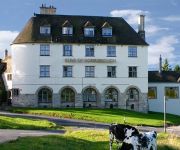
Bear of Rodborough
JCT.12 Holiday Inn Express GLOUCESTER - SOUTH M5
TRAVELODGE STONEHOUSE
Videos from this area
These are videos related to the place based on their proximity to this place.
Pokémon X And Y Cyllage City Gym & the Cliff Badge!
Pokémon X and Y Lets get through this cave ep1 still working camera issues out but do enjoy on may to the next city New nitro rigged gaming channel run purely on caffeine and randomness....
COTSWOLD CANALS - Flotilla of boats at Dudbridge 19th March 2014
19th March 2014. Stroudwater Navigation. A flotilla of craft gather near Dudbridge wharf prior to using Dudbridge lock and Foundry lock, with work boat "Wookey Hole" making history by proceeding...
Cotswold Canals 501 Dudbridge to Hilly Orchard
Navigating the recently restored Cotswold Canals - part 1 / 10 of a three mile east to west journey. Not the best of films, but it lets you see what's been done. Fast forward if you get bored!...
Cotswold Canals 503 Ebley to Oil Mills Bridge
Navigating the recently restored Cotswold Canals - part 3 / 10 of a three mile east to west journey. Not a great film, but it lets you see what's been happening. Shown in real time - fast...
Dead Rising 3 Walkthrough episode 2
https://www.youtube.com/channel/UCly1vAZ71eNrJoQzyM6sRFg https://www.facebook.com/Antisocials101?ref=hl https://twitter.com/AntiSocals hey guys welcome to my walkthrough of dead riseing 3...
Dead Rising 3 Walkthrough episode 5 Roaring Thunder Mask
https://www.youtube.com/channel/UCly1vAZ71eNrJoQzyM6sRFg https://www.facebook.com/Antisocials101?ref=hl https://twitter.com/AntiSocals hey guys welcome to my walkthrough of dead riseing 3...
Cotswold Canals 502 Hilly Orchard to Ebley
Navigating the recently restored Cotswold Canals near Stroud, Gloucestershire - part 2 / 10 of a three mile east to west journey. Not a great film, but it lets you see what's been happening....
Cotswold Canals 505 Ryeford Top Lock
Navigating the recently restored Cotswold Canals near Stroud, Gloucestershire - part 5 / 10 of a three mile east to west journey. Not a great film, but it lets you see what's been happening....
Dead Rising 3 Walkthrough Episode 5 Car Bomb Pushy Bear Boom Cannon
https://www.youtube.com/channel/UCly1vAZ71eNrJoQzyM6sRFg https://www.facebook.com/Antisocials101?ref=hl https://twitter.com/AntiSocals Dead Rising 3 is a survival horror video game being...
Videos provided by Youtube are under the copyright of their owners.
Attractions and noteworthy things
Distances are based on the centre of the city/town and sightseeing location. This list contains brief abstracts about monuments, holiday activities, national parcs, museums, organisations and more from the area as well as interesting facts about the region itself. Where available, you'll find the corresponding homepage. Otherwise the related wikipedia article.
Cashes Green
Cashes Green is a substantial residential area on the outskirts of Stroud, in Gloucestershire, England.
Downfield Sixth Form
Downfield Sixth Form was a sixth-form college located in Stroud, Gloucestershire until 2010. The building continues to provide shared sixth form provision for Marling School Sixth Form and Stroud High School Sixth Form. It provided post-school level education of Years 12 and 13, the majority of which were from Marling School, and Stroud High School. The Sixth Form was part of the Stroud Post 16 Consortium which included Archway School and South Gloucestershire and Stroud College.
Whiteshill, Gloucestershire
Whiteshill is a village in the Cotswolds, situated between Stroud and Gloucester, in Gloucestershire, England. Whiteshill has a population of just over 1,000. As the name suggests, Whiteshill is far from flat, and some of the houses in Whiteshill have wonderful views of nearby scenery. The Church of England Church is St. Paul's; the Minister [April 2008] is Rev. Brian Woollaston. When the limits of Stroud parish were set in 1304, Whiteshill and Ruscombe formed part of the tithing of Paganhill.
Stratford Park
Stratford Park is a green flag awarded area of Stroud in Gloucestershire, south west England. With a large park and lake, and a leisure centre complex, Stratford Park is a major tourist area for Stroud. It is located on the outskirts of Stroud near Paganhill and Whiteshill. It is also the site of the first wholly successful British campaign to save trees from road-widening.
Rodborough
Rodborough is a civil parish in the district of Stroud, Gloucestershire, in Southwest England. It is directly south of the town of Stroud, north of the town of Nailsworth and north-west of the village of Minchinhampton. Until 1974 much of the parish was part of the Stroud Urban District Council and forms part of the Stroud urban area along with Stroud and Cainscross. Built on a hill, Rodborough is located near Rodborough Common, a public recreation area popular with walkers.
Ebley Crossing Halt railway station
Ebley Crossing Halt was opened on 12 October 1903 on what is now the Golden Valley Line between Stroud and Stonehouse. This line was opened in 1845 as the Cheltenham and Great Western Union Railway from Swindon to Gloucester and this was one of many small stations and halts built on this line for the local passenger service.
Erinoid Ground
Erinoid Ground was a cricket ground in Stroud, Gloucestershire. The first recorded important match on the ground was in 1880, when Stroud played a United South of England Eleven. In 1956, Gloucestershire played Nottinghamshire in the grounds first first-class match. Gloucestershire played first-class matches at the ground from 1956 to 1963, playing a total of 14 first-class matches there, the last of which saw them play Glamorgan in the 1963 County Championship.
Randwick, Gloucestershire
Randwick is a village in Gloucestershire, England, the United Kingdom.


