Safety Score: 3,0 of 5.0 based on data from 9 authorites. Meaning we advice caution when travelling to United Kingdom.
Travel warnings are updated daily. Source: Travel Warning United Kingdom. Last Update: 2024-08-13 08:21:03
Touring Nympsfield
Nympsfield in Gloucestershire (England) with it's 382 residents is a town located in United Kingdom about 94 mi (or 151 km) west of London, the country's capital place.
Time in Nympsfield is now 08:30 PM (Thursday). The local timezone is named Europe / London with an UTC offset of zero hours. We know of 9 airports nearby Nympsfield, of which 5 are larger airports. The closest airport in United Kingdom is Gloucestershire Airport in a distance of 14 mi (or 23 km), North. Besides the airports, there are other travel options available (check left side).
There are several Unesco world heritage sites nearby. The closest heritage site in United Kingdom is Blaenavon Industrial Landscape in a distance of 27 mi (or 44 km), West. Also, if you like the game of golf, there are several options within driving distance. We collected 1 points of interest near this location. Need some hints on where to stay? We compiled a list of available hotels close to the map centre further down the page.
Being here already, you might want to pay a visit to some of the following locations: Charfield, Luckington, Horton, Gloucester and Falfield. To further explore this place, just scroll down and browse the available info.
Local weather forecast
Todays Local Weather Conditions & Forecast: 3°C / 37 °F
| Morning Temperature | 1°C / 33 °F |
| Evening Temperature | 1°C / 34 °F |
| Night Temperature | 1°C / 34 °F |
| Chance of rainfall | 0% |
| Air Humidity | 77% |
| Air Pressure | 999 hPa |
| Wind Speed | Gentle Breeze with 7 km/h (5 mph) from South-West |
| Cloud Conditions | Overcast clouds, covering 100% of sky |
| General Conditions | Overcast clouds |
Friday, 22nd of November 2024
6°C (42 °F)
2°C (35 °F)
Sky is clear, moderate breeze, clear sky.
Saturday, 23rd of November 2024
10°C (49 °F)
14°C (57 °F)
Moderate rain, strong breeze, overcast clouds.
Sunday, 24th of November 2024
14°C (58 °F)
10°C (49 °F)
Moderate rain, high wind, near gale, overcast clouds.
Hotels and Places to Stay
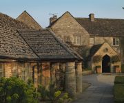
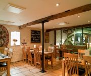
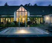
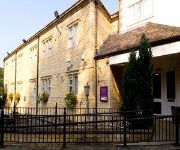
Wild Garlic Restaurant & Rooms
Calcot
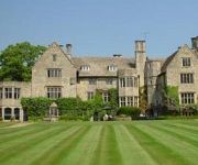
Stonehouse Court
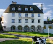
Les Douvres Hotel
Bear of Rodborough
TRAVELODGE STONEHOUSE
Egypt Mill
CALCOT MANOR
Stroud
The Imperial Hotel
Videos from this area
These are videos related to the place based on their proximity to this place.
Elite: Dangerous - Speed Docking Redux
After my 43 second win at LaveCon 2014: https://www.youtube.com/watch?v=ZnC3WSuwsWA I challenged people to beat my time, with the rules: * Sidewinder * 5km from the station * Facing away...
Elite: Dangerous - Kerrash Landing #64 (Part 1)
Elite: Dangerous - Kerrash Landing #64 (Part 1) Standard Beta 1.00 missions and more! in 1080p no less! Watch me crash live at http://twitch.tv/kerrashlanding Follow on: https://twitter.com/Kerrr...
Stinchcombe Hill House & Golf Club - Bexcopter - Aerial Video
Bexcopter is a UK based aerial video production company that specialises in aerial video and photography working alongside Bexmedia to create stunning aerial videos and photos. Please 'Like'...
Vulcan Mantis Test - Bexcopter - Aerial Video
Bexcopter is a UK based aerial video production company that specialises in aerial video and photography working alongside Bexmedia to create stunning aerial videos and photos for clients....
Elite: Dangerous - Kerrash Landing #61
Elite: Dangerous - Kerrash Landing #61 Tonight I chat with the one and only, Darren Grey Watch me crash live at http://twitch.tv/kerrashlanding Follow on: https://twitter.com/Kerrrash For...
Wedding snaps from Kingscote barn nr Stroud (Barnsley)
I am not sure what I was thinking when I did this video, I was going to grab the odd shots and details of the wedding, just ended up looking like this. well had a bit of a play, not much you...
Elite: Dangerous - Kerrash Landing #49 - Alpha 4
Kerrash Landing #49 Live game-play of the latest Elite: Dangerous release with Oculus rift Watch me crash live at http://twitch.tv/kerrashlanding Follow on: https://twitter.com/Kerrrash ...
Elite: Dangerous - Kerrash Landing #100
Elite: Dangerous - Kerrash Landing #100 Celebrating our 100th show with guests from Frontier Developments. Community Manager Edward Lewis and Game producers Adam Woods and Eddie ...
Elite: Dangerous - Kerrash Landing #64 (Part 2)
Elite: Dangerous - Kerrash Landing #64 (Part 2) Standard Beta 1.00 explained to Cmdr. Shorty in 1080p no less! Watch me crash live at http://twitch.tv/kerrashlanding Follow on: https://twitter.co...
StarTraX goes gliding - starting with a winch launch
It's a beautiful early autumn morning at Nympsfield, an old gliding field in S/W England. We replay the winch launch from three angles to showcase some StarTraX features. Notice the on-screen...
Videos provided by Youtube are under the copyright of their owners.
Attractions and noteworthy things
Distances are based on the centre of the city/town and sightseeing location. This list contains brief abstracts about monuments, holiday activities, national parcs, museums, organisations and more from the area as well as interesting facts about the region itself. Where available, you'll find the corresponding homepage. Otherwise the related wikipedia article.
Uley Bury
Uley Bury is the long, flat-topped hill just outside Uley, Gloucestershire, England. It is an impressive multi-vallate, scarp-edge Iron Age hill fort dating from around 300 B.C. Standing some 750 feet (235 metres) above sea level it commands spectacular views over the Severn Vale.
Owlpen Manor
Owlpen Manor is a Tudor Grade I listed manor house of the Mander family, situated in the village of Owlpen in the Stroud district in Gloucestershire, England. There is an associated estate set in a picturesque valley within the Cotswold Area of Outstanding Natural Beauty. The manor house is about one mile east of Uley, and three miles east of Dursley.
Coaley Peak
Coaley Peak is a picnic site and viewpoint in the English county of Gloucestershire. Located about 4 miles south-west of the town of Stroud overlooking the village of Coaley, Coaley Peak offers 12 acres of reclaimed farmland (now a wild flower meadow) with views over the Severn Vale and the Forest of Dean. It is next to a Woodland Trust beech wood and the National Trust's Frocester Hill site. The Cotswold Way long-distance footpath passes through the site.
Nympsfield
Nympsfield is a village and civil parish in the English county of Gloucestershire. It is located around six miles south-west of the town of Stroud. As well as Nympsfield village, the parish also contains the hamlet of Cockadilly. Nympsfield is on the path of a former Roman road, which ran from Cirencester to Arlingham. The village has a pub, the Rose and Crown, a working mans club, both Catholic and church of England churches and a Catholic primary school.
Stouts Hill
Stouts Hill is an 18th-Century Gothic revival country house situated in the Cotswolds, just outside the village of Uley. The house is currently a timeshare property. Although there are records of one Adam le Stut settled here in the 13th century, the present house, built for the Gyde family of local weavers, dates only from 1743, the design being attributed to William Halfpenny.
Uley Long Barrow
Uley Long Barrow, also known locally as "Hetty Pegler's Tump", is a Neolithic burial mound, near the village of Uley, Gloucestershire, England. Although typically described as a long barrow, the mound is actually a transepted gallery grave. It was probably built before 3000 BC. It measures about 37 metres long, 34 metres wide, and has a maximum height of 3 metres. It contains a stone built central passage with two chambers on either side and another at the end.
Leonard Stanley Priory
Leonard Stanley Priory was a priory in Gloucestershire, England.
Nympsfield Long Barrow
Nympsfield Long Barrow is the remains of a Neolithic burial site or barrow, located close to the village of Nympsfield in Gloucestershire, South West England. It lies at the edge of a woods, and is now the location of a picnic site. It is one of the earliest examples of a barrow with separate chambers. It was constructed around 2800 BCE. It is a Scheduled Monument (number 22857) in the guardianship of English Heritage.


