Safety Score: 3,0 of 5.0 based on data from 9 authorites. Meaning we advice caution when travelling to United Kingdom.
Travel warnings are updated daily. Source: Travel Warning United Kingdom. Last Update: 2024-08-13 08:21:03
Delve into Matson
Matson in Gloucestershire (England) is a town located in United Kingdom about 92 mi (or 149 km) west of London, the country's capital town.
Time in Matson is now 11:37 AM (Thursday). The local timezone is named Europe / London with an UTC offset of zero hours. We know of 9 airports closer to Matson, of which 5 are larger airports. The closest airport in United Kingdom is Gloucestershire Airport in a distance of 4 mi (or 7 km), North-East. Besides the airports, there are other travel options available (check left side).
There are several Unesco world heritage sites nearby. The closest heritage site in United Kingdom is Blaenavon Industrial Landscape in a distance of 30 mi (or 48 km), West. Also, if you like the game of golf, there are some options within driving distance. In need of a room? We compiled a list of available hotels close to the map centre further down the page.
Since you are here already, you might want to pay a visit to some of the following locations: Gloucester, Churchdown, Uckington, Swindon Village and Kemble. To further explore this place, just scroll down and browse the available info.
Local weather forecast
Todays Local Weather Conditions & Forecast: 3°C / 37 °F
| Morning Temperature | 1°C / 34 °F |
| Evening Temperature | 1°C / 34 °F |
| Night Temperature | 0°C / 32 °F |
| Chance of rainfall | 0% |
| Air Humidity | 63% |
| Air Pressure | 1000 hPa |
| Wind Speed | Gentle Breeze with 8 km/h (5 mph) from North-East |
| Cloud Conditions | Overcast clouds, covering 100% of sky |
| General Conditions | Overcast clouds |
Friday, 22nd of November 2024
6°C (42 °F)
2°C (35 °F)
Light rain, moderate breeze, clear sky.
Saturday, 23rd of November 2024
8°C (47 °F)
14°C (58 °F)
Moderate rain, high wind, near gale, overcast clouds.
Sunday, 24th of November 2024
15°C (60 °F)
12°C (53 °F)
Moderate rain, strong breeze, overcast clouds.
Hotels and Places to Stay
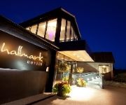
Hallmark Gloucester
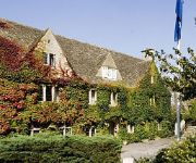
Hatton Court
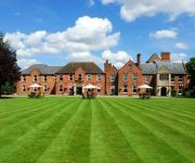
Mercure Gloucester Bowden Hall
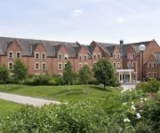
Hatherley Manor
CHELTENHAM CHASE HOTEL-QHOTELS
Cardynham House
Les Douvres Hotel
JCT.12 Holiday Inn Express GLOUCESTER - SOUTH M5
Cheltenham Regency
TRAVELODGE GLOUCESTER
Videos from this area
These are videos related to the place based on their proximity to this place.
GLOUCESTER BUSES 1997
a trailer for www.pmpfilms.com the world's largest range of transport hobby films see website for shop, list, links, blog etc.
Driving around Gloucester in 1982
I found this video the other day of my Father and Grandfather driving from Quedgeley to longlevens around 1982. Here you can see just how much Gloucester has changed in those years. They...
Commercial Carpet Cleaning Gloucester from Mavis Russell Floorcare
http://www.mavisrussellfloorcare.co.uk/carpet-cleaning/gloucester/ - Are you looking for Commercial Carpet Cleaning Gloucester ? Welcome to Mavis Russell Floorcare, We have been doing ...
The Women's Centre, Gloucester Maternity Tour
Tour of the Birth Unit, Delivery Suite and Maternity ward at Gloucestershire Royal Hospital.
Flight over Tuffley, Gloucester with my model plane
This is an onboard video taken from my RC Piper Cub, enjoy!
Gunjee.com 10/10/08 at Gloucester: Foam Party, Gunge'n'Dunk Tank
Big, big thanks to everyone who was in Gloucester on Friday 10th to help Big Dave celebrate his 30th birthday! What a party it was! Special thanks to Leon and Lyn who had to do all the hard...
Alexander RH Volvo Olympian Gloucester-Lydney SOUND
This video is mostly for the sound, so don't complain there is no view. On board Alexander RH bodied Volvo Olympian 16759 from Gloucester to Lydney on Stagecoach West's Route 23 that runs from...
Indian Sandstone Patio Cleaned In Gloucester
Go To http://www.cleanandsealsouthwest.co.uk/external/patio-cleaning-and-sealing.html And See More Videos On Patio Cleaning, Plus Checkout The Rest Of Our Site. "Clean 'N' Seal Southwest" The.
MSC Racers at Gloucester CN 2012
Midland Ski Club Slalom Racers at the 2012 Gloucester Club National.
Videos provided by Youtube are under the copyright of their owners.
Attractions and noteworthy things
Distances are based on the centre of the city/town and sightseeing location. This list contains brief abstracts about monuments, holiday activities, national parcs, museums, organisations and more from the area as well as interesting facts about the region itself. Where available, you'll find the corresponding homepage. Otherwise the related wikipedia article.
Gloucestershire Wildlife Trust
The Gloucestershire Wildlife Trust is the Gloucestershire local partner in a conservation network of 47 Wildlife Trusts. The Wildlife Trusts are local charities with the specific aim of protecting the United Kingdom's natural heritage. The Gloucestershire Wildlife Trust is managed by a Board of Trustees elected from its membership who provide overall direction for the development of the Trust and there are Advisory Committees. The work of the trust is carried out through staff and volunteers.
Abbey, Gloucester
Abbeydale and Abbeymead are modern and affluent suburbs of the city of Gloucester in the county of Gloucestershire, England. They lie approximately 3 miles south-east of the city centre, and are bounded by the suburbs of Coney Hill to the north west, Barnwood and Hucclecote to the north and north east, Matson to the south west and the M5 motorway to the south and east. The village of Upton St Leonards is immediately across the M5 motorway.
Barnwood House Hospital
Barnwood House Hospital (1860–1968) was a private mental hospital in Barnwood, Gloucester, England. It was founded by the Gloucester Asylum Trust in 1860 as Barnwood House Institution and later became known as Barnwood House Hospital. The hospital catered for well-to-do patients, with reduced terms for those in financial difficulties. It was popular with the military and clergy, and once counted an Archbishop amongst its patients.
Matson, Gloucester
Matson is a suburb in the City of Gloucester, Gloucestershire, England.
Robinswood Hill
Robinswood Hill is a hill and country park to the south of the city centre of Gloucester, close to the Stroud Road (A4173). It rises to 650 ft (198 m), and is owned and managed by Gloucester City Council's Countryside Unit. The Gloucestershire Wildlife Trust also has its head office based here. It was originally one of the main sources of water to the city. The springs rising on Robin's Wood Hill were used by Gloucester Abbey in the 13th century.
Barton and Tredworth
Barton and Tredworth is an area of Gloucester, Gloucestershire, England that lies just outside the Eastgate of the city and has a population of over 3,000. Up to 45 different communities live in the area and as many as 50 languages are spoken here. Currently involved in a project to record the memory's of the people living in the area both past and present *http://www. bartonandtredworth. org. uk Barton is one of the few places in England still to elect a Mock Mayor.
Gloucester FM
Gloucester FM (which describes itself on air exclusively as GFM) is a community radio station in Gloucestershire. It broadcasts countywide on 96.6 FM & online. The stations strapline is 'Serving the Community', Gloucester FM prides itself on being the only local radio station in the City of Gloucester providing music, news, information & advice. Gloucester FM is a 'not-for-profit organisation'. All of the station's presenters and behind the scene staff are volunteers.
White City, Gloucester
White City is an estate in the City of Gloucester. It takes its name from the original white concrete houses. Following World War I, there was a national movement to improve working-class housing, and rehouse families living in city centre slums. Land nearby had already been used for model housing in 1914, forming Northfield Road and Northfield Square. In 1927, Gloucester Corporation compulsorily purchased Starveall Farm to build the new homes that became White City.


