Safety Score: 3,0 of 5.0 based on data from 9 authorites. Meaning we advice caution when travelling to United Kingdom.
Travel warnings are updated daily. Source: Travel Warning United Kingdom. Last Update: 2024-08-13 08:21:03
Explore Hayden
Hayden in Gloucestershire (England) is located in United Kingdom about 91 mi (or 146 km) west of London, the country's capital.
Local time in Hayden is now 01:40 AM (Friday). The local timezone is named Europe / London with an UTC offset of zero hours. We know of 9 airports in the wider vicinity of Hayden, of which 5 are larger airports. The closest airport in United Kingdom is Gloucestershire Airport in a distance of 1 mi (or 2 km), South-West. Besides the airports, there are other travel options available (check left side).
There are several Unesco world heritage sites nearby. The closest heritage site in United Kingdom is Blaenavon Industrial Landscape in a distance of 34 mi (or 55 km), West. Also, if you like golfing, there are multiple options in driving distance. If you need a place to sleep, we compiled a list of available hotels close to the map centre further down the page.
Depending on your travel schedule, you might want to pay a visit to some of the following locations: Uckington, Churchdown, Swindon Village, Gloucester and Shipton. To further explore this place, just scroll down and browse the available info.
Local weather forecast
Todays Local Weather Conditions & Forecast: 9°C / 47 °F
| Morning Temperature | 5°C / 40 °F |
| Evening Temperature | 6°C / 43 °F |
| Night Temperature | 5°C / 41 °F |
| Chance of rainfall | 0% |
| Air Humidity | 78% |
| Air Pressure | 1028 hPa |
| Wind Speed | Light breeze with 5 km/h (3 mph) from North-East |
| Cloud Conditions | Overcast clouds, covering 100% of sky |
| General Conditions | Overcast clouds |
Saturday, 16th of November 2024
8°C (46 °F)
7°C (44 °F)
Overcast clouds, gentle breeze.
Sunday, 17th of November 2024
8°C (46 °F)
4°C (39 °F)
Light rain, moderate breeze, overcast clouds.
Monday, 18th of November 2024
6°C (43 °F)
6°C (43 °F)
Light rain, gentle breeze, overcast clouds.
Hotels and Places to Stay
Wyastone
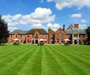
Hatherley Manor
Queens Hotel Cheltenham - MGallery by Sofitel
Cotswold Grange
CHELTENHAM CHASE HOTEL-QHOTELS
Cheltenham Townhouse
Jurys Inn Cheltenham
Hotel du Vin & Bistro Cheltenham
No 38 The Park
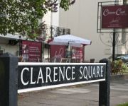
Clarence Court Hotel
Videos from this area
These are videos related to the place based on their proximity to this place.
Cheltenham snow 07-Jan-2010
http://www.bullsworld.net -------------------------------------------------------- A short, and probably boring video clip of this weeks snow, taken travelling in a car so I'm sorry about the...
A few of the finer points of Wing Chun demonstrated by Sifu Shaun Rawcliffe in Cheltenham.
via YouTube Capture.
In the woods with the GoPro Hero 3 & Frontier X5
http://www.daniel-baker.eu/2013/08/14/gopro-hero-3-c...k-in-the-woods/ My first video using the GoPro Hero 3 camera, it's on default settings as I haven't had time to fiddle yet, recompressed...
Driving On The M5 Motorway From J8 (Strensham) To J11 (Cheltenham), England 4th May 2012
Driving on the M5 motorway from Junction 8 ((Strensham Ross M50) to Junction 11 (Staverton Cheltenham Gloucester A40) England Videoed on Friday, 4th May 2012 Playlist: ...
Staverton Airport Gloucestershire landing by helicopter
Helicopter cockpit view of landing at Staverton Airport Gloucestershire.
Battle of Britain Memorial Flight BBMF at Gloucestershire Airport, Staverton
The Hurricane and Spitfire came in for a refuel before heading off to the Bristol Balloon Fiesta. Thanks to the Airport staff for allowing us onto the apron near to these Aviation Icons. The...
Gloucestershire Airport Staverton helicopter flying tour
A helicopter flight tour around Gloucestershire Airport at Staverton- taking off and starting by the Control Tower and flying above runway 27.
Videos provided by Youtube are under the copyright of their owners.
Attractions and noteworthy things
Distances are based on the centre of the city/town and sightseeing location. This list contains brief abstracts about monuments, holiday activities, national parcs, museums, organisations and more from the area as well as interesting facts about the region itself. Where available, you'll find the corresponding homepage. Otherwise the related wikipedia article.
Government Communications Headquarters
The Government Communications Headquarters (GCHQ) is a British intelligence agency responsible for providing signals intelligence (SIGINT) and information assurance to the UK government and armed forces. Based in Cheltenham, it operates under the guidance of the Joint Intelligence Committee. GCHQ was originally established after the First World War as the Government Code and Cypher School (GC&CS or GCCS), by which name it was known until 1946.
RAF Boddington
RAF Boddington was a non-flying Royal Air Force station in Boddington, Gloucestershire, and was the former home of 9 Signals Unit. Boddington was the first computerised communication centre in the 1950s when it was run by the Army. The tradition of computerised relay communications has continued to the present day. The station closed on 14 December 2007.
Hesters Way
Hesters Way is an area in the western part of Cheltenham, Gloucestershire, England. It is home to Gloucestershire College's Cheltenham campus (formerly Gloscat) and Pate's Grammar School. According to the last Census the district has a population of 5,605 and an average unemployment rate of 4.75% of people who are of economically active age (16-74).
Bamfurlong, Gloucestershire
Bamfurlong is a village in Gloucestershire, England. It is located between Cheltenham and Gloucester, near Gloucestershire Airport. Today, Bamfurlong is a village of two halves, being divided in two by the M5 motorway. There is no access from one half of Bamfurlong to the other (east to west) other than via Bamfurlong Lane and the motorway bridge.
Staverton, Gloucestershire
Staverton is a village between the city of Gloucester and the town of Cheltenham in Gloucestershire, England, in the borough of Tewkesbury. It is the location of Gloucestershire Airport, which was previously called Staverton Airport and RAF Staverton. It is the home of the Dowty Rotol and Messier-Dowty aircraft components factories. The airport is the largest general aviation airfield in South West England.
Boddington, Gloucestershire
Boddington is a village and parish near Cheltenham. It is home to RAF Boddington.
Campden Rural District
Campden was, from 1894 to 1935, a rural district in the administrative county of Gloucestershire, England. The district lay on the north-eastern boundary of the Gloucestershire, and consisted of three separate areas nearly surrounded by the counties of Warwickshire and Worcestershire. The county and district boundaries were simplified in 1931 and the district was abolished in 1935.
Dowty Arle Court
Dowty Arle Court is a cricket ground in Cheltenham, Gloucestershire. The first important match on the ground was in 1988, when the Gloucestershire Second XI played the Warwickshire Second XI in the Second XI Championship. Between 1988 and 1995, the ground held a combined total of 11 Second XI fixtures for the Gloucerstershire Second XI in both the Second XI Championship and the Second XI Trophy. In 1992, Gloucestershire played 2 List-A matches at the ground.


