Safety Score: 3,0 of 5.0 based on data from 9 authorites. Meaning we advice caution when travelling to United Kingdom.
Travel warnings are updated daily. Source: Travel Warning United Kingdom. Last Update: 2024-08-13 08:21:03
Discover Dursley
Dursley in Gloucestershire (England) with it's 14,992 citizens is a town in United Kingdom about 96 mi (or 155 km) west of London, the country's capital city.
Current time in Dursley is now 03:55 AM (Friday). The local timezone is named Europe / London with an UTC offset of zero hours. We know of 9 airports near Dursley, of which 5 are larger airports. The closest airport in United Kingdom is Bristol Filton Airport in a distance of 15 mi (or 24 km), South-West. Besides the airports, there are other travel options available (check left side).
There are several Unesco world heritage sites nearby. The closest heritage site in United Kingdom is Blaenavon Industrial Landscape in a distance of 25 mi (or 40 km), West. Also, if you like playing golf, there are a few options in driving distance. We discovered 1 points of interest in the vicinity of this place. Looking for a place to stay? we compiled a list of available hotels close to the map centre further down the page.
When in this area, you might want to pay a visit to some of the following locations: Charfield, Falfield, Horton, Tytherington and Hill. To further explore this place, just scroll down and browse the available info.
Local weather forecast
Todays Local Weather Conditions & Forecast: 8°C / 47 °F
| Morning Temperature | 4°C / 39 °F |
| Evening Temperature | 6°C / 42 °F |
| Night Temperature | 5°C / 40 °F |
| Chance of rainfall | 0% |
| Air Humidity | 77% |
| Air Pressure | 1028 hPa |
| Wind Speed | Light breeze with 5 km/h (3 mph) from North-East |
| Cloud Conditions | Broken clouds, covering 84% of sky |
| General Conditions | Broken clouds |
Saturday, 16th of November 2024
8°C (47 °F)
6°C (44 °F)
Broken clouds, gentle breeze.
Sunday, 17th of November 2024
7°C (45 °F)
4°C (40 °F)
Light rain, gentle breeze, overcast clouds.
Monday, 18th of November 2024
6°C (43 °F)
9°C (49 °F)
Light rain, moderate breeze, overcast clouds.
Hotels and Places to Stay
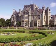
De Vere Tortworth Estate
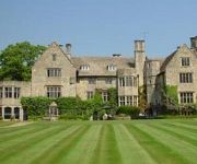
Stonehouse Court
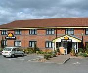
Days Inn Michaelwood Gloucester Welcome Break Service Area
TRAVELODGE STONEHOUSE
Videos from this area
These are videos related to the place based on their proximity to this place.
Bristol City v Millwall 07/08/10 - End of game
Bristol City 0 Millwall 3 2000 travelling wall celebrate life back in the Championship with a bang. Sorry for shit recording, to buzzing to give a fuck. Comment, Rate & Subscribe.
A Ride Through Dursley in Goucestershire
Subscribe for the love of motorcycles and the great outdoors: http://www.youtube.com/subscription_center?add_user=wiltshirebyways Please click 'S H O W M O R E' for route info: ↓↓↓↓↓↓...
1993 Mister Pedersen the Second in Dursley.mpg
The Second is Jesper Sølling, die samen met andere Pedersenliefhebbers het 100-jarig bestaan van de fiets vierde.
Dursley Tabernacle, Dursley, Gloucestershire
http://www.hibbitt.org.uk - CLICK THE LINK FOR MY FAMILY HISTORY WEBSITE. My Dando ancestors lived in Dursley, Gloucestershire, during the 18th and 19th centuries and had strong connections.
Farewell to Lister @ Dursley !
Today, 29/12/14, was a special but sad day, By special arrangement with Cudy's the demolition contractors at the Lister factory in Dursley, i was able to hold a final crank-up at the factory,...
Truck gets stuck on tree in Dursley
A lorry driver takes his eight tonne lorry the wrong route because of his sat nav and ends up wedging the trailer under a tree.
Dursley Fireworks 2011
Coates Fireworks - 01453 860832 This video was uploaded from an Android phone.
Melksham to Dursley Off-Road (TTR250, 15.01.14)
Subscribe for the love of motorcycles and the great outdoors: http://www.youtube.com/subscription_center?add_user=wiltshirebyways Please click 'S H O W M O R E' for route info: ↓↓↓↓↓↓...
Dursley Rifle and Pistol Club Guest Day - May 2008
Dursley Rifle and Pistol Club is a small shooting club based in Gloucestershire, England. For mor information visit http://www.dursleyrpc.org.uk.
Videos provided by Youtube are under the copyright of their owners.
Attractions and noteworthy things
Distances are based on the centre of the city/town and sightseeing location. This list contains brief abstracts about monuments, holiday activities, national parcs, museums, organisations and more from the area as well as interesting facts about the region itself. Where available, you'll find the corresponding homepage. Otherwise the related wikipedia article.
Tyndale Monument
The Tyndale Monument is a tower built on a hill at North Nibley, Gloucestershire, England. It was built in honour of William Tyndale, a translator of the New Testament, who is believed to have been born at North Nibley. The tower was constructed in 1866 and is 111 ft (34 m) tall. It is possible to enter and climb to the top of the tower, up a spiral staircase of about 120 steps.
Coombe, Gloucestershire
Coombe is a settlement in the English county of Gloucestershire.
Uley Bury
Uley Bury is the long, flat-topped hill just outside Uley, Gloucestershire, England. It is an impressive multi-vallate, scarp-edge Iron Age hill fort dating from around 300 B.C. Standing some 750 feet (235 metres) above sea level it commands spectacular views over the Severn Vale.
Vale of Berkeley
The Vale of Berkeley (sometimes known as Berkeley Vale) is an area in Gloucestershire, England. It lies between the River Severn and the Cotswold Edge, north of Bristol and south of Gloucester. It includes the towns of Berkeley, Thornbury, Cam, Dursley, Wotton-under-Edge and surrounding villages. Vale of Berkeley College was a comprehensive school at Wanswell, just north of Berkeley, closed in 2010.
Dursley railway station
Dursley railway station served the town of Dursley in Gloucestershire, England, and was the terminus of the short Dursley and Midland Junction Railway line which linked the town to the Midland Railway's Bristol to Gloucester line at Coaley Junction. The railway, just 2.5 miles long, ran along the valley of the river Cam. Dursley station was situated at the bottom of the town, in a marshy area that was later developed by the engineering group R A Lister and Company.
Cam railway station
Cam railway station served the village of Cam in Gloucestershire, England. The station was on the short Dursley and Midland Junction Railway line which linked the town of Dursley to the Midland Railway's Bristol to Gloucester line at Coaley Junction. The railway, just 2.5 miles (4 km) long, ran along the valley of the river Cam. Cam station was situated at northern end of the village, close to the cloth mill of Hunt and Winterbotham, to which there was a siding.
Bradley, Gloucestershire
Bradley is a small village in the Stroud District, in the county of Gloucestershire, England. Also part of the village is the hamlet of Bradley Green. Nearby settlements include the town of Wotton-under-Edge, the villages of Kingswood, Gloucestershire, Charfield and the hamlets Howley and Bournstream. For transport there is the B4060 road, the B4062 road, the B4058 road and the M5 motorway nearby.
Woodmancote, Dursley
Woodmancote is a small village near Dursley in Gloucestershire, England.


