Safety Score: 3,0 of 5.0 based on data from 9 authorites. Meaning we advice caution when travelling to United Kingdom.
Travel warnings are updated daily. Source: Travel Warning United Kingdom. Last Update: 2024-08-13 08:21:03
Discover Cherington
Cherington in Gloucestershire (England) is a city in United Kingdom about 87 mi (or 140 km) west of London, the country's capital city.
Local time in Cherington is now 01:35 AM (Friday). The local timezone is named Europe / London with an UTC offset of zero hours. We know of 10 airports in the vicinity of Cherington, of which 5 are larger airports. The closest airport in United Kingdom is Gloucestershire Airport in a distance of 14 mi (or 23 km), North. Besides the airports, there are other travel options available (check left side).
There are several Unesco world heritage sites nearby. The closest heritage site in United Kingdom is City of Bath in a distance of 30 mi (or 48 km), South-East. Also, if you like golfing, there are a few options in driving distance. Looking for a place to stay? we compiled a list of available hotels close to the map centre further down the page.
When in this area, you might want to pay a visit to some of the following locations: Hankerton, Kemble, Charlton, Norton and Luckington. To further explore this place, just scroll down and browse the available info.
Local weather forecast
Todays Local Weather Conditions & Forecast: 8°C / 46 °F
| Morning Temperature | 4°C / 38 °F |
| Evening Temperature | 5°C / 41 °F |
| Night Temperature | 4°C / 39 °F |
| Chance of rainfall | 0% |
| Air Humidity | 78% |
| Air Pressure | 1028 hPa |
| Wind Speed | Light breeze with 5 km/h (3 mph) from North-East |
| Cloud Conditions | Broken clouds, covering 77% of sky |
| General Conditions | Broken clouds |
Saturday, 16th of November 2024
8°C (46 °F)
6°C (43 °F)
Broken clouds, gentle breeze.
Sunday, 17th of November 2024
6°C (44 °F)
4°C (38 °F)
Light rain, gentle breeze, overcast clouds.
Monday, 18th of November 2024
6°C (42 °F)
10°C (50 °F)
Light rain, moderate breeze, overcast clouds.
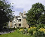
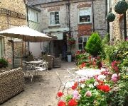
Hotels and Places to Stay
Hare & Hounds
Wild Garlic Restaurant & Rooms
Ormond at Tetbury
Priory Inn
The Snooty Fox
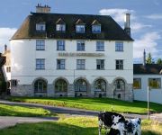
Bear of Rodborough
BEST WESTERN MAYFIELD HOUSE
Egypt Mill
Old Stocks
The Imperial Hotel
Videos from this area
These are videos related to the place based on their proximity to this place.
Avening - Star Lane to Mays Lane (ORPA, W-E)
Subscribe for the love of motorcycles and the great outdoors: http://www.youtube.com/subscription_center?add_user=wiltshirebyways Please click 'S H O W M O R E' for route info: ↓↓↓↓↓↓...
Festival of British Eventing at Gatcombe: Advanced Section A
Here are the rushes from the Advanced Class today straight off the Sony Highlights Facility. Sorry about the quality and the odd bush that gets in the shot. Full quality version will follow...
Minchinhampton - Knave-In-Hole (ORPA, N-S)
Subscribe for the love of motorcycles and the great outdoors: http://www.youtube.com/subscription_center?add_user=wiltshirebyways Please click 'S H O W M O R E' for route info: ↓↓↓↓↓↓...
Novice Cross Country: Gatcombe (1) Horse Trials 2015
Cross Country Action from the Novice, Open Novice and Intermediate Novice Sections of the Land Rover Gatcombe Horse Trials held on Saturday 28th March 2015. It was a wet and windy day and...
Gatcombe International Horse Trials: Novice Cross Country
20 minutes of Novice Cross Country action from the Gatcombe International Horse Trials sponsored by Whatley Manor. Really enjoyable day with parking next to the course, helpful commentary and...
Charlotte Monk: Gatcombe (1) Horse Trials 2015
Gatcombe Teaser: Cross Country and Show Jumping action from the Novice Section B of the Land Rover Gatcombe Horse Trials held on Saturday 28th March 2015. The combination featured are ...
Gatcombe Horse Trials: Loretta Joynson and Lyndell Alexander the Great
I videoed two complete show jumping rounds on Sunday. Alexander the Great was one of them and ironically the other one was Ulises!
Novice Show Jumping: Gatcombe (1) Horse Trials 2015
Show Jumping action from the Novice Sections of the Land Rover Gatcombe Horse Trials held on Saturday 28th March 2015. The riders featured are: Stine Hoff Richard Waygood Alicia Hawker ...
Wiggle Mountain Mayhem 2014 24 hour endurance race - Lap 5
Parts of my first lap for the Trent Army (Nottingham Trent University) team for Mountain Mayhem 24 hour endurance race at Gatcombe Park, Gloucestershire. First ride after moving from hardtail...
Remembering Opposition Buzz
Can't believe we've lost this great horse. Here is my little tribute filmed at the Gatcombe Festival of British Eventing in 2014. He was 6th in the British Open finishing 8 seconds inside...
Videos provided by Youtube are under the copyright of their owners.
Attractions and noteworthy things
Distances are based on the centre of the city/town and sightseeing location. This list contains brief abstracts about monuments, holiday activities, national parcs, museums, organisations and more from the area as well as interesting facts about the region itself. Where available, you'll find the corresponding homepage. Otherwise the related wikipedia article.
Avening Valley
The Avening Valley is located in the South Cotswolds in England, running roughly east from Nailsworth. During the 17th century the cloth industry developed in the Avening Valley, with mills powered by the Avening Stream. One of the larger cloth mills was named the Holcombe Mill (an old "gig" mill), which was adapted in 1879 for manufacture of bedding.
Gatcombe Park
Gatcombe Park is the private country home of HRH The Princess Royal, situated in England between the Gloucestershire villages of Minchinhampton and Avening, five miles (8 km) south of Stroud and around six miles (10 km) north of Highgrove House, the country residence of HRH The Prince of Wales. The house and farming estate were bought by Queen Elizabeth II in 1976 for Princess Anne and Captain Mark Phillips at the price of £5 million.
Avening
Avening is a village and civil parish in the Cotswold district of Gloucestershire, England, about three miles north of Tetbury. According to the 2001 census it had a population of 1,094. The village has two pubs. Nearby is Gatcombe Park, the home of the Princess Royal.
Aston Down
Aston Down is located 2.5 miles east of Minchinhampton, Gloucestershire, South West England and 6.9 miles west of Cirencester, Gloucestershire. The airfield was used by the Royal Air Force from the First World War until 1967 when the Cotswold Gliding Club moved in from their previous base near Tetbury. In 2002 the land and most of hangars surrounding the airfield were sold by the Ministry of Defence to private developers for use as industrial units.
Frampton Mansell
Frampton Mansell is a small settlement 5 miles ESE of Stroud, in the parish of Sapperton, England. It is situated off the A419 road from Cirencester to Stroud.
Cotswold Gliding Club
The Cotswold Gliding Club (CGC) is based at Aston Down airfield, between Cirencester and Stroud in Gloucestershire, South West England. The Club maintains a fleet of aircraft for training purposes, and is a centre for cross-country gliding and competitions.
St Mary's Crossing Halt railway station
St Mary's Crossing Halt was opened on 12 October 1903 on what is now the Golden Valley Line between Kemble and Stroud. This line was opened in 1845 as the Cheltenham and Great Western Union Railway from Swindon to Gloucester and this was one of many small stations and halts built on this line for the local passenger service. This halt opened with the introduction of the GWR steam railmotor services between Stonehouse and Chalford.
Windmill Tump
Windmill Tump, also known as Rodmarton Chambered Tomb, is a Neolithic burial site, a stone tumulus or barrow. It is a mound covering the site of graves, in the form of a cairn, located in Gloucestershire. It lies to the west of the village of Rodmarton, south of the road between Cherington and Tarlton. There are trees growing on the site.


