Safety Score: 3,0 of 5.0 based on data from 9 authorites. Meaning we advice caution when travelling to United Kingdom.
Travel warnings are updated daily. Source: Travel Warning United Kingdom. Last Update: 2024-08-13 08:21:03
Delve into Brimpsfield
Brimpsfield in Gloucestershire (England) is a city located in United Kingdom about 87 mi (or 140 km) west of London, the country's capital town.
Current time in Brimpsfield is now 02:02 AM (Friday). The local timezone is named Europe / London with an UTC offset of zero hours. We know of 9 airports closer to Brimpsfield, of which 5 are larger airports. The closest airport in United Kingdom is Gloucestershire Airport in a distance of 7 mi (or 11 km), North-West. Besides the airports, there are other travel options available (check left side).
There are several Unesco world heritage sites nearby. The closest heritage site in United Kingdom is City of Bath in a distance of 35 mi (or 57 km), South-East. Also, if you like playing golf, there are some options within driving distance. We saw 1 points of interest near this location. In need of a room? We compiled a list of available hotels close to the map centre further down the page.
Since you are here already, you might want to pay a visit to some of the following locations: Churchdown, Swindon Village, Uckington, Kemble and Shipton. To further explore this place, just scroll down and browse the available info.
Local weather forecast
Todays Local Weather Conditions & Forecast: 8°C / 47 °F
| Morning Temperature | 4°C / 40 °F |
| Evening Temperature | 6°C / 43 °F |
| Night Temperature | 5°C / 40 °F |
| Chance of rainfall | 0% |
| Air Humidity | 78% |
| Air Pressure | 1028 hPa |
| Wind Speed | Light breeze with 5 km/h (3 mph) from North-East |
| Cloud Conditions | Overcast clouds, covering 100% of sky |
| General Conditions | Overcast clouds |
Saturday, 16th of November 2024
8°C (46 °F)
6°C (44 °F)
Overcast clouds, gentle breeze.
Sunday, 17th of November 2024
7°C (45 °F)
3°C (38 °F)
Light rain, moderate breeze, overcast clouds.
Monday, 18th of November 2024
6°C (43 °F)
6°C (42 °F)
Light rain, gentle breeze, overcast clouds.
Hotels and Places to Stay
Wyastone
DoubleTree by Hilton Cheltenham
Hotel du Vin & Bistro Cheltenham
Hilden Lodge
CHELTENHAM CHASE HOTEL-QHOTELS
No 131
Queens Hotel Cheltenham - MGallery by Sofitel
Royal George
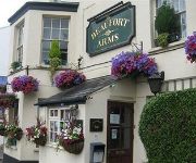
The Beaufort Arms
London Inn
Videos from this area
These are videos related to the place based on their proximity to this place.
Miserden - Througham to Lypiatt (ORPA, W-E)
Subscribe for the love of motorcycles and the great outdoors: http://www.youtube.com/subscription_center?add_user=wiltshirebyways Please click 'S H O W M O R E' for route info: ↓↓↓↓↓↓...
Abandoned bits of Ermin Street by the A417 near Elkstone in Gloucestershire (URC, N-S)
Subscribe for the love of motorcycles and the great outdoors: http://www.youtube.com/subscription_center?add_user=wiltshirebyways Please click 'S H O W M O R E' for route info: ↓↓↓↓↓↓...
Birdlip Hill View
View from Birdlip Hill, Cheltenham, taken with my GoPro Hero 3 black edition on 1440p stretched ti wide using GoPro Studio 2.0. Best viewed in 1080p.
20120516 - Zona1 Trials Ground
By day two engineers pine to be Dougie Lampkin, by night... watch them clear some amazing (well they looked big when we rode up to them!) obstacles, forget Virgin Galactic - watch one of us try ...
Birdlip Timelapse
750 frames @ 5 second intervals downloaded to a netbook controlling the Canon 40D camera and interval timing.
Biker vs Landowner #2
A civil altercation with a landowner at Little Shurdington near Cheltenham. This right of way has been signed on the ground as a bridleway for a number of years despite being marked as an...
The Barber Lounge
Award-winning entry to Cineclub 2007 Teacher's Prize. Reviewed by Ian Freer of Empire Magazine - " an elegant piece of simple storytelling". Follows a lad through his journey to his haircut...
Rioting Chimps
These Chimps caught a live rabbit that entered their enclosure. What happens makes you wonder whether we have progressed much.
Videos provided by Youtube are under the copyright of their owners.
Attractions and noteworthy things
Distances are based on the centre of the city/town and sightseeing location. This list contains brief abstracts about monuments, holiday activities, national parcs, museums, organisations and more from the area as well as interesting facts about the region itself. Where available, you'll find the corresponding homepage. Otherwise the related wikipedia article.
Whiteway Colony
Whiteway Colony is a residential community in the Cotswolds in the parish of Miserden near Stroud, Gloucestershire, UK. The community was founded in 1898 by Tolstoyans and today has no spare land available with over sixty homes and one hundred and fifty colonists. At the beginning, private property was rejected and personal property shared; however, today the colonists' homes are privately owned and sold at market value.
River Frome, Stroud
The River Frome, once also known as the Stroudwater, is a small river in Gloucestershire, England. It is to be distinguished from another River Frome in Gloucestershire, the Bristol Frome. The river is approximately 18 miles long.
Brimpsfield Castle
Brimpsfield Castle was a castle in the village of Brimpsfield in the county of Gloucestershire, England, between Gloucester and Cirencester. It is likely that the first castle was built after the Norman invasion. Then, in the 12th or 13th century, it was rebuilt in stone. The owner, John Giffard, 2nd Lord of Brimpsfield, rebelled against King Edward II and was executed in 1322. The castle was then destroyed.
Ullenwood
Ullenwood is a village near Cheltenham in Gloucestershire. It is the site of a secret civil defence bunker intended as a Regional Seat of Government in the event of nuclear war. It is the site of the former Ullenwood army camp which was used during the two World Wars as a U.S. military hospital. For three decades at the end of the 20th century, Ullenwood Camp was used each summer as accommodation for archaeologists engaged in excavating the site at nearby Crickley Hill.
Miserden
Miserden is a village and civil parish in Stroud District, Gloucestershire, England, 4 miles north east of Stroud. The parish includes Whiteway Colony and the hamlets of Sudgrove and The Camp. In the 2001 census the parish had a population of 420. The village lies in the Cotswolds at an elevation of over 800 ft, above the valley of the River Frome. Until the Middle Ages, Miserden was known as Greenhampstead, and was mentioned by that name in the Domesday Book.
National Star College
National Star College received an 'Outstanding' rating from Ofsted in their College inspection of June 2012 - full report http://www. ofsted. gov.
Brimpsfield Priory
Brimpsfield Priory was a priory in Gloucestershire, England.
Miserden Castle
Miserden Castle was a castle near the village of Miserden in Gloucestershire, England. The castle is a large motte and bailey Norman castle, built before 1146 by Robert Musard, after whose family the local village is named. The castle overlooks the River Frome and included a 60 ft wide shell keep, protected by a stone wall and a moat.


