Safety Score: 3,0 of 5.0 based on data from 9 authorites. Meaning we advice caution when travelling to United Kingdom.
Travel warnings are updated daily. Source: Travel Warning United Kingdom. Last Update: 2024-08-13 08:21:03
Touring Barley Mow
Barley Mow in Gateshead (England) is a town located in United Kingdom about 241 mi (or 387 km) north of London, the country's capital place.
Time in Barley Mow is now 04:50 AM (Friday). The local timezone is named Europe / London with an UTC offset of zero hours. We know of 9 airports nearby Barley Mow, of which 5 are larger airports. The closest airport in United Kingdom is Newcastle Airport in a distance of 12 mi (or 19 km), North-West. Besides the airports, there are other travel options available (check left side).
There are several Unesco world heritage sites nearby. The closest heritage site is Frontiers of the Roman Empire in Germany at a distance of 10 mi (or 16 km). The closest in United Kingdom is Durham Castle and Cathedral in a distance of 46 mi (or 16 km), North-East. Also, if you like the game of golf, there are several options within driving distance. We collected 1 points of interest near this location. Need some hints on where to stay? We compiled a list of available hotels close to the map centre further down the page.
Being here already, you might want to pay a visit to some of the following locations: Pelton, Lamesley, Gateshead, West Rainton and Newcastle upon Tyne. To further explore this place, just scroll down and browse the available info.
Local weather forecast
Todays Local Weather Conditions & Forecast: 3°C / 38 °F
| Morning Temperature | 2°C / 35 °F |
| Evening Temperature | 1°C / 34 °F |
| Night Temperature | 1°C / 34 °F |
| Chance of rainfall | 0% |
| Air Humidity | 58% |
| Air Pressure | 1004 hPa |
| Wind Speed | Moderate breeze with 11 km/h (7 mph) from South-East |
| Cloud Conditions | Clear sky, covering 1% of sky |
| General Conditions | Sky is clear |
Saturday, 23rd of November 2024
1°C (34 °F)
10°C (49 °F)
Rain and snow, fresh breeze, overcast clouds.
Sunday, 24th of November 2024
15°C (58 °F)
9°C (48 °F)
Moderate rain, fresh breeze, overcast clouds.
Monday, 25th of November 2024
9°C (48 °F)
8°C (46 °F)
Light rain, strong breeze, scattered clouds.
Hotels and Places to Stay
Vermont
Copthorne Newcastle
Lumley Castle
Mercure Newcastle George Washington Hotel Golf and Spa
Hilton Newcastle Gateshead
Sleeperz Newcastle
Ramada Encore Newcastle-Gateshead
Holiday Inn WASHINGTON
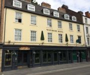
Waterside Hotel
Eslington Villa
Videos from this area
These are videos related to the place based on their proximity to this place.
Spire Sunderland Clinic - Free Cosmetic Appointments
Sharon Day, Customer Services Team Leader at Spire Washington Hospital discusses the new Sunderland Clinic offering patients in the Sunderland area the chance to have free 10 minute cosmetic...
How To Make A Kerbal Space Program Mod- Episode 5- Testing
How To Make A Kerbal Space Program Mod- Episode 5- Testing Welcome back to the series, guys! Today, we are going to be testing out our fuel tank, just to make sure that everything is working...
Minecraft Building Tutorials- How To Build A Large Skyrim House!
Welcome back to Thyruul, for our second build! In this episode, we're going to be going over constructing another house, but this one is more intricate, and slightly larger, than our last...
How To Make A Minecraft Mod [1.6.4]- Episode 15- Food
How To Make A Minecraft Mod [1.6.4]- Episode 15- Food Welcome back to the series! In this episode, episode 15, we'll be creating our own food! We will also be editing our plants' class files...
How To Make A Kerbal Space Program Mod- Episode 2- Texturing
How To Make A Kerbal Space Program Mod- Episode 2- Texturing Paint.NET: www.getpaint.net.
What Went Wrong – Jon Venables
What should we do with children who commit serious crime? Following the recall of Jon Venables who, along with his friend Robert Thompson, murdered two-year-old James Bulger in Liverpool aged...
Coals to Newcastle!
At 13:59 DB Shenker Class 66 No. 66151 passes through Durham, heading north, with a train of empty hoppers on Bank Holiday Monday 30th August 2010. I would be very grateful if anyone could...
Passing Through: Deltic D9009 at Chester-Le-Street
This was end of March, beginning of April. Enjoy !!! This is part of my "Passing Through" series.
James Howie Entertains
This Is Jimmy,entertaining in the works canteen after our Christmas Dinner.He's been doing this for years so its about time he was unleashed upon the world!
Videos provided by Youtube are under the copyright of their owners.
Attractions and noteworthy things
Distances are based on the centre of the city/town and sightseeing location. This list contains brief abstracts about monuments, holiday activities, national parcs, museums, organisations and more from the area as well as interesting facts about the region itself. Where available, you'll find the corresponding homepage. Otherwise the related wikipedia article.
Chester-le-Street (district)
Chester-le-Street was a local government district in County Durham, England. Its council was based in Chester-le-Street. Other places in the district included Great Lumley and Sacriston.
South Pelaw
South Pelaw /ˈpiːlɔː/ is a village in County Durham, in England. It is situated immediately to the north of Chester-le-Street.
A194 road
The A194 road is a road in Tyne and Wear, England. It runs northeast from its start at junction 65 of the A1/A1(M) near Washington, and the first 3 miles are motorway standard, designated the A194(M). There are intermediate junctions with the A182 and the A195 before the motorway section ends at the A184 junction. The A194 continues as a trunk road to its next major junction, the A19 which provides access to the Tyne Tunnel, Sunderland and Teesside.
Chester-le-Street Rural District
Chester-le-Street was a rural district in County Durham, England from 1894 to 1974. http://www. visionofbritain. org. uk/relationships. jsp?u_id=10136854&c_id=10001043 It surrounded the urban district of Chester-le-Street. The district was split in 1974, under the Local Government Act 1972, with the bulk going to the current Chester-le-Street district.
Rickleton
Rickleton is a village which lies within the district of Washington, Tyne and Wear, England. It is located on the south side of Washington Town and borders Harraton village, Birtley and County Durham. The village mainly consists of housing. The village centre includes a Londis supermarket, a general store, a hairdressing salon, Finewood Chinese takeaway and a bus link, which has buses linking to other areas of Washington and County Durham.
Cong Burn
The Cong Burn is a small river in County Durham, England. It has its origin in a number of streams, among them Wheatley Green Burn, that rise on the southern and eastern slopes of Wheatley Hill, north of the village of Burnhope, and other streams, principally Whiteside Burn, that have their source on the southern slopes of Wheatley Hill and the northern slopes of Taylor's Hill, just east of Burnhope.
Pelaw Grange
Pelaw Grange Greyhound Stadium is a greyhound racing track located at North Lodge in the English county of Durham, between Chester-le-Street and Gateshead. The stadium has a restaurant and a number of bars and has been owned by the McKenna family since January 1965. Racing takes place every Friday and Saturday night as well as Sunday lunchtimes.
Chester New Bridge
Chester New Bridge is a Grade II* listed medieval stone bridge over the River Wear near Chester-le-Street in County Durham, England. It carries Black Drive, the private entrance road to Lambton Castle, across the Wear just north of the A1052 road bridge, which superseded it in 1926. Frank Graham in Bridges of Northumberland and Durham describes it as "a fine 14th century bridge" but the official English Heritage listing citation considers it to be "probably C15".


!['How To Make A Minecraft Mod [1.6.4]- Episode 15- Food' preview picture of video 'How To Make A Minecraft Mod [1.6.4]- Episode 15- Food'](https://img.youtube.com/vi/kapP1n0GfBE/mqdefault.jpg)


