Safety Score: 3,0 of 5.0 based on data from 9 authorites. Meaning we advice caution when travelling to United Kingdom.
Travel warnings are updated daily. Source: Travel Warning United Kingdom. Last Update: 2024-08-13 08:21:03
Discover Pattiswick
Pattiswick in Essex (England) is a place in United Kingdom about 42 mi (or 67 km) north-east of London, the country's capital city.
Current time in Pattiswick is now 11:49 AM (Friday). The local timezone is named Europe / London with an UTC offset of zero hours. We know of 10 airports near Pattiswick, of which 5 are larger airports. The closest airport in United Kingdom is Wethersfield Airport in a distance of 8 mi (or 13 km), North-West. Besides the airports, there are other travel options available (check left side).
There are several Unesco world heritage sites nearby. The closest heritage site in United Kingdom is Royal Botanic Gardens, Kew in a distance of 31 mi (or 51 km), South-West. Also, if you like playing golf, there are a few options in driving distance. We encountered 1 points of interest in the vicinity of this place. If you need a hotel, we compiled a list of available hotels close to the map centre further down the page.
While being here, you might want to pay a visit to some of the following locations: Tiptree, Chelmsford, Leigh-on-Sea, Southend-on-Sea and Canvey Island. To further explore this place, just scroll down and browse the available info.
Local weather forecast
Todays Local Weather Conditions & Forecast: 9°C / 48 °F
| Morning Temperature | 6°C / 42 °F |
| Evening Temperature | 6°C / 44 °F |
| Night Temperature | 5°C / 41 °F |
| Chance of rainfall | 0% |
| Air Humidity | 77% |
| Air Pressure | 1028 hPa |
| Wind Speed | Light breeze with 5 km/h (3 mph) from North-East |
| Cloud Conditions | Overcast clouds, covering 89% of sky |
| General Conditions | Overcast clouds |
Saturday, 16th of November 2024
9°C (48 °F)
8°C (46 °F)
Light rain, gentle breeze, scattered clouds.
Sunday, 17th of November 2024
7°C (45 °F)
4°C (38 °F)
Light rain, moderate breeze, overcast clouds.
Monday, 18th of November 2024
6°C (42 °F)
4°C (38 °F)
Moderate rain, moderate breeze, broken clouds.
Hotels and Places to Stay
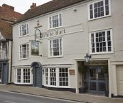
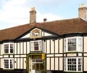
White Hart Hotel
THE RIVENHALL HOTEL
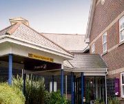
Holiday Inn Express BRAINTREE
The White Hart
Braintree (Freeport Village)
Braintree (A120)
Videos from this area
These are videos related to the place based on their proximity to this place.
Braintree BMX club National BMX series promo video 2012
Braintree BMX Club - The 'only' BMX club in Essex proud hosts of Round 6 and 7 of the British BMX Series 23 and 24 June 2012 Free entry for spectators For more details check out braintreebmx.com.
Braintree FC 0-1 Kidderminster Harriers 2013-14
3rd game of the season for the Harriers as they travelled to Braintree and a late goal from Kyle Storer sealed the win.
Cursed 2012 Essex's No 1 Halloween Event
www.thecursed.co.uk, Essex's No. 1 Halloween Event. Cursed is a Halloween scare event that provides the ultimate scare experience. Visitors will journey through a series of themed mazes ...
Stone Carver - Tom Clark
In this short film, shot at the European Woodworking Show, Tom explains about his job which he has been doing "all my life". "I'm doing what I want to do everyday now, which is important...
This is so stupid!
Billy Atkins Is actually retarded! You actually can't even ride up this thing, So I don't know how he can flair it, haha.
Skyfall movie, in the Parish Hall of Coggeshall, East Coast Essex, England 27 04 13 by Mal Hyams
The www.reelpicturehouse.org, a Community Cinema, showed the Bond Movie "Skyfall" together with a Casino, Cocktails, Dinner and a Disco Saturday night (27th April) Took a few photos & put...
A Hazy Trip to Earls Colne
One fine day in June, Sarah and I took off from Southend and headed up the Earls Colne. As soon as we took off we could see that the vis was poor. But we carried on and arrived safely at Earls...
Chilly Chills - Charlie Arnold V2
Chilly Chills is back for 2014!!! Sorry for the bad filming towards the end there, can't afford to be to picky about my shots when it's freezing cold ahha! Enjoy :)
GoPro Earls Colne
First flight for the GoPro in a Robin R-2120U Alpha. I had to abort the takeoff as I used too much rudder. At 01:51 you can just see an aircraft going across the centre of the screen. Clearly...
Videos provided by Youtube are under the copyright of their owners.
Attractions and noteworthy things
Distances are based on the centre of the city/town and sightseeing location. This list contains brief abstracts about monuments, holiday activities, national parcs, museums, organisations and more from the area as well as interesting facts about the region itself. Where available, you'll find the corresponding homepage. Otherwise the related wikipedia article.
A120 road
The A120 is an important trunk road in southern England. It follows the course of Stane Street, a Roman road from Standon, Hertfordshire at its western terminus to Colchester. From Colchester the A120 leads roughly east to Harwich, on the way carrying much traffic from Stansted Airport. The road forms part of the unsigned Euroroute E32.
RAF Rivenhall
RAF Rivenhall is a former World War II airfield in Essex, England. The airfield is located approximately 4 miles south-southeast of Braintree; about 40 miles northeast of London Opened in 1942, it was used by both the Royal Air Force and United States Army Air Forces. During the war it was used primarily as a combat airfield with various fighter and bomber units. After the war it was closed in 1946 and kept in reserve until 1956.
Fillol's Hall
Fillol's Hall or Felix Hall, Kelvedon, Essex was an English manor house. It belonged to the Fillol family, which included Catherine Fillol, Duchess of Somerset, aunt of Edward VI and as wife of the Lord Protector of England, one of the most important women during his reign. Charles Western, 1st Baron Western bought Felix Hall about 1790. Western in the early nineteenth century made additions there in classical style, to create a modern mansion.
Pattiswick
Pattiswick is a village near the A120 road, in the Braintree District, in the English county of Essex.
Stockstreet
Stockstreet is a hamlet on the A120 road to the west of the town of Coggeshall in Braintree District, Essex, England
Marks Hall
Marks Hall was a Jacobean country house in Essex, England. Thomas Phillips Price (1844-1932), a Welsh landowner, mine owner, and Liberal politician, purchased Marks Hall, then a mansion and deer park, in 1898. He made provision in his Will to leave the Marks Hall estate to the nation in the interest of agriculture, arboriculture and forestry. During the Second World War, Earls Colne Airfield was built on the edge of the deer park and much of the property was requisitioned.


