Safety Score: 3,0 of 5.0 based on data from 9 authorites. Meaning we advice caution when travelling to United Kingdom.
Travel warnings are updated daily. Source: Travel Warning United Kingdom. Last Update: 2024-08-13 08:21:03
Discover Horsebridge
Horsebridge in East Sussex (England) is a place in United Kingdom about 46 mi (or 74 km) south of London, the country's capital city.
Current time in Horsebridge is now 10:40 PM (Friday). The local timezone is named Europe / London with an UTC offset of zero hours. We know of 11 airports near Horsebridge, of which 5 are larger airports. The closest airport in United Kingdom is Shoreham Airport in a distance of 24 mi (or 38 km), West. Besides the airports, there are other travel options available (check left side).
There are several Unesco world heritage sites nearby. The closest heritage site in United Kingdom is Stonehenge, Avebury and Associated Sites in a distance of 27 mi (or 44 km), North-West. Also, if you like playing golf, there are a few options in driving distance. We encountered 2 points of interest in the vicinity of this place. If you need a hotel, we compiled a list of available hotels close to the map centre further down the page.
While being here, you might want to pay a visit to some of the following locations: Lewes, Rottingdean, Paddock Wood, Felbridge and Brighton. To further explore this place, just scroll down and browse the available info.
Local weather forecast
Todays Local Weather Conditions & Forecast: 10°C / 50 °F
| Morning Temperature | 5°C / 41 °F |
| Evening Temperature | 8°C / 46 °F |
| Night Temperature | 8°C / 46 °F |
| Chance of rainfall | 0% |
| Air Humidity | 81% |
| Air Pressure | 1028 hPa |
| Wind Speed | Light breeze with 4 km/h (3 mph) from East |
| Cloud Conditions | Broken clouds, covering 81% of sky |
| General Conditions | Broken clouds |
Saturday, 16th of November 2024
10°C (50 °F)
10°C (50 °F)
Light rain, gentle breeze, broken clouds.
Sunday, 17th of November 2024
9°C (47 °F)
4°C (39 °F)
Light rain, moderate breeze, overcast clouds.
Monday, 18th of November 2024
11°C (53 °F)
12°C (54 °F)
Moderate rain, strong breeze, overcast clouds.
Hotels and Places to Stay
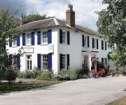
Crossways Hotel
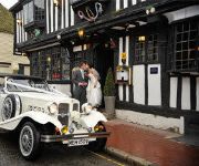
The Star Inn Alfriston
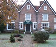
Boship Farm
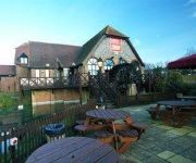
The Corn Exchange Relaxinnz
TRAVELODGE HELLINGLY EASTBOURNE
Eastbourne
TRAVELODGE EASTBOURNE WILLINGDON DROVE
Eastbourne (Polegate)
Videos from this area
These are videos related to the place based on their proximity to this place.
Brighton Implant Clinic at Hailsham
Brighton Implant Clinic offers affordable dental implant treatment in modern and well equipped clinics. See more of our clinic. http://www.brightonimplantclinic.co.uk Photos by Dr Federico Brunner.
Hailsham Bonfire 2012
Hailsham Bonfire Society 2012 Procession at Night in Hailsham Sussex with Fireworks, Torches, Guy Fawkes.
Brighton Implant Clinic Hailsham Branch
http://www.brightonimplantclinic.co.uk Brighon Implant Clinic @ Hailsham facilities.
Sussex Bonfire Night Celebration : Destruction Of Guy Fawkes Effigy : Hailsham Bonfire Society (HBS)
Fun in the playpen and the destruction of Guy Fawkes at Hailsham Bonfire Society bonfire night on 17th October 2009. Info On The Lewes Bonfire Night Celebrations : Click Below http://www.lewesbon...
Zombies Atack at bushy wood hailsham uk
MOOVIE DAY AT SCOUTS! THIS IS MY VISEO! I filmed it but do not take any credit for the Script or credits!!!! Unknown to the brave scouts in the swamp at bushy wood scut camp that some swamp...
Mining Company - Runaway Train
Come and enjoy our newest ride, sit in our motion simulator & experience the breathtaking thrill of a runaway train journey. Watch the simulator movie from your seat and feel various motions...
Arlington Stadium Van Bangers racing on May 5th 2014
I took the family out to Arlington Stadium in East Sussex for a May 5th bank holiday treat. This 15 minute video is an edited example of the Van bashing mayhem that occurred that afternoon....
Knockhatch Adventure Park
We went to Knockhatch Adventure Park in Hailsham to celebrate my dads birthday. We all had a really enjoyable day, thoroughly recommended. Clips recorded on GoPro Hero2 HD and Samsung ...
Videos provided by Youtube are under the copyright of their owners.
Attractions and noteworthy things
Distances are based on the centre of the city/town and sightseeing location. This list contains brief abstracts about monuments, holiday activities, national parcs, museums, organisations and more from the area as well as interesting facts about the region itself. Where available, you'll find the corresponding homepage. Otherwise the related wikipedia article.
Hailsham Town F.C
Hailsham Town F.C. is a football club based in Hailsham, East Sussex, England. They were established in 1885 and joined the Sussex County League in 1955 as Hailsham F.C. , changing to their present name in 1970. For the 2012–13 season, they are members of the Sussex County League Division One. The club are known locally as 'The Stringers', a nickname which derives from traditional industry in the town, and was adopted officially at the turn of the Millennium.
Hellingly railway station
Hellingly was a railway station on the now closed Eridge to Polegate line in East Sussex. It served the village of Hellingly. There was also a separate platform for passengers visiting Hellingly Hospital by tram, until 1933, the passenger service via Tramcar being discontinued from 1931. The line, known as the Hellingly Hospital Railway continued in use for transporting coal wagons from Hellingly Station for use at the Hospital until 1959 .
Michelham Priory
Michelham Priory is the site of a former Augustine Priory near Upper Dicker, East Sussex, England, United Kingdom. It is owned and administered by the Sussex Archaeological Society.
Hailsham railway station
Hailsham Railway Station was on the Cuckoo Line between Polegate and Hellingly serving the town of Hailsham. Originally built in 1849 by the London, Brighton and South Coast Railway. it was a terminus station serving both passengers and livestock for the nearby market. It remained a terminus until 1880 when it was connected with Eridge on a single line railway. On 14 June 1965 the station became a terminus again when the line northward closed to passenger traffic.
Hellingly Hospital Railway
The Hellingly Hospital Railway was a light railway owned and operated by East Sussex County Council, used for coal and passengers to Hellingly Hospital, a psychiatric hospital near Hailsham, from the London, Brighton and South Coast Railway's Cuckoo Line at Hellingly railway station. The railway was constructed in 1899 and opened to passengers on 20 July 1903, following its electrification in 1902.
Hellingly Hospital
Hellingly Hospital, formerly the East Sussex County Asylum was a large psychiatric hospital close to the village of Hellingly, east of Hailsham, in the English county of East Sussex.
Zoar Strict Baptist Chapel
Zoar Strict Baptist Chapel is a Strict Baptist place of worship in the hamlet of Lower Dicker in the English county of East Sussex. Founded in 1837 and originally known as The Dicker Chapel, the "large and impressive" Classical/Georgian-style building stands back from a main road in a rural part of East Sussex.
Farley Farm House
Farley Farm House is a farm house near Chiddingly, East Sussex which has been converted into a museum and archive featuring the lives and work of its former residents, the photographer Lee Miller and the surrealist artist Roland Penrose. Lee Miller and Roland Penrose came to live at Farley Farm House in 1949 and, in the thirty five years they lived there, built up a collection of contemporary art treasures.


