Safety Score: 3,0 of 5.0 based on data from 9 authorites. Meaning we advice caution when travelling to United Kingdom.
Travel warnings are updated daily. Source: Travel Warning United Kingdom. Last Update: 2024-08-13 08:21:03
Discover Friston
Friston in East Sussex (England) with it's 1,620 citizens is a place in United Kingdom about 53 mi (or 86 km) south of London, the country's capital city.
Current time in Friston is now 10:46 PM (Friday). The local timezone is named Europe / London with an UTC offset of zero hours. We know of 11 airports near Friston, of which 5 are larger airports. The closest airport in United Kingdom is Shoreham Airport in a distance of 22 mi (or 36 km), West. Besides the airports, there are other travel options available (check left side).
There are several Unesco world heritage sites nearby. The closest heritage site in United Kingdom is Stonehenge, Avebury and Associated Sites in a distance of 33 mi (or 53 km), North-West. Also, if you like playing golf, there are a few options in driving distance. We encountered 2 points of interest in the vicinity of this place. If you need a hotel, we compiled a list of available hotels close to the map centre further down the page.
While being here, you might want to pay a visit to some of the following locations: Lewes, Rottingdean, Brighton, Fulking and Felbridge. To further explore this place, just scroll down and browse the available info.
Local weather forecast
Todays Local Weather Conditions & Forecast: 10°C / 51 °F
| Morning Temperature | 7°C / 44 °F |
| Evening Temperature | 9°C / 49 °F |
| Night Temperature | 9°C / 49 °F |
| Chance of rainfall | 0% |
| Air Humidity | 80% |
| Air Pressure | 1028 hPa |
| Wind Speed | Light breeze with 5 km/h (3 mph) from South |
| Cloud Conditions | Overcast clouds, covering 87% of sky |
| General Conditions | Overcast clouds |
Saturday, 16th of November 2024
11°C (51 °F)
11°C (51 °F)
Light rain, moderate breeze, broken clouds.
Sunday, 17th of November 2024
9°C (48 °F)
5°C (41 °F)
Light rain, moderate breeze, overcast clouds.
Monday, 18th of November 2024
12°C (53 °F)
13°C (55 °F)
Moderate rain, strong breeze, overcast clouds.
Hotels and Places to Stay
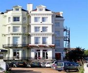
The Ravilious
Crossways Hotel
The Star Inn Alfriston
Horsted Place
The Hydro
Parkview Hotel
Citrus Hotel Eastbourne by Compass Hospitality
Eastbourne (Polegate)
Videos from this area
These are videos related to the place based on their proximity to this place.
Bicycle Touring 2013- Pre-Season Stealth Camp & New Gear Testing.
6 weeks ago I was involved in a bicycle accident which resulted in me breaking my hip. I am currently unable to ride a bike but still wanted to come outside into the great outdoors to test...
033 Vanlife Road Trip - Birling Gap National Trust (Part 1 of 2)
I spend the day at Birling Gap with views of Beachy Head and The Seven Sisters.
Friston Forest - Snow Run & Final Decent
Callum Pettitt in Friston Forest's, Riding down the Snow Run and Final Decent. Unfortunately being hampered by a fading rear brake. (Later found caliper had stuck).
Friston Forest - Doris & Bert
Callum Pettitt on his second run of the day down Friston Forest's, Doris & Bert. Not as clean as the first run due to being hampered by a fading rear brake. (Later found caliper had stuck).
Friston Forest. Snow Run & Final Decent
Friston Forest, Snow Run & Final Decent. Callum Pettitt 22/03/15.
GoPro HD HERO 2 Friston Downhill
One of the downhill sections shot on my hd hero 2. 24/02/2013 Bike: Specialized Stumpjumper FSR comp.
Friston Forest MTB Ride - Bomb Hole
Members of the 1066 cycle club at Friston Forest on 25th September 2011.
Videos provided by Youtube are under the copyright of their owners.
Attractions and noteworthy things
Distances are based on the centre of the city/town and sightseeing location. This list contains brief abstracts about monuments, holiday activities, national parcs, museums, organisations and more from the area as well as interesting facts about the region itself. Where available, you'll find the corresponding homepage. Otherwise the related wikipedia article.
Seven Sisters, Sussex
The Seven Sisters are a series of chalk cliffs by the English Channel. They form part of the South Downs in East Sussex, between the towns of Seaford and Eastbourne in southern England. They are within the Seven Sisters Country Park. They are the remnants of dry valleys in the chalk South Downs, which are gradually being eroded by the sea.
Coombe Hill, East Sussex
Coombe Hill or Combe Hill is the name of a hill near Jevington in the English county of East Sussex. It is the site of a Neolithic causewayed enclosure and much later archaeological evidence. Built around 3200 BC, the enclosure consists of two concentric, segmented ditches with an internal area measuring around 6,000 m². Excavations in 1949 found animal bone, flint tools and Ebbsfleet type Peterborough ware at the site.
Sovereign FM
Sovereign FM is a United Kingdom radio station, based in Hailsham, East Sussex, and operated by Media Sound Holdings Ltd. The station plays a selection of hit songs from the last forty years, and offers regular updates on local news, sport, travel and events. The station also works with a number of local charities and organisations, and can regularly be seen broadcasting from events in their transmission area.
Lullington Church
Lullington Church, also known as the Church of the Good Shepherd, on the South Downs at Lullington in East Sussex is claimed to be the smallest church in England. It was built from the remains of the chancel of an earlier church that was destroyed by fire, generally believed to have occurred at the time of Oliver Cromwell. It measures a mere 16 feet (5 metres) square and seats 20 people.
Church of St. Andrew, Alfriston
St Andrew's Church is the parish church of Alfriston, East Sussex, England. This Grade I listed building was built in the 1370s and is also known as the 'Cathedral of the Downs'. It sits on a small, flint-walled mound, indicating that it was the site of a pre-Christian place of worship, in the middle of 'the Tye' (the local village green), overlooking the River Cuckmere, and is surrounded by the flowered graveyard. It is built in the form of a cross.
Belle Tout lighthouse
The Belle Tout lighthouse (also spelled Belle Toute lighthouse) is a decommissioned lighthouse and British landmark located at Beachy Head, East Sussex close to the town of Eastbourne. It has been called "Britain's most famous inhabited lighthouse" because of its striking location and use in film and television. In 1999, the Grade II listed building was moved in one piece to prevent it from succumbing to coastal erosion.
Seven Sisters Sheep Centre
The Seven Sisters Sheep Centre is a farm near East Dean, in the Seven Sisters Country Park of the South Downs. It holds a large collection of about 50 sheep breeds, including rare breeds no longer raised by commercial farmers, and a number of Southdown sheep. Besides sheep, other animals on display include goats, pigs, rabbits, guinea pigs, cats, geese and ducks, a cow, a Shetland pony, and a donkey. Visitors can feed the animals feed pellets, bottle-feed the lambs, or take a ride on a tractor.
Action of 2 May 1707
The Action of 2 May 1707, also known as Beachy Head, was a naval battle of the War of the Spanish Succession in which a French squadron under Claude de Forbin, intercepted a large British convoy escorted by three ships of the line, under Commodore Baron Wylde. The Action began when 3 French ships, the Grifon, Blackoal and Dauphine, grappled the HMS Hampton Court, killing her captain, George Clements, and taking her.


