Safety Score: 3,0 of 5.0 based on data from 9 authorites. Meaning we advice caution when travelling to United Kingdom.
Travel warnings are updated daily. Source: Travel Warning United Kingdom. Last Update: 2024-08-13 08:21:03
Delve into Wordsley
Wordsley in Dudley (England) is a town located in United Kingdom about 110 mi (or 177 km) north-west of London, the country's capital town.
Time in Wordsley is now 02:47 AM (Monday). The local timezone is named Europe / London with an UTC offset of zero hours. We know of 8 airports closer to Wordsley, of which 5 are larger airports. The closest airport in United Kingdom is Birmingham International Airport in a distance of 18 mi (or 28 km), East. Besides the airports, there are other travel options available (check left side).
There are several Unesco world heritage sites nearby. The closest heritage site in United Kingdom is Pontcysyllte Aqueduct and Canal in a distance of 46 mi (or 74 km), North-West. Also, if you like the game of golf, there are some options within driving distance. We saw 1 points of interest near this location. In need of a room? We compiled a list of available hotels close to the map centre further down the page.
Since you are here already, you might want to pay a visit to some of the following locations: Dudley, Wolverhampton, Oldbury, Romsley and Stourport-on-Severn. To further explore this place, just scroll down and browse the available info.
Local weather forecast
Todays Local Weather Conditions & Forecast: 7°C / 45 °F
| Morning Temperature | 6°C / 43 °F |
| Evening Temperature | 6°C / 42 °F |
| Night Temperature | 7°C / 45 °F |
| Chance of rainfall | 7% |
| Air Humidity | 81% |
| Air Pressure | 1012 hPa |
| Wind Speed | Moderate breeze with 9 km/h (6 mph) from North-West |
| Cloud Conditions | Overcast clouds, covering 100% of sky |
| General Conditions | Moderate rain |
Tuesday, 19th of November 2024
3°C (37 °F)
-1°C (31 °F)
Rain and snow, moderate breeze, broken clouds.
Wednesday, 20th of November 2024
4°C (39 °F)
1°C (34 °F)
Light snow, gentle breeze, clear sky.
Thursday, 21st of November 2024
5°C (41 °F)
-1°C (31 °F)
Light snow, fresh breeze, scattered clouds.
Hotels and Places to Stay
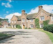
Dunsley Hall Hotel
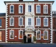
Copthorne Merry Hill Dudley
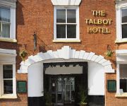
The Talbot Hotel
RAMADA PARK HALL HOTEL & CONFERENCE CTR
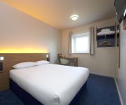
TRAVELODGE BIRMINGHAM KINGWINSFORD
TRAVELODGE BIRMINGHAM DUDLEY
Dudley (Kingswinford)
Stourbridge Town Centre
Hagley
Videos from this area
These are videos related to the place based on their proximity to this place.
Karting - Full Throttle Raceway - Stourbridge
An on-board capture of the 2nd session I did along with a few mates at Full Throttle Raceway in Stourbridge in the West Midlands on Saturday. Footage captured with a GoPro Hero3 Black Edition....
Diamond Head - Helpess (Live Stourbridge 2009)
Diamond Head performing their hit "Helpless" live at the Riverrooms, Stourbridge August 2009.
Ford Transit full colour change to Gloss White Vinyl Wrapping Stourbridge WrapIT tk
vinyl wrapping specialists in stourbridge west midlands. call for a free quote on 01384 469 789. www.Wrap.IT.tk.
RED HOUSE GLASS CONE MUSEUM STOURBRIDGE.
The Red House Cone is a Museum is an educational Museum devoted the the art of glass making in a place that made glass wares on the site for over 140 years. visit The Stuart Crystal gift shop...
Alstone Quay at Stourbridge
Terry Robinson's new "Alstone Quay" O:16.5mm layout on its debut exhibition at Stourbridge. 12 April 2014.
WrapIT tk Vinyl Wrapping Stourbridge, West Midlands VW Classic Wrap
Vinyl Wrapping In Specialist Stourbridge West Midlands. Cars, Vans, Bikes, and more. wrapit.tk wrapituk.blogspot.co.uk Tel 01384 469 789.
Videos provided by Youtube are under the copyright of their owners.
Attractions and noteworthy things
Distances are based on the centre of the city/town and sightseeing location. This list contains brief abstracts about monuments, holiday activities, national parcs, museums, organisations and more from the area as well as interesting facts about the region itself. Where available, you'll find the corresponding homepage. Otherwise the related wikipedia article.
Hawbush
Hawbush is a council estate in Brierley Hill, West Midlands, England. It was built in the 1920s and 1930s. It has been served by a primary school, Hawbush Primary School, since 1930, when 5-7 infant and 7-11 junior schools were opened. The infant school became the first school in September 1972, covering the 5-8 age range, while the junior school became a middle school for pupils aged 8-12.
Bromley, West Midlands
Bromley is a residential area of Kingswinford, West Midlands, England. It was a rural area for many centuries, mostly consisting of farmland, but since the Second World War has been extensively developed for upmarket private housing. Since the 1960s it has been home to The Crestwood School, a secondary school located on Bromley Lane.
Kingswinford Rural District
Kingswinford Rural District was a rural district in Staffordshire, England from 1894 to 1934. It was created by the Local Government Act 1894, and originally consisted of the two parishes of Amblecote and Kingswinford. Amblecote became a separate urban district in 1898, leaving Kingswinford the only parish in the district. The district was abolished in 1934 under a County Review Order.
Stourbridge Canal
The Stourbridge Canal is a canal in the West Midlands of England. It links the Staffordshire and Worcestershire Canal (at Stourton Junction, affording access to traffic from the River Severn) with the Dudley Canal, and hence, via the Birmingham Canal Navigations, to Birmingham and the Black Country.
Red House Cone
The Red House Cone is located in Wordsley in the West Midlands, adjacent to the Stourbridge Canal bridge on the A491 High Street. It is a 90-foot high conical brick structure with a diameter of 60 feet, used for the production of glass. It was used by the Stuart Crystal firm till 1936, when the company moved to a new facility at Vine Street. It is one of only four cones remaining in the United Kingdom.
Wordsley Hospital
Wordsley Hospital was a NHS-owned hospital located in Wordsley, near Dudley, West Midlands, England.
Ketley Claypit
Ketley Claypit is a 13.7 hectare (33.9 acre) geological site of Special Scientific Interest in the West Midlands. The site was notified in 1990 under the Wildlife and Countryside Act 1981. It is located in Kingswinford.
The Lace Guild
The Lace Guild is the largest organization in the British Isles for lacemakers and those interested in lacemaking. Its aims are to provide information about the craft of lacemaking, its history and use, to promote a high standard of lacemaking, and to encourage the design, development and professional presentation of lace. It is a registered educational charity.


