Safety Score: 3,0 of 5.0 based on data from 9 authorites. Meaning we advice caution when travelling to United Kingdom.
Travel warnings are updated daily. Source: Travel Warning United Kingdom. Last Update: 2024-08-13 08:21:03
Discover Netherton
Netherton in Dudley (England) with it's 2,587 citizens is a town in United Kingdom about 107 mi (or 172 km) north-west of London, the country's capital city.
Current time in Netherton is now 03:00 PM (Friday). The local timezone is named Europe / London with an UTC offset of zero hours. We know of 8 airports near Netherton, of which 5 are larger airports. The closest airport in United Kingdom is Birmingham International Airport in a distance of 14 mi (or 23 km), East. Besides the airports, there are other travel options available (check left side).
There are several Unesco world heritage sites nearby. The closest heritage site in United Kingdom is Pontcysyllte Aqueduct and Canal in a distance of 48 mi (or 78 km), North-West. Also, if you like playing golf, there are a few options in driving distance. We discovered 1 points of interest in the vicinity of this place. Looking for a place to stay? we compiled a list of available hotels close to the map centre further down the page.
When in this area, you might want to pay a visit to some of the following locations: Dudley, Oldbury, Wolverhampton, Walsall and Birmingham. To further explore this place, just scroll down and browse the available info.
Local weather forecast
Todays Local Weather Conditions & Forecast: 8°C / 46 °F
| Morning Temperature | 5°C / 41 °F |
| Evening Temperature | 7°C / 44 °F |
| Night Temperature | 5°C / 41 °F |
| Chance of rainfall | 0% |
| Air Humidity | 75% |
| Air Pressure | 1027 hPa |
| Wind Speed | Light breeze with 5 km/h (3 mph) from North-East |
| Cloud Conditions | Overcast clouds, covering 100% of sky |
| General Conditions | Overcast clouds |
Saturday, 16th of November 2024
10°C (49 °F)
6°C (43 °F)
Light rain, gentle breeze, overcast clouds.
Sunday, 17th of November 2024
8°C (46 °F)
3°C (37 °F)
Light rain, moderate breeze, overcast clouds.
Monday, 18th of November 2024
5°C (41 °F)
0°C (32 °F)
Snow, moderate breeze, overcast clouds.
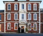
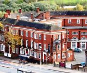
Hotels and Places to Stay
Copthorne Merry Hill Dudley
RAMADA OLDBURY BIRMINGHAM
RAMADA PARK HALL HOTEL & CONFERENCE CTR
Quality Hotel Dudley
Village Hotel Birmingham Dudley
Bay Rooms
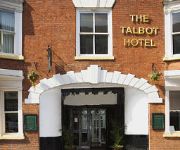
The Talbot Hotel
Travellers Inn
Station
TRAVELODGE BIRMINGHAM FRANKLEY M5 SOUTHB
Videos from this area
These are videos related to the place based on their proximity to this place.
Black Country Pond & Garden Solutions
From Pond Design & installation, Garden Makeovers & Maintenance to Shed Design & Construction, Fencing, Decking, Patio Design & Construction & much more. We do everything for you! Visit us...
Black Country Living Museum 2011
As seen on ITV. Covering 26 acres of former industrial land, Black Country Living Museum is uniquely placed to tell the story of the creation of the world's first industrial landscape. ...
Dudley Ambassador Club - Talk to me, don't ignore me!
Whizz-Kidz Ambassadors at the Dudley Ambassador Club have been campaigning for better disability awareness training for local retailers. So, they decided to make a training video to distribute...
DUDLEY No2 CANAL WINDMILL JUNCTION TO PARKHEAD LOCKS
DUDLE No2 CANAL WINDMILL JUNCTION TO PARKHEAD LOCKS http://www.dudley.gov.uk/leisure-and-culture/tourism-travel/out-and-about/dudley-canals/dudley-no-2-canal ...
Powerpress gym dudley jermaine and Mitchell
Jermaine (superman) and John Mitchell 290kg raw deadlift.
Netherton Tunnel - Boats crossing inside the tunnel - One
This is a film of me on a trip into and out of the Netherton Tunnel. Its 9081 feet (2788 m) long. Netherton Tunnel was the last canal tunnel to be built in Britain during the Canal Age....
Netherton Tunnel - Boats crossing inside the tunnel - Two
This is a film of me on a trip into and out of the Netherton Tunnel. Its 9081 feet (2788 m) long. Netherton Tunnel was the last canal tunnel to be built in Britain during the Canal Age....
I'm not a celebrity Let Me Innnn.........!
Spring Meadow Baptist Chapel - Holiday Bible Club Video February 2013.
STOUR VALLEY FROM QUARRY BANK TO STOURBRIDGE WALK
STOUR VALLEY FROM QUARRY BANK TO STOURBRIDGE WALK http://www.dudley.gov.uk/index.asp?pgid=14212 http://www.stourbridge.com/htm/welcome.htm.
Composting with Mick Poultney
Composting with Mick Poultney a member of the National Vegetable Society. Mick is a keen Black Country allotment keeper and member of Cradley Gardening Club. This video show how over a short...
Videos provided by Youtube are under the copyright of their owners.
Attractions and noteworthy things
Distances are based on the centre of the city/town and sightseeing location. This list contains brief abstracts about monuments, holiday activities, national parcs, museums, organisations and more from the area as well as interesting facts about the region itself. Where available, you'll find the corresponding homepage. Otherwise the related wikipedia article.
Netherton Reservoir
Netherton Reservoir - otherwise known as Lodge Farm Reservoir - is a canal feeder reservoir in the Netherton district of Dudley, England. It opened in 1838, and is now used for watersports, as well as supplying water to the canal system.
Cradley Heath railway station
Cradley Heath railway station serves the town of Cradley Heath in the West Midlands of England. It is located on the Birmingham to Worcester via Kidderminster Line. The station is managed by London Midland, who provide the majority of train services; there are also occasional services provided by Chiltern Railways. Cradley Heath is the nearest station to the Merry Hill Shopping Centre in Brierley Hill, and connecting bus services are provided.
Windmill End railway station
Windmill End railway station was a station on the former Great Western Railway's Bumble Hole Line between Blowers Green and Old Hill. It opened in 1878, was destaffed in 1952 and closed in 1964. It was immortalised in that year as the closing words of the song "Slow Train" by Flanders and Swann. The railway, however, remained open for another four years. The site of the railway and the station had been obliterated by the end of the 1970s. It has now been largely reclaimed by nature.
Cobb's Engine House
Cobb's Engine House (properly known as Windmill End Pumping Station) in Rowley Regis, West Midlands, England, is a scheduled ancient monument and a Grade II listed building built around 1831. It housed a stationary steam pump used to pump water firstly from Windmill End Colliery and later other mines in the area. Utilizing a shaft 525 feet deep, 1,600,000 litres of water were pumped from the mines into the canal daily.
Bumble Hole Branch Canal
The present day Bumble Hole Branch Canal and Boshboil Branch surround Bumble Hole, a water-filled clay pit, in Bumble Hole and Warren's Hall Nature Reserve, Rowley Regis, West Midlands, England. They formed a looped part of the original Dudley No. 2 Canal until the opening of the Netherton Tunnel in 1858 when the loop was bypassed by a new cut, in line with the new tunnel. Part of the bypassed canal loop, which surrounds Bumble Hole, is now in-filled giving access to the pool of Bumble Hole.
Mushroom Green
Mushroom Green is a hamlet in the Dudley Wood/Netherton area of Dudley, UK. It is known for its traditional chain making shop. The Chain Shop is open to the public for free demonstrations of traditional chainmaking on the second Sunday of the month from April to October between 2pm and 5pm. The chainshop is run by volunteers and curated by local sculptor Luke Perry director of the Non-Profit Black Country company I.H.S. More information on Mushroom Green can be found at their website: www.
Dudley Wood Stadium
Dudley Wood Stadium on Dudley Wood Road in Dudley, West Midlands, England was opened in 1947 and was mainly used for greyhound racing and speedway. The stadium was demolished in 1998 by the new owners, despite not receiving planning permission for their home development project.
Baptist End railway station
Baptist End railway station was a station on the former Great Western Railway's Bumble Hole Line between Blowers Green and Old Hill. It opened in 1905 and closed in 1964 as part of the Beeching Axe. The railway which passed through the site had closed completely within four years of the station's closure, and the track was removed soon afterwards. Nature has since reclaimed the section of the railway which passed through the site of the station.
Darby End railway station
Darby End railway station was a station on the former Great Western Railway's Bumble Hole Line between Blowers Green and Old Hill. It opened in 1905 and closed in 1964 as part of the Beeching Axe.
Brewin's Canal Section
Brewin's Canal Section is a 1.34 hectare (3.3 acre) geological site of Special Scientific Interest in the West Midlands. The site was notified in 1990 under the Wildlife and Countryside Act 1981 and is currently managed by the Country Trust.
Doulton's Claypit
Doulton's Claypit is a 3.3 hectare (8.2 acre) geological site of Special Scientific Interest in the West Midlands. The site was notified in 1986 under the Wildlife and Countryside Act 1981 and is currently managed by the Country Trust.
Cradley Heath Baptist Church
Cradley Heath Baptist Church, also known as Four-ways Baptist Church, was the first Church of any denomination to build a chapel in Cradley Heath, West Midlands. The first meeting was in December 1833, in Granger's Lane. Later, land was bought near the Four-Ways end of the High Street, and a meeting place was built. The site was expanded, and two further buildings were built, the last in 1904. This is now a listed building.


