Safety Score: 3,0 of 5.0 based on data from 9 authorites. Meaning we advice caution when travelling to United Kingdom.
Travel warnings are updated daily. Source: Travel Warning United Kingdom. Last Update: 2024-08-13 08:21:03
Explore Brettell Lane
Brettell Lane in Dudley (England) is a city in United Kingdom about 109 mi (or 175 km) north-west of London, the country's capital.
Local time in Brettell Lane is now 03:23 PM (Friday). The local timezone is named Europe / London with an UTC offset of zero hours. We know of 8 airports in the vicinity of Brettell Lane, of which 5 are larger airports. The closest airport in United Kingdom is Birmingham International Airport in a distance of 16 mi (or 26 km), East. Besides the airports, there are other travel options available (check left side).
There are several Unesco world heritage sites nearby. The closest heritage site in United Kingdom is Pontcysyllte Aqueduct and Canal in a distance of 47 mi (or 75 km), North-West. Also, if you like golfing, there are multiple options in driving distance. We found 1 points of interest in the vicinity of this place. If you need a place to sleep, we compiled a list of available hotels close to the map centre further down the page.
Depending on your travel schedule, you might want to pay a visit to some of the following locations: Dudley, Wolverhampton, Oldbury, Walsall and Romsley. To further explore this place, just scroll down and browse the available info.
Local weather forecast
Todays Local Weather Conditions & Forecast: 8°C / 47 °F
| Morning Temperature | 5°C / 41 °F |
| Evening Temperature | 7°C / 45 °F |
| Night Temperature | 6°C / 42 °F |
| Chance of rainfall | 0% |
| Air Humidity | 75% |
| Air Pressure | 1027 hPa |
| Wind Speed | Light breeze with 5 km/h (3 mph) from North-East |
| Cloud Conditions | Overcast clouds, covering 100% of sky |
| General Conditions | Overcast clouds |
Saturday, 16th of November 2024
10°C (50 °F)
7°C (44 °F)
Light rain, gentle breeze, overcast clouds.
Sunday, 17th of November 2024
8°C (46 °F)
3°C (37 °F)
Light rain, moderate breeze, overcast clouds.
Monday, 18th of November 2024
5°C (42 °F)
1°C (33 °F)
Snow, moderate breeze, overcast clouds.
Hotels and Places to Stay
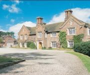
Dunsley Hall Hotel
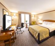
Copthorne Merry Hill Dudley
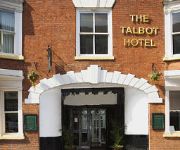
The Talbot Hotel
Village Hotel Birmingham Dudley
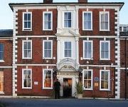
Quality Hotel Dudley
RAMADA PARK HALL HOTEL & CONFERENCE CTR
Bay Rooms
TRAVELODGE BIRMINGHAM DUDLEY
TRAVELODGE BIRMINGHAM KINGWINSFORD
Station
Videos from this area
These are videos related to the place based on their proximity to this place.
Timelapse Canals: Dudley to Windmill End
Timelapse film of our cruise by narrowboat from Dudley (Merry Hill) on the Dudley No. 1 Canal to Windmill End on the Dudley No. 2 Canal.
Pensnet Canal / Fens Branch
Pensnet Canal has i call it or its real name the fens branch In an area that reaches from the fens pool nature reserve to the buckpool nature reserve lies between an old disued canal called...
Beware the Gman
PUBLIC WARNING! A GMan has been sighted in the area, Do Not approach it, as GMans are highly dangerous and may beat you to death with its deadly suitcase! BEWARE!
Moses the British Shorthair Blue
Here is Moses, he is a British Shorthair Blue, with copper eyes, aged 4 months, as you can see from the video he is alert and playful with tons of energy. This video was taken after only 2...
BARROW HILL, BUCKPOOL AND FEN POOLS NATURE RESERVE
the barrow hill, Buckpool and the fens are separate nature resrves which are a stones throw from each other. like most of the area they were open cast mines of some sort and now used for walking...
2156 (brierley hill) ATC Squdron Banner drill
2156 (brierley hill) ATC Squdron Banner drill At brockmoor school jewbille event.
Canon Ixus 240 HS Video Test Canal Basin plus narrow boats Merry Hill UK nice sunny day
Amazing quality from such a tiny camera First 1080p Video Test Canal Basin Merry Hill UK Well Pleased !!! The Waterfront Level Street Brierley Hill West Midlands DY5 1XE.
Captain Cutlass' Debut (Rumble) Match
Debut match of Captain Dave Cutlass at the Secret Venue in Brierley Hill, Sunday 8th of March, 2015.
Videos provided by Youtube are under the copyright of their owners.
Attractions and noteworthy things
Distances are based on the centre of the city/town and sightseeing location. This list contains brief abstracts about monuments, holiday activities, national parcs, museums, organisations and more from the area as well as interesting facts about the region itself. Where available, you'll find the corresponding homepage. Otherwise the related wikipedia article.
Dudley South (UK Parliament constituency)
Dudley South is a constituency represented in the House of Commons of the UK Parliament since 2010 by Chris Kelly of the Conservative Party.
Bromley, West Midlands
Bromley is a residential area of Kingswinford, West Midlands, England. It was a rural area for many centuries, mostly consisting of farmland, but since the Second World War has been extensively developed for upmarket private housing. Since the 1960s it has been home to The Crestwood School, a secondary school located on Bromley Lane.
Round Oak Steel Terminal
Round Oak Steel Terminal is a railway freight terminal dealing in steel from the Round Oak Steel Works until 1982 and from other sources thereafter, in Brierley Hill, West Midlands, England managed by Corus Group.
Brettell Lane railway station
Brettell Lane railway station was a station on the Oxford-Worcester-Wolverhampton Line built to serve the communities between Brierley Hill and Stourbridge in England.
Brierley Hill railway station
Brierley Hill railway station was a station on the Oxford-Worcester-Wolverhampton Line.
Round Oak railway station
Round Oak railway station was a station on the Oxford-Worcester-Wolverhampton Line.
Brockmoor Halt railway station
Brockmoor Halt was a small railway stop on the Wombourne Branch Line. It suffered from very poor patronage and, along with the rest of the line's passenger stations, was closed just seven years after its introduction by the Great Western Railway in 1925. The halt served the small town of Brockmoor, which is now a part of the Brierley Hill area. In fact, Brierley Hill railway station was closer to the town's small High Street than the halt named after it.
Bromley Halt railway station
Bromley Halt was a small railway stop on the Wombourne Branch Line. It suffered from very poor patronage and, along with the rest of the line's passenger stations, was closed just seven years after its introduction by the Great Western Railway in 1925. The halt served the communities between Pensnett, Wordsley and Kingswinford. Bromley Halt ran alongside the Stourbridge Extension Canal, which itself was eventually removed.
Chapel Street Estate
Chapel Street Estate is a residential area of Brierley Hill, West Midlands, England. Although the Chapel Street Estate was only created in the 1960s, the actual site of the estate had been a dense residential area for at least 100 years previously. Hundreds of terraced houses had been built on the site of Chapel Street during the 19th century, housing the many industrial workers who were being employed at new factories like the Round Oak Steel Works.
Stourbridge Extension Canal
The Stourbridge Extension Canal was a short canal built to serve a number of mines in the Kingswinford area of Staffordshire in England. Although connected to the Stourbridge Canal, it was independent from it. It opened in 1840, and was abandoned in 1935. A short section of it is still used as moorings for boats using the Stourbridge Canal.
Daniel Batham and Son Ltd
Bathams is a brewer, established in 1877 and based in Brierley Hill, West Midlands, England. It is described by the CAMRA Good Beer Guide as "A classic Black country small brewery". The company produces three beers all of which are cask conditioned, Best Bitter (4.3%) and Mild (3.5%) are year-round whilst XXX (6.3%) is a Christmas special. The Best Bitter won its highly contested class at the Great British Beer Festival in 1991. Bottled versions are also available at certain Bathams pubs.
Brierley Hill Urban District
Brierley Hill Urban District was a former Urban District in Staffordshire, England, comprising the areas of Brierley Hill, Kingswinford, Quarry Bank, and Pensnett, now within the modern-day Dudley Metropolitan Borough in the West Midlands county. Brierley Hill became an urban district in 1894 under the Local Government Act. Previously, it had been an urban sanitory authority within the parish of Kingswinford.


