Safety Score: 3,0 of 5.0 based on data from 9 authorites. Meaning we advice caution when travelling to United Kingdom.
Travel warnings are updated daily. Source: Travel Warning United Kingdom. Last Update: 2024-08-13 08:21:03
Delve into Weston
Weston in Dorset (England) is located in United Kingdom about 121 mi (or 195 km) south-west of London, the country's capital town.
Current time in Weston is now 10:50 AM (Friday). The local timezone is named Europe / London with an UTC offset of zero hours. We know of 10 airports close to Weston, of which 5 are larger airports. The closest airport in United Kingdom is Bournemouth Airport in a distance of 31 mi (or 50 km), North-East. Besides the airports, there are other travel options available (check left side).
There are several Unesco world heritage sites nearby. The closest heritage site in United Kingdom is Dorset and East Devon Coast in a distance of 64 mi (or 103 km), East. Also, if you like playing golf, there is an option about 25 mi (or 41 km). away. We encountered 1 points of interest near this location. If you need a hotel, we compiled a list of available hotels close to the map centre further down the page.
While being here, you might want to pay a visit to some of the following locations: Dorchester, Poole, Mere, Bournemouth and Kilmington. To further explore this place, just scroll down and browse the available info.
Local weather forecast
Todays Local Weather Conditions & Forecast: 10°C / 51 °F
| Morning Temperature | 7°C / 45 °F |
| Evening Temperature | 10°C / 50 °F |
| Night Temperature | 10°C / 49 °F |
| Chance of rainfall | 0% |
| Air Humidity | 75% |
| Air Pressure | 1028 hPa |
| Wind Speed | Gentle Breeze with 6 km/h (4 mph) from South-West |
| Cloud Conditions | Broken clouds, covering 64% of sky |
| General Conditions | Broken clouds |
Saturday, 16th of November 2024
11°C (51 °F)
12°C (53 °F)
Light rain, moderate breeze, clear sky.
Sunday, 17th of November 2024
10°C (51 °F)
9°C (48 °F)
Light rain, moderate breeze, overcast clouds.
Monday, 18th of November 2024
9°C (49 °F)
13°C (55 °F)
Light rain, strong breeze, overcast clouds.
Hotels and Places to Stay
Barnes's Rest
B+B Weymouth
Heights Hotel
Beach House B&B
The Aqua
Weymouth Beach B&B
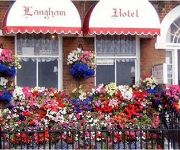
Langham Hotel
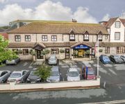
BEST WESTERN WEYMOUTH HOTEL REMBRANDT
The Rosefield
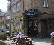
Weatherbury Hotel
Videos from this area
These are videos related to the place based on their proximity to this place.
portland siren by joe walker and curtis munts
i heared they were testing the flood warning system down my road so i went and called for curtis so we could watch it and naturaly i brought my camera. i last heared this noise 1995 when my...
Chesil Beach Dorset England UK
Chesil Beach, sometimes called Chesil Bank, in Dorset, southern England is one of three major shingle structures in Britain.Its toponym is derived from the Old English ceosel or cisel, meaning...
2009-03-15 Who's Afear'd - Ower Moigne Dead Body'
Live at the Royal Portland Arms, Fortuneswell, Portland, Dorset, 14th March 2009 http://www.myspace.com/whosafeard.
Grass seed_0002.wmv
A Red Setter Dog was presented to the veterinary surgery with a history of coughing. An endoscope was used to try to find the cause of coughing and a grass seed was found deep in the dog's...
Powerful Storm Waves, Portland Bill, 2014
The second of 4 great storms to batter the English Channel coast in early 2014. This is the iconic and much photographed Red Crane at Portland Bill. This derrick is used by fishermen to launch...
Cove House Inn, Dorset Wedding Venue
http://www.LinusMoranPhotography.co.uk - Alistair & Naila's Wedding at The Cove House Inn, Portland, Dorset - 20th May 2011 Why not visit www.linusmoranphotography.co.uk for more information...
Airsoft: Christmas Crisis III - The Naughty List
Santa hires TF: Hammer to take out several Christmas-hating terrorists... Rifle used: VFC AK-74N.
Portland uk GoPro Mountain Biking
A collection of clips shot on Portland of me mountain biking during the Christmas week The bike is a Lapierre Froggy 318 Shot using a GoPro at 720p 60fps mounted on my chest using a chest mount.
Videos provided by Youtube are under the copyright of their owners.
Attractions and noteworthy things
Distances are based on the centre of the city/town and sightseeing location. This list contains brief abstracts about monuments, holiday activities, national parcs, museums, organisations and more from the area as well as interesting facts about the region itself. Where available, you'll find the corresponding homepage. Otherwise the related wikipedia article.
Isle of Portland
The Isle of Portland is a limestone tied island, 6 kilometres long by 2.4 kilometres wide, in the English Channel. Portland is 8 kilometres south of the resort of Weymouth, forming the southernmost point of the county of Dorset, England. A barrier beach over which runs the A354 road connects it to Chesil Beach and the mainland. Portland and Weymouth together form the borough of Weymouth and Portland. The population of Portland is 12,400.
Easton (Portland) railway station
Easton railway station was the terminus of the Portland Branch Railway, which operated in the west of the English county of Dorset. Opened with the Easton and Church Hope Railway, one of the constituent parts of a complex line, on 1 September 1902, the line past Portland station was technically a separate railway, although the branch was operated as one line throughout. Easton was closed from 11 November 1940 to 1 January 1945 following air raid damage.
St George's Church, Portland
St George's Church is a Church of England church on the Isle of Portland, built between 1754 and 1766 to replace St. Andrew's which had fallen into disuse and was no longer suitable as a place of worship. During the 1960s a restoration of the church took place under the stewardship of a group formed to protect the church. It then came under the care of the Churches Conservation Trust, which continues to the present.
Villages of Portland
The Isle of Portland, Dorset, contains eight settlements, the largest being Fortuneswell in Underhill and Easton in Tophill. Castletown and Chiswell are the other villages in Underhill, and Weston, Southwell, Wakeham and the Grove occupy Tophill.
Clay Ope
Clay Ope is on the west side of the Isle of Portland in Dorset, England. It forms part of the Jurassic Coast. The geology of the area includes Purbeck Beds, Portland Stone, Portland Sand, and Kimmeridge Clay. Above Clay Ope is West Cliff.
Hallelujah Bay
Hallelujah Bay is a bay located on the west side (West Weares area) of the Isle of Portland in Dorset, UK, and is part of the Dorset and East Devon Coast World Heritage Site. Located close to Blacknor Fort it can be viewed from above or reached by a dead end footpath commencing from the Chiswell esplanade. It is believed that the bay is so named because in the 1880s, Hiram Otter painted and carved religious texts on the rocks in this area.
Tout Quarry
Tout Quarry (aka Tout Quarry Sculpture Park) is a once working quarry that later became a sculpture park, located on the Isle of Portland, Dorset. The quarry that stands at the north-west corner of Tophill, Easton and is located close to the cliff's edge and alongside the road leading to Weston and Portland Bill. It is found close to King Barrow Quarry which is further east.
Blacknor Fort
Blacknor Fort is a fort on the Isle of Portland, Dorset, England. The fort is situated on the cliff edge within Blacknor area of the island. It is found close to the estate of the Weston village and near to Hallelujah Bay and West Weares.
Portland Windmills
The Portland Windmills are two historic, presumed medieval, stone towers which were once windmills. The disused windmills are located nearby south of Easton village and the east of Weston village. Both towers are found within close proximity to one another, (135 metres), within an area of rolling fields and old quarries. The northern one is found at Cottonfields and the southern one at Top Growlands.
Avalanche Memorial Church
The Avalanche Memorial Church, also known as the Church of St Andrew, is a 19th century church, located in Southwell village, on the Isle of Portland, Dorset. It was built in 1879 and, along with its boundary wall, has been a Listed Grade II building since 1978.
South Coast Steam
South Coast Steam Ltd is a United Kingdom-based steam locomotive operating company, based in Portland, Dorset. Owned by Barry Gambles and incorporated in January 2003, the company is registered along with South Coast Crane Hire in Loughborough, but operationally located in South Coast Crane Hire's main yard in Portland.
Chiswell Earthworks
Chiswell Earthworks is a land sculpture, located on the Isle of Portland, Dorset, England. It is found close to the village of Chiswell and Chesil Beach, at the end of the promenade sea wall, towards West Weares. It was created by John Maine RA, between 1986 and 1993.


