Safety Score: 3,0 of 5.0 based on data from 9 authorites. Meaning we advice caution when travelling to United Kingdom.
Travel warnings are updated daily. Source: Travel Warning United Kingdom. Last Update: 2024-08-13 08:21:03
Touring Melbury Abbas
Melbury Abbas in Dorset (England) is a town located in United Kingdom about 96 mi (or 154 km) south-west of London, the country's capital place.
Time in Melbury Abbas is now 02:08 AM (Friday). The local timezone is named Europe / London with an UTC offset of zero hours. We know of 9 airports nearby Melbury Abbas, of which 5 are larger airports. The closest airport in United Kingdom is Bournemouth Airport in a distance of 20 mi (or 32 km), South-East. Besides the airports, there are other travel options available (check left side).
There are several Unesco world heritage sites nearby. The closest heritage site in United Kingdom is City of Bath in a distance of 36 mi (or 58 km), North-East. Also, if you like the game of golf, there are several options within driving distance. Need some hints on where to stay? We compiled a list of available hotels close to the map centre further down the page.
Being here already, you might want to pay a visit to some of the following locations: Ansty, Hindon, Chicklade, Mere and Boyton. To further explore this place, just scroll down and browse the available info.
Local weather forecast
Todays Local Weather Conditions & Forecast: 8°C / 46 °F
| Morning Temperature | 3°C / 38 °F |
| Evening Temperature | 6°C / 42 °F |
| Night Temperature | 4°C / 40 °F |
| Chance of rainfall | 0% |
| Air Humidity | 79% |
| Air Pressure | 1028 hPa |
| Wind Speed | Light breeze with 3 km/h (2 mph) from North-East |
| Cloud Conditions | Few clouds, covering 10% of sky |
| General Conditions | Sky is clear |
Saturday, 16th of November 2024
8°C (47 °F)
8°C (46 °F)
Sky is clear, gentle breeze, clear sky.
Sunday, 17th of November 2024
8°C (47 °F)
4°C (39 °F)
Light rain, moderate breeze, broken clouds.
Monday, 18th of November 2024
6°C (42 °F)
10°C (50 °F)
Light rain, fresh breeze, overcast clouds.
Hotels and Places to Stay
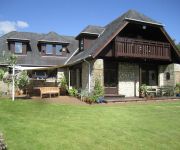
Hare Lodge B&B
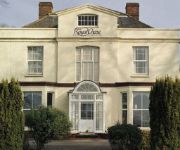
The Fontmell
BW SHAFTESBURY RYL CHASE HTL
Holbrook B&B
The Talbot
The Grosvenor Arms
Coppleridge Inn
Videos from this area
These are videos related to the place based on their proximity to this place.
Grimeton Radio SAQ VLF 17.2 kHz Xmas Eve Sweden's Dec 24 2010.avi
This is Sweden's historic station Grimeton Radio/SAQ on 17.2 kHz as was received here in Shaftesbury, Dorset UK this morning 24 /12 /2010. I received this transmission at my home, using...
Grimeton Radio SAQ 17.2 kHz message RXed in England January 4 2010
This is Sweden's Grimeton Radio / SAQ's special transmission primarily for listeners in North America, as it was received here in Dorset, Southern UK. Grimeton to Dorset is roughly 1...
A Ride up Zig Zag Hill, Dorset on a CRF450X and WR450
Enjoying our first ride up the hill. The WR is burning oil and the CRF has a flat back tyre. A job for supermotos really! ST891208, 21.07.11.
Pet Friendly Care Homes: The Old Vicarage
One of 6 videos produced by Just Film (http://www.justfilm.co.uk) for The Cinnamon Trust (http://http://www.cinnamon.org.uk). Each video features one of the best pet friendly care homes of...
Zig Zag Hill - On-board Motorbike
Footage of us riding up Zig Zag Hill, which is a series on tight and twisting hair-pin turns on the B3081 near Shaftsbury on motorbikes.
PS28 Cruiser G-EGHA at Compton Abbas
My first solo flight in Compton's shiny new PS28 Cruiser. Brilliant!
Big Beautiful Doll at Compton Abbas
Rob Davies making a perfect landing in his Mustang, at Compton Abbas, after an air test.
Compton Abbas French Connection Fly-In
A film of a fly-in at Compton Abbas aerodrome on 22nd May 2010.
Videos provided by Youtube are under the copyright of their owners.
Attractions and noteworthy things
Distances are based on the centre of the city/town and sightseeing location. This list contains brief abstracts about monuments, holiday activities, national parcs, museums, organisations and more from the area as well as interesting facts about the region itself. Where available, you'll find the corresponding homepage. Otherwise the related wikipedia article.
Shaftesbury Abbey
Shaftesbury Abbey was an abbey that housed nuns in Shaftesbury, Dorset. Founded in 888, the abbey was the wealthiest Benedictine nunnery in England, a major pilgrimage site, and the town's central focus. The abbey was destroyed in 1539 during the English Reformation by the order of Thomas Cromwell, minister to King Henry VIII.
North Dorset (UK Parliament constituency)
North Dorset is a constituency represented in the House of Commons of the UK Parliament since 1997 by Robert Walter, a Conservative.
Gold Hill, Shaftesbury
Gold Hill is a steep cobbled street in the town of Shaftesbury in the English county of Dorset. It is famous for its picturesque appearance; the view looking down from the top of the street has been described as "one of the most romantic sights in England. " The image of this view appears on the covers of many books about Dorset and rural England, as well as on countless chocolate boxes and calendars.
Redlane Hundred
Redlane Hundred or Redland Hundred was a hundred in the county of Dorset, England, containing the following parishes: Buckhorn Weston Child Okeford East Stour Fifehead Magdalen Hanford (from 1858) Iwerne Courtney Kington Magna Manston Silton Sutton Waldron Todber West Stour
Shaftesbury Town F.C
Shaftesbury Town F.C. are a football club based in Shaftesbury, Dorset, England. The club is affiliated to the Dorset County Football Association and is a FA chartered Standard club. They are currently members of Dorset Premier League.
Melbury Down
Melbury Down is an area of downland in northern Dorset, England. It is owned by the National Trust. The chalk grassland here supports large butterfly populations, including very large numbers of Chalkhill Blue, and a colony of Silver-spotted Skipper.
Ludwell, Wiltshire
Ludwell is a village in South Wiltshire, approximately 3 miles away from Shaftesbury, Dorset. It lies within the Cranborne Chase and West Wiltshire Downs Area of Outstanding Natural Beauty. Ludwell is 17 miles West of Salisbury and has the A30 running directly through it.
The Breeze (North Dorset)
The Breeze (formerly Gold Radio, Vale FM and Midwest Radio) is a radio station which serves North Dorset, in the United Kingdom, and is owned and operated by Celador Radio and is part of The Breeze network of stations.


