Safety Score: 3,0 of 5.0 based on data from 9 authorites. Meaning we advice caution when travelling to United Kingdom.
Travel warnings are updated daily. Source: Travel Warning United Kingdom. Last Update: 2024-08-13 08:21:03
Delve into Lytchett Matravers
Lytchett Matravers in Dorset (England) with it's 3,315 habitants is located in United Kingdom about 99 mi (or 160 km) south-west of London, the country's capital town.
Current time in Lytchett Matravers is now 10:18 AM (Sunday). The local timezone is named Europe / London with an UTC offset of zero hours. We know of 9 airports close to Lytchett Matravers, of which 5 are larger airports. The closest airport in United Kingdom is Bournemouth Airport in a distance of 10 mi (or 17 km), East. Besides the airports, there are other travel options available (check left side).
There are several Unesco world heritage sites nearby. The closest heritage site in United Kingdom is City of Bath in a distance of 47 mi (or 76 km), North-East. Also, if you like playing golf, there are some options within driving distance. If you need a hotel, we compiled a list of available hotels close to the map centre further down the page.
While being here, you might want to pay a visit to some of the following locations: Poole, Bournemouth, Bower Chalke, Ansty and Bishopstone. To further explore this place, just scroll down and browse the available info.
Local weather forecast
Todays Local Weather Conditions & Forecast: 17°C / 62 °F
| Morning Temperature | 16°C / 61 °F |
| Evening Temperature | 13°C / 55 °F |
| Night Temperature | 10°C / 51 °F |
| Chance of rainfall | 13% |
| Air Humidity | 71% |
| Air Pressure | 996 hPa |
| Wind Speed | High wind, near gale with 27 km/h (17 mph) from North-East |
| Cloud Conditions | Overcast clouds, covering 100% of sky |
| General Conditions | Moderate rain |
Monday, 25th of November 2024
11°C (51 °F)
8°C (47 °F)
Moderate rain, fresh breeze, overcast clouds.
Tuesday, 26th of November 2024
10°C (50 °F)
8°C (47 °F)
Light rain, fresh breeze, broken clouds.
Wednesday, 27th of November 2024
8°C (46 °F)
4°C (40 °F)
Moderate rain, fresh breeze, broken clouds.
Hotels and Places to Stay
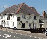
The Charlton Inn
THE PRIORY HOTEL
Poole North
Premier Inn Poole Centre (Holes Bay)
Videos from this area
These are videos related to the place based on their proximity to this place.
Ham Common, Rockly Caravan Park, Hamworthy, Poole, Dorset.
first test of new Martinez controlled gimbal, still needs a tweak as it it not quite horizontal, and still some small amounts of jello to cure. But all in all i am quite happy with it.
6X04 Poole 2nd - 5th March 2015
Network Rail's High Output Track Renewal Train visited the Bournemouth Mainline between Wareham and Wool from March 2nd - March 5th 2015. It was the first time that the HOTRT had worked over...
Purbeck Agility Group - Sukie recall
http://www.purbeckagility.org.uk Recorded in 2011, this shows Sukie, a 19 month old border collie being trained for her Gold Award under the Kennel Club Good Citizen Dog Scheme. For details...
2 Clumbers & a Springer on a Walk
2 Clumbers & a Springer on a Walk September 2009 Wareham Forest, Dorset UK.
Purbeck Agility Group - Dog Obedience Training
http://www.purbeckagility.org.uk In the advanced dog training classes we have a bit of fun as well as working towards the Gold level of the Kennel Club Good Citizen Dog Scheme. Here the goal...
Calum Gray Showreel 2015
Calum Gray Showreel - Vocal Performances, Dancing and Entertaining calumgray90@gmail.com.
Call On Me Variety Show Dance Lytchett Minster School Nov. 2009
No copyright intended. All songs are copyright of their distributor/s From left to right: Jimmy, Tom, Jamie, Lewis & Josh Thanks to Kayleigh for the clip!
Lytchett Manor to Poole
A cycle ride to Poole from Lytchett Manor campsite, a few mistakes but we had no map.
Sandford Heritage: Cordite, Clay and Calluna: Dig at Holton Lee
"Sandford Heritage: Cordite Clay and Calluna" is a local heritage project at Sandford near Wareham in Dorset. Various aspects of the area are being researched, shared and celebrated and as...
Videos provided by Youtube are under the copyright of their owners.
Attractions and noteworthy things
Distances are based on the centre of the city/town and sightseeing location. This list contains brief abstracts about monuments, holiday activities, national parcs, museums, organisations and more from the area as well as interesting facts about the region itself. Where available, you'll find the corresponding homepage. Otherwise the related wikipedia article.
Sturminster Marshall
Sturminster Marshall is a village and civil parish in east Dorset in England, situated on the River Stour between Blandford Forum and Poole. The parish has a population of 1,895 (as of the 2001 census), and includes the village of Almer west of Sturminster Marshall, near Winterborne Zelston and the hamlet of Henbury to the south-east of the village. The village is twinned with the French commune Sainte-Mère-Église
Combe Almer
Combe Almer is a hamlet in Dorset, England, situated in the Stour valley in the parish of Sturminster Marshall.
Royal Navy Cordite Factory, Holton Heath
The Royal Navy Cordite Factory, Holton Heath, (RNCF), was set up at Holton Heath, Dorset in World War I to manufacture Cordite for the Royal Navy. It was reactivated in World War II to manufacture gun propellants for the Admiralty and its output was supplemented by the Royal Navy Propellant Factory, Caerwent. After the end of World War II, the explosive manufacturing areas of the site were closed down and some areas of the site reopened as an Admiralty Research Establishment.
Bailey Gate railway station
Bailey Gate railway station was on the Somerset & Dorset Joint Railway in the English county of Dorset. The station served the United Dairies Cheese Factory and the village of Sturminster Marshall but was named after a local farm to avoid confusion with another station on the same railway at Sturminster Newton. The station had extensive sidings and was one of the largest depots for transporting milk on the UK railway system.
Beacon Hill, Dorset
Beacon Hill is one of the highest viewpoints in the hinterland of Poole Harbour, Dorset. Its tree-covered summit reaches 84 metres above sea level and there is a public footpath running roughly north to south over the top. Historically it was one of a series of beacons used to warn of the advancing Spanish Armada. The earlier name for the hill was Lytchett Beacon. To the northeast of Beacon Hill is a clay pit.
Charborough House
Charborough House is is a rural estate located between the villages of Sturminster Marshall and Bere Regis in Dorset, England. The Deer Park and estate adjoins the villages of Winterborne Zelston, Newton Peveril and Lytchett Matravers. The house and grounds have been owned by the same family since Elizabethan times and is first recorded in the Doomsday Book.
Lytchett Minster and Upton
Lytchett Minster and Upton is a civil parish in the English county of Dorset. The parish comprises the village of Lytchett Minster and the nearby built up area of Upton, which is contiguous with the urban area of Poole. The parish has an area of 14.35 square kilometres. At the time of the 2001 census, it had a population of 7,573 living in 3,227 dwellings. The parish forms part of the Purbeck local government district of the county of Dorset.
Holton Heath
Holton Heath is an area of the parish of Wareham St. Martin, Dorset, England. The area includes a trading estate, on the site of the former Royal Navy Cordite Factory, Holton Heath, (RNCF). East of the trading estate is the Holton Heath National Nature Reserve, currently closed to the public. The area is served by the Holton Heath railway station.


