Safety Score: 3,0 of 5.0 based on data from 9 authorites. Meaning we advice caution when travelling to United Kingdom.
Travel warnings are updated daily. Source: Travel Warning United Kingdom. Last Update: 2024-08-13 08:21:03
Delve into Pinhoe
Pinhoe in Devon (England) is a city located in United Kingdom about 154 mi (or 248 km) west of London, the country's capital town.
Current time in Pinhoe is now 12:56 PM (Friday). The local timezone is named Europe / London with an UTC offset of zero hours. We know of 8 airports closer to Pinhoe, of which 3 are larger airports. The closest airport in United Kingdom is Exeter International Airport in a distance of 2 mi (or 4 km), East. Besides the airports, there are other travel options available (check left side).
There are two Unesco world heritage sites nearby. The closest heritage site in United Kingdom is Cornwall and West Devon Mining Landscape in a distance of 66 mi (or 106 km), South-West. Also, if you like playing golf, there are some options within driving distance. We saw 2 points of interest near this location. In need of a room? We compiled a list of available hotels close to the map centre further down the page.
Since you are here already, you might want to pay a visit to some of the following locations: Exeter, Bickleigh, Torquay, Taunton and Barry. To further explore this place, just scroll down and browse the available info.
Local weather forecast
Todays Local Weather Conditions & Forecast: 9°C / 48 °F
| Morning Temperature | 5°C / 40 °F |
| Evening Temperature | 7°C / 45 °F |
| Night Temperature | 6°C / 42 °F |
| Chance of rainfall | 0% |
| Air Humidity | 81% |
| Air Pressure | 1028 hPa |
| Wind Speed | Calm with 2 km/h (1 mph) from South-West |
| Cloud Conditions | Few clouds, covering 19% of sky |
| General Conditions | Few clouds |
Saturday, 16th of November 2024
10°C (51 °F)
10°C (50 °F)
Sky is clear, gentle breeze, clear sky.
Sunday, 17th of November 2024
10°C (51 °F)
6°C (43 °F)
Light rain, moderate breeze, overcast clouds.
Monday, 18th of November 2024
8°C (47 °F)
12°C (54 °F)
Light rain, fresh breeze, overcast clouds.
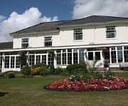
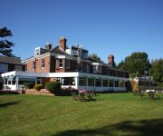
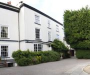
Hotels and Places to Stay
Hotel Du Vin Exeter
The City Gate Hotel
Mercure Exeter Rougemont Hotel
Buckerell Lodge
The Globe
Mercure Exeter Southgate Hotel
Gipsy Hill
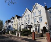
Queens Court Hotel
St Olaves Hotel & Treasury Restaurant
Exeter Court Kennford
Videos from this area
These are videos related to the place based on their proximity to this place.
Loft conversion to a 1930s semi-detached house in Exeter.MP4
A typical conversion of a 1930's semi-detached house. Hip removed and replaced with a brick gable end. Flat roof dormer window to rear added to give more space. This created a master bedroom...
Stoke Canon Level Crossing - Bristol to Exeter
A short preview video of the fully animated and working level crossings which feature on the Just Trains Bristol to Exeter route add-on for RailWorks & RailWorks 2. See more details about this...
The Devonian 6024 King Edward I & 57601 at Stoke Canon
The Devonian 6024 King Edward I & 57601 at Stoke Canon. Filmed using an 4th Gen Ipod Touch.
Nothing But Blue Skies
Big Azza with his slow blues original. Stellar solo from Andy Knight on his Strat. Stoke Canon Blues Jam regular Neil Ewins on Saxophone, Cuffy on Drums, Sam Heston on Guitar. Video shot by...
She's taking me to heaven
Here's Azza doing "She's Taking me to Heaven" With Ray Kemp playing a fantastic twangtastic solo on that beautiful blond Tele of his, Geoff Collins on guitar, Young Alfie on Drums, Toby James...
Countess Wear Paper Mills, Exeter
A walk to Countess Wear Paper mills, November 5th 2012. The mills originally ground corn but were used to make paper from rags from about 1638. On 29 May 1816 the mills were destroyed by fire...
Unusual yet effective methods of drying a golf course
As we have had such a bad winter in the UK I have decided to take action and dry the golf course with some unusual yet effective methods.
Bad Driving UK - Elderly and impatient driver hazard
The elderly driver of the green Rover (WD04 BMV) which is in front of the impatient Volkswagen (WF55 YLP) first jumps a red light, then proceeds to indicate right when in fact they are turning...
Videos provided by Youtube are under the copyright of their owners.
Attractions and noteworthy things
Distances are based on the centre of the city/town and sightseeing location. This list contains brief abstracts about monuments, holiday activities, national parcs, museums, organisations and more from the area as well as interesting facts about the region itself. Where available, you'll find the corresponding homepage. Otherwise the related wikipedia article.
Fosse Way
The Fosse Way was a Roman road in England that linked Exeter in South West England to Lincoln in Lincolnshire, via Ilchester, Bath, Cirencester and Leicester. It joined Akeman Street and Ermin Way at Cirencester, crossed Watling Street at Venonis south of Leicester, and joined Ermine Street at Lincoln. The word Fosse is derived from the Latin fossa, meaning ditch.
Sowton
Sowton is a village and civil parish east of Exeter in East Devon, England. It has a population of 639. Its parish council merged with that of nearby Clyst St Mary in 1976 to form Bishop's Clyst. St Michael's church was rebuilt in 1844–45, by John Hayward and paid for by John Garratt. He retained the original perpendicular north arcade. It is a rare example of an early Victorian Tractarian village church. It is a grade I listed building.
Poltimore House
Poltimore House is an 18th century country house just outside Exeter, Devon. The manor of Poltimore was from the 13th. to the 20th. century the seat of the Bampfylde family, which acquired the title Baron Poltimore in 1831. The house retains much of the fabric of earlier buildings on the site erected by the family. It is designated a Grade II* listed building.
A379 road
The A379 is a road in the English county of Devon. It links points on the edges of that county's two principal cities, Exeter and Plymouth, by an indirect and largely coastal route. The A38 provides a faster and more direct inland route between Exeter and Plymouth, whilst the A380 provides a similarly faster route between Exeter and the Torbay area. However the A379 serves a large number of smaller coastal communities and ports along the coast.
Battle of Pinhoe
The Battle of Pinhoe was a battle between the Danes and the Devons of Pinhoe.
Sandy Park
Sandy Park is a rugby union stadium in Exeter, England. It is the home ground of Exeter Chiefs who from the 2010/11 season have been playing in the Aviva Premiership, the top flight of the English rugby union league system. The club relocated there from their former stadium at the County Ground in 2006. The stadium can hold 10,744 spectators and is located adjacent M5 junction 30 which is around 5 miles from Exeter City Centre.
Bishop's Clyst
Bishop's Clyst is the name adopted by the council representing two civil parishes that form part of the East Devon district in the English county of Devon. Bishop's Clyst was formed in 1976 by the merger of the parish councils of Clyst St Mary and Sowton. These are two separate settlements Sowton being a mile or so north of Clyst St Mary.
Clyst Honiton
Clyst Honiton (or Honiton Clyst) is an English village and civil parish five miles from Exeter in the East Devon district, in the county of Devon. It has a primary school. The church is St Michael and All Angels. Exeter International Airport which was opened in 1938 is located on the outskirts of the village. The village was originally on the main A30 road from Exeter to Honiton but was Bypassed in the 1990s. In 2001 the population of the civil parish of Clyst Honiton was 295.


