Safety Score: 3,0 of 5.0 based on data from 9 authorites. Meaning we advice caution when travelling to United Kingdom.
Travel warnings are updated daily. Source: Travel Warning United Kingdom. Last Update: 2024-08-13 08:21:03
Discover Wingerworth
Wingerworth in Derbyshire (England) with it's 6,430 citizens is a place in United Kingdom about 129 mi (or 208 km) north-west of London, the country's capital city.
Current time in Wingerworth is now 08:28 PM (Friday). The local timezone is named Europe / London with an UTC offset of zero hours. We know of 8 airports near Wingerworth, of which 5 are larger airports. The closest airport in United Kingdom is Nottingham Airport in a distance of 24 mi (or 39 km), South-East. Besides the airports, there are other travel options available (check left side).
There are several Unesco world heritage sites nearby. The closest heritage site in United Kingdom is Liverpool – Maritime Mercantile City in a distance of 23 mi (or 36 km), North-East. Also, if you like playing golf, there are a few options in driving distance. If you need a hotel, we compiled a list of available hotels close to the map centre further down the page.
While being here, you might want to pay a visit to some of the following locations: Matlock, Sheffield, Orgreave, Wales and Ulley. To further explore this place, just scroll down and browse the available info.
Local weather forecast
Todays Local Weather Conditions & Forecast: 9°C / 48 °F
| Morning Temperature | 6°C / 42 °F |
| Evening Temperature | 7°C / 44 °F |
| Night Temperature | 6°C / 43 °F |
| Chance of rainfall | 0% |
| Air Humidity | 89% |
| Air Pressure | 1026 hPa |
| Wind Speed | Gentle Breeze with 6 km/h (4 mph) from North-East |
| Cloud Conditions | Overcast clouds, covering 99% of sky |
| General Conditions | Overcast clouds |
Saturday, 16th of November 2024
10°C (51 °F)
7°C (44 °F)
Overcast clouds, gentle breeze.
Sunday, 17th of November 2024
7°C (45 °F)
2°C (35 °F)
Light rain, moderate breeze, clear sky.
Monday, 18th of November 2024
1°C (35 °F)
0°C (33 °F)
Snow, moderate breeze, overcast clouds.
Hotels and Places to Stay
Casa
The View at the White Horse Woolley Moor
PEAK EDGE HOTEL
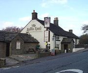
The Robin Hood Inn
BUCKINGHAMS HOTEL - TO BE DELE
ibis Chesterfield Centre - Market Town
Chesterfield North
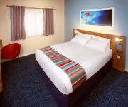
TRAVELODGE CHESTERFIELD
Videos from this area
These are videos related to the place based on their proximity to this place.
31/03/13 - Tac House: Spartan - Chesterfield - 3rd game highlights - Airsoft HD
Just a little highlights video from the 3rd game, lots of shorter snippits of what was otherwise quite a slow and death intensive game for me. The full round lasted about 25 minutes, these...
Chesterfield Retail Awards 2014
The first ever Chesterfield Retail Awards were held on the 18th June 2014 in the Assembly Rooms at Chesterfield Market Hall. Find out who the winners were.
Chesterfield Food and Drink Awards Finalists 2014
Discover the finalists of the Chesterfield Food and Drink Awards 2014.
Street Triple Rx At Triumphworld Chesterfield
The Triumph Street Triple Rx combines raw aggressive style with devilish looks to create an extreme, eye catching machine. Take a closer look at it for yourself in our video. For more information...
Chesterfield Retail Awards Finalist 2014
Finalists of the first ever Chesterfield Retail Awards www.chesterfield.co.uk/retailawards.
J B King & Son Ltd - Plumber in Chesterfield
Professional plumbers in Chesterfield offering bathroom installation, tiles installation, kitchen remodelling, central heating repair and boiler repairs throughout the Chesterfield. Visit http://jb...
Chesterfield v Mansfield FA Cup 1st round 08/11/2008
View from the kop as the teams come out for what was probably the last derby for a while...
Loft Conversions - Attic Conversions By Restyle Loft and Garage Conversions In Chesterfield
A Loft Conversion we completed in Chesterfield. We transformed this loft into a games room complete with pool table. We also added a toilet & wash hand basin for convenience. This is a testimonial...
Celebrate Chesterfield 2015
Time lapse of Destination Chesterfield's Celebrate Chesterfield Event at the Winding Wheel on the 25th March 2015. 220 businesses attended and heard about the £1 billion of investment planned...
Videos provided by Youtube are under the copyright of their owners.
Attractions and noteworthy things
Distances are based on the centre of the city/town and sightseeing location. This list contains brief abstracts about monuments, holiday activities, national parcs, museums, organisations and more from the area as well as interesting facts about the region itself. Where available, you'll find the corresponding homepage. Otherwise the related wikipedia article.
Chesterfield
Chesterfield is a market town and a borough of Derbyshire, England. It lies 24 miles north of Derby, on a confluence of the rivers Rother and Hipper. Its population is 103,800 (2011), making it Derbyshire's largest town (the larger Derby being a city). It is located on the A61, 6 miles from the M1, and forms part of the Sheffield City Region. Chesterfield received its market charter in 1204. It has the largest open air markets in Britain.
Chesterfield coach station
Chesterfield coach station opened on 3 May 2005, and is in Chesterfield, Derbyshire, England. It was built on the site of the old bus station. It is owned by Stagecoach and is served by Stagecoach Express and National Express coach services.
Chesterfield Market Place railway station
Chesterfield Market Place was a railway station in the centre of the town of Chesterfield, England. It was opened by the Lancashire, Derbyshire and East Coast Railway in March 1897 and was the headquarters of the line. It was closed to passenger traffic by British Railways in 1951 because of the prohibitive cost of maintaining and repairing Bolsover Tunnel, together with concerns over Doe Lea viaduct and the limited amount of traffic. Goods traffic continued until 1957.
Queen's Park, Chesterfield
Queen's Park is a county cricket ground located in Chesterfield, Derbyshire, England and lies within a park in the centre of the town established for Queen Victoria's golden jubilee in 1887. It is among the most attractive cricket grounds in the world, with a small pavilion and surrounded by mature trees. The park is the home of Chesterfield CC and also played home to Derbyshire CCC for 100 years between 1898 and 1998, before the county team returned in 2006 after an 8 year absence.
Church of St Mary and All Saints, Chesterfield
Chesterfield Parish Church is an Anglican church dedicated to Saint Mary and all saints, located in the town of Chesterfield in Derbyshire, England. Predominantly dating back to the 14th century, the church is a Grade I listed building and is most known for its twisted spire; an architectural phenomenon which has led to the church being given the common byname of the Crooked Spire.
River Hipper
The River Hipper is a tributary of the River Rother in Derbyshire, England. Its source is a large expanse of wetlands, fed by the surrounding moors between Chatsworth and Chesterfield, known as the Hipper Sick on Beeley Moor, which is part of the Chatsworth Estate. It then passes through Holymoorside and down into Chesterfield, just south of the town centre, before flowing into the River Rother.
Wingerworth Hall
Wingerworth Hall, demolished 1927, was the ancestral home of the Hunloke family in the village of Wingerworth, Derbyshire, England. It was built on an elevated site and completed in 1724 by an unknown architect. The house was in the rare style of understated Baroque peculiar to England. The rectangular building was on three floors raised above a semi-basement, thus causing to the principal rooms to be on a piano nobile reached from a broad straight external staircase.
Walton Hall, Chesterfield
Walton Hall is a late 18th century country house, now a farmhouse, situated at Foljambe Avenue, Walton, Chesterfield. It is a Grade II listed building. The house occupies the site of the former manor house known as Walton Hall, which was the seat of the Foljambe family in the 16th and 17th centuries. Several members of the family served as High Sheriff of Derbyshire.


