Safety Score: 3,0 of 5.0 based on data from 9 authorites. Meaning we advice caution when travelling to United Kingdom.
Travel warnings are updated daily. Source: Travel Warning United Kingdom. Last Update: 2024-08-13 08:21:03
Delve into South Normanton
South Normanton in Derbyshire (England) is a town located in United Kingdom about 122 mi (or 196 km) north-west of London, the country's capital town.
Time in South Normanton is now 09:38 PM (Friday). The local timezone is named Europe / London with an UTC offset of zero hours. We know of 10 airports closer to South Normanton, of which 5 are larger airports. The closest airport in United Kingdom is Nottingham Airport in a distance of 17 mi (or 27 km), South-East. Besides the airports, there are other travel options available (check left side).
There are several Unesco world heritage sites nearby. The closest heritage site in United Kingdom is Liverpool – Maritime Mercantile City in a distance of 25 mi (or 40 km), North-East. Also, if you like the game of golf, there are some options within driving distance. In need of a room? We compiled a list of available hotels close to the map centre further down the page.
Since you are here already, you might want to pay a visit to some of the following locations: Matlock, Derby, Wales, Nottingham and Todwick. To further explore this place, just scroll down and browse the available info.
Local weather forecast
Todays Local Weather Conditions & Forecast: 9°C / 48 °F
| Morning Temperature | 5°C / 41 °F |
| Evening Temperature | 8°C / 47 °F |
| Night Temperature | 5°C / 41 °F |
| Chance of rainfall | 0% |
| Air Humidity | 84% |
| Air Pressure | 1027 hPa |
| Wind Speed | Gentle Breeze with 6 km/h (4 mph) from North-East |
| Cloud Conditions | Overcast clouds, covering 98% of sky |
| General Conditions | Overcast clouds |
Saturday, 16th of November 2024
10°C (50 °F)
6°C (43 °F)
Broken clouds, gentle breeze.
Sunday, 17th of November 2024
7°C (44 °F)
1°C (34 °F)
Light rain, moderate breeze, few clouds.
Monday, 18th of November 2024
1°C (34 °F)
-0°C (32 °F)
Rain and snow, moderate breeze, overcast clouds.
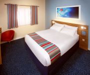
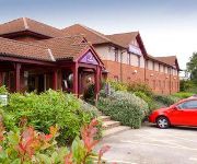
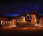
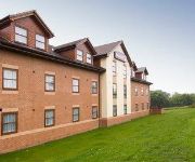
Hotels and Places to Stay
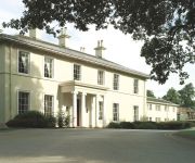
Eastwood Hall
The Derbyshire PH Hotels
Lumb Farm Country Club
Days Inn Chesterfield Tibshelf
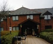
TRAVELODGE ALFRETON
Mansfield
Independent (SPHC) THE DERBYSHIRE HOTEL
Ripley
Videos from this area
These are videos related to the place based on their proximity to this place.
Adventures of a local optician in Alfreton!
Michael from Stanley H Field Opticians shows how they are part of the vibrant local business community in Alfreton. SPECS network brings you probably the World's only video featuring an optician,...
Telford Smoke bomb at Alfreton Away
AFC Telford United, smoke grenade at Alfreton away on saturday the 16th october.
Steven Hewitt goal vs Alfreton
Steven Hewitt knocks a third goal in for Burnley in a pre-season game with Alfreton, 28/07/12.
Joe Jackson goal vs Alfreton
Joe Jackson heads Burnley 2-0 in front in a pre-season game with Alfreton, 28/7/12.
Charlotte Bryan Wins the David Nieper Fashion Academy Student Competition 2010
East Midlands today report on the winner of the David Nieper Fashion Academy Student Competition 2010 and the start of Charlotte Bryan's 6 month internship as an apprentice at the design rooms...
Videos provided by Youtube are under the copyright of their owners.
Attractions and noteworthy things
Distances are based on the centre of the city/town and sightseeing location. This list contains brief abstracts about monuments, holiday activities, national parcs, museums, organisations and more from the area as well as interesting facts about the region itself. Where available, you'll find the corresponding homepage. Otherwise the related wikipedia article.
Alfreton railway station
Alfreton railway station serves the town of Alfreton in Derbyshire, England. The station is on the Erewash Valley Line 18+⁄4 miles north of Nottingham. As of late 2009 Alfreton is a Penalty fare station when travelling on East Midlands Trains services.
East Midlands Designer Outlet
The East Midlands Designer Outlet, run by the company McArthurGlen, is a shopping complex of 70 stores located at Pinxton, Derbyshire in the East Midlands, just off Junction 28 of the M1. 14 million people live within a 90 minute drive of the centre and 2.7 million shoppers visit each year. There is parking capacity for 1,200 vehicles. Brands represented in the outlet include Calvin Klein Jeans, Next Clearance, Marks & Spencer Outlet, Clarks, Bench, Jaeger, Mexx, adidas and Gap.
Tibshelf Town railway station
Tibshelf Town railway station is a disused station in the village of Tibshelf in Derbyshire. The station was opened on 2 January 1893 by the Manchester, Sheffield and Lincolnshire Railway (later part of the Great Central Railway and subsequently the LNER), on its line from Beighton in the outskirts of Sheffield to Annesley in Nottinghamshire, which later became part of the Great Central main line to London.
Miners Welfare Ground
The Miners Welfare Ground is a cricket ground in Blackwell, England that Derbyshire CCC used between 1909 and 1913. The ground hosted 7 first-class matches. Game Information: Game Statistics: first-class:
North Street (stadium)
North Street also known as the Impact Arena is a football stadium in Alfreton, Derbyshire. It is the home of Alfreton Town F.C. who currently play in the Conference National. Capacity is 3,600 with 1,500 seats. Between 1986 and 1988, it was home to a rugby league team called Mansfield Marksman. It has two seated stands and one standing stand. The fourth side contains a bar and the changing rooms.
Pinxton South railway station
Pinxton South railway station was a former railway station that served Pinxton, Derbyshire; the station stie lies within the parish of Selston, Nottinghamshire. It was opened by the Great Northern Railway (Great Britain) as "Pinxton" on its Derbyshire Extension in 1875-6 In some timetables it was listed as "Pinxton for South Normanton". It was renamed "Pinxton South" in January 1954.
St. Helen's Church, Selston
St. Helen's Church, Selston is a parish church in the Church of England in Selston, Nottinghamshire. The church is Grade II* listed by the Department for Culture, Media & Sport as it is a particularly significant building of more than local interest.
Carnfield Hall
Carnfield Hall is a privately owned country house located at South Normanton, near Alfreton in Derbyshire, England. It is a Grade II* listed building. The estate includes around ninety acres of park and ancient woodland. The manor was anciently held by the Babington family of Dethick Manor but was sold in about 1502 to Hugh Revell, a younger brother of John Revell of Ogston Hall Documents relating to the Carnfield estate date from the early 14th century.


