Safety Score: 3,0 of 5.0 based on data from 9 authorites. Meaning we advice caution when travelling to United Kingdom.
Travel warnings are updated daily. Source: Travel Warning United Kingdom. Last Update: 2024-08-13 08:21:03
Delve into Smisby
Smisby in Derbyshire (England) is located in United Kingdom about 104 mi (or 168 km) north-west of London, the country's capital town.
Current time in Smisby is now 11:36 AM (Friday). The local timezone is named Europe / London with an UTC offset of zero hours. We know of 10 airports close to Smisby, of which 5 are larger airports. The closest airport in United Kingdom is East Midlands Airport in a distance of 8 mi (or 13 km), North-East. Besides the airports, there are other travel options available (check left side).
There are several Unesco world heritage sites nearby. The closest heritage site in United Kingdom is Derwent Valley Mills in a distance of 44 mi (or 71 km), North-East. Also, if you like playing golf, there are some options within driving distance. If you need a hotel, we compiled a list of available hotels close to the map centre further down the page.
While being here, you might want to pay a visit to some of the following locations: Netherseal, Derby, Shirley, Yeldersley and Rodsley. To further explore this place, just scroll down and browse the available info.
Local weather forecast
Todays Local Weather Conditions & Forecast: 9°C / 47 °F
| Morning Temperature | 5°C / 41 °F |
| Evening Temperature | 7°C / 44 °F |
| Night Temperature | 6°C / 42 °F |
| Chance of rainfall | 0% |
| Air Humidity | 75% |
| Air Pressure | 1027 hPa |
| Wind Speed | Light breeze with 5 km/h (3 mph) from North-East |
| Cloud Conditions | Overcast clouds, covering 100% of sky |
| General Conditions | Overcast clouds |
Saturday, 16th of November 2024
10°C (49 °F)
7°C (44 °F)
Light rain, gentle breeze, overcast clouds.
Sunday, 17th of November 2024
7°C (45 °F)
4°C (39 °F)
Light rain, moderate breeze, overcast clouds.
Monday, 18th of November 2024
5°C (42 °F)
-0°C (32 °F)
Snow, moderate breeze, overcast clouds.
Hotels and Places to Stay
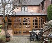
Smithy Studio Bed and Breakfast
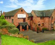
The Mill Wheel
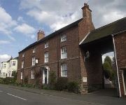
Ravenstone Guest House
Champneys Springs
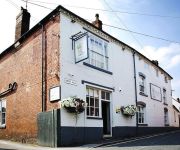
The Boot
Queens Head Hotel
Ashby De La Zouch
Videos from this area
These are videos related to the place based on their proximity to this place.
Ashby Model Car Track August 2010
Whilst in the area, I decided to take a look at track I spent many Sundays at. I knew they had stopped racing there but I was surprised to see it like this.
lee and tully snowboarding
only had 2 lessons and this is our second open practice, so go easy on us. we've just managed to link 2 turns together.
PPG (Paramotoring) Morning Test flight
Test Flight Over Moira (South Derbyshire) after new prop fitted Got to see some clouds forming below, engine off at around 2500ft for a slow glide back down Happy days.
Paramoring Moira Feb 8th 2015
Feb 2015 a cold Sunday morning Paramotoring flight over Moira Hicks lodge and surrounding areas max Alt 1836ft max speed 41.7mph av speed 17mph wind speed Surface 4mph at 1200ft alt 12mph.
Samochód w gothicu
Elo. w tym filmiku mozesz zobaczyc samochód w gothicu. jest on w drugim swiecie gdzie musisz zabic kruka. to musisz isc do kanionu to obozowiska orków i jest nad swiatynia. jesli go nie bedzie...
Nielsen Retail Range | Interior Dressing
Providing flawless results every time, Nielsen Interior Dressing leaves a high sheen finish on your vehicle's plastic, vinyl and rubber, to instantly revive the cockpit's appearance. Also provides...
Hicks Lodge MTB GoPro 01 December 2013 Trek 4900
Some footage from Hicks Lodge filmed on a GoPro Hero 3+ (Black Edition) using handle bar mount, Bike: Trek 4900.
Videos provided by Youtube are under the copyright of their owners.
Attractions and noteworthy things
Distances are based on the centre of the city/town and sightseeing location. This list contains brief abstracts about monuments, holiday activities, national parcs, museums, organisations and more from the area as well as interesting facts about the region itself. Where available, you'll find the corresponding homepage. Otherwise the related wikipedia article.
Packington
Packington is a village and civil parish in the district of North West Leicestershire. It is situated close to the A42 road and the town of Ashby de la Zouch. The population of Packington according to the 2001 UK census is 738. Nearby villages include Normanton le Heath and Measham. Packington has a public house called the 'Bull and Lion' (reputedly the only one in Britain) and a local shop called 'Daybreak Services'.
Bath Grounds
The Bath Grounds is a cricket ground based in the town of Ashby-de-la-Zouch, Leicestershire. It is home to Ashby Hastings Cricket Club and is also known for Leicestershire's appearances on the ground. Leicestershire played 42 first class games all together at the Bath Grounds. The first taking place in 1912 against Derbyshire and the last taking place in 1964, also against Derbyshire. Of the 43 games played there Leicestershire Won 9, Lost 18 whilst 15 were Drawn.
Blackfordby
Blackfordby is a small village about 2 miles to the northwest of Ashby-de-la-Zouch in England. On some early maps, such as one dated 1587, the village is shown as "Blaugherby", hence the local name of "Blofferby". The village is dominated by the Church of St. Margaret of Antioch, erected in 1858 on the site of an earlier Anglican Chapel which was attached to the Church of St. Helen at nearby Ashby-de-la-Zouch.
Castles in Leicestershire
Calke Priory
St Helen's Church, Ashby-de-la-Zouch
St. Helen's Church, Ashby-de-la-Zouch, is a parish church in the Church of England in Ashby-de-la-Zouch, Leicestershire.
Holy Trinity, Ashby-de-la-Zouch
Holy Trinity, Ashby-de-la-Zouch, is a parish church in the Church of England in Ashby-de-la-Zouch, Leicestershire.
Bluebell Arboretum
Bluebell Arboretum is an arboretum and associated plant nursery near the village of Smisby in South Derbyshire, England. It is a Royal Horticultural Society recommended garden, comprising a large selection of rare trees, shrubs and climbers growing in a woodland garden. Planting was started by the owners, Suzette and Robert Vernon in 1992 on what was then a six acre (2.2 hectare) meadow, just under 500 feet (150 metres) above sea level.


