Safety Score: 3,0 of 5.0 based on data from 9 authorites. Meaning we advice caution when travelling to United Kingdom.
Travel warnings are updated daily. Source: Travel Warning United Kingdom. Last Update: 2024-08-13 08:21:03
Discover Shottle
Shottle in Derbyshire (England) is a place in United Kingdom about 122 mi (or 196 km) north-west of London, the country's capital city.
Current time in Shottle is now 04:18 PM (Friday). The local timezone is named Europe / London with an UTC offset of zero hours. We know of 8 airports near Shottle, of which 5 are larger airports. The closest airport in United Kingdom is East Midlands Airport in a distance of 17 mi (or 28 km), South-East. Besides the airports, there are other travel options available (check left side).
There are several Unesco world heritage sites nearby. The closest heritage site in United Kingdom is Liverpool – Maritime Mercantile City in a distance of 33 mi (or 54 km), North-East. Also, if you like playing golf, there are a few options in driving distance. If you need a hotel, we compiled a list of available hotels close to the map centre further down the page.
While being here, you might want to pay a visit to some of the following locations: Matlock, Derby, Bradley, Yeldersley and Shirley. To further explore this place, just scroll down and browse the available info.
Local weather forecast
Todays Local Weather Conditions & Forecast: 9°C / 48 °F
| Morning Temperature | 5°C / 41 °F |
| Evening Temperature | 7°C / 44 °F |
| Night Temperature | 5°C / 41 °F |
| Chance of rainfall | 0% |
| Air Humidity | 84% |
| Air Pressure | 1027 hPa |
| Wind Speed | Gentle Breeze with 6 km/h (3 mph) from East |
| Cloud Conditions | Overcast clouds, covering 99% of sky |
| General Conditions | Overcast clouds |
Saturday, 16th of November 2024
10°C (50 °F)
6°C (43 °F)
Overcast clouds, gentle breeze.
Sunday, 17th of November 2024
6°C (43 °F)
3°C (38 °F)
Light rain, moderate breeze, overcast clouds.
Monday, 18th of November 2024
5°C (40 °F)
-1°C (30 °F)
Snow, moderate breeze, overcast clouds.
Hotels and Places to Stay
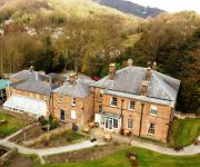
Alison House
New Bath Hotel
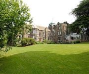
Makeney Hall Belper
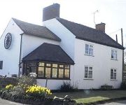
The Wheel House
White Hart Inn
The Greyhound Hotel
Videos from this area
These are videos related to the place based on their proximity to this place.
Derbyshire by Car - Hazelwood to Duffield in HD July 2009, A Time-lapse journey.
Andy's Driving videos around Derbyshire, UK : Are you an ex-pat of Derbyshire, feeling homesick? Or perhaps you just want a clear way of giving someone directions to a location in Derbyshire...
Helicopter Crash.This in morning Valhalla
was go to Helicopter this morning( god is good too us ) Helicopter Crash.This in morning Valhalla Helicopter Crash.This in morning Valhalla Helicopter Crash.This in morning Valhalla.
My Grunge not mini To Remember
Hi everybody, here is my a bit grunge a bit romantic a bit huge album :D I took inspiration for rosete flower from Kay channel,so go check it out,so many beautiful projects are over there...
Altered old sewing box
Hi to everyone ; ) my auntie gave to me old sewing box to make it more shabby chic so I tried to do this. My lovely mum was help me again of course so here you can see how its turns out. Hope...
Victoria Design / Madame Payraud vintage File Folder
Hi everybody I made small teachers notebook or file folder for my lovely friend Natalie. I really hope she will like it and I hope you will like it as well :D Here is a link for Victoria Design...
CBBC: Walk on The Wild Side - Snow Love
We get the feeling this wolf really loves snow! To watch more funny animal clips and full episodes from Walk on The Wild Side visit the CBBC website at http://www.bbc.co.uk/cbbc/shows/walk-on-the-...
CBBC: Walk on The Wild Side - Owl Impressions
Check out this talented Owl's impressions as she entertains her chicks! To watch more funny animal clips and full episodes from Walk on The Wild Side visit the CBBC website at http://www.bbc.co....
Videos provided by Youtube are under the copyright of their owners.
Attractions and noteworthy things
Distances are based on the centre of the city/town and sightseeing location. This list contains brief abstracts about monuments, holiday activities, national parcs, museums, organisations and more from the area as well as interesting facts about the region itself. Where available, you'll find the corresponding homepage. Otherwise the related wikipedia article.
Derwent Valley Mills
Derwent Valley Mills is a World Heritage Site along the River Derwent in Derbyshire, England, designated in December 2001. It is administered by the Derwent Valley Mills Partnership. The modern factory, or 'mill', system was born here in the 18th century to accommodate the new technology for spinning cotton developed by Richard Arkwright. With advancements in technology, it became possible to produce cotton continuously.
Ecclesbourne Valley Railway
The Ecclesbourne Valley Railway is a 10-mile long heritage railway in Derbyshire, the headquarters of the railway centre around Wirksworth station respectively, and services operate in both directions between Wirksworth and Duffield and from Wirksworth to Ravenstor. From April 2011 onward, passengers are now able to board and alight heritage services at Duffield where in recent years a station platform (3) has been re-constructed.
Whatstandwell railway station
Whatstandwell railway station is a railway station owned by Network Rail and managed by East Midlands Trains (EMT) Train operating company (TOC). It serves the villages of Whatstandwell and Crich Carr in Derbyshire, England. The station is located on the Derwent Valley Line from Derby to Matlock. The full range of tickets for travel for any destination in the country are purchased from the guard on the train at no extra cost.
Duffield Frith
Duffield Frith was, in medieval times, an area of Derbyshire in England, part of that bestowed upon Henry de Ferrers (or Ferrars) by King William, controlled from his seat at Duffield Castle. From 1266 it became part of the Duchy of Lancaster and from 1285 it was a Royal Forest with its own Forest Courts. It extended from Duffield to Wirksworth and from Hulland to Heage.
Shining Cliff Woods, Derbyshire
Shining Cliff Woods are on the west bank of the River Derwent near to Ambergate Derbyshire. In medieval times "Schymynde-cliffe" was one of the seven royal parks within Duffield Frith and, as such, belonged to Edmund Crouchback, Earl of Lancaster. It was an estate within the manor of Alderwasley and in 1284 was given to William Foun who was given the job of maintaining the boundaries between the Pendleton and Peatpits Brooks.
Idridgehay
Idridgehay is a village in the English county of Derbyshire. 65x50px Pronounced noicon (listen) Problems listening to this file? See media help.
Idridgehay and Alton
Idridgehay and Alton is a civil parish in the English county of Derbyshire. Idridgehay and Alton forms part of the non-metropolitan district of Amber Valley. Its principal settlements are the village of Idridgehay and the hamlets of Alton, Idridgehay Green and Ireton Wood. 65x50px Pronounced noicon (listen) Problems listening to this file? See media help.
Derby Road Ground, Wirksworth
Derby Road Ground is a cricket ground in Wirksworth, Derbyshire. The first recorded match on the ground was in 1866, when Wirksworth played an All-England Eleven. Derbyshire played a single first-class match on the ground against Kent in 1874. In local domestic cricket the ground is the home of Wirksworth & Middleton Cricket Club.


