Safety Score: 3,0 of 5.0 based on data from 9 authorites. Meaning we advice caution when travelling to United Kingdom.
Travel warnings are updated daily. Source: Travel Warning United Kingdom. Last Update: 2024-08-13 08:21:03
Delve into Langley Mill
Langley Mill in Derbyshire (England) is a town located in United Kingdom about 116 mi (or 187 km) north-west of London, the country's capital town.
Time in Langley Mill is now 07:51 PM (Friday). The local timezone is named Europe / London with an UTC offset of zero hours. We know of 10 airports closer to Langley Mill, of which 5 are larger airports. The closest airport in United Kingdom is Nottingham Airport in a distance of 12 mi (or 20 km), South-East. Besides the airports, there are other travel options available (check left side).
There are several Unesco world heritage sites nearby. The closest heritage site in United Kingdom is Liverpool – Maritime Mercantile City in a distance of 30 mi (or 48 km), North-East. Also, if you like the game of golf, there are some options within driving distance. In need of a room? We compiled a list of available hotels close to the map centre further down the page.
Since you are here already, you might want to pay a visit to some of the following locations: Derby, Nottingham, Matlock, Wales and Yeldersley. To further explore this place, just scroll down and browse the available info.
Local weather forecast
Todays Local Weather Conditions & Forecast: 8°C / 46 °F
| Morning Temperature | 5°C / 41 °F |
| Evening Temperature | 6°C / 43 °F |
| Night Temperature | 5°C / 41 °F |
| Chance of rainfall | 0% |
| Air Humidity | 75% |
| Air Pressure | 1026 hPa |
| Wind Speed | Gentle Breeze with 6 km/h (4 mph) from North-East |
| Cloud Conditions | Overcast clouds, covering 100% of sky |
| General Conditions | Overcast clouds |
Saturday, 16th of November 2024
10°C (50 °F)
6°C (43 °F)
Overcast clouds, gentle breeze.
Sunday, 17th of November 2024
7°C (44 °F)
1°C (34 °F)
Scattered clouds, moderate breeze.
Monday, 18th of November 2024
1°C (34 °F)
0°C (32 °F)
Rain and snow, moderate breeze, overcast clouds.
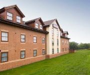
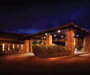
Hotels and Places to Stay
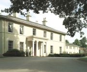
Eastwood Hall
Lumb Farm Country Club
The Derbyshire PH Hotels
Morley Hayes
mour
TRAVELODGE NOTTINGHAM TROWELL M1
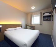
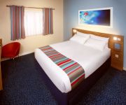
TRAVELODGE ALFRETON
Ripley
Independent (SPHC) THE DERBYSHIRE HOTEL
Mansfield
Videos from this area
These are videos related to the place based on their proximity to this place.
Kawasaki VN 1500 C2 1997 My wife's 1st & Last ride on my bike
My wife wanted to have ago on my motorcycle before it was sold on eBay , as you hear she quite liked it. This video was taken on the grounds at MFN on the 10th September 2011.
Midland General buses operating from Langley Mill Garage, Ilkeston and Heanor Market Places
Additional 1960's footage of Midland General buses operating from the Langley Mill garage in the 1960's locations include Heanor market place and Ilkeston market place. Also featured is some...
Blend Heanor Opening
The Blend Youth Project in Heanor is opened by Nigel Mills MP. Take a look round at the facilities.
Heanor iPad drawings - 12th February 2011
iPad Brushes field study test - Springtime for Heanor - year 5 The other week I entered the fifth year of this project-within-a-project, still learning how to deal with 'site', still learning...
The Big Lift
The Lifting of the Great northen Carriage out of the car park of the Stoneyford Lodge, Heanor, Derbyshire 1994 www.lner-svr-coachfund.org.uk.
Roper Avenue Allotments - Sharon's plot
One of our plots on the Roper Avenue Allotments site, Heanor, Derbyshire. Photographs taken Mid August 2012.
New In home service for iPhone and iPod Touch repairs - The Computer Room Nottingham
http://www.thecomputerroomnottingham.co.uk - 0115 972 1120 / 07545 251 571 Serving Nottingham Derby and Leicester with parts and repair for iPhone, iPod, pc and mac of all kinds. We can...
The Route of the Ripley Rattler
To celebrate100 years since the 1st tram ride between Ripley and Cinderhill as described in DH Lawrence's short story 'Ticket's Please'. Ruth has painted 40 artworks from the route as it is today.
Smash Bros Brawl Custom Stage - 50m
This stage has caused me no end of trouble. But i'm happy with this version of 50m from Donkey Kong. I know it's a bit ghetto, but unfortunately thats how it ended up due to restrictions....
Videos provided by Youtube are under the copyright of their owners.
Attractions and noteworthy things
Distances are based on the centre of the city/town and sightseeing location. This list contains brief abstracts about monuments, holiday activities, national parcs, museums, organisations and more from the area as well as interesting facts about the region itself. Where available, you'll find the corresponding homepage. Otherwise the related wikipedia article.
Erewash Canal
The Erewash Canal is a broad canal in Derbyshire, England. It runs just under 12 miles and has 14 locks. The first lock at Langley Bridge is actually part of the Cromford Canal.
Erewash Valley
The Erewash Valley is the valley of the River Erewash on the border of Derbyshire and Nottinghamshire as far as the River Trent. It runs along the boundary of the southern end of the Derbyshire hills and the more rolling Nottinghamshire country. It is on the edge of an area of great mineral wealth, particularly coal, extending from Yorkshire to Leicestershire.
Langley Mill railway station
Langley Mill railway station (formerly Langley Mill and Eastwood) on the Erewash Valley Line serves the village of Langley Mill and the towns of Heanor in Derbyshire and Eastwood in Nottinghamshire, England. The station isBad rounding here{{#invoke:Math|precision_format| 19*1,000/1,609.344 | 1-1 }} miles (19 km) north of Nottingham. The station lies between Nottingham and Sheffield and is managed by East Midlands Trains.
Aldercar and Langley Mill
Aldercar and Langley Mill is a civil parish in the Amber Valley district of Derbyshire, England. It includes the towns of Aldercar and Langley Mill, along with the hamlets of Stoneyford and Woodlinkin.
A610 road
The A610 is an A-road in England, which runs from Nottingham to Ambergate, where it joins the A6.
Aldercar Community Language College
Aldercar Community Language College is a comprehensive, mixed secondary school for ages 11–19, on Daltons Close in Aldercar, Derbyshire. It is close to the A610 and Langley Mill Junior School, and is next door to Aldercar Infants School.
Eastwood and Langley Mill railway station
Eastwood and Langley Mill railway station was a former railway station to serve the villages of Eastwood and Langley Mill . It was opened by the Great Northern Railway (Great Britain) on its Derbyshire Extension in 1875-6. It lay on the branch from Awsworth Junction, where it crossed the Giltbrook Viaduct, on the way to Pinxton. At the time it was in Nottinghamshire, but since recent boundary changes it would now be in Derbyshire.
Marlpool railway station
Marlpool railway station was a former railway station at Marlpool in Derbyshire. Nottinghamshire. It was opened on the Heanor branch from Ilkeston on the Great Northern Railway (Great Britain) Derbyshire Extension line. Opened in 1891, passenger services finished in 1928.


