Safety Score: 3,0 of 5.0 based on data from 9 authorites. Meaning we advice caution when travelling to United Kingdom.
Travel warnings are updated daily. Source: Travel Warning United Kingdom. Last Update: 2024-08-13 08:21:03
Delve into Ireton Wood
Ireton Wood in Derbyshire (England) is a town located in United Kingdom about 122 mi (or 196 km) north-west of London, the country's capital town.
Time in Ireton Wood is now 04:31 PM (Friday). The local timezone is named Europe / London with an UTC offset of zero hours. We know of 8 airports closer to Ireton Wood, of which 5 are larger airports. The closest airport in United Kingdom is East Midlands Airport in a distance of 17 mi (or 28 km), South-East. Besides the airports, there are other travel options available (check left side).
There are several Unesco world heritage sites nearby. The closest heritage site in United Kingdom is Liverpool – Maritime Mercantile City in a distance of 36 mi (or 57 km), North-East. Also, if you like the game of golf, there are some options within driving distance. We saw 1 points of interest near this location. In need of a room? We compiled a list of available hotels close to the map centre further down the page.
Since you are here already, you might want to pay a visit to some of the following locations: Bradley, Yeldersley, Shirley, Matlock and Rodsley. To further explore this place, just scroll down and browse the available info.
Local weather forecast
Todays Local Weather Conditions & Forecast: 9°C / 48 °F
| Morning Temperature | 5°C / 41 °F |
| Evening Temperature | 8°C / 47 °F |
| Night Temperature | 5°C / 41 °F |
| Chance of rainfall | 0% |
| Air Humidity | 86% |
| Air Pressure | 1027 hPa |
| Wind Speed | Gentle Breeze with 6 km/h (4 mph) from East |
| Cloud Conditions | Overcast clouds, covering 100% of sky |
| General Conditions | Overcast clouds |
Saturday, 16th of November 2024
10°C (50 °F)
6°C (43 °F)
Overcast clouds, gentle breeze.
Sunday, 17th of November 2024
7°C (44 °F)
1°C (34 °F)
Light rain, moderate breeze, few clouds.
Monday, 18th of November 2024
1°C (33 °F)
0°C (32 °F)
Rain and snow, moderate breeze, overcast clouds.
Hotels and Places to Stay
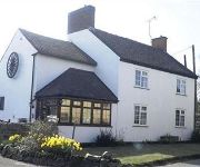
The Wheel House
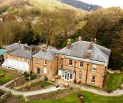
Alison House
The Greyhound Hotel
Videos from this area
These are videos related to the place based on their proximity to this place.
Ecclesbourne Valley Railway,Wirksworth,Ravenstor,Idridgehay,Duffield,2012,England.
Ecclesbourne Valley Railway,Wirksworth,Ravenstor,Idridgehay,Duffield,2012,Full HD,England.Wirksworth Station is the main hub of Ecclesbourne Valley Railway,and the line runs through the ...
Half an Hour at (94) - Ecclesbourne Valley Railway 28.2.2015 -Wirksworth-Class 122 Derby Lightweight
Third visit of the day was to the Ecclesbourne Valley Railway at Wirksworth in the Peak District near Matlock. This line runs for 9 miles to Duffield and features predominantly heritage DMU's....
Hunt for the Lost Sheep of Wirksworth
Children of Wirksworth go on the hunt for sheep hiding in shops in the town, find out all their names.
Wirksworth Gala - Part One. Ravenstor
The first real steam gala - this bit shows the run uphill to Ravenstor. The former DMU coach was propelled up the bank by newly restored Barclay - Ferrybridge No. 3. Once at Ravenstor,...
helicopter buzzing wirksworth
this helicopter spent over an hour hovering over wirksworth derbyshire on saturday oct 21 2006 21/10/06 - filming ? spying ? watching model railway steam locos?
Wirksworth Festival 2011 finale
A leading rural arts festival where everyone can enjoy great art in a unique and inspiring setting. This is the final display.
EVR,2013,Steam Gala,HD,Ecclesbourne Valley Railway,GWR 5643,5th May,England.
Steam at Ecclesbourne Valley Railway,EVR,Bank Holiday Weekend,5th May,2013,England,HD.Glorious weather,stunning countryside and Steam locomotives in action.We arrive at Wirksworth ...
Ecclesbourne Valley Railway,EVR,2013,HD,Diesel Weekend,2nd March,England,UK
Ecclesbourne Valley Railway,EVR,Diesel Weekend,2nd March,2013,Full HD,England ,UK.Beautiful Spring like day,9 degrees c and sunny.Starting off at EVR's Hub Station,Wirksworth,Derbyshire Dales ...
Duffield to Ravenstor on the Ecclesborne Valley Railway
A time lapse video on board M55006 of the trip from Duffield to Ravenstor with a short shunt in Wirksworth yard.
Videos provided by Youtube are under the copyright of their owners.
Attractions and noteworthy things
Distances are based on the centre of the city/town and sightseeing location. This list contains brief abstracts about monuments, holiday activities, national parcs, museums, organisations and more from the area as well as interesting facts about the region itself. Where available, you'll find the corresponding homepage. Otherwise the related wikipedia article.
Duffield Frith
Duffield Frith was, in medieval times, an area of Derbyshire in England, part of that bestowed upon Henry de Ferrers (or Ferrars) by King William, controlled from his seat at Duffield Castle. From 1266 it became part of the Duchy of Lancaster and from 1285 it was a Royal Forest with its own Forest Courts. It extended from Duffield to Wirksworth and from Hulland to Heage.
List of United Kingdom locations: Wir-Wood
Idridgehay
Idridgehay is a village in the English county of Derbyshire. 65x50px Pronounced noicon (listen) Problems listening to this file? See media help.
Idridgehay and Alton
Idridgehay and Alton is a civil parish in the English county of Derbyshire. Idridgehay and Alton forms part of the non-metropolitan district of Amber Valley. Its principal settlements are the village of Idridgehay and the hamlets of Alton, Idridgehay Green and Ireton Wood. 65x50px Pronounced noicon (listen) Problems listening to this file? See media help.
Callow, Derbyshire
Callow is a village and a civil parish in the Derbyshire Dales District, in the English county of Derbyshire. It is near the small town of Wirksworth and the reservoir Carsington Water.


