Safety Score: 3,0 of 5.0 based on data from 9 authorites. Meaning we advice caution when travelling to United Kingdom.
Travel warnings are updated daily. Source: Travel Warning United Kingdom. Last Update: 2024-08-13 08:21:03
Discover High Peak Junction
High Peak Junction in Derbyshire (England) is a place in United Kingdom about 125 mi (or 201 km) north-west of London, the country's capital city.
Current time in High Peak Junction is now 06:39 PM (Friday). The local timezone is named Europe / London with an UTC offset of zero hours. We know of 8 airports near High Peak Junction, of which 5 are larger airports. The closest airport in United Kingdom is East Midlands Airport in a distance of 20 mi (or 33 km), South-East. Besides the airports, there are other travel options available (check left side).
There are several Unesco world heritage sites nearby. The closest heritage site in United Kingdom is Liverpool – Maritime Mercantile City in a distance of 30 mi (or 49 km), North-East. Also, if you like playing golf, there are a few options in driving distance. If you need a hotel, we compiled a list of available hotels close to the map centre further down the page.
While being here, you might want to pay a visit to some of the following locations: Matlock, Bradley, Yeldersley, Derby and Shirley. To further explore this place, just scroll down and browse the available info.
Local weather forecast
Todays Local Weather Conditions & Forecast: 9°C / 48 °F
| Morning Temperature | 5°C / 41 °F |
| Evening Temperature | 8°C / 47 °F |
| Night Temperature | 5°C / 41 °F |
| Chance of rainfall | 0% |
| Air Humidity | 86% |
| Air Pressure | 1027 hPa |
| Wind Speed | Gentle Breeze with 6 km/h (4 mph) from East |
| Cloud Conditions | Overcast clouds, covering 100% of sky |
| General Conditions | Overcast clouds |
Saturday, 16th of November 2024
10°C (50 °F)
6°C (43 °F)
Overcast clouds, gentle breeze.
Sunday, 17th of November 2024
7°C (44 °F)
1°C (34 °F)
Light rain, moderate breeze, few clouds.
Monday, 18th of November 2024
1°C (33 °F)
0°C (32 °F)
Rain and snow, moderate breeze, overcast clouds.
Hotels and Places to Stay
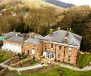
Alison House
New Bath Hotel
White Hart Inn
The View at the White Horse Woolley Moor
The Wheel House
The Greyhound Hotel
The Duke of Wellington
Matlock
Videos from this area
These are videos related to the place based on their proximity to this place.
Heights of Abraham Matlock Bath (UK)
Heights of Abraham Matlock Bath (UK) cable car system - view from base station.
Climbing Riber Road Matlock
A huffing and puffing slow bike ride up Riber Road in Matlock, Derbyshire.
Matlock Raft Race Boxing Day 2011 - Catastrophic planning!
Matlock Raft Race Boxing Day 2011 - Catastrophic planning!
Matlock Bath Illuminations 2008 Decorated Boats Parade.
A video shot on my phone of the parade of illuminated and decorated boats 2008. The winning boat is first followed by 2nd, 3rd & 4th placed boats.
The Wirksworth Assessment Trial 2014
The Wirksworth Assessment Trial from Wirksworth Station to Crich Tramway Village and back to Wirksworth on Saturday 17th May 2014. Video taken on Cromford Hill in Cromford Derbyshire. All...
MTB Hardtail at Black Rocks, Derbyshire (Jan 2013)
First trip out of the new year having a play at Black Rocks, Derbyshire. First time there and only had an hour to kill but looks like there are some great routes around there. Didn't follow...
Blackening of Black Rocks
A short film of an ancient but threatened Peak District custom enacted annually in the Derbyshire village of Cromford.
Cromford Canal - Cromford to Langley Mill - History Walks
This is the first video in a series i'm going to call History Walks, this instalment sees me walk the entire length of what was once the Cromford Canal in Derbyshire. The Canal once stretched...
Lizzy's Geocaching at Cromford Canal
Just a quick play with 'Youtube Editor' a bit too basic and limited to be of any use really...
Videos provided by Youtube are under the copyright of their owners.
Attractions and noteworthy things
Distances are based on the centre of the city/town and sightseeing location. This list contains brief abstracts about monuments, holiday activities, national parcs, museums, organisations and more from the area as well as interesting facts about the region itself. Where available, you'll find the corresponding homepage. Otherwise the related wikipedia article.
Cromford and High Peak Railway
Cromford railway station
Cromford railway station is a railway station owned by Network Rail and managed by East Midlands Trains (EMT) Train operating company (TOC). It is located in the village of Cromford in Derbyshire, England. The station is on the Derwent Valley Line 15+⁄2 miles north of Derby towards Matlock.
Matlock Bath railway station
Matlock Bath railway station is a railway station owned by Network Rail and managed by East Midlands Trains (EMT) Train operating company (TOC). It is located in the village of Matlock Bath in Derbyshire, England. The station is located on the Derwent Valley Line 16+⁄4 miles north of Derby towards Matlock. The full range of tickets for travel for any destination in the country are purchased from the guard on the train at no extra cost.
Derwent Valley Heritage Way
The Derwent Valley Heritage Way (DVHW) is a 55 miles walk along the Derwent Valley from Ladybower Reservoir in the Peak District National Park via Chatsworth, the scenery around the Derbyshire Dales, and through the Derwent Valley Mills World Heritage Site. It follows the Riverside Path through Derby and continue onwards to the historic inland port of Shardlow. Journey's end is at Derwent Mouth where the River Derwent flows into the River Trent.
Willersley Castle
Willersley Castle is a late 18th century country mansion situated above the River Derwent at Cromford, Derbyshire which is now a Grade II* listed building. Standing in 60 acres of grounds, the Georgian style castellated house is three storeys with a seven bay frontage, the central bay flanked by full height round towers.
Dethick Manor
Dethick Manor is a 16th century manor house, situated at Dethick, Amber Valley, Derbyshire, much altered in the 18th century and converted to use as a farmhouse. It is a Grade II* listed building. The manor of Dethick was anciently owned by the eponymous family.
High Peak Junction
High Peak Junction, near Cromford, Derbyshire, England, is the name now used to describe the site where the former Cromford and High Peak Railway (C&HPR), whose workshops were located here, meets the Cromford Canal. It lies within Derwent Valley Mills World Heritage Site, designated in 2001, and today marks the southern end of the High Peak Trail, a 17 miles trail for walkers, cyclists and horse riders.
Leawood Pump House
The Leawood Pump House was built in 1849 to supply water to the Cromford Canal, built some 50 years previously. It is a Grade II* listed building. Located a little along the canal towpath from High Peak Junction, it stands to a height of 45 feet on the right bank of the River Derwent, at the end of the Derwent Aqueduct, and has a 95 feet chimney stack with a cast-iron cap. The Watt-type beam engine was designed and erected by Graham and Company of Milton Works, Elsecar, Sheffield.


