Safety Score: 3,0 of 5.0 based on data from 9 authorites. Meaning we advice caution when travelling to United Kingdom.
Travel warnings are updated daily. Source: Travel Warning United Kingdom. Last Update: 2024-08-13 08:21:03
Explore Great Rowsley
Great Rowsley in Derbyshire (England) is a city in United Kingdom about 132 mi (or 212 km) north-west of London, the country's capital.
Local time in Great Rowsley is now 06:38 PM (Thursday). The local timezone is named Europe / London with an UTC offset of zero hours. We know of 8 airports in the vicinity of Great Rowsley, of which 5 are larger airports. The closest airport in United Kingdom is Manchester Woodford Airport in a distance of 24 mi (or 39 km), North-West. Besides the airports, there are other travel options available (check left side).
There are several Unesco world heritage sites nearby. The closest heritage site in United Kingdom is Liverpool – Maritime Mercantile City in a distance of 30 mi (or 48 km), North-East. Also, if you like golfing, there are multiple options in driving distance. We found 1 points of interest in the vicinity of this place. If you need a place to sleep, we compiled a list of available hotels close to the map centre further down the page.
Depending on your travel schedule, you might want to pay a visit to some of the following locations: Matlock, Bradley, Yeldersley, Shirley and Bradfield. To further explore this place, just scroll down and browse the available info.
Local weather forecast
Todays Local Weather Conditions & Forecast: 2°C / 35 °F
| Morning Temperature | -0°C / 31 °F |
| Evening Temperature | 2°C / 35 °F |
| Night Temperature | 3°C / 37 °F |
| Chance of rainfall | 0% |
| Air Humidity | 80% |
| Air Pressure | 1000 hPa |
| Wind Speed | Moderate breeze with 13 km/h (8 mph) from East |
| Cloud Conditions | Broken clouds, covering 76% of sky |
| General Conditions | Light snow |
Friday, 22nd of November 2024
4°C (38 °F)
1°C (34 °F)
Rain and snow, fresh breeze, scattered clouds.
Saturday, 23rd of November 2024
4°C (40 °F)
13°C (55 °F)
Rain and snow, strong breeze, overcast clouds.
Sunday, 24th of November 2024
14°C (57 °F)
9°C (48 °F)
Moderate rain, high wind, near gale, overcast clouds.
Hotels and Places to Stay
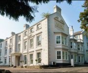
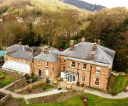
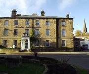
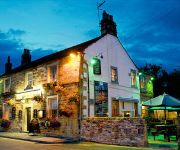
New Bath Hotel
Alison House
The Rutland Arms Hotel
The Peacock
The Duke of Wellington
The Greyhound Hotel
Matlock
Chesterfield West
Videos from this area
These are videos related to the place based on their proximity to this place.
Stanton-In-Peak & Beeley Moor in the snow in a Landcruiser HDJ80
Heading over to a service call at Stanton-In-Peak. First time with the truck in any appreciable amount of snow and it did really well, passing a Derbyshire County Council Defender 90 on the...
Peak District Ancient Graffiti Amazing View
Quite simply... an amazing view After the bilizzard of February 2010 filmed from the top of the Andle Stone looking towards Youlgreave on the edge of Stanton Moor not far from Matlock & Darley...
Peak District - Bradford Dale & Nine Ladies Stone Circle
A year ago I found a map, not a treasure map but a regular White Peak Ordnance Survey map. It had a route plotted on it that i'd not walked before so today we headed off to check it out. We'd...
Rowtor Rocks
Me and Dave doing a few problems round Rowtor Rocks. Gotta love guide book grading for this area, so grades are all a bit of a guess.
TUFO AZVF
Cheese to Oedipus and Egoistic Coma Vocal Flip https://soundcloud.com/aishazoe/tufo-cheese-to-oedipus-and-egoistic-coma.
Chatsworth Country Fair. Sept 2012
Chatsworth Country Fair was great! Spread over several acres it has so much to see and expierence. I was there on Saturday and hopefully my footage gives you a taste of the event. Bet you...
A Ride Through the Village of Edensor in Derbyshire
A ride through the very pretty Derbyshire village near Chatsworth House. The village is owned by the Duke of Devonshire. http://en.wikipedia.org/wiki/Edensor SK250700, 28.09.13.
The Red Arrows at Chatsworth Country Fair. Sept 2012
It was amazing to see the world famous Red Arrows air display at Chatsworth Country Fair. When they flew low, you could actually feel the roar of the engines! -- Watch my video Chatsworth...
Shunter Hunter Extravaganza
On 26th and 27th September 2009 the Heritage Shunters Trust Held their first shunter gala organised by themselves. This feature 11 shunters running from Classes 01 to 06 and an 08 running...
The Peak Forester,Peak Rail,Braunton 34046,23rd March,2014,HD.
Peak Rail welcomes The Peak Forester,Bulleid Pacific Class,Braunton,34046 to Rowsley South,Derbyshire,23rd March,2014,England.Braunton on turntable arrival,departure from Rowsley South.
Videos provided by Youtube are under the copyright of their owners.
Attractions and noteworthy things
Distances are based on the centre of the city/town and sightseeing location. This list contains brief abstracts about monuments, holiday activities, national parcs, museums, organisations and more from the area as well as interesting facts about the region itself. Where available, you'll find the corresponding homepage. Otherwise the related wikipedia article.
River Lathkill
The River Lathkill is a river in the Peak District National Park in Derbyshire, England. First recorded in 1280, the name "Lathkill" possibly has Scandinavian roots, the old Norse hlada-kill translating as "narrow valley with a barn".
Nine Ladies
Nine Ladies is a Bronze Age stone circle located on Stanton Moor, Derbyshire, England. Part of the Peak District National Park, the site is owned by English Heritage and is often visited by tourists and hill walkers. Druids and pagans occasionally celebrate summer solstice there.
Stanton Moor
Stanton Moor is a small upland area in the Derbyshire Peak District of central and northern England, lying between Matlock and Bakewell near the villages of Birchover and Stanton-in-Peak. It is known for its megaliths and erratics.
Rowsley South railway station
Rowsley South railway station lies approximately a mile short of Rowsley village, the location of the settlement's previous stations. This makes Rowsley South the third station to be built in the area, constructed as it was by Peak Rail volunteers in the latter part of the 1990s. Opened to passenger services in 1997, the station was for a time referred to as 'Northwood', which is the part of Rowsley settlement that is near to the terminus.
Stancliffe Hall
Stancliffe Hall is a grade II Listed building on Whitworth Road in the settlement of Darley Dale, near Matlock, Derbyshire.
Rowsley South (DDNGR) railway station
Rowsley South is the main station on the Derbyshire Dales Narrow Gauge Railway. Derbyshire Dales Narrow Gauge Railway is a short narrow-gauge railway operating at Rowsley South, and operates ex-industrial diesels and carriages similar to the Golden Valley light railway at Butterley, but as the running line is presently shorter one day there is hope of a further extension so the line can live up to its name of 'Derbyshire Dales narrow gauge railway'.
Park Side railway station
Park Side railway station is a station on the Derbyshire Dales Narrow Gauge Railway located at Peak Rail, Derbyshire.
Derbyshire Dales Narrow Gauge Railway
The Derbyshire Dales Narrow Gauge Railway (DDNGR) is a short, railway located at Rowsley South at Peak Rail. It operates ex-industrial diesel locomotives and carriages similar to the Golden Valley light railway at Butterley. Rowsley South is the main station on the DDNGR.


