Safety Score: 3,0 of 5.0 based on data from 9 authorites. Meaning we advice caution when travelling to United Kingdom.
Travel warnings are updated daily. Source: Travel Warning United Kingdom. Last Update: 2024-08-13 08:21:03
Explore Glapwell
Glapwell in Derbyshire (England) with it's 2,202 inhabitants is located in United Kingdom about 126 mi (or 203 km) north-west of London, the country's capital.
Local time in Glapwell is now 11:39 PM (Friday). The local timezone is named Europe / London with an UTC offset of zero hours. We know of 10 airports in the wider vicinity of Glapwell, of which 5 are larger airports. The closest airport in United Kingdom is Nottingham Airport in a distance of 20 mi (or 33 km), South-East. Besides the airports, there are other travel options available (check left side).
There are several Unesco world heritage sites nearby. The closest heritage site in United Kingdom is Liverpool – Maritime Mercantile City in a distance of 19 mi (or 30 km), North-East. Also, if you like golfing, there are multiple options in driving distance. If you need a place to sleep, we compiled a list of available hotels close to the map centre further down the page.
Depending on your travel schedule, you might want to pay a visit to some of the following locations: Wales, Todwick, Ulley, Orgreave and Whiston. To further explore this place, just scroll down and browse the available info.
Local weather forecast
Todays Local Weather Conditions & Forecast: 10°C / 50 °F
| Morning Temperature | 5°C / 42 °F |
| Evening Temperature | 8°C / 47 °F |
| Night Temperature | 6°C / 43 °F |
| Chance of rainfall | 0% |
| Air Humidity | 82% |
| Air Pressure | 1026 hPa |
| Wind Speed | Gentle Breeze with 6 km/h (4 mph) from North-East |
| Cloud Conditions | Overcast clouds, covering 94% of sky |
| General Conditions | Overcast clouds |
Saturday, 16th of November 2024
10°C (51 °F)
7°C (45 °F)
Overcast clouds, gentle breeze.
Sunday, 17th of November 2024
7°C (45 °F)
2°C (36 °F)
Light rain, moderate breeze, clear sky.
Monday, 18th of November 2024
2°C (35 °F)
0°C (32 °F)
Rain and snow, moderate breeze, overcast clouds.
Hotels and Places to Stay
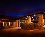
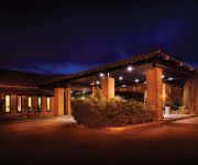
The Derbyshire PH Hotels
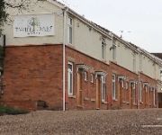
Twin Oaks Hotel
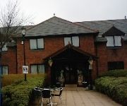
TRAVELODGE MANSFIELD
Days Inn Chesterfield Tibshelf
Independent (SPHC) THE DERBYSHIRE HOTEL
Mansfield
Videos from this area
These are videos related to the place based on their proximity to this place.
Teversal Trail - Silverhill Wood Walk - 2009
Silverhill Wood 2 - 4 miles Walk - A network of trails based on former rail routes. Teversal, Sutton-in-Ashfield, Nottinghamshire.
Whyte 46
Just a quick video of Kev riding his whyte 46 near Teversal Trail Visitor Centre in the East midlands Uk.
Hardwick Hall National Trust
This was the first time we visited Hardwick Hall even though we have passed it many times. We found it really interesting will go back again as we needed longer there to appreciate all it...
Stedman Doubles at Teversal
A mixed bunch of founders created this, ahem, tuneful ring of five in a tiny hamlet/village on the Derbyshire/Nottinghamshire border. The oldest bell dates from 1551, the newest from 1758,...
Terra Nova - Voyager 30 - Lightweight Rucksack Review
This is my review / demo of the Terra Nova Voyager 30 Rucksack, I've been using it a lot over the last 7 months so I feel I can now give my honest opinion. A few YouTube friends have asked...
Piantings and photographs of The Bolsover District, Derbyshire, England, by Markijnr
How beautiful the English countryside can be if we only open our eyes and look a little more closer. How wonderful it was to have had the opportunity to go out and paint this wonderful landscape....
Bolsover Castle, Derby, England, Suzie trip 2014
Suzie's visit to Bolsover Castle in Derbyshire, England June 2014.
Stedman Triples at Bolsover
In north Derbyshire, in the Peak District, one particular family made its mark. The Cavendish family have ruled the area as the Dukes of Devonshire. Despite their title, their lands have...
Bolsover - Clash of Knights - 20140601 131646
English Heritage Clash of Knights event at Bolsover Castle.
Videos provided by Youtube are under the copyright of their owners.
Attractions and noteworthy things
Distances are based on the centre of the city/town and sightseeing location. This list contains brief abstracts about monuments, holiday activities, national parcs, museums, organisations and more from the area as well as interesting facts about the region itself. Where available, you'll find the corresponding homepage. Otherwise the related wikipedia article.
Hardwick Hall
Hardwick Hall, in Derbyshire, is an architecturally significant Elizabethan country houses in England. Built between 1590–1597 for the formidable Bess of Hardwick, it was designed by the architect Robert Smythson, an exponent of the Renaissance style of architecture, Hardwick Hall is one of the earliest examples of the English interpretation of the style, which came into fashion, having slowly spread from Florence.
Stainsby Mill
Stainsby Mill is a 19th-century flour water mill in Doe Lea, Chesterfield, Derbyshire, England. The mill, which is in full working order, is under the ownership of the National Trust. The mill was originally constructed in 1849–50 and was restored in 1991. The Mill was worked with stainsby mill Farm until 1930s. The farm now has B and B. the web site is www. stainsbymillfarmbandb. co. uk The mill is located in the grounds of Hardwick Hall, another National Trust property.
Pleasley Colliery
Pleasley Colliery is a former English coal mine. It is located to the NW of Pleasley village which sits astride the River Meden on the Nottinghamshire/Derbyshire border. The colliery is located to the NW of Pleasley village which sits astride the River Meden on the Nottinghamshire/Derbyshire border. It lies 3 miles (4.8 km) north of Mansfield and 9 miles (14.5 km) south of Chesterfield.
Old Bolsover
Old Bolsover is the zone between Bolsover Castle, and the Eastern edge of the town, at Moor Hall, in Bolsover, Derbyshire, that is represented by Old Bolsover Town Council. This chiefly consists of Bolsover town centre, some council estates to the east of the centre, as well as houses in the Hill Top area, and on the road to Shuttlewood.
Bolsover South railway station
Bolsover South railway station is a former railway station in Bolsover, Derbyshire. It was opened by the Lancashire, Derbyshire and East Coast Railway in March 1897 and closed to all traffic by British Railways in December 1951 primarily due to the prohibitive cost of repairing and maintaining Bolsover Tunnel. Track lifting started immediately after closure and was completed within weeks.
Scarcliffe railway station
Scarcliffe railway station was a former railway station in Scarcliffe, Derbyshire. It was opened by the Lancashire, Derbyshire and East Coast Railway (later part of the Great Central Railway and subsequently the LNER) in March 1897. As originally planned, this was a highly ambitious scheme, as its name suggests, but only the central section between Chesterfield and Lincoln, together with a branch from Langwith Junction to the outskirts of Sheffield, were ever built.
St. Katherine's Church, Teversal
St. Katherine's Church, Teversal is a parish church in the Church of England in Teversal, Nottinghamshire. The church is Grade I listed by the Department for Culture, Media & Sport as a building of outstanding architectural or historic interest. The church was built in the 12th and 13th centuries and has an unrestored 17th and 18th century interior. The Molyneux pew is in the south aisle and has a roof supported by barley-sugar columns.
Teversal Manor
Teversal Manor is a small Grade II listed 17th century country house in Teversal, Nottinghamshire, some 5km (3 miles) west of Mansfield. The building is constructed of coursed and dressed rubble stone with ashlar dressings and slate roofs. It is built in two storeys with attics with an irregular 7 bay frontage.


