Safety Score: 3,0 of 5.0 based on data from 9 authorites. Meaning we advice caution when travelling to United Kingdom.
Travel warnings are updated daily. Source: Travel Warning United Kingdom. Last Update: 2024-08-13 08:21:03
Discover Etwall
Etwall in Derbyshire (England) with it's 2,572 citizens is a town in United Kingdom about 114 mi (or 183 km) north-west of London, the country's capital city.
Current time in Etwall is now 01:48 PM (Friday). The local timezone is named Europe / London with an UTC offset of zero hours. We know of 9 airports near Etwall, of which 5 are larger airports. The closest airport in United Kingdom is East Midlands Airport in a distance of 12 mi (or 19 km), East. Besides the airports, there are other travel options available (check left side).
There are several Unesco world heritage sites nearby. The closest heritage site in United Kingdom is Liverpool – Maritime Mercantile City in a distance of 44 mi (or 70 km), North-East. Also, if you like playing golf, there are a few options in driving distance. We discovered 1 points of interest in the vicinity of this place. Looking for a place to stay? we compiled a list of available hotels close to the map centre further down the page.
When in this area, you might want to pay a visit to some of the following locations: Shirley, Yeldersley, Rodsley, Derby and Bradley. To further explore this place, just scroll down and browse the available info.
Local weather forecast
Todays Local Weather Conditions & Forecast: 9°C / 48 °F
| Morning Temperature | 5°C / 42 °F |
| Evening Temperature | 7°C / 45 °F |
| Night Temperature | 6°C / 42 °F |
| Chance of rainfall | 0% |
| Air Humidity | 77% |
| Air Pressure | 1027 hPa |
| Wind Speed | Light breeze with 5 km/h (3 mph) from North-East |
| Cloud Conditions | Overcast clouds, covering 100% of sky |
| General Conditions | Overcast clouds |
Saturday, 16th of November 2024
10°C (51 °F)
7°C (44 °F)
Light rain, gentle breeze, overcast clouds.
Sunday, 17th of November 2024
7°C (45 °F)
4°C (39 °F)
Light rain, moderate breeze, overcast clouds.
Monday, 18th of November 2024
5°C (42 °F)
-0°C (32 °F)
Snow, fresh breeze, overcast clouds.
Hotels and Places to Stay
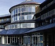
Hallmark Derby Mickleover Mickleover Court
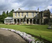
Mercure Burton upon Trent Newton Park Hotel
The Unicorn Inn
The Boot
Derby North West
Videos from this area
These are videos related to the place based on their proximity to this place.
46233 at Willington, Derbyshire 30 June 2012
Duchess of Sutherland heading from Tyseley to Derby, then York and ultimately Scarborough. Unfortunately, they let a Turbostar out at North Stafford Junction about a mile further towards Derby...
police witness C11 YNH 24112012
Video Submitted to www.policewitness.com Taken on MI-Witness HD camera 720P (www.mi-witness.co.uk) A38/A50 Inter change South of Derby Copyright Steven Warren.
Duchess of Sutherland 6233 at Willington
Duchess of Sutherland returns to Derby through Willington Station after a Load Test run to Crewe. 6233 is seen at night at speed.
Willington Raft Race 2010 Part 1
Annual Charity Raft Race from Newton Solney to WIllington in Derbyshire. 27 Rafts left Newton Solney Launch Pad Clowns Going Downs took off 25th.
DRS Class 68 68009 passes Willington Station 6U77
Direct Rail Services Class 68 passes Willington Station on the 6U77 IOA loads from Mounstorrel Sdgs. to Crewe Basford Hall 30/09/14.
Mercia marina Willington GoPro
This is a lovely place to have a walk around and a coffee you could even buy yourself a nice expensive boat...there has always been a reserve of some kind here and was linked up to the Trent...
Bmw K75 ride from Saltbox Cafe Hatton to the Bubble inn GoPro
Filmed with GoPro a ride From the Saltbox Café in Hatton Derbyshire to the Bubble Inn Stenson. going through Hilton and Willington and past the abandoned Cooling towers of Willington Power...
Whiskered Terns in Derbyshire
The scene at Willington Gravel Pits with an unprecedented flock of Whiskered Terns (also a larger whiter Common Tern featured in this video). The dark bellied birds with the white cheeks at...
Videos provided by Youtube are under the copyright of their owners.
Attractions and noteworthy things
Distances are based on the centre of the city/town and sightseeing location. This list contains brief abstracts about monuments, holiday activities, national parcs, museums, organisations and more from the area as well as interesting facts about the region itself. Where available, you'll find the corresponding homepage. Otherwise the related wikipedia article.
Derby Airfield
Derby Airfield is located 6 NM southwest of Derby, East Midlands, England. Derby Aerodrome has a CAA Ordinary Licence (Number P785) that allows flights for flying instruction as authorised by the licensee (Derby Aero Club & Flying School). The aerodrome is not licensed for night use. It is the home of Airspeed Aviation Ltd and operates Derby Aero Club. Airspeed Aviation Ltd is a CAA and EASA Approved Aircraft Maintenance Organisation holding approvals EASA Part M Subpart F (Approval Number UK.
A516 road
The A516 road is a road in Derbyshire that is used mostly for traffic flowing from the A50 to the A38. It finishes in Derby.
Rolleston-on-Dove railway station
Rolleston-on-Dove railway station is a former railway station built to serve Rolleston in Staffordshire.
Etwall railway station
Etwall railway station was a former railway station in Etwall, Derbyshire. It was opened by the Great Northern Railway (Great Britain) on its Derbyshire Extension in 1878.
Egginton railway station
Egginton railway station was a former railway station in Egginton, Derbyshire. It was opened by the North Staffordshire Railway. However it closed in 1878 when the Great Northern Railway (Great Britain) opened its Derbyshire Extension and a joint station was built at Egginton Junction. The buildings next to the Etwall Road level crossing, however, have survived and are still occupied.
Egginton Junction railway station
Egginton Junction railway station is a former railway station in Egginton, Derbyshire.
Radbourne Hall
Radbourne Hall is an 18th century country house, the home of the Chandos-Pole family, situated at Radbourne, Derbyshire. It is a Grade I listed building. The Manor of Radbourne was held by the Chandos family from the time of the Norman Conquest. On the death of Sir John Chandos in 1369 it passed to his niece who married Sir Peter de la Pole of Newborough, Staffordshire.


